

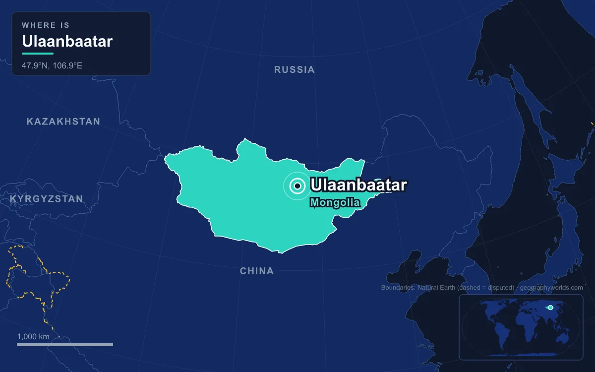
The capital of Mongolia is Ulaanbaatar, the country's largest city. It lies in north-central Mongolia at about 1,350 metres above sea level, in the valley of the Tuul River below Bogd Khan Mountain. The city had just over 1.6 million residents in December 2022, almost half of Mongolia's population. Its average annual temperature is 0.2 °C, which makes it the coldest national capital in the world. It began in 1639 as a mobile Buddhist monastery that changed location 29 times before settling here in 1778, and most of that history can still be seen on a walk through the city.
Sükhbaatar Square and the Government Palace
Start in the middle, on Sükhbaatar Square. At its centre is an equestrian statue of Damdin Sükhbaatar, the revolutionary leader the square was named after when he died in 1923. The square was renamed Chinggis Square in 2013, but the original name came back in 2016. On the north side is the Government Palace, completed in 1951. It houses the State Great Khural (the parliament) and the offices of the President and the Prime Minister. Residents used to call it the Grey Palace until it was painted white in 2007. Its colonnade holds a seated Genghis Khan, with Ögedei and Kublai on either side.
Before the revolution this ground was Züün Khüree, the eastern monastery. The Jebtsundamba Khutuktu, the head of Mongolian Buddhism, lived here in the Yellow Palace, and the open field in front was used for wrestling and Tsam dances until it became a rubbish dump. The monastery was a descendant of Örgöö, a camp of felt tents founded in 1639 at Lake Shireet Tsagaan, about 230 kilometres to the south-west. It moved up and down the Selenge, Orkhon and Tuul rivers, once as far as Inner Mongolia, before settling in 1778 where the Selbe meets the Tuul. At that time the site was on the caravan route between Beijing and Kyakhta, which the Treaty of Kyakhta had opened to Russian-Chinese trade in 1727. Westerners called the town Urga, and Mongols called it Ikh Khüree, "the great enclosure". On 29 December 1911, as the Qing dynasty collapsed, the 8th Jebtsundamba was declared Bogd Khan, ruler of an independent Mongolia, and the town became Niislel Khüree, "capital enclosure".
The Soviet-backed army entered the city in July 1921, and after the revolution the temple complex in front of the palace was razed. On 29 October 1924 the city was renamed Ulaanbaatar, "Red Hero". Most delegates had voted for Baatar Khot, "Hero City", but the Comintern representative Turar Ryskulov insisted on adding "Red". The square later became the centre of Mongolia's move to democracy. Protests began on 10 December 1989, the ruling Mongolian People's Revolutionary Party resigned on 9 March 1990, and the first free elections were held that July.
East Along Peace Avenue to the Choijin Lama Temple
Peace Avenue (Enkh Taivny Örgön Chölöö), the city's main street, runs along the south side of the square from east to west. It is one of the city's most congested roads: in 2021 peak-hour traffic across Ulaanbaatar averaged 8.9 kilometres an hour, and residents spent an average of 2.5 hours a day in traffic. The State Department Store, known simply as Ikh Delguur, "the Great Store", is on this avenue. Behind it, the skyline shows the construction boom of the 2010s. Tower C of the Shangri-La complex is 120 metres tall and was the country's tallest building in 2024, and the 150-metre Encanto Trade Center is under construction. The oldest part of the centre was built in the Soviet style of the 1940s and 1950s, and most of the core dates from between 1960 and 1985.
A short walk from the square, surrounded by newer buildings, is the Choijin Lama Temple. It was built between 1904 and 1908 for Luvsankhaidav, the state oracle and brother of the 8th Bogd Khan, and has one main temple and five smaller ones. It was active until 1937, when the anti-religious campaign closed it. Instead of being demolished, it was turned into a museum, which is why it survived. Its collection includes Tsam dance masks and an 18th-century gilt Buddha Shakyamuni. The purges of the late 1930s destroyed most of the city's other temples and killed more than 32,000 people, including lamas, herders, scholars and politicians. The small museum dedicated to the victims was demolished on 7 October 2019 despite public protests.
Gandan Hill and the Western Monastery
Head west along Peace Avenue and turn north up Gandan hill. Gandantegchinlen Monastery grew around the Shar Temple, built here in 1809. In the 1830s the 5th Jebtsundamba moved the clergy west to this spot, further from the encroaching Chinese buildings, and built a palace called Gandantegchinlen, which gave the whole monastery its name. The Vajradhara Temple holds a silver and gold statue that Zanabazar, the first Jebtsundamba, made in 1683. It is one of several objects older than the city's permanent site that have never left the city. The Megzed Janraiseg Temple, ordered by the 8th Jebtsundamba to celebrate independence in 1911 and completed in 1913, once held a 25.6-metre statue of Avalokiteśvara, known in Mongolian as Migjid Janraisig. That statue was broken up in the purge years, and the 26.5-metre gilded copper replacement standing today was dedicated in 1996.

Gandan was closed in 1939. It reopened in 1944, a step variously credited to Stalin's advice and to a request from the visiting US vice-president, Henry Wallace, to see a monastery, and from then until 1989 it was the only active monastery in Mongolia. More than 100 monks live there today. In the 2020 census, 53.7 percent of residents aged over 15 said they were religious, and 89.1 percent of those were Buddhist. Shamanism, Christianity and Islam made up most of the rest. Most of the city's Muslims are Kazakhs living in the outlying district of Nalaikh. The ger district that surrounds Gandan has been there for more than a hundred years, much longer than the newer settlements on the city's edge.
South Across the Tuul to the Green Palace and Zaisan
From the centre, head south towards the Tuul River into Khan-Uul district. The Green Palace, built between 1893 and 1903, is the only one left of the Bogd Khan's four residences. The two-storey white Winter Palace, added in 1905, now holds the Bogd Khan Palace Museum, which has items from the court of Mongolia's last monarch. The Trans-Mongolian Railway, completed in 1956 and linking the city with Moscow and Beijing, runs across the city from east to west. Further south, beyond the Tuul, is Zaisan hill.
The Zaisan Memorial was begun in 1969 and unveiled in 1971 for the 50th anniversary of the 1921 revolution. It honours Soviet and Mongolian soldiers who died in the Second World War. A staircase of 612 steps leads up to a circular mural that shows the Soviet victory over Japan's Kwantung Army at Khalkhin Gol in 1939 and the Soyuz 39 flight that carried Jügderdemidiin Gürragchaa, the first Mongolian in space. From the top you can see the whole valley. Behind you is Bogd Khan Mountain, which rises to 2,250 metres. It has been protected since the 12th and 13th centuries, when the Keraite ruler Tooril Khan banned logging and hunting on it, and it is now a strictly protected area of 67,300 hectares.
Up Into the Ger Districts
From Zaisan, the northern hillsides look very different from the centre. They are covered in ger districts, plots fenced with two-metre wooden boards, each holding a felt ger or a small self-built house. Estimates of how many residents live in these districts range from about half to two-thirds, and only about 43 percent of those actually live in gers. Most plots have no mains water, so people collect drinking water from public wells, use pit toilets and go to public bathhouses. Ulaanbaatar had about 535,000 people in 1990. As herding families left the countryside after the move to a market economy, it passed a million around 2007 and reached 1,466,125 in the 2020 census. In 2020, 64.6 percent of residents had been born in the city.

Winter shows the cost of this growth. The city's four coal-fired power plants heat the central apartment blocks from September to April, but the ger districts are not on that network, so households burn coal in simple iron stoves. The valley's surrounding mountains block the winter winds, so the smoke stays over the city, and PM10 and PM2.5 particulate levels regularly exceed World Health Organization recommended maximums by more than a dozen times. Raw coal was banned in 2019 in favour of briquettes, but smoke was still a serious problem in 2023. Just before sunrise in January, still-air temperatures of −36 to −40 °C are normal, and the record low is −43.9 °C, set in January 1957. The same city reached 39.0 °C in July 1988. Most of the 267 millimetres of annual precipitation falls between May and September, and the ground sits in a zone of discontinuous permafrost, which makes building harder in shaded spots.
Ulaanbaatar ranks near the top of our list of the coldest cities in the world, and the reasons are its altitude, its latitude and its distance from any coast. The steppe and mountain setting that explains all three is covered in our guide to the geography of Mongolia. For the bigger picture of the high plateau around the Tuul valley, see our guide to the Mongolian Plateau.
Quick Facts About Ulaanbaatar
- Country: Mongolia
- Continent: Asia (East Asia)
- Country population: approximately 3.6 million
- Capital city status: Ulaanbaatar is the capital of Mongolia, the seat of national government, and the location of foreign embassies, parliament, and the head of state's official residence.
Frequently Asked Questions
What is the capital of Mongolia?
The capital of Mongolia is Ulaanbaatar. Ulaanbaatar is the seat of national government, hosts most foreign embassies and consulates, and is typically where the head of state and parliament are located.
What continent is Ulaanbaatar in?
Ulaanbaatar, the capital of Mongolia, is located in Asia, in the East Asia region. As Mongolia's capital, Ulaanbaatar serves as the country's primary connection to the broader Asian political, economic, and cultural sphere.
Why is Ulaanbaatar the capital of Mongolia?
Ulaanbaatar was chosen as the capital of Mongolia for reasons that typically combine geography, history, and politics. Capital city selections often reflect a desire for centrality (being accessible from across the country), historical importance (being a longstanding seat of government or culture), or neutrality (being acceptable to multiple regions or ethnic groups within the country). The specific reasons for Ulaanbaatar's designation are detailed in the city's history above.
What is Ulaanbaatar known for?
As the capital of Mongolia, Ulaanbaatar is best known for housing the country's central government institutions — parliament, presidential or royal residences, supreme court, and key ministries. It is also typically a major cultural and economic center within Mongolia, hosting national museums, embassies, and signature monuments. The introduction and history sections above provide detailed coverage of the city's specific notable institutions and landmarks.
Related Pages
- Mongolia Country Guide — full geography, climate, economy, and culture overview
- Flag of Mongolia — meaning, history, and design of Mongolia's national flag