
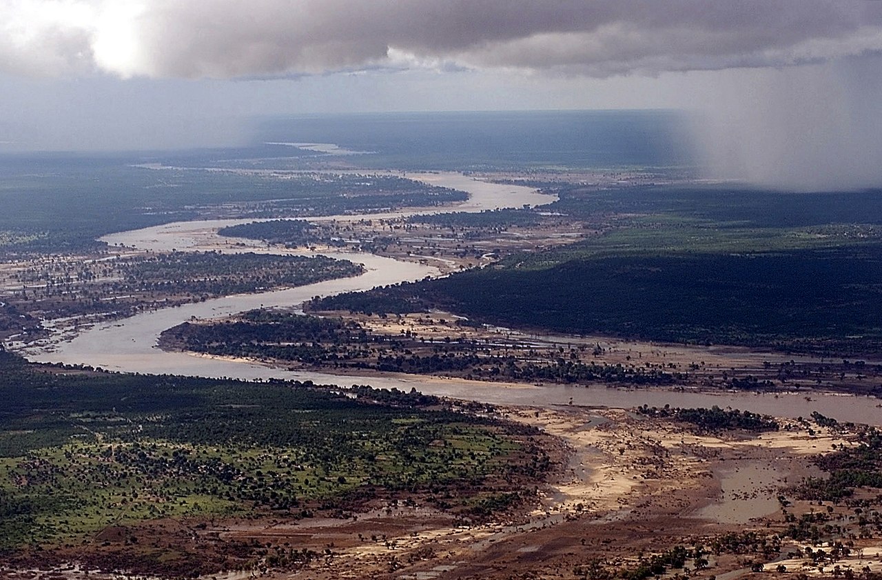
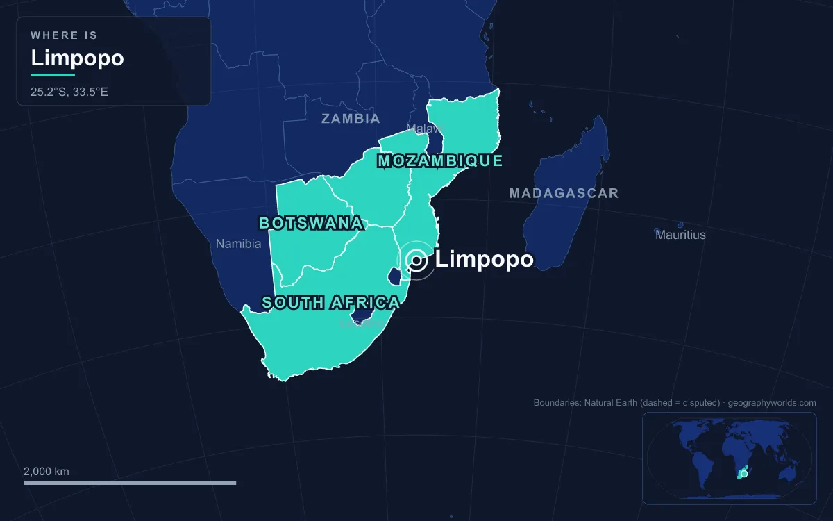
The Limpopo River is a roughly 1,750 km (1,090 mi) river of southern Africa that begins where the Crocodile and Marico rivers meet in South Africa, swings north and east in a great arc as the border with Botswana and then Zimbabwe for about 640 km, and crosses southern Mozambique to reach the Indian Ocean below Xai-Xai. Its basin covers about 415,000 km² across four countries and is home to roughly 14 million people, which makes it, after the Zambezi, the second-largest African river draining to the Indian Ocean. Farmers, miners, border traders, city water users and safari workers all draw a living from a river that, in dry years, flows in its upper reaches for 40 days or less.
Fourteen Million People Along a River That Often Stops Flowing
The Limpopo offers its people less water than its size suggests. Mean discharge at the mouth is given as somewhere between 170 and 313 m³ per second, modest for a basin of its size, and rainfall over the catchment is seasonal and unreliable. The western headwaters drain the edge of the Kalahari Desert in Botswana, where the Notwane River rises; further east the land becomes less arid, and the fertile lowlands carry much denser populations than the semi-deciduous forests of the Waterberg Massif. Kipling’s “great grey-green, greasy Limpopo” in the 1902 Just So Stories is a fair description of a slow, silt-laden river.
Because the river forms an international border along so much of its course, almost every use of it involves more than one government. South Africa lies to the south-east of the border stretch, Botswana to the north-west and Zimbabwe to the north. The main tributary is the Olifants River (the Lepelle, or Rio dos Elefantes in Mozambique), which contributes around 1,233 million m³ of water a year; the Shashe, Mzingwane, Mwenezi and Luvuvhu also feed the main stream. Below the Olifants confluence the river is navigable to the sea, although a sandbar at the mouth keeps large ships out except at high tide.
The name the local Venda communities use, Vhembe, has been adopted by the South African government for its northernmost district municipality. The first European known to have seen the river was Vasco da Gama, who anchored off the mouth in 1498 and called it the Rio do Espírito Santo. St Vincent Whitshed Erskine explored the lower course in 1868–69, and Captain J. F. Elton travelled down the middle course in 1870.
Mapungubwe: Cattle, Ivory and Gold at the Shashe Confluence, 1000–1300
Long before borders, the Limpopo valley supported one of the earliest states in southern Africa. Bantu-speaking farmers lived in the Shashe–Limpopo basin between about 350 and 450 CE. Around 900, Zhizo people drawn by the ivory trade settled at Schroda near the river, and around 1000 CE people of the Leopard’s Kopje culture crossed the Limpopo to Bambandyanalo, where they kept large cattle herds and traded with the Swahili city-states of the East African coast.
Between 1000 and 1200 the area received more rain than today, and the Limpopo’s floods spread nutrients across the valley floor, so the sandy-to-clay soils of the Mapungubwe Valley could be farmed all year round. Around 1220, during a dry period, the elite moved to the top of Mapungubwe Hill and the population settled the land below. By 1250 the capital held about 5,000 people and the state probably covered about 30,000 km². Wealth flowed from tribute and from the trade centre at the river confluence, with ivory and gold exported towards the coast. Around 1300 trade routes shifted north and the population moved away; their descendants are often associated today with the Kalanga (Shona) and Venda peoples.

Mapungubwe was rediscovered by the scientific community and the colonial government only in 1933, although local people had always known of the sacred site. Its artefacts, including the gold rhinoceros figurine, are now held in the Mapungubwe Museum in Pretoria, and the hill lies inside Mapungubwe National Park, on the meeting point of the South African, Botswanan and Zimbabwean borders. Deeper still, the Makapans Valley near Mokopane, inside the basin, holds Australopithecus fossils about 3.5 million years old.
Johannesburg, Pretoria and Gaborone at the Head of the Basin
The most populous part of the Limpopo’s catchment is not on the Limpopo at all, but at the top of its headwater rivers. The Crocodile River rises on the Witwatersrand ridge at Constantia Kloof in Roodepoort, Gauteng, and flows north past Lanseria, through the Hartbeespoort and Roodekoppies dams, past Brits and Thabazimbi, to its meeting with the Marico. Hartbeespoort Dam, about 35 km north-west of Johannesburg and 20 km west of Pretoria, was built mainly for irrigation and also supplies domestic and industrial water.
That proximity comes at a price. The Crocodile is one of the most polluted river systems in South Africa, carrying untreated industrial, mining, agricultural and household waste from the Johannesburg and Tshwane metropolitan areas. Hartbeespoort Dam has been hypereutrophic since the early 1970s, with more than 280 tonnes of phosphate and nitrate deposits blamed largely on poorly managed urban wastewater, and algal blooms have also hit the Roodekoppies Dam downstream.
On the Botswana side, the capital depends on the basin too. The Gaborone Dam on the Notwane River was begun in 1963, completed in 1964 and first filled and overflowed in the 1965–66 rainy season. Raised by 7 metres between 1983 and 1985, it now stands 25 m high and 3.6 km long, holds about 141 million m³ and supplies both Gaborone and Lobatse. With annual rainfall of 450–550 mm and potential evaporation of about 1,400 mm, it shows how thin the water margin is at the dry western edge of the basin.
Copper at Musina and Freight Over the Beitbridge Crossing
Mining is the basin’s other great employer. About 1,900 mines operate in the Limpopo basin, not counting roughly 1,700 abandoned ones. Musina (formerly Messina), the northernmost town in South Africa’s Limpopo province, grew from copper. Colonel John Pascoe Grenfell bought the farm Berkenrode in October 1903 after prospectors told him of copper that local people had once worked, founded the village in March 1904 and set up the Messina (Transvaal) Development Company in January 1905; Herbert Hoover sat on its board from 1914 to 1916. Iron ore, coal, magnetite, graphite, diamonds and copper are still mined in the district, which has between 20,000 and 40,000 residents, most of them Venda or Sotho.
About 16 km north of Musina, the river carries the busiest road border post in southern Africa. The Alfred Beit Road Bridge, named after the De Beers founder and financed by the Beit Railways Trust and South African Railways, was built in 1929 for $600,000. A new road bridge, built by the Zimbabwean government and opened on 24 November 1995, now takes the heavy traffic, and the old bridge carries rail only. The N1 runs south to Pretoria (463 km) and Johannesburg (521 km), while on the Zimbabwean side roads divide towards Bulawayo and Masvingo.
Beitbridge town, just north of the river, had 41,767 people at the 2012 census, mainly Venda and Ndebele. Freight, retail, construction, customs and policing employed about 1,200 people there, while informal work, mainly vending, employed about 1,400 more, and cross-border trading is a common source of income for women.

Rice and Tomatoes at Chókwè and Xai-Xai, and the Floods of 2000
In Mozambique the Limpopo becomes a farming river. Chókwè District in Gaza Province, regarded as the province’s economic capital, lies entirely below 100 metres in the Limpopo valley and gets 500–800 mm of rain a year. It had 187,422 people in 2007 and about 31,000 farms averaging 2.1 hectares, growing maize, cassava, cowpeas, groundnuts, sweet potatoes and rice; the town of Chókwè, about 230 km north of Maputo, is known for its tomatoes. Tsonga is the most common mother tongue, and the district, which lies in the Limpopo Corridor, is also home to many Zimbabwean immigrants.
Those irrigation schemes were meant to draw on the Massingir Dam on the Olifants. Construction stopped at independence in 1975 and again in the early 1980s amid economic decline and war, so the schemes downstream at Chókwè never received what was planned. A US$61 million rehabilitation finished in 2007, and the reservoir can now hold 2.8 billion m³, the second-largest in Mozambique; a new spillway and a 25 MW hydroelectric plant are being added.
Near the mouth, Xai-Xai, called João Belo until 1975 and now capital of Gaza Province, had 116,343 people in 2007. It grew in the early 1900s as a port and as a centre for processing rice and cashews from the wide, fertile plain around it.
Living on that plain carries a heavy risk. Heavy rain in January 2000 pushed the Limpopo at Chókwè to 6 metres on 24 January, twice its normal level, before Cyclone Eline struck near Beira on 22 February. The combined floods left about 463,000 people displaced or homeless and caused about 700 deaths, half of them in Chókwè, with damage estimated at US$500 million; some buildings in Xai-Xai stood 3 metres under water. In 2013 Chókwè was devastated again and many residents were evacuated to the Chiaquelane accommodation centre.
Hippos, Crocodiles and the Great Limpopo Transfrontier Park
Wildlife is the river’s other great asset. In north-eastern South Africa the Limpopo borders Kruger National Park, and the stretch between the Mokolo and Mogalakwena rivers holds the river’s highest concentration of hippopotamus. Zambezi sharks tolerate fresh water: one was caught at the Luvuvhu confluence, hundreds of kilometres upstream, in July 1950. In 2013, roughly 15,000 Nile crocodiles escaped into the river through the flood gates of the Rakwena Crocodile Farm.
A memorandum of understanding signed on 10 November 2000 created the Gaza–Kruger–Gonarezhou Transfrontier Park, renamed the Great Limpopo Transfrontier Park in October 2001. On 4 October 2001 the first 40 of a planned 1,000 elephants were moved from crowded Kruger to Mozambique’s war-damaged Limpopo National Park, and the Giriyondo border post between South Africa and Mozambique opened in March 2004.
The park now covers about 35,000 km², with plans to grow it to 99,800 km², and fences between its parts have begun to come down so animals can use old migration routes. The park takes in community land as well as state reserves, from the Makuleke region in South Africa to the Sengwe communal land in Zimbabwe. The Limpopo’s floods, droughts and wildlife are shared by four countries, much as along its larger northern neighbour, the Zambezi River; for the safari side of the basin, see our guide to Kruger National Park, and for the floodplains at the river’s end, our overview of Mozambique’s geography.