

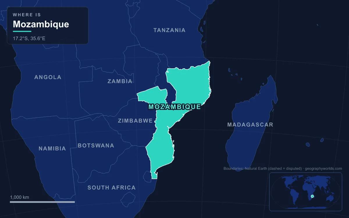
Mozambique lies on the south-east coast of Africa, facing Madagascar across the Mozambique Channel, and covers about 801,537 km², the 35th-largest country in the world. Its geography is a staircase: coastal lowlands take up most of the south and the long Indian Ocean shore, uplands rise through the centre, high plateaus and mountains line the western and north-western borders, and the Zambezi cuts across the middle to reach the sea in a wide delta. The highest point is Monte Binga, about 2,440 m, on the Zimbabwe border; Mount Namuli, 2,419 m, is second. The main rivers are the Zambezi, the Limpopo, the Save and the Rovuma, which forms the border with Tanzania.
Each of those pieces was made at a different time. Some of the rock near Manica is more than two billion years old, while the dunes of Bazaruto are still being shaped by wind and waves. Following the events in order, oldest first, explains why about 57% of the country stands on ancient crystalline basement while the south is soft sand, and why coal, gas, gemstones and mineral sands sit where they do.
More Than Two Billion Years Old: the Zimbabwe Craton at Manica and Chimanimani
The oldest ground in Mozambique lies along the western border in Manica Province, where the edge of the Zimbabwe Craton, a block of stable continental crust, crosses into the country. Its greenstone belts and granite-gneisses date from the Archean and early Proterozoic, more than 2 billion years ago. The schists are split into the Manica, Gairezi and Umkondo groups, the oldest individual rock units in the country, and their formation is tied to the Irumide orogeny, a mountain-building episode about 1.35 billion years ago.
These old rocks still pay their way. The Manica Belt is the continuation of Zimbabwe’s Mutare–Manica gold belt and carries gold, iron, copper, nickel and lead, and small mines have targeted placer gold in its sediments. South of Manica, the Chimanimani Mountains straddle the Zimbabwe border. They are built of hard, pale grey Precambrian quartzite tilted to about 40 degrees, and their highest summit, Monte Binga, is the roof of Mozambique at roughly 2,440 m. The hard quartzite gives the plateau a bare, rocky look; on Binga the beds dip east, so the western face is steep to sheer while the eastern approach, facing into Mozambique, is gentler.
The Pan-African Orogeny and the Granite Dome of Mount Namuli
The next great event reshaped almost the whole north. In the Neoproterozoic, an ocean called the Mozambique Ocean opened and then closed as fragments of crust collided to assemble the supercontinent Gondwana. The collision, known as the Pan-African orogeny, left a long suture called the Mozambique Belt that runs from East Antarctica through East Africa to Arabia. Its final closure is dated to about 585–550 million years ago. The orogeny, a tectonic event lasting some 250 million years, emplaced granites and pegmatites across Mozambique and overprinted many of its older rocks. At around the same time, the Snowball Earth glaciation of roughly 600 million years ago left glacial deposits in the Katangula Group of north-western Mozambique.
Weathering has since stripped away softer rock and left the hardest granite standing as inselbergs, isolated domes that rise sharply from the plateau between Lake Niassa and the coast at Ibo. The greatest is Mount Namuli in Zambezia Province, 12 km north-east of the tea town of Gurué. A plateau at 700–800 m carries a granite dome that climbs about 1,600 m higher, to 2,419 m. The British consul Henry Edward O’Neill measured and described it in 1886. Its forests shelter animals found nowhere else, including the Namuli apalis, a small bird, and Vincent’s bush squirrel. The same Proterozoic rocks hold graphite in seven of Mozambique’s ten provinces, and the inland plateau they form averages only about 600–750 m.
Karoo Coal at Moatize and Jurassic Lava in the Lebombo Mountains
From the Carboniferous to the Early Jurassic, large basins inside southern Gondwana filled with river and glacial sediment. These are the rocks of the Karoo Supergroup, and in Mozambique they lie in the Alto Zambezi, Rio Lunho and Rio Lugenda basins. Swampy forests in those basins became coal. The richest deposit is around Moatize, near Tete on the Zambezi, where the basin holds an estimated 2.5 billion tonnes of coal, mined chiefly as coking coal. The Brazilian company Vale won a concession there in 2006, the rebuilt Sena railway carried the first train in more than two decades to Moatize on 30 January 2010, and a second line to a new coal port at Nacala opened in 2015.
The Karoo era ended in fire. About 183 million years ago, as Gondwana began to break apart, enormous volumes of basalt poured out across southern Africa and Antarctica, a flood-basalt province that covered around 3 million km². In the far south of Mozambique the lavas form the Lebombo Mountains, a narrow ridge of alternating basalt and rhyolite that runs about 800 km from KwaZulu-Natal north through Eswatini and along the South African border. Before the break-up, the Lebombo line matched the Explora Escarpment off Dronning Maud Land in Antarctica. The hard rhyolite stands up as parallel ridges and the soft basalt wears into savanna valleys; in Mozambique the range nowhere tops 630 m. The Jurassic also produced Mount Gorongosa, an oval ring complex of granite and gabbro about 30 by 25 km across, linked to Karoo volcanism, whose highest peak, Gogogo, reaches 1,863 m.
As Gondwana broke apart, the new eastern edge of Africa subsided. Sediment began piling up offshore in the Jurassic and has continued ever since in the Mozambique and Rovuma basins. Those layers now form the largest aquifer in the country, under about 21% of its area, and the offshore Rovuma Basin in the far north holds the large natural gas fields, such as Mamba South, found in 2010–2011 off Cabo Delgado Province. East of the coast lies the Mozambique Channel, about 1,700 km long and 3,292 m deep at one point, 230 km off the Mozambican coast.
The East African Rift Reaches Lake Niassa and Gorongosa
The most recent tectonic chapter began around the start of the Miocene, 22–25 million years ago, when the crust of eastern Africa started to split along the East African Rift. One of its great lakes straddles Mozambique’s north-western border. Lake Niassa, called Lake Malawi in Malawi and Lake Nyasa in Tanzania, is 560–580 km long, covers about 29,600 km² and reaches 706 m deep, making it the fourth-largest freshwater lake in the world by volume. It holds more fish species than any other lake, including at least 700 kinds of cichlid, and the Mozambican shore was declared a reserve on 10 June 2011. On the south-east shore a range of 1,500–1,800 m drops about 900 m to the lake within 10 km.

Further south the rift continues as a graben, a strip of dropped crust, running from the Zambezi to Pungwe Bay. Gorongosa National Park fills more than 4,000 km² of this valley floor and its flanking plateaus, with Mount Gorongosa rising beside it. The flat, low floor floods each wet season and drains in the dry months, producing a mix of grassland, acacia, pans and termite-hill thicket that once carried some of the densest wildlife populations in Africa. Large mammal numbers fell by as much as 95% during the civil war of 1977–1992, and a restoration programme with the Carr Foundation has been rebuilding them since.
Zambezi Silt and Save Sand: Building the Coast from Beira to Bazaruto
The last layer is still being laid down. The Zambezi, 2,574 km long and the largest African river flowing into the Indian Ocean, crosses Mozambique from the Zambian and Zimbabwean borders to the sea. In Tete Province it is held back by Cahora Bassa, Africa’s fourth-largest artificial lake, which began filling in December 1974. Before the Kariba and Cahora Bassa dams, the river peaked in April at a mean of about 6,700 m³ a second, and in 1958 a record 22,500 m³ a second came down. Controlled flows since the 1970s have left the delta only about half as broad as it once was. More on the river’s full course is in our Zambezi River guide.
Between Bazaruto and Angoche the rivers have built the Bight of Sofala, the low “Swamp Coast” of mangroves and wetlands, where the continental shelf reaches 140 km wide off Beira and supports the country’s main fishery. South of the Save River the coast is sand. A belt of dunes about 30 km wide overlies Cretaceous and Paleogene rock, and some dunes reach 120 m, with lagoons and salt lakes trapped behind them. The Bazaruto Archipelago off Vilankulo was built from sand the Save River deposited before it shifted course; it became a national park in 1971 and holds Mozambique’s largest remaining dugong population, about 120 animals.

North of the Zambezi the pattern changes again. The Mozambique Current runs close inshore and scours away soft sediment, so the coast north of Angoche to Cape Delgado is indented with rocky headlands and cliffs and fringed with islands such as the Quirimbas, part of the coral coast that continues into Tanzania and Kenya. Across the country, rain falls between October and March, averaging about 590 mm a year, and the wet season also brings cyclones. Put together, the sequence runs from craton to collision belt, from Karoo coal to rift valley, and finally to the sand and silt still moving today, which is why the country’s landscapes change so sharply across the borders it shares with the six countries that border Mozambique.