

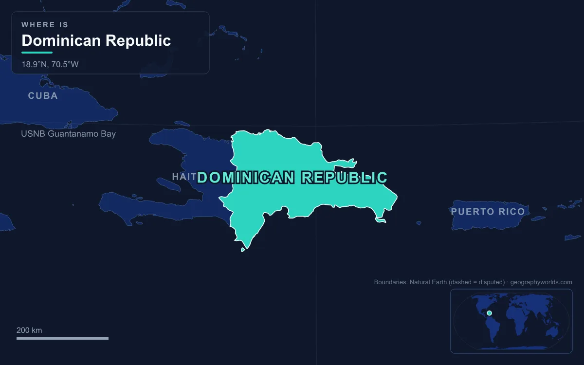
The Dominican Republic occupies the eastern five-eighths of Hispaniola in the Greater Antilles, covering about 48,670 km² and sharing a 376 km land border with Haiti. Its surface is a set of parallel northwest–southeast mountain ranges and valleys: the Cordillera Septentrional, the Cibao Valley, the Cordillera Central, the San Juan Valley and Plain of Azua, the Sierra de Neiba, the below-sea-level Hoya de Enriquillo and the Sierra de Bahoruco, with the Caribbean Coastal Plain spreading east of Santo Domingo. Pico Duarte, about 3,100 m (3,101 m in a 2021 survey), is the highest peak in the Caribbean, while Lake Enriquillo, about 46 m below sea level, is the lowest point of any island country. The longest river is the Yaque del Norte at 296 km. Every one of those features is the product of a geological story that runs from Cretaceous volcanoes on the sea floor to faults that are still moving today, told here in order.
Cretaceous Island Arcs and the Duarte Complex
The oldest rocks of Hispaniola formed in the early Cretaceous, more than 100 million years ago, as magma rose beneath volcanic island arcs in what was then open ocean. The island is not one arc but an amalgam of about 11 small ones, swept together over tens of millions of years. Through the Albian to Campanian stages, volcanism, plutonism and metamorphism ran side by side, almost entirely under water. A first arc collision before the Aptian uplifted the east of the landmass; a second followed in the Campanian.
The deepest of these rocks now stand at the top of the country. The Duarte Complex, exposed in the Cordillera Central, contains picrite that geologists have compared to the rocks of an oceanic plateau built by a Galápagos-type hotspot. Mid-Cretaceous peridotite, a mantle rock, was pushed up over a sheared schist zone in the Maimón Formation. Further north, the volcanic and sedimentary Los Ranchos Formation preserves a small ancient basin where gold, quartz and pyrophyllite became concentrated. That deposit is Pueblo Viejo in Sánchez Ramírez Province, the first gold deposit the Spanish exploited in the Americas, where the current open-pit operation began in 2012. It is now the largest gold mine in Latin America, run by a company owned 60% by Barrick Gold and 40% by Newmont.
The Eocene Collision with the Bahamas Platform
Into the Paleogene, the arc complex kept erupting below sea level. The change came in the middle Eocene, roughly 45 million years ago, when the amalgamated arcs drove into the southern edge of the North American Plate at the Florida–Bahamas carbonate platform. The collision switched off the volcanoes and the plutons. Arc rocks rose above the waves for the first time and began to erode, and an east–west strike-slip fault system emerged along the new plate boundary.
With arc volcanism ended in the Eocene, the Dominican Republic today has no active volcanic arc, unlike the Lesser Antilles to the southeast. It also fixed the basic grain of the country. Hispaniola's ranges run northwest to southeast because they follow the sutures between the old arcs, and the plate boundary that formed after the Eocene still runs along the island, which is why the country sits squeezed between the North American and Caribbean plates.
Miocene Uplift: Nine Ranges, Amber and Larimar
From the Miocene onward, roughly the last 23 million years, the island was compressed against North America and against oceanic plateau crust to the south. Oblique strike-slip faults formed along the old arc sutures and lifted nine large fault-bounded mountain ranges. The Cordillera Central became the most rugged of them, called the Massif du Nord where it continues into Haiti. Its highest summits sit in the Pico Duarte and Valle Nuevo massifs. Pico Duarte stands only a few metres above its twin, La Pelona (3,097 m), separated by a col about 1.5 km wide called Valle del Baíto. The first reported climb was made in 1851 by Robert Hermann Schomburgk, who named it Monte Tina; it took its present name, after the founding father Juan Pablo Duarte, after the death of the dictator Rafael Trujillo, whose name it had carried.
Elevation gives the Cordillera Central a climate few associate with the Caribbean. Mean temperatures fall to about 18 °C at Constanza, and around Pico Duarte nights drop several degrees below freezing in winter, in forests of the endemic Hispaniolan pine (Pinus occidentalis) and treeless tussock meadows.
The northern Cordillera Septentrional, which peaks at Diego de Ocampo (1,249 m) near Santiago, rose astride the strike-slip boundary itself, its marine rocks folded into an anticline by Miocene–Pliocene compression. Those same Miocene sediments hold Dominican amber, the resin of the extinct tree Hymenaea protera. Its age has been argued over: one early-1990s study suggested up to 40 million years, while marine microfossils in the host sediment point to about 20 to 15 million years. It is mined in the Cordillera Septentrional and around Bayaguana and Sabana de la Mar in the east; in the north the amber-bearing unit is made of clastic rock washed down with sandstone fragments.
In the far southwest, the Sierra de Bahoruco tells a different story. It is a Cretaceous volcanic massif that sank beneath a blanket of coral limestone and was then pushed up again, so fossil reef rock now crops out above 2,000 m. Miocene andesites and basalts erupted into those limestones, and their gas cavities later filled with pectolite stained blue by copper. That stone is larimar, found only in the Dominican Republic around Barahona. Miguel Méndez and Peace Corps volunteer Norman Rilling picked it up on a beach in 1974, traced it up the Bahoruco River and opened the Los Chupaderos mine at the outcrop.
Los Haitises: A Limestone Platform Dissolved into Karst
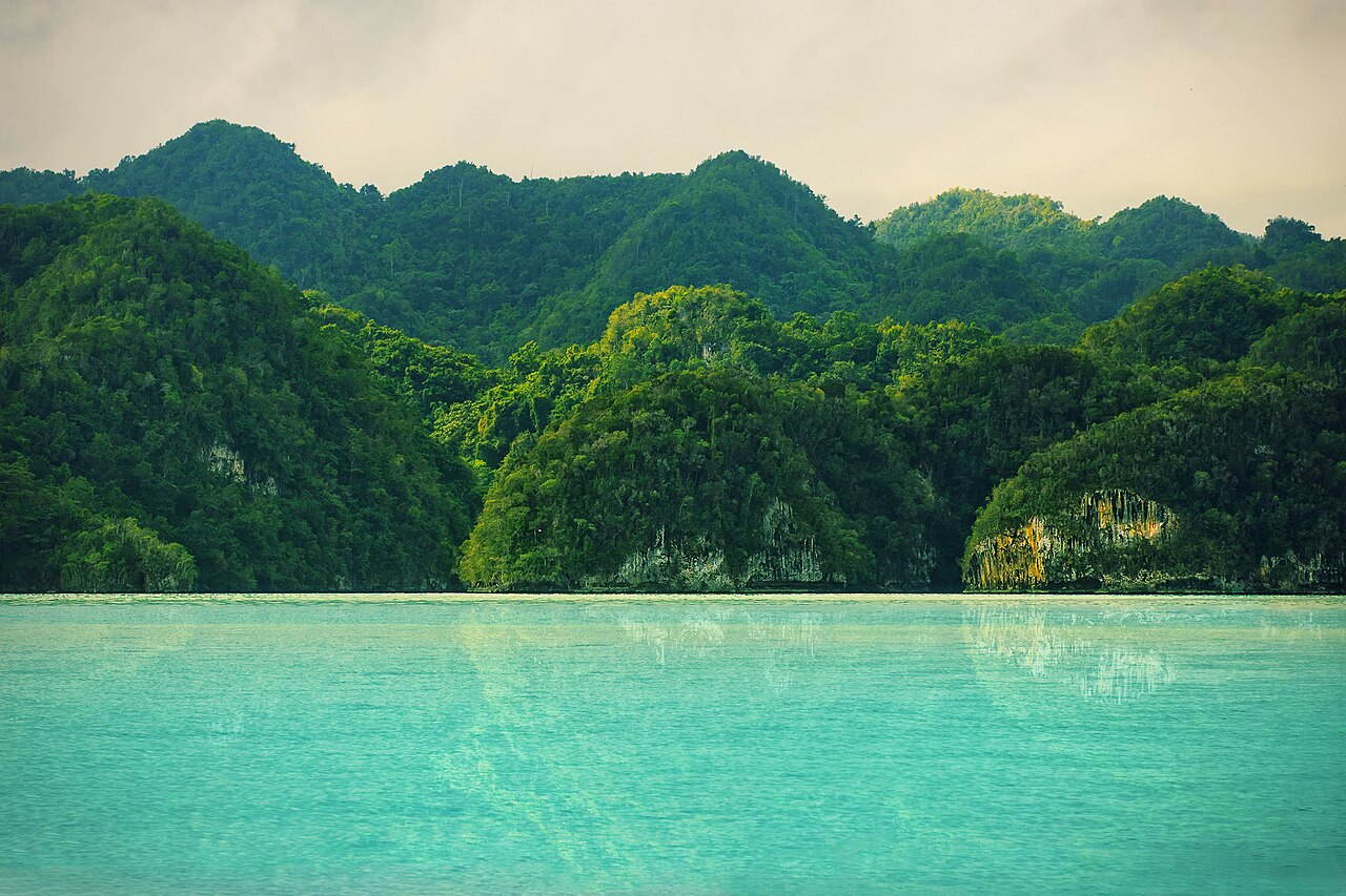
While the ranges rose, shallow Miocene seas laid down thick limestone on the island's flanks. South of Samaná Bay that rock now forms Los Haitises, a platform karst about 82 km from Sabana de la Mar to Cevicos and 26 km from Samaná Bay to Bayaguana. Rain of roughly 1,900 to 2,000 mm a year, among the highest totals in the country, has dissolved it into dense clusters of conical hills of nearly uniform height, 200 to 300 m, separated by sinkholes and riddled with caverns. The islets scattered across Samaná Bay are the same hills, drowned at their feet by the sea.
The karst divides the Cordillera Central from its eastern branch, the Cordillera Oriental or Sierra del Seibo. Los Haitises National Park was created by Law 409 on 3 June 1976 and expanded by decree in 1996 from 208 to 826 km². Its coast holds the largest stands of Caribbean mangrove in the country, where the Yuna and Barracote rivers reach the bay.
One Million Years Ago: The Strait That Became the Hoya de Enriquillo
The country's youngest major landform lies in the southwest. Between the Sierra de Neiba (Mount Neiba, 2,279 m) and the Sierra de Bahoruco runs a linear depression that continues west into Haiti as the Plaine du Cul-de-Sac. It formed as a ramp basin, squeezed between the Haitian fold-and-thrust belt to the north and the uplifted oceanic crust of Bahoruco and the Massif de la Selle to the south. Until about one million years ago it was a marine strait, an arm of the sea. When the water level fell, the strait was filled in by sediment carried down by the Yaque del Sur River, leaving a closed basin whose floor lies below sea level.

What remains is Lake Enriquillo, the largest lake in the Caribbean, lying about 46 m below sea level only 85 km southwest of Pico Duarte. It has no outlet, and its salinity swings from about 33 parts per thousand, close to seawater, to over 100. Its size swings too: it covered 164 km² in 2004 and about 350 km² by 2011, drowning farmland and two of its three islands, Barbarita and Islita; only Isla Cabritos remains. The lake holds the largest population of American crocodiles in the Caribbean, along with rhinoceros and Ricord's iguanas. A national park was declared in 1974 and in 2002 it became part of the Jaragua-Bahoruco-Enriquillo Biosphere Reserve.
The Yaque del Norte, the Yuna and the Cibao Valley
Rivers are the agents still shaping the surface. Almost all of the main ones rise in the Cordillera Central and radiate outward. The Yaque del Norte flows northwest through the Cibao to the Atlantic; the Yuna runs east through the Vega Real into Samaná Bay; the Yaque del Sur heads south to the Caribbean, and its sediment filled in the old Enriquillo strait. The Cibao Valley between the Cordillera Central and the Cordillera Septentrional is the country's largest valley, and its eastern half, the Vega Real, is the most fertile land in the republic and one of its most densely populated; the valley as a whole stretches from Samaná Bay west into Haiti, where it is called the Plaine du Nord.
Rainfall controls how hard they work. The northeast trade winds drop 2,500 mm or more a year on the windward northeast, while the rain-shadowed southwestern valleys get about 500 mm and stay semi-arid. The Artibonite is the longest river on Hispaniola, but only 68 km of it runs through Dominican territory before it turns into Haiti. The Ozama, rising in the Sierra de Yamasá, reaches the Caribbean at Santo Domingo, the colonial city described in our guide to Santo Domingo, the Dominican capital.
Faults Still Moving: Samaná 1946 and the Enriquillo Fault
The building is not finished. Two left-lateral fault systems share the motion between the North American and Caribbean plates: the Septentrional–Oriente fault zone along the north of Hispaniola and the Enriquillo–Plantain Garden fault zone along the south, the latter named for the lake where it emerges. The Septentrional fault is estimated to store about 12 mm of strain a year; a tremor on it destroyed Cap-Haïtien and towns in the northern Dominican Republic on 7 May 1842.
The largest Caribbean earthquake of the instrumental era struck near Samaná on 4 August 1946. Measured at magnitude 7.8, it ruptured a thrust fault offshore, raised a tsunami that exceeded 5 m in several places and was recorded as far as Atlantic City, New Jersey, and killed 1,790 people. The Enriquillo system to the south was associated with the 2010 Port-au-Prince earthquake across the border, which our guide to the geography of Haiti covers from the other side. The ranges, valleys and lowest lake in the Caribbean are still being reshaped by the same plate boundary that drew the line between the two countries, set out in detail in the countries that border the Dominican Republic.