

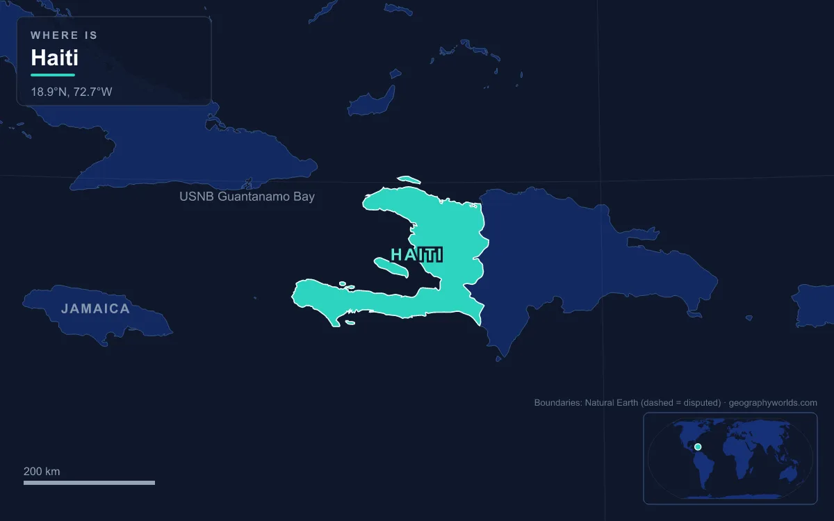
Haiti occupies the western three-eighths of Hispaniola in the Caribbean, sharing the island with the Dominican Republic along a 360 km border. It covers 27,750 km², and more than three-quarters of that land stands above 210 m. Its main physical regions are the Massif du Nord and the Plaine du Nord in the north, the Plateau Central and the Artibonite valley in the middle, the Plaine du Cul-de-Sac depression behind Port-au-Prince, and the mountainous southern (Tiburon) peninsula, whose Chaîne de la Selle and Massif de la Hotte form its spine. The highest point is Pic la Selle, usually given as 2,680 m, though some surveys put it at 2,574 m. The longest river is the Artibonite, which runs 253 km through Haiti to the Gulf of Gonâve. The largest lake is Étang Saumâtre (Lake Azuei) at 170 km². The country has about 11.4 million people. All of these features are young by geological standards. They were built over the last 130 million years or so, in a sequence of volcanic island arcs, a collision, rising fault blocks and retreating seas, and the earthquakes of 2010 and 2021 showed that the process is still going on.
Early Cretaceous Island Arcs: Haiti’s Volcanic Basement
Hispaniola has no ancient continental core of the kind found under Canada or Brazil. Its oldest rocks formed in the Early Cretaceous, when the land that would become Haiti was a string of volcanic islands above a subduction zone in the ancestral Caribbean. Magma rose beneath these islands and cooled into granite-like plutons, while lava and ash piled up on the sea floor around them. Geologists count about 11 separate small island arcs in the make-up of Hispaniola, each with its own volcanic history, which were later pushed together like train carriages in a collision.
Before the Aptian stage, roughly 120 million years ago, part of the island was uplifted, most strongly in the east, probably because a volcanic island arc collided with it. From the Albian to the Campanian, plutonism, metamorphism and volcanism went on at the same time, but almost entirely underwater, because the young landmass was still largely submerged. A second arc collision followed in the Campanian. Southern Haiti also holds a different kind of crust. The so-called Enriched Basalts of the southern peninsula, like the picrite of the Duarte Complex in central Hispaniola, are read as oceanic-plateau rocks of Galápagos hotspot type.
The Beloc Formation and the Asteroid of 66 Million Years Ago
One of the most closely studied rock layers in Haiti is the Beloc Formation on the southern peninsula. It preserves tektites, small glassy droplets of melted rock thrown into the air by an impact, together with shocked quartz and plagioclase, mineral grains deformed by pressures that only a hypervelocity collision can produce. They came from the asteroid that struck the Yucatán Peninsula in Mexico about 66 million years ago, the event behind the mass extinction at the end of the Cretaceous that wiped out the non-avian dinosaurs. Haiti still sat largely below sea level, so the debris settled into a marine basin and was buried there, which is why the layer survived to be studied.
Into the Paleogene, volcanism and the intrusion of plutons continued, but the arcs stayed submerged for millions of years more.
Eocene Collision with the Florida–Bahama Platform
The turning point came in the middle Eocene, around 45 million years ago. The welded-together island arcs of the Caribbean plate ran into the southern edge of the North American plate at the Florida–Bahama Platform, a broad shelf of carbonate rock. The collision ended volcanism and plutonism on Hispaniola. With subduction stopped, the arc rocks were pushed up above the waterline for the first time and began to erode, while shallow seas around them laid down thick limestone.
The same collision changed how the two plates move past each other. Unable to push further north, the Caribbean plate began sliding east relative to North America along strike-slip faults, which shear sideways rather than up and down. The Gonâve microplate, a strip about 1,100 km long that includes western Hispaniola, began to form in the Early Eocene after the leading edge of the Caribbean plate, today’s Cuba, struck the Bahamas platform. It is bounded by the Septentrional–Oriente fault zone in the north and the Enriquillo–Plantain Garden fault zone in the south, and Haiti sits across both.
Miocene Faulting Raises the Massif du Nord and the Chaîne de la Selle
From the Miocene onward, beginning about 23 million years ago, Hispaniola was squeezed against North America at an angle. Oblique strike-slip faults opened along the old sutures between the island arcs, and nine large fault-bounded mountain ranges rose across the island. Several of Haiti’s ranges line up with ranges across the border. The Massif du Nord continues the Dominican Cordillera Central, the range that also carries Pico Duarte, at 3,101 m the highest peak in the Antilles. The Chaîne des Matheux faces the Sierra de Neiba. The Chaîne de la Selle extends the Sierra de Bahoruco.
Between the ranges, the down-dropped blocks became Haiti’s lowlands. The Plateau Central spreads along both sides of the Guayamouc River south of the Massif du Nord. The Plaine de l’Artibonite lies between the Montagnes Noires and the Chaîne des Matheux and opens west to the Gulf of Gonâve, the largest gulf in the Antilles. The Plaine du Cul-de-Sac lies between the Chaîne des Matheux and the Chaîne de la Selle. The two peninsulas give the country a rough horseshoe shape around the gulf, and with it 1,771 km of coastline, second only to Cuba in the Greater Antilles. Île de la Gonâve, 743 km², sits in the middle of the gulf. Tortuga, 180 km², lies off the north coast.
Old Sea Channels: When the Massif de la Hotte Was an Island
As the ranges rose, the sea did not leave Haiti all at once. About 2.5 million years ago, the Massif de la Hotte at the western tip of the Tiburon Peninsula was cut off from the Massif de la Selle by a deep, wide sea channel and stood as a separate island. Isolation turned it into a centre of endemism. Plants, birds, reptiles and frogs evolved there that are found nowhere else, and Conservation International ranks the area among the most urgent conservation sites in the world because 13 of Hispaniola’s most critically endangered species, all amphibians, live there. The range rises to Pic Macaya, 2,347 m, Haiti’s second-highest mountain, 36 km northwest of Les Cayes, and its summits hold some of the last stands of dense cloud forest in the country.
An older arm of the sea ran along the Plaine du Cul-de-Sac, which stretches about 130 km from the Gulf of Gonâve into the Dominican Republic, where it is called the Hoya de Enriquillo. When the land rose during the Oligocene–Miocene uplift and the sea withdrew, salt water was trapped in the lowest parts of the trough, and parts of the valley still lie below sea level. Étang Saumâtre, 22 km east of Port-au-Prince, is the result. It is 22 km long and up to 12 km wide, has no surface outlet, sits about 15 m above sea level and reaches 30 m deep. Its water is brackish, at about 15 parts per thousand, and it is home to American crocodiles and American flamingos. Smaller Trou Caïman, 16.2 km², lies in the same depression, and so does the hypersaline Lake Enriquillo across the border.

The Artibonite River Carves the Central Valley
Once the mountains stood clear of the sea, rivers started cutting into them. The Artibonite is the largest of them and the longest river on Hispaniola. It rises in the Cordillera Central northeast of Río Limpio in the Dominican Republic, forms the border for several kilometres near Pedro Santana, then turns west into Haiti. Of its total length, 68 km lie in the Dominican Republic and 253 km in Haiti. Its basin covers 9,013 km², of which 6,399 km² is Haitian. The river empties into the Gulf of Gonâve south of La Grande Saline, and for its last stretch it crosses the Plaine de l’Artibonite, Haiti’s most important valley for crops. The river is navigable by barge for part of its course.
People have changed the river’s work in recent decades. The Péligre Dam, finished in 1956 on the upper river in the Centre department, is 72 m high and the tallest dam in Haiti. Its three 17 MW turbines give an installed capacity of 51 MW, and filling its reservoir, Lake Péligre, forced local families to leave their land. Deforestation has also loaded the river with eroded soil. Satellite studies estimate Haiti’s tree cover at about 30 per cent, down from about 60 per cent in 1925.

From 1770 to 2021: The Enriquillo Fault Is Still Building Haiti
The faults that raised Haiti’s mountains are still active. The Enriquillo–Plantain Garden fault zone runs along the southern peninsula from Lake Enriquillo to Jamaica. It takes up about half of the motion between the Caribbean and North American plates, about 20.6 mm a year, while the Septentrional–Oriente fault along the north coast takes up most of the rest. Because the plates also press together, the fault zone lifts the land as well as shearing it, and that vertical movement keeps the southern ranges high.
The cost of that movement is earthquakes. One estimated at magnitude 7.5 struck Port-au-Prince in 1770. On 12 January 2010 a magnitude 7.0 earthquake hit at a depth of 13 km near Léogâne, about 25 km west-southwest of the capital, on blind thrust faults linked to the fault zone. The rupture was roughly 65 km long. Death-toll estimates range from about 100,000 to 316,000, and the figures are still disputed. On 14 August 2021 a magnitude 7.2 earthquake struck the Tiburon Peninsula near Petit-Trou-de-Nippes and killed at least 2,248 people. Both struck along the same plate boundary whose squeeze has been raising the southern ranges since the Miocene.
Seen this way, Haiti’s terrain is a timeline. Cretaceous arc rocks lie beneath, Eocene carbonates record the collision, Miocene fault blocks divide plain from mountain, and salt lakes mark where old seas withdrew. Rivers and earthquakes are still reshaping it today. The same story continues east across the border, as our guide to the geography of the Dominican Republic shows. For the human side of the land frontier, see the countries that border Haiti. If you want to see how the capital has been rebuilt in the Cul-de-Sac fault zone, read our profile of Port-au-Prince.