

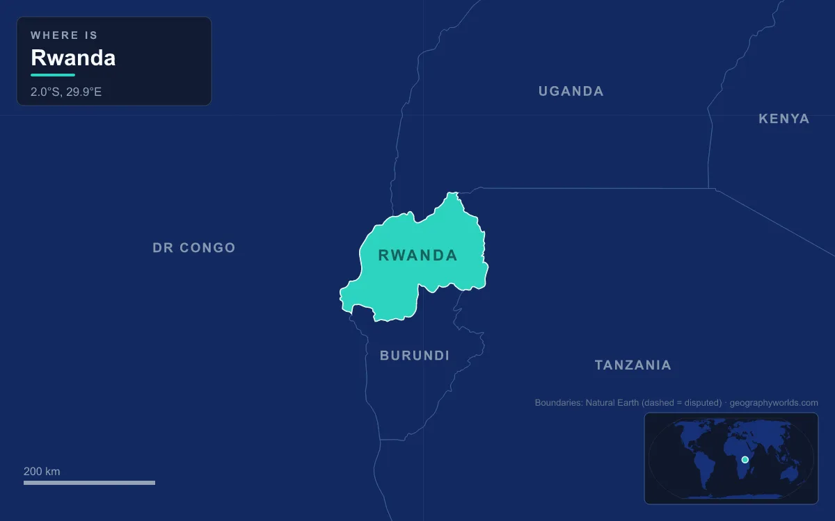
Rwanda is a small, landlocked country in the highlands of East Africa, a few degrees south of the Equator, bordered by Uganda, Tanzania, Burundi and the Democratic Republic of the Congo. It covers 26,338 km², about 6% of it water, and falls into three physical regions from west to east: the mountains of the Albertine Rift, including the Virunga volcanoes; a central plateau of rolling hills and steep ridges that gives Rwanda its nickname, the “land of a thousand hills”; and the savanna, lakes and swamps of the Akagera basin in the east. The highest point is Mount Karisimbi at 4,507 m and the lowest is the Rusizi River on the Congolese border at 950 m. The longest river is the 351 km Nyabarongo, which joins the Akanyaru to form the Kagera, and the largest lake is Lake Kivu on the western border. The 2022 census counted 13,246,394 people, or 503 per km², one of the highest densities in Africa. Nearly everything about how those people live, farm and trade follows from that relief.
The Virunga Volcanoes and the Crowded Districts of Musanze and Rubavu
The northwest corner of Rwanda is volcanic. Five of the eight main Virunga volcanoes, Karisimbi, Bisoke, Muhabura, Gahinga and Sabyinyo, lie inside Rwanda’s Volcanoes National Park, which covers 160 km² along the borders with the DR Congo and Uganda. Karisimbi, at 4,507 m, is the highest; its name comes from the Kinyarwanda word amasimbi, meaning snow, which can appear on the summit in the dry months of June, July and August.
The park was established in 1925, initially as a small area between Karisimbi, Bisoke and Mikeno to protect mountain gorillas from poachers, and it was the first national park created in Africa. In 1967 the American primatologist Dian Fossey set up the Karisoke Research Centre in the saddle between Karisimbi and Bisoke. The park was not always left alone: 700 hectares were cleared for settlement in 1958, and another 1,050 hectares were turned over to pyrethrum between 1969 and 1973.
Those clearances show the pull of volcanic soil. Volcanic activity has left much of Rwanda with fertile soils, and farmers have crowded onto it. Outside Kigali, the two most densely settled districts in the country are Rubavu, at 1,614 people per km², and Musanze, at 1,157, both in the northwestern highlands. The same volcanoes are also the main natural hazard: Nyiragongo, across the border in the DR Congo, is the most active in the chain and threatens the region with lava flows and gas.
Lake Kivu’s Shore From Gisenyi to Cyangugu
Rwanda’s western border runs down the floor of the Albertine Rift, the western branch of the East African Rift, and most of it is water. Lake Kivu covers about 2,700 km² at an altitude of 1,460 m and reaches a maximum depth of about 475 m; about 58% of its area lies in the DR Congo. The Rwandan shore holds three towns, Gisenyi in Rubavu District in the north, Kibuye on the central coast and Cyangugu in the south, and Gisenyi, across the border from Goma, is Rwanda’s second-largest city.

The lake owes its present shape to the volcanoes to its north. Kivu once drained north towards the White Nile, but between about 13,000 and 9,000 years ago the rising Virungas blocked that outlet. The water was forced south down the Rusizi into Lake Tanganyika, and the Rusizi valley now holds the lowest ground in Rwanda, at 950 m. The lake’s deep water is unusual: it is layered, saltier with depth, and holds an estimated 65 km³ of dissolved methane and 256 km³ of carbon dioxide, fed by volcanic springs. Kivu is one of only three lakes in the world known to undergo limnic eruptions, when gas-rich bottom water overturns. The methane is a potential energy source for the lakeside towns; the carbon dioxide is a hazard for the roughly two million people who live around the shore.
The Congo–Nile Divide, Nyungwe Forest and the Tea Estates
East of the lake, the land climbs to the Congo–Nile watershed, a north–south line of ridges along the western highlands at 1,500 to 2,500 m. It splits the country unevenly: about 80% of Rwanda drains east into the Nile basin, mainly through the Nyabarongo and Kagera to Lake Victoria, while about 20% drains west into the Congo basin through Lake Kivu and the Rusizi.
In the southwest, the divide is covered by Nyungwe Forest, about 1,019 km² of montane rainforest, bamboo, grassland and bog on the Burundi border, where it continues as Kibira National Park. Nyungwe was made a national park in 2004 and added to the UNESCO World Heritage List in September 2023. It holds 13 primate species and more than 300 bird species, and Mount Bigugu, at 2,921 m, rises inside its boundaries. The source of the Nyabarongo in Nyungwe is one of the contenders for the most distant source of the Nile.
The same high, wet, steep ground suits Rwanda’s export crops. Coffee and tea are the main cash crops, favoured by the altitude, slopes and volcanic soils, and by 2002 tea had become the country’s largest export. In 2019 Rwanda produced about 31,000 tonnes of tea and 29,000 tonnes of coffee, much of it from hillside estates and smallholdings on terraced slopes.

Kigali, a Capital Spread Across Ridges
The central plateau descends east from the rift highlands in a mass of rounded hills, and Kigali sits near the middle of it at about 1,567 m. The city’s site was chosen in 1907 by Richard Kandt, the German colonial resident, for its central position, views and security. It stayed small for decades, with about 6,000 people at independence in 1962, when it was chosen as the national capital over Nyanza, the royal seat, and Butare, then called Astrida, because of its central location.
Growth since then has been rapid. Kigali counted 1,745,555 inhabitants at the 2022 census, after reaching 115,000 in 1978 and 235,000 in 1991, and it is by far the most crowded part of the country at 2,401 people per km². Its suburbs climb from valley wetlands to ridge tops, and the government has restored some of those valley floors, such as the Nyandungu Urban Wetland Eco-Park. Altitude keeps the city mild for a place so close to the Equator: daily temperatures typically range from 12 to 27 °C, and about 1,100 mm of rain falls a year in two rainy seasons, from March to May and from October to December.
Even so, Rwanda remains a rural country. Only 27.9% of its people lived in urban areas in 2022, and most families still depend on small farms on slopes that heavy rain can strip of soil. Terracing and reforestation programmes are the government’s answer to that erosion, alongside a national ban on plastic bags.
Akagera’s Savanna and the Edges of the Country
East of Kigali the hills flatten into the lowest and driest part of the country: savanna, plains and a network of lakes and papyrus swamps. The Nyabarongo, Rwanda’s longest river, rises in the southwest, loops north, east and southeast, and meets the Akanyaru to form the Kagera, which then runs due north along the Tanzanian border towards Lake Victoria. Smaller lakes such as Muhazi, Rweru and Ihema are scattered across the east.
Akagera National Park, founded by the Belgian administration in 1934, protects 1,122 km² of this country along the Kagera. Lakes and swamps make up more than a third of the park, which is the largest protected wetland in east-central Africa. The park was once far larger, at about 2,500 km² when it was created, and it was so well stocked with African wild dogs that it was nicknamed the Parc aux Lycaons; the last wild dogs were seen in 1984. Since 2010 it has been run jointly by the Rwanda Development Board and African Parks. Because the land is drier, the Eastern Province is the most thinly settled region at 433 people per km², even though, with 3,563,145 people, it is the most populous of the four provinces.
Borders Drawn Along Rivers, Lakes and Volcanoes
Rwanda’s 930 km of land borders follow its geography closely. It shares 172 km with Uganda in the north, partly across the Virunga volcanoes; 222 km with Tanzania, largely along the Kagera; 315 km with Burundi in the south, where Nyungwe Forest meets Kibira; and 221 km with the DR Congo, mostly down Lake Kivu and the Rusizi. The territory was assigned to Germany at the Berlin Conference of 1884 as part of German East Africa, occupied by Belgium in 1916 and governed from 1922 as part of the League of Nations mandate of Ruanda-Urundi until independence on 1 July 1962.
Being landlocked is the last geographic fact that shapes daily life. The nearest coast, near Tanga in Tanzania, is roughly 1,000 km away in a straight line, so Rwanda’s trade moves along the Central Corridor through Tanzania to Dar es Salaam and the Northern Corridor through Uganda and Kenya to Mombasa. To see how the capital uses its hills, read our guide to Kigali; for each neighbour along those 930 km, see the countries that border Rwanda; and to place the country on the continent at a glance, start with where Rwanda is.