
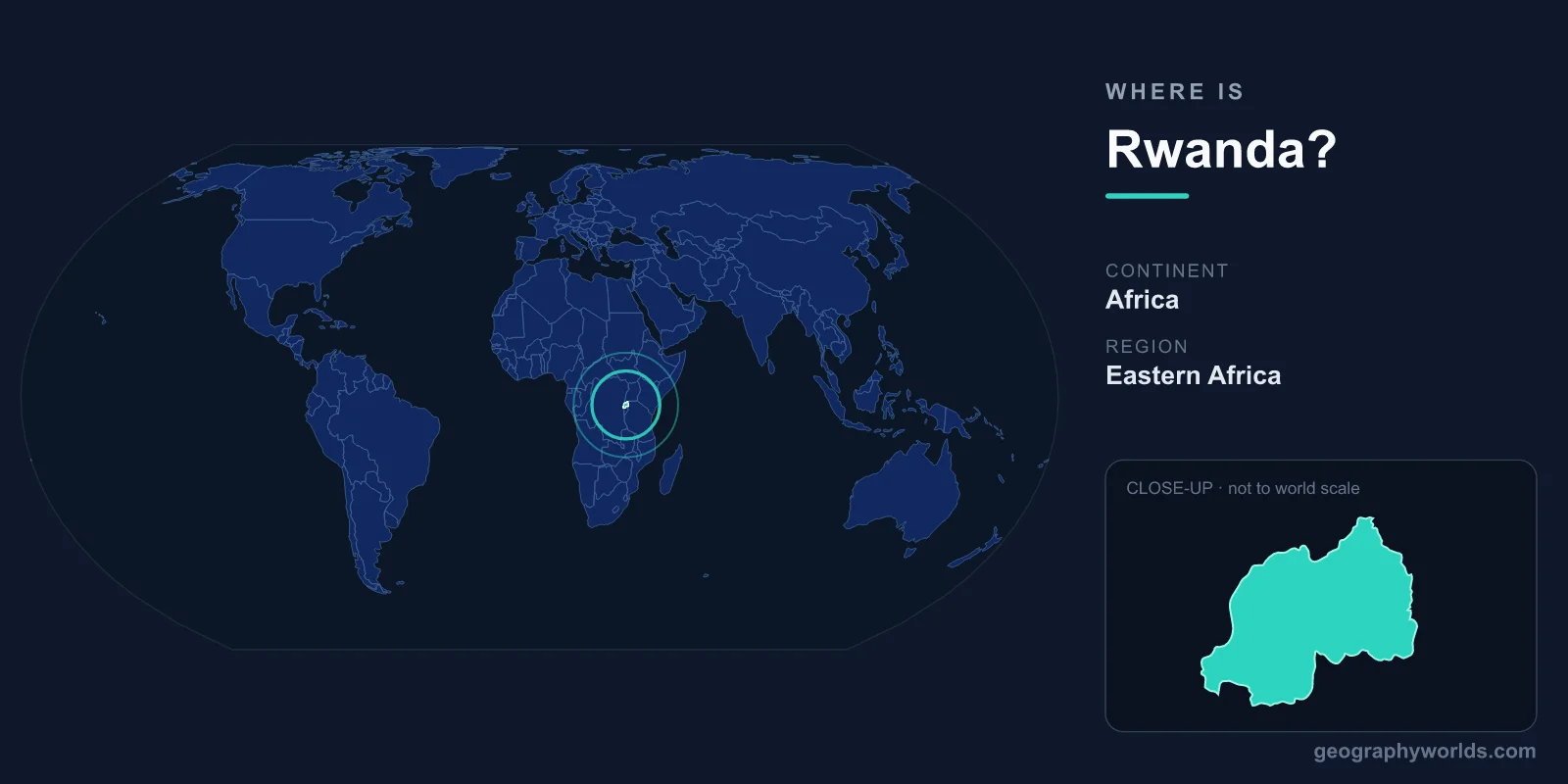
Rwanda is a small, landlocked country in East-Central Africa, sitting just south of the Equator between roughly 1° and 3° South latitude and 29° and 31° East longitude. Bordered by Uganda, Tanzania, Burundi, and the Democratic Republic of the Congo, it covers about 26,338 km² and is governed from its capital, Kigali. Nicknamed the "Land of a Thousand Hills," Rwanda is one of the most densely populated nations on the African continent.
Where Exactly Is Rwanda on the Map?
Rwanda lies in the African Great Lakes region, near the geographic heart of the continent. Although it sits just south of the Equator, much of the country occupies a cool, elevated plateau, so its climate is far milder than its tropical latitude suggests. Most of Rwanda rests at altitudes between 1,000 and 2,500 metres above sea level, with the highest peaks in the volcanic northwest.
Because it is entirely surrounded by land, Rwanda has no coastline. Its nearest access to the sea is through the ports of Mombasa in Kenya and Dar es Salaam in Tanzania, hundreds of kilometres to the east. This landlocked position has long shaped Rwanda's trade routes, infrastructure projects, and regional partnerships within the East African Community.
Countries That Border Rwanda
Rwanda shares land borders with four neighbouring countries, each connecting it to a different part of the Great Lakes region:
- Uganda – to the north, separated in part by the Virunga volcanic chain.
- Tanzania – to the east, across the Akagera River and wetlands.
- Burundi – to the south, a country with which Rwanda shares deep historical and cultural ties.
- Democratic Republic of the Congo – to the west, with Lake Kivu forming much of the natural boundary.
These four borders place Rwanda at a strategic crossroads between East and Central Africa, making it an important hub for regional trade and travel.
The Land of a Thousand Hills
Rwanda earned its famous nickname from its rolling, terraced landscape of countless hills and ridges. The terrain descends from the mountainous west toward the savanna and marshlands of the east. In the northwest stand the Virunga Mountains, a chain of volcanoes that includes Mount Karisimbi, Rwanda's highest point at roughly 4,507 metres.
This region is home to Volcanoes National Park, one of the last refuges of the endangered mountain gorilla and the site where primatologist Dian Fossey carried out her research. To the west, the deep waters of Lake Kivu form one of the African Great Lakes and mark the border with the DRC. The country also gives rise to one of the most remote headwater streams of the Nile River, making Rwanda part of the river's vast watershed.
Hemispheres, Climate, and Time Zone
Rwanda lies in both the Southern Hemisphere (south of the Equator) and the Eastern Hemisphere (east of the Prime Meridian). Despite its equatorial position, the high elevation keeps average temperatures moderate, typically ranging from about 12°C to 27°C depending on altitude and season. Rwanda experiences two rainy seasons and two drier seasons each year, supporting its productive agriculture of coffee, tea, and bananas.
The country observes Central Africa Time (UTC+2) year-round, the same time zone shared by several of its neighbours. Its compact size means that despite the dramatic topography, almost anywhere in Rwanda can be reached from Kigali within a few hours by road. To test how well you can place Rwanda and its neighbours, try our interactive map and quiz games on the games page.
Frequently Asked Questions
What continent is Rwanda in?
Rwanda is located on the continent of Africa, in the East-Central region known as the African Great Lakes area. It sits just south of the Equator and is one of the smallest countries on the African mainland.
Is Rwanda landlocked?
Yes. Rwanda is completely landlocked, with no direct access to any ocean or sea. It relies on overland routes to coastal ports in Kenya and Tanzania for most of its international maritime trade.
What is the capital of Rwanda?
The capital and largest city is Kigali, located near the geographic centre of the country. Kigali serves as Rwanda's political, economic, and cultural hub and is known regionally for its cleanliness and orderly planning.
How big is Rwanda?
Rwanda covers approximately 26,338 km², making it comparable in size to Slovenia, Israel, or the U.S. state of Maryland. Despite its small footprint, it is among Africa's most densely populated countries, with a population of roughly 14 million people.
For a deeper look at Rwanda's history, culture, and travel highlights, explore our full rwanda country guide.