
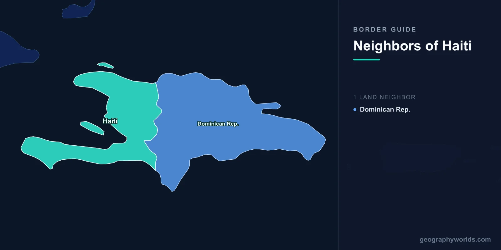
Haiti shares a land border with exactly one country: the Dominican Republic, which occupies the eastern two-thirds of the island of Hispaniola. The frontier runs roughly 376 kilometres from the Atlantic in the north to the Caribbean in the south, crossing mountain ranges, a salt lake and several rivers. Haiti holds about a third of the island's area and, historically, rather more than a third of its people — a mismatch that explains much of what happens along the line.
Two Colonies on One Island
The border exists because Spain and France divided Hispaniola. Spain settled it first, from 1492, but French buccaneers established themselves on the western end during the seventeenth century, and Spain formally ceded the western third at the Treaty of Ryswick in 1697.
The two colonies then developed on entirely different models. French Saint-Domingue became the most profitable colony in the world, worked by an enslaved population of several hundred thousand producing sugar and coffee at a lethal rate of attrition. Spanish Santo Domingo was comparatively poor, with a smaller enslaved population, more cattle ranching and a great deal more racial mixing.
By the late eighteenth century the western third held perhaps half a million people and the eastern two-thirds something closer to a tenth of that. The population imbalance across the border dates from this period and has never reversed.
The Twenty-Two Years When There Was No Border
After the Haitian revolution produced the first independent Black republic in 1804, Haiti twice extended its authority over the whole island. In 1822, following the eastern colony's brief declaration of independence from Spain, Haitian forces under Jean-Pierre Boyer occupied Santo Domingo and governed the entire island for twenty-two years.
Haitian rule abolished slavery in the east and redistributed church and crown land, but it also imposed military government, conscription, heavy taxation and restrictions on Spanish-language education and on the Catholic church. Resentment accumulated, and in 1844 a Dominican independence movement expelled the Haitians.
That is the origin of a fact that surprises outsiders: Dominican independence day commemorates separation from Haiti, not from Spain. The memory of the occupation has been used by Dominican nationalists ever since, and it is the foundation of an anti-Haitian strand in Dominican politics that the modern border disputes draw on directly.
The Massacre River
The river at the northern end of the border is called the Massacre — named, according to the usual account, for a seventeenth-century killing of French buccaneers by Spanish colonists, long before either modern state existed.
The name acquired a second meaning in October 1937, when the Dominican dictator Rafael Trujillo ordered the killing of Haitians living in the Dominican borderlands. Soldiers and civilians murdered somewhere between several thousand and thirty thousand people over several days, many of them at or near the river.
The episode is remembered as the Parsley Massacre, from the account that victims were identified by being made to say perejil, the Spanish word for parsley, on the reasoning that Creole speakers would not roll the r. Trujillo eventually paid a modest indemnity, most of which never reached survivors, and the event was suppressed in Dominican public memory for decades.
A Border Visible From Orbit
Satellite images of Hispaniola show the boundary without needing a map: green on the Dominican side, brown on the Haitian. Haiti's forest cover has been reduced to a small fraction of the island's original extent, while the Dominican Republic retains substantially more.
The usual single-cause explanation — charcoal — is incomplete. Haiti's deforestation reflects a much longer sequence: colonial clearance for sugar, the indemnity France extracted in 1825 in exchange for recognition, which forced decades of export extraction; land fragmentation into plots too small to leave fallow; and the absence of an alternative cooking fuel for a large rural population.
The Dominican Republic, meanwhile, banned commercial logging in the 1960s, developed hydroelectric and imported fuel, and built a protected area system covering a substantial share of its territory. The line is a border between two policy histories as much as between two countries.
Lake Azuéi and the Water That Rose
Near the southern end of the frontier lies Lake Azuéi, Haiti's largest lake, with the Dominican Lake Enriquillo just across the border. Both are saline, both sit below sea level in a rift valley, and both expanded dramatically from around 2004, roughly doubling in area over a decade.
The cause is still debated — increased rainfall, changed runoff from deforested slopes, sedimentation blocking drainage — but the effect was unambiguous. Farmland, homes and roads on both sides went under water, including sections of the main border highway, and thousands of people were displaced. It is a shared environmental problem on a border where shared anything is politically difficult.
Dajabón, and the Market That Opens Twice a Week
The single most important economic institution on the frontier is the binational market at Dajabón, on the Dominican side of the Massacre River opposite Ouanaminthe. Twice a week the gates open and tens of thousands of people cross to trade.
Haitian buyers purchase Dominican food, clothing and building materials; Haitian sellers bring second-hand clothing and agricultural produce. Similar markets operate at Belladère, Anse-à-Pitres and elsewhere along the line. For the Haitian north-east the market is the principal source of goods, and for Dominican border provinces it is the principal source of income.
The relationship is asymmetric and the conditions are often harsh — crossings are crowded, harassment is common, and the fees collected are opaque — but the dependence runs both ways, which is why closures hurt Dominican traders as much as Haitian ones.
The Canal on the Massacre River
In 2021 Haitian farmers and business interests began building an irrigation canal to draw water from the Massacre River for the Maribaroux plain. The Dominican government objected that it violated a 1929 treaty governing shared waters and would reduce flow to Dominican farmers.
In September 2023 the Dominican Republic closed the entire border — land, sea and air — and suspended visas for Haitians. Work on the canal continued regardless, taken up as a national project in Haiti and funded partly by the diaspora, and it became a rare point of unity in a country with no functioning elected government.
The land border reopened partially after several weeks, because the closure was expensive for Dominican exporters, for whom Haiti is a substantial market. The dispute itself remains unresolved.
Gangs, Collapse and a Frontier Under Pressure
Since the assassination of President Jovenel Moïse in 2021, Haitian state authority has collapsed across much of the country, with armed groups controlling most of Port-au-Prince and the main roads out of it.
The Dominican Republic has responded by militarising the frontier: additional troops, drones, and from 2022 the construction of a border fence — concrete, mesh and sensors — along roughly half the boundary. Deportations of Haitians and of Dominicans of Haitian descent have run at tens of thousands per month at points, drawing criticism from United Nations human rights bodies.
Santo Domingo's argument is that it cannot absorb the consequences of a neighbour's collapse and has repeatedly asked for international intervention in Haiti while declining to participate in one.
The Indemnity That Shaped Everything After
No account of Haiti's position on the island is complete without the debt. In 1825 France sent a squadron to Port-au-Prince and demanded 150 million francs in compensation for the property — including the enslaved people — lost by French colonists, in exchange for recognising Haitian independence.
Haiti agreed under the guns. The sum was several times the country's annual revenue, and it was financed through loans from French banks, so that repaying the indemnity meant servicing debt on top of it. The obligation was reduced later in the century but was not fully discharged until the 1940s.
For more than a hundred years, a very large share of Haitian government income therefore left the country, in a period when the Dominican Republic across the border was paying no such levy. Investigations published in recent years have attempted to quantify the cumulative cost and place it in the tens of billions of dollars in foregone development.
This matters to a piece about borders because the divergence visible from orbit — the forest that stops at the line, the difference in road quality, the gap in output — is usually explained by reference to what each country did. The indemnity is a substantial part of what was done to one of them, and it began a century before either government had any capacity to manage a frontier at all.
One Neighbour, No Alternatives
Most countries with a single land neighbour have sea routes that make the relationship optional. Haiti does not, in practice: its ports have been repeatedly paralysed by gang control of the roads around them, and its airport has closed for extended periods after aircraft were fired on.
That leaves a 376-kilometre land border with the one country that has the least appetite for opening it. Two states on one island, sharing rivers, a lake, a mountain range and an ecosystem, with no possibility of either moving away, is a geography that offers no exit from the relationship — only better or worse ways of managing it. Haiti in wider terms is our Haiti country guide, and our Caribbean countries guide sets Hispaniola beside the region's other islands.
