
The longest river in Africa is the Nile, at about 6,650 km (4,130 mi), followed by the Congo at 4,700 km and the Niger at 4,200 km; the Zambezi (2,740 km) and the Orange (2,432 km) complete the top five. Those figures come from Wikipedia's list of river systems by length, which uses Encyclopædia Britannica for the Nile and counts each river as a system, following its longest chain of headstreams to the mouth. Other methods give other numbers: a peer-reviewed 2009 study put the Nile at 7,088 km, and the Congo's own main channel, measured with the Lualaba, comes to 4,370 km. The order of the top three is the same whichever figure you use.
System length versus main-stem length: why the Congo is 4,370 km or 4,700 km
A river does not have one obvious length. Its mouth may spread across a delta, its course may pass through lakes and reservoirs, and meanders shift with every flood. The biggest choice, though, is where the river starts. Geographers who rank rivers usually follow the river system: they trace the longest chain of channels upstream, even if those channels carry different names, and add them together.
The Congo shows how much this matters. Upstream of Boyoma Falls the river is called the Lualaba, and Wikipedia gives the Congo measured with the Lualaba as 4,370 km. Follow the system further, through the Luvua and Luapula to the Chambeshi in north-eastern Zambia, and the total rises to 4,700 km, enough to make it the ninth-longest river system on Earth.
The same gap appears lower down the ranking. The Senegal River itself is 1,086 km long, from the meeting of its headwaters to the Atlantic; counted as a system with its longest feeder, it reaches 1,641 km. The Zambezi is 2,574 km in its own article but 2,740 km in the system list, which flags that figure as an average of several sources. The Jubba–Shebelle pairing is stranger still: the Shebelle rises in the Ethiopian highlands and flows 1,820 km into Somalia, but in most years it dries out near the Jubba and reaches the sea only after heavy rain. A ranking that treats the two as one 2,064 km system is making a judgement call, and this article says so where it applies.
The Nile: 6,650 km, or 7,088 km from Rwanda's Nyungwe Forest
The Nile's figure is the most argued over. Britannica's 6,650 km is the length usually quoted, and it keeps the Nile ahead of the Amazon (about 6,400 km by the same source). In 2007 and 2008 some scientists claimed the Amazon was 6,992 km and the Nile 6,853 km, which would reverse the order. The 2009 peer-reviewed study that combined satellite images with field visits to the source regions gave 7,088 km for the Nile and 6,575 km for the Amazon. Wikipedia's Nile article now leads with 7,088 km, while its ranking table keeps 6,650 km and shows the larger figure in brackets.
Much of the uncertainty lies at the top of the river. The farthest source is generally placed on a tributary of the Rukarara River in Nyungwe National Park, Rwanda, at 2,539 m above sea level. That water feeds the Kagera, which drains into Lake Victoria; the southernmost source is one of the heads of the Ruvyironza in Burundi, marked by a monument that Burkhart Waldecker put up near Rutovu in 1937. The Rwandan spring counts as the source because it starts the longest year-round watercourse in the basin, and the 7,088 km figure was measured in 2009 along the river's centreline using satellite imagery.

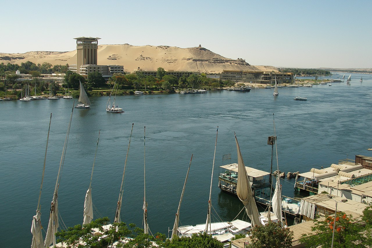
From Lake Victoria the White Nile runs through Uganda and South Sudan to Khartoum, where it meets the Blue Nile from Lake Tana in Ethiopia. The White Nile is the longer branch, but the Blue Nile brings more than twice as much water. The basin covers parts of 11 countries, yet the downstream three, Egypt, Sudan and South Sudan, are mostly desert and depend on rain that falls far upstream. Since the Aswan High Dam was completed in 1970, Lake Nasser behind it has controlled the annual flood and trapped the silt that once renewed the delta, which has begun to shrink. Our Blue Nile guide follows the shorter, wetter branch from Ethiopia.
Africa's ten longest river systems, ranked
| Rank | River system | Length | Outflow | Main countries |
|---|---|---|---|---|
| 1 | Nile (White Nile–Kagera) | 6,650 km (4,130 mi) | Mediterranean Sea | Egypt, Sudan, South Sudan, Uganda, Ethiopia and six others |
| 2 | Congo (Lualaba–Chambeshi) | 4,700 km (2,922 mi) | Atlantic Ocean | DR Congo, Republic of the Congo, Angola, Zambia and others |
| 3 | Niger | 4,200 km (2,611 mi) | Gulf of Guinea | Guinea, Mali, Niger, Nigeria |
| 4 | Zambezi | 2,740 km (1,703 mi) | Mozambique Channel | Zambia, Angola, Zimbabwe, Mozambique |
| 5 | Orange | 2,432 km (1,511 mi) | Atlantic Ocean | Lesotho, South Africa, Namibia |
| 6 | Ubangi–Uele | 2,270 km (1,410 mi) | Congo River | DR Congo, Central African Republic, Republic of the Congo |
| 7 | Kasai | 2,153 km (1,338 mi) | Congo River | Angola, DR Congo |
| 8 | Jubba–Shebelle | 2,064 km (1,282 mi) | Indian Ocean | Ethiopia, Somalia |
| 9 | Limpopo | 1,800 km (1,118 mi) | Indian Ocean | South Africa, Botswana, Zimbabwe, Mozambique |
| 10 | Senegal | 1,641 km (1,020 mi) | Atlantic Ocean | Guinea, Mali, Mauritania, Senegal |
Just outside the ten comes the upper Jubba with its Ganale Dorya headstream (1,634 km), a shorter way of counting the same Somali river, and then three systems tie at 1,600 km in the same list: the Blue Nile, the Volta of Ghana and its neighbours, and the Okavango, which never reaches the sea at all but spreads out into the Okavango Delta in Botswana.
Congo, Niger and Zambezi: three different kinds of giant
Length is only one measure of size, and the three rivers behind the Nile each lead on a different one. The Congo carries about 41,400 m³ of water a second on average, roughly sixteen times the Nile's 2,490 m³/s, and is the third-largest river on Earth by discharge after the Amazon and the Ganges–Brahmaputra. It is the only major river to cross the equator twice, and soundings of about 220 m make it the deepest river ever recorded. At Inga Falls, 40 km from Matadi, it drops 96 m in 15 km. Its basin of roughly 3.7 to 4 million km² covers about 13% of Africa, and two of its tributaries, the Ubangi and the Kasai, are long enough to rank sixth and seventh on their own. Our Congo River guide covers the basin in more detail.
The Niger has the strangest route. It rises in the Guinea Highlands only about 240 km from the Atlantic, then flows away from the ocean, north-east towards the Sahara. Near Timbuktu it turns sharply and heads south-east through Niger and Nigeria to the Gulf of Guinea. In Mali it spreads into the Inner Niger Delta, about 20,000 km² of braided channels, lakes and floodplains around Mopti and Djenné, where it loses nearly two-thirds of its potential flow to seepage and evaporation between Ségou and Timbuktu. Europeans did not work out its course until the 18th-century travels of the Scottish explorer Mungo Park.

The Zambezi is the longest east-flowing river in Africa and the largest African river draining to the Indian Ocean. It rises in a marshy dambo in north-western Zambia at about 1,524 m, crosses eastern Angola, follows the borders of Namibia, Botswana and Zimbabwe, and crosses Mozambique to the sea. Victoria Falls, 1,708 m wide and known locally as Mosi-oa-Tunya, "the smoke that thunders", lies on the Zambia–Zimbabwe border; the Scottish missionary David Livingstone was taken to it in 1855 and named it after Queen Victoria. The river's two main sources of hydroelectric power are the Kariba Dam, shared by Zambia and Zimbabwe, and the Cahora Bassa Dam in Mozambique, which also supplies South Africa.
From the Orange to the Senegal: ranks 5 to 10
The Orange, South Africa's longest river, rises in the Drakensberg of Lesotho, where it is called the Senqu, and flows west to the Atlantic, forming part of the borders between South Africa and Lesotho and between South Africa and Namibia. The Dutch explorer Robert Jacob Gordon named it after the House of Orange. Apart from Upington it passes no large city.
The Ubangi is only about 1,060 km long by itself, but with its longest headstream, the Uele, it reaches 2,270 km. It forms the boundary between the Central African Republic and DR Congo, passes the Central African capital, Bangui, and joins the Congo at Liranga. Its upper reaches are thought to have once drained north into the Chari River and Lake Chad before the Congo captured them, probably in the early Pleistocene. The Kasai rises in central Angola, follows the Angola–DR Congo border and enters the Congo at Kwamouth, north-east of Kinshasa; its basin is known for diamonds.
The Limpopo runs about 1,750 to 1,800 km from South Africa to the Indian Ocean in Mozambique. Vasco da Gama anchored off its mouth in 1498 and called it Rio do Espírito Santo. Its basin was once larger: until the Late Pliocene or Pleistocene, the upper Zambezi drained into the Limpopo, before uplift to the north diverted that water into the Zambezi. The Senegal marks much of the border between Senegal and Mauritania, and since 1972 it has been managed jointly by Mali, Mauritania and Senegal through the OMVS, which Guinea joined in 2005. Several of these rivers gave their names to modern states, a story told in our list of countries named after rivers.