
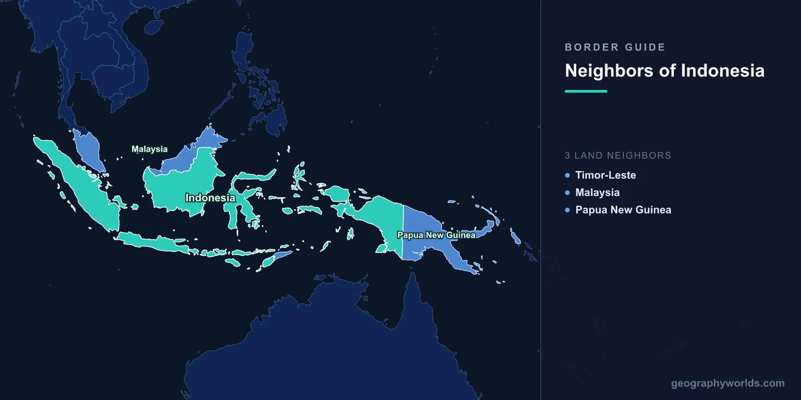
Indonesia shares land borders with three countries: Malaysia, Papua New Guinea, and Timor-Leste (East Timor), with a combined land boundary of roughly 2,958 km. Because Indonesia is the world's largest archipelagic state, spanning more than 17,000 islands, the overwhelming majority of its frontiers are maritime rather than terrestrial. Its three land borders all run through islands shared with another nation, and beyond them lies a long list of countries with which Indonesia meets at sea.
Indonesia's Three Land Borders
Each of Indonesia's land borders sits on an island it does not fully control:
- Malaysia — The longest land border, running across the island of Borneo. Indonesia's territory here is called Kalimantan, while the Malaysian states of Sarawak and Sabah occupy the north. This frontier stretches through dense tropical rainforest and is the busiest of the three for trade and migration.
- Papua New Guinea — A largely straight, north–south border bisecting the island of New Guinea. Indonesia governs the western half (the provinces of Papua, West Papua, and several newer provinces), while Papua New Guinea holds the east. Much of the boundary follows the 141st meridian east.
- Timor-Leste (East Timor) — The shortest land border, on the island of Timor. Indonesia controls West Timor, while Timor-Leste occupies the eastern portion plus the small Oecusse enclave, which is surrounded entirely by Indonesian territory.
Borneo and the Border with Malaysia
The Indonesia–Malaysia border is the country's most significant land frontier. Borneo is the world's third-largest island, and it is divided among three nations: Indonesia, Malaysia, and the small sultanate of Brunei. Indonesian Kalimantan covers about two-thirds of the island, but the boundary with Malaysia winds through remote highland and forest terrain that has historically been difficult to demarcate. The region is economically important for timber, palm oil, and cross-border commerce, and it also poses challenges around illegal logging and migration. Notably, Indonesia is relocating its national capital from Jakarta to a new city, Nusantara, in East Kalimantan, raising Borneo's strategic profile even further.
New Guinea and the Papua New Guinea Border
New Guinea is the world's second-largest island, and its political division between Indonesia and Papua New Guinea is among the most geometrically simple on Earth, following lines of longitude rather than rivers or mountain ridges. The exception is a short southern stretch along the Fly River. The Indonesian side, often referred to as Western New Guinea, is one of the most biodiverse and culturally diverse regions in the world, home to hundreds of distinct languages. The border separates communities that share deep ethnic and linguistic ties, and cross-border movement of indigenous Papuan groups predates the modern boundary by millennia.
Timor and the Border with Timor-Leste
Timor-Leste is Indonesia's newest neighbor. It was occupied by Indonesia from 1975 until it gained independence in 2002 following a UN-supervised referendum. The land border on Timor includes an unusual feature: the Oecusse exclave, a piece of Timor-Leste completely encircled by Indonesian West Timor and accessible from the rest of the country only by sea or air. The two nations have worked through border demarcation and continue to cooperate on trade, fishing, and the management of shared maritime resources.
Maritime Neighbors of Indonesia
Because Indonesia is an archipelago straddling the equator between the Indian and Pacific Oceans, it has far more sea borders than land borders. It shares maritime boundaries with several countries, including:
- Australia — to the south, across the Timor and Arafura Seas.
- The Philippines — to the northeast, near the Celebes Sea.
- Singapore — to the northwest, across the narrow Singapore Strait.
- Malaysia — which is also a maritime neighbor in the Strait of Malacca and Celebes Sea.
- Thailand, Vietnam, and India — in the Strait of Malacca and Andaman Sea region.
- Palau — a small Pacific island nation lying to the northeast.
The Strait of Malacca, between Sumatra and the Malay Peninsula, is one of the busiest shipping lanes in the world, underscoring how central Indonesia's seas are to global trade. For more context on the country itself, see our indonesia country guide.
Frequently Asked Questions
How many countries border Indonesia by land?
Three countries share a land border with Indonesia: Malaysia, Papua New Guinea, and Timor-Leste. Each border lies on an island that Indonesia shares with the neighboring nation — Borneo, New Guinea, and Timor respectively.
Does Indonesia border Australia?
Indonesia and Australia do not share a land border, but they are close maritime neighbors. The two countries are separated by the Timor and Arafura Seas, with the gap between Timor and northern Australia spanning only a few hundred kilometers.
Which country has the longest border with Indonesia?
Malaysia shares the longest land border with Indonesia, running across the island of Borneo between Indonesian Kalimantan and the Malaysian states of Sarawak and Sabah.
Is Singapore a neighbor of Indonesia?
Yes, Singapore is a maritime neighbor. It lies just across the Singapore Strait from the Indonesian Riau Islands, making it one of Indonesia's closest sea neighbors despite having no shared land border.
