
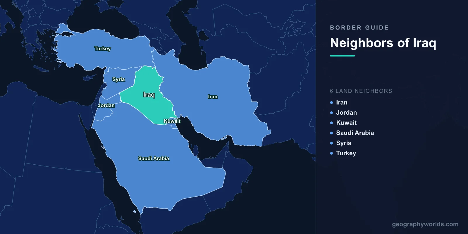
Iraq shares land borders with six neighboring countries: Iran, Turkey, Syria, Jordan, Saudi Arabia, and Kuwait, spanning a total land boundary of about 3,809 km. Sitting at the crossroads of the Middle East, Iraq is bordered on almost every side, with only a narrow 58 km stretch of coastline along the Persian Gulf giving it access to the open sea. This dense ring of neighbors has shaped Iraq's history, trade, and culture for thousands of years.
The Six Countries That Border Iraq
Iraq's neighbors wrap around it in a near-complete arc. Moving roughly clockwise from the east, they are:
- Iran — to the east, sharing Iraq's longest border.
- Turkey — to the north.
- Syria — to the northwest and west.
- Jordan — to the west.
- Saudi Arabia — to the south and southwest.
- Kuwait — to the southeast, near the head of the Persian Gulf.
Each of these frontiers carries its own geography, from mountain ranges and river valleys to vast stretches of open desert. You can learn more about the country itself in our iraq country guide.
Iran: The Longest Border
Iran shares roughly 1,599 km of border with Iraq, by far the longest of any neighbor. The frontier runs from the snow-capped Zagros Mountains in the north down to the marshlands and the Shatt al-Arab waterway near the Persian Gulf. This river boundary, formed where the Tigris and Euphrates merge, has been a point of dispute for centuries and was a flashpoint of the Iran-Iraq War (1980-1988). Today the border region remains important for pilgrimage routes, with millions of Iranians crossing to visit the Shia holy cities of Najaf and Karbala.
Turkey and Syria: The Northern and Western Frontiers
To the north, Iraq shares about 367 km of mountainous border with Turkey. This region is the source of Iraq's lifeblood: both the Tigris and Euphrates rivers rise in the highlands of eastern Turkey before flowing south into Iraq. Control of these headwaters and the dams built along them gives Turkey significant influence over Iraq's water supply. The northern border also crosses the Kurdish cultural region that spans both nations.
To the west and northwest lies Syria, sharing roughly 599 km of largely flat, arid terrain. The Euphrates River and ancient caravan routes cross this boundary, which historically linked Mesopotamia to the Mediterranean world. The border passes through desert that has long been home to Bedouin communities and, in more recent decades, has seen significant population movement and security concerns.
Jordan, Saudi Arabia, and Kuwait: The Western and Southern Borders
Jordan, to the west, shares about 179 km of desert border. The single major crossing here is a vital trade and transit artery, historically connecting Baghdad to the port of Aqaba and onward to global markets. Much of this frontier runs through the empty, gravelly expanse of the Syrian and Arabian deserts.
Saudi Arabia forms Iraq's long southern flank, sharing around 811 km of border across some of the most sparsely populated desert in the region. For decades a demilitarized "neutral zone" sat astride this boundary before it was formally partitioned. Cross-border traffic was limited for years but has expanded as relations between the two countries warmed.
Kuwait, the smallest of Iraq's neighbors, shares roughly 254 km of border in the southeast, near the head of the Persian Gulf. This frontier became internationally significant in 1990 when Iraq invaded Kuwait, triggering the Gulf War. A United Nations demarcation later fixed the boundary, which remains tightly monitored today.
Why Iraq's Borders Matter
Iraq's position as a heavily bordered, nearly landlocked nation has defined its strategic importance. With only a sliver of Gulf coastline, it relies on overland routes through its neighbors for much of its trade, and on rivers fed by Turkey and Iran for its water. The country sits at the meeting point of Arab, Persian, Turkish, and Kurdish worlds, a blend reflected in the languages, religions, and cultures found along each frontier. These borders, drawn largely in the 20th century after the fall of the Ottoman Empire, continue to influence the politics of the wider Middle East.
Frequently Asked Questions
How many countries border Iraq?
Iraq borders six countries: Iran, Turkey, Syria, Jordan, Saudi Arabia, and Kuwait. Together these frontiers total about 3,809 km of land boundary.
Which country shares the longest border with Iraq?
Iran shares the longest border with Iraq, stretching approximately 1,599 km from the Zagros Mountains in the north to the Persian Gulf marshlands in the south.
Is Iraq landlocked?
No, Iraq is not landlocked, but it is nearly so. It has only about 58 km of coastline on the Persian Gulf, giving it limited but vital access to the sea through ports such as Umm Qasr and Basra.
Which rivers cross Iraq's borders?
The Tigris and Euphrates rivers, which gave ancient Mesopotamia its name, both rise in Turkey and flow southeast across Iraq before joining to form the Shatt al-Arab near the border with Iran.
