
Niagara Falls is a group of three waterfalls on the Niagara River, straddling the international border between the US state of New York and the Canadian province of Ontario. The three falls — Horseshoe Falls, American Falls, and Bridal Veil Falls — have a combined flow rate of approximately 2,832 cubic meters (100,000 cubic feet) per second during peak daytime tourist hours, making Niagara the most powerful waterfall in North America by volume.
Introduction
Located at coordinates 43.0962°N, 79.0377°W, the falls sit approximately midway along the 58-kilometer Niagara River, which connects Lake Erie to Lake Ontario and drops 99 meters in elevation over its course. The falls formed approximately 12,000 years ago when glaciers from the last Ice Age retreated, allowing water from the Great Lakes to carve a path through the Niagara Escarpment.
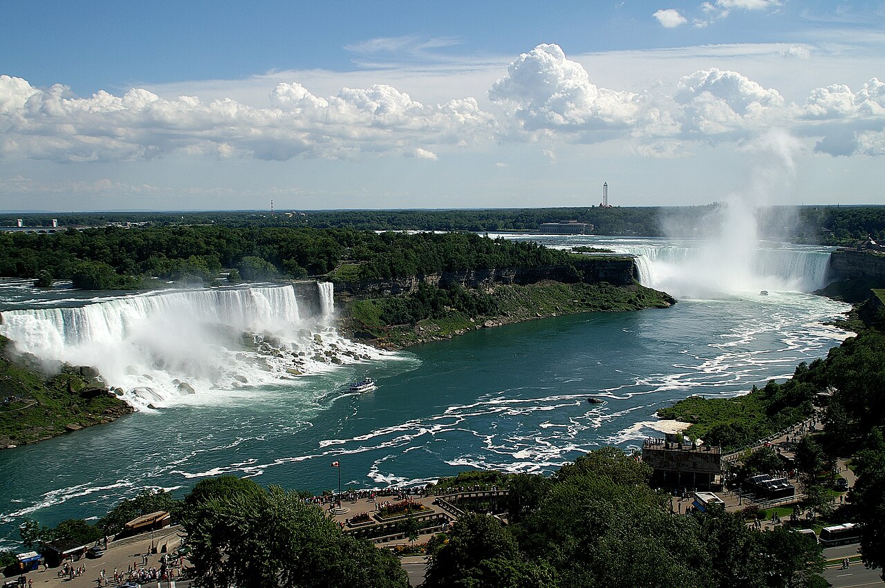
Geography & Dimensions
- Horseshoe Falls Height: 51 m (167 ft)
- American Falls Height: 21–30 m (70–100 ft)
- Horseshoe Falls Width: 792 m (2,600 ft)
- Combined Flow Rate: 2,832 m³/s (peak daytime)
Horseshoe Falls, the largest of the three, curves in a dramatic horseshoe shape on the Canadian side, measuring 792 meters wide and 51 meters high. American Falls, entirely on the US side, is 260 meters wide but only 21 to 30 meters of free-falling water due to massive rock talus at its base. Bridal Veil Falls, separated from American Falls by Luna Island, is just 17 meters wide.
The Niagara River drains four of the five Great Lakes — Superior, Michigan, Huron, and Erie — into Lake Ontario, carrying a drainage area of approximately 684,000 square kilometers. The river's flow is now regulated by the 1950 Niagara Treaty between the US and Canada, which diverts a significant portion of water through hydroelectric tunnels, especially at night. Natural flow would be approximately 5,720 cubic meters per second.
Geology & Formation
- Age: ~12,000 years
- Retreat Rate: ~0.3 m/year (historically ~1 m/year)
- Escarpment Rock: Lockport Dolostone over softer shale
- Original Location: ~11 km downstream at Queenston/Lewiston
Niagara Falls was born when the Laurentide Ice Sheet retreated approximately 12,000 years ago, exposing the Niagara Escarpment — a ridge of hard Lockport Dolostone (dolomite limestone) overlying softer Rochester Shale, Irondequoit Limestone, and Queenston Shale. Water pouring over the hard cap rock erodes the softer layers beneath, causing the cap to collapse and the falls to retreat upstream.
The falls originally formed at the present-day Queenston-Lewiston area, approximately 11 kilometers downstream. Over 12,000 years, this erosion process carved the Niagara Gorge. Before water diversion for hydropower, Horseshoe Falls retreated at roughly 1 meter per year. Today, the rate has slowed to approximately 0.3 meters per year due to reduced flow and engineering interventions.
Hydroelectric Power
- First Plant: 1882 (one of the world's first)
- Current Capacity: 4.4 GW combined US and Canadian plants
- Water Diversion: Up to 75% of flow diverted at night
- Niagara Treaty: 1950, governs water sharing
Niagara Falls has been a hydroelectric power source since 1882, when the first plant began generating electricity. Today, the Robert Moses Niagara Power Plant on the US side and the Sir Adam Beck Generating Stations on the Canadian side have a combined generating capacity of approximately 4.4 gigawatts — enough to power over 3 million homes. Massive underground tunnels divert water from above the falls to turbines below.
The 1950 Niagara Treaty requires a minimum of 2,832 cubic meters per second to flow over the falls during daytime tourist hours (8 AM–10 PM April through October, 8 AM–8 PM November through March). At night and during the off-season, up to 75 percent of the river's flow may be diverted for power generation, dramatically reducing the falls' volume.
Visitor Information
- Annual Visitors: ~12 million (combined US and Canada)
- Maid of the Mist: Operating since 1846
- Cave of the Winds: Walk to within 6 m of Bridal Veil Falls
- State Park: Niagara Falls State Park, est. 1885 (oldest in US)
Approximately 12 million people visit Niagara Falls each year from both the US and Canadian sides. The Maid of the Mist boat tour, operating since 1846, carries passengers into the mist basin at the base of Horseshoe Falls. On the US side, the Cave of the Winds tour brings visitors onto a wooden deck within 6 meters of the base of Bridal Veil Falls.
Niagara Falls State Park, designed by Frederick Law Olmsted (who also designed Central Park), was established in 1885 and is the oldest state park in the United States. The Canadian side features the Niagara Parks system with better panoramic views of the falls, while the US side offers closer access to American Falls and Bridal Veil Falls. The Rainbow Bridge connects the two countries for pedestrian and vehicle crossings.
Key Facts
- Horseshoe Falls is 51 meters high and 792 meters wide.
- The combined flow rate is 2,832 m³/s during peak tourist hours.
- The falls have retreated approximately 11 km upstream over 12,000 years.
- Combined US and Canadian hydroelectric plants generate 4.4 GW of power.
- Approximately 12 million people visit annually from both countries.
Fun Facts
- In 1969, the US Army Corps of Engineers completely shut off water to American Falls for five months to study erosion, revealing the rocky riverbed.
- At least 16 people have survived going over the falls, beginning with a 63-year-old schoolteacher in a barrel in 1901.
- Niagara Falls freezes into a spectacular ice bridge roughly once every few decades — most recently in 2015.
- The falls' mist can be seen from over 25 kilometers away on a clear day and heard from over 1.6 km.
Final Thoughts
Niagara Falls is a dynamic geological feature that continues to evolve, retreat, and reshape the landscape. Its position on the US-Canada border, its immense power, and its 12,000-year history of erosion make it one of North America's most significant natural landmarks.
Test Your Knowledge!
Think you know American landmarks? Try our interactive geography games!
Play Geography Games →