
The Niger River is the third-longest river in Africa (after the Nile and the Congo) at about 4,180 km and one of the most geographically distinctive rivers in the world. Rising in the Guinea Highlands only about 240 km from the Atlantic coast, the Niger makes a remarkable 4,000 km journey: it flows northeast into the Sahara, reaching its northern apex at Timbuktu in Mali, then bends sharply southeast and finally south to enter the Gulf of Guinea via the great Niger Delta in Nigeria. The basin covers 2.27 million km² across 11 West African countries — Guinea, Mali, Niger, Algeria (small headwater area), Côte d'Ivoire, Burkina Faso, Benin, Chad, Cameroon, Nigeria, and a tiny part of Sierra Leone — and is home to about 130 million people. The Niger is also unique in having a major inland delta — the Inner Niger Delta in Mali, a vast seasonal wetland that historically sustained the medieval Mali Empire.
Introduction
The Niger is the river that built West African civilisation. The medieval empires of Ghana, Mali, and Songhai were all Niger-based; Timbuktu, Djenné, and Gao on the Niger were major medieval centres of learning, trade, and Islam. Today the river remains the lifeline of the Sahel — a region where rainfall is increasingly unreliable and where the Niger's seasonal flood is the difference between food security and famine for tens of millions of people. The river is also the central feature of one of the world's most actively fragile geopolitical regions, with security crises in Mali, Burkina Faso, Niger, and northern Nigeria all directly tied to basin water and land politics.
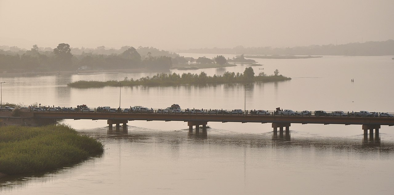
Geography & Extent
The Niger has three distinctive sections. The Upper Niger flows northeast from the Guinea Highlands across Mali, fed by tropical rainfall in its headwater region. As the river enters Mali it spreads into the Inner Niger Delta — a 30,000 km² seasonal wetland that doubles in size during the August-November flood and supports vast populations of fish, livestock, and migratory birds. North of the delta the river makes its great northern bend at Timbuktu, swinging east and then southeast across drier and drier terrain. The Middle Niger flows southeast through Niger and Nigeria, joined at Lokoja, Nigeria, by the Benue, the largest tributary by discharge. The Lower Niger flows south across Nigeria to the great Niger Delta on the Gulf of Guinea — a 70,000 km² distributary network that is the third-largest delta in the world and a major centre of African oil production.
Hydrology
The Niger's average discharge is about 5,600 m³/s at its mouth, with strong monsoon seasonality — peak flood discharge can exceed 25,000 m³/s, while dry-season flows fall to 600-800 m³/s. The river loses roughly half its flow to evaporation in the Inner Niger Delta during the journey across Mali. The Benue, joining at Lokoja, contributes about 35-40% of the Niger's lower-basin discharge. Major dams include Kainji and Jebba in Nigeria, Selingue and Manantali (on the Bafing tributary) in Mali. Sediment loads are moderate (about 40 million tonnes per year reach the delta), and the river carries a substantial bed load of sand. The Niger Delta receives water and sediment from a basin of about 1.4 million km² before the river's final mouth.
Geology & Formation
The Niger Basin sits on the West African craton, a stable continental block dominated by Precambrian crystalline rocks with Paleozoic sedimentary cover. The basin's modern course reflects a complex history: the upper Niger and the lower Niger were originally separate rivers, captured and integrated only in the Quaternary as drainage reorganised in response to climate change. The current "great bend" at Timbuktu marks the line where this integration occurred. The Niger Delta is a Cenozoic feature built up over the past 50 million years and contains some of West Africa's most important petroleum reserves — Nigeria is the leading African oil producer, with most production concentrated in the delta.
Climate & Ecology
The basin spans tropical rainforest in the Guinea Highlands and Niger Delta to Sahel grassland and Saharan desert in the middle reaches. Rainfall varies from over 2,500 mm/year in the headwaters to under 100 mm/year at the river's northern apex near Timbuktu. The Inner Niger Delta is one of the most important wetlands in Africa, supporting roughly 1 million people through fishing, flood-recession agriculture, and pastoralism, plus large populations of waterbirds (it is the most important wintering site for European waders south of the Sahara). The Niger Delta on the Gulf of Guinea contains substantial mangrove and tropical rainforest ecosystems, although these have been heavily impacted by oil-industry pollution. Manatees, hippos, and Nile crocodiles inhabit the river's middle reaches, while the upper basin supports forest elephants and chimpanzees.
Cultural & Historical Significance
The Niger Basin has been one of Africa's great cultural and economic regions for millennia. The Empire of Ghana (8th-11th centuries CE) controlled the gold trade between West African mines and trans-Saharan caravans. The Mali Empire (13th-16th centuries), founded by Sundiata Keita and made famous by Mansa Musa's 1324 pilgrimage to Mecca, was based on the upper Niger and controlled most of West Africa's gold and salt trade. Timbuktu, founded around 1100, became one of the great medieval centres of Islamic scholarship — the Sankoré University at one point had thousands of students. The Songhai Empire (15th-16th centuries) succeeded Mali and ruled from Gao. European exploration of the Niger began in the late 18th century with Mungo Park's expeditions; colonial occupation (French in the upper basin, British in the lower) ended traditional river-based polities. The basin gave its name to two modern countries (Niger and Nigeria).
Modern Issues
The Niger Basin faces three converging crises. First, climate change in the Sahel: rainfall has declined by roughly 25-30% since the 1960s in parts of the middle basin, and the Inner Niger Delta's flood pulse has weakened, with major implications for food security. Second, security: the basin is the heartland of the contemporary Sahel security crisis, with active jihadist insurgencies in Mali, Burkina Faso, and Niger, and the Boko Haram insurgency in Nigeria's Lake Chad-Niger borderlands. Many basin governments have weak control over rural areas. Third, the Niger Delta oil environment: Nigerian oil extraction has caused severe pollution, with thousands of oil spills documented since the 1960s, and ongoing conflict between Niger Delta communities and oil companies. The Niger Basin Authority, founded in 1980, manages basin-wide governance with mixed results — it is one of the older transboundary basin organisations in Africa but has struggled to coordinate water-resource development.
Frequently Asked Questions
How long is the Niger River?
About 4,180 km, making it the third-longest river in Africa after the Nile and the Congo. Its great northern bend takes it to within 200 km of the Sahara before it turns south to the Gulf of Guinea.
Which countries does the Niger Basin cover?
Eleven: Guinea, Mali, Niger, Algeria, Côte d'Ivoire, Burkina Faso, Benin, Chad, Cameroon, Nigeria, and a small part of Sierra Leone. Guinea contains the headwaters; Nigeria contains most of the lower basin and the delta.
What is the Inner Niger Delta?
The Inner Niger Delta is a vast seasonal inland wetland in Mali — about 30,000 km² in low water and 80,000 km² in flood — where the Niger spreads across a near-flat former lake basin before resuming its course. It is the lifeline of central Mali and one of Africa's most important wetlands.
Why does the Niger flow toward the Sahara?
The Niger's distinctive northeast-then-south course reflects a complex geological history. The upper Niger and the lower Niger were originally separate drainage systems; their integration in the Quaternary, combined with the river's path around the West African craton, produced the great northern arc that today reaches its apex at Timbuktu.
Final Thoughts
The Niger is one of the most geographically distinctive and historically consequential rivers on Earth — a river that built medieval West African empires, that arcs deep into the Sahara before turning to the Gulf of Guinea, and that today links the climate, security, and economic challenges of West Africa more tightly than any other single physical feature.