
The Niger is West Africa's principal river, running about 4,200 km in a great arc — and it begins only around 240 km from the Atlantic Ocean, then flows directly away from it, north-east into the Sahara, before turning south-east and returning to the sea in Nigeria. That boomerang course is the third-longest river route in Africa and, for a long time, the continent's most stubborn geographical puzzle.
The route, in order
The river rises in the Guinea Highlands, close to the border with Sierra Leone, in some of the wettest country in West Africa. From there it heads north-east through Mali, passing Bamako, and enters a zone where it does something no other major river does: it runs into the desert and spreads out.
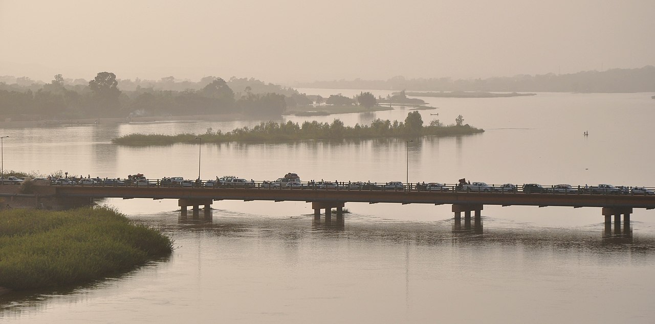
Beyond Timbuktu it bends east and then south-east, running through Niger past Niamey, forming part of the Niger–Benin border, and entering Nigeria. At Lokoja it takes in the Benue, its largest tributary, roughly doubling in volume. Below that it runs south to the Atlantic, ending in one of the largest river deltas in the world.
Laid out like that, the shape is obvious — but consider what it means at the top of the arc. Water that falls a few hundred kilometres from the Atlantic coast travels several thousand kilometres inland, across the southern Sahara and back, before reaching an ocean it started beside.
The Inner Niger Delta: a delta in the wrong place
The strangest feature of the course sits in the middle of Mali. Between Ségou and Timbuktu the river loses gradient almost entirely and fans out into an enormous seasonal wetland — the Inner Niger Delta — that inundates something on the order of 20,000 to 30,000 square kilometres at high water, and shrinks drastically in the dry season.
It is called a delta because it looks like one, with the river splitting into distributaries and depositing sediment, but it is nowhere near the sea. The consequences are considerable. The river loses a large fraction of its water here to evaporation and infiltration — in a hot, dry climate, spreading a river thinly over tens of thousands of square kilometres is an efficient way to lose it. It is also one of the most productive inland fisheries in Africa and the basis for a system of seasonal movement in which fishers, herders and rice farmers use the same land at different points in the flood cycle.
Downstream of the inner delta, the Niger is a smaller river than it was upstream of it. Few major rivers shrink in the middle.
Why the course baffled Europe for three centuries
European geography knew there was a great river in the West African interior — Arab geographers and traders had described it for centuries — but could not work out where it went. Some held it joined the Nile. Others thought it drained into a great inland lake, or flowed west to the Senegal, or connected to the Congo.
The confusion was reasonable. Anyone reaching the upper river near Bamako saw water flowing north-east, into the desert, which pointed away from every coast Europeans knew. Anyone examining the enormous, swampy, many-channelled delta on the Gulf of Guinea had no reason to connect it to a river a thousand miles inland; it was known as the Oil Rivers, for palm oil, and its channels looked like a coastal feature in their own right.
Mungo Park reached the river at Ségou in 1796 and confirmed it flowed east, which settled one question and sharpened the other. He died on a second expedition attempting to follow it down. Not until Richard Lander and his brother John descended the lower river to the sea in 1830 was the connection between the interior river and the Atlantic delta established.
The Benue, and the river's second half
Below the bend the Niger is joined at Lokoja by the Benue, which rises in the Adamawa highlands of Cameroon and runs west for roughly 1,400 km. The confluence roughly doubles the river's flow, and it is the reason the lower Niger behaves so differently from the upper one: fed by tributaries draining the wet tropics rather than by water that has already crossed a desert.
The Benue is also seasonally navigable a long way inland, which made it the main route into the Nigerian interior for nineteenth-century steamers and, later, the axis along which the Nigeria–Cameroon boundary was argued. The confluence at Lokoja was chosen as the administrative centre of Britain's Niger territories for exactly that reason, and the two-rivers geography is why Nigeria's capital was eventually sited at Abuja, on the high ground between them.
Two rivers that became one
The explanation for the course is that the Niger was not always a single river. The generally accepted account is that there were two: an upper river that drained inland and ended in a large lake or inland basin in what is now the Sahara, and a separate lower river rising in the Nigerian highlands and flowing south to the Atlantic.
As the climate dried — the Sahara's transition from a green, lake-strewn landscape to desert occurred over the last several thousand years — the inland lake shrank and eventually failed. Headward erosion by the lower river eventually cut back far enough to capture the upper one, splicing the two systems into a single channel that keeps the shape of both.
The Inner Niger Delta is essentially the remnant of the old inland terminus: the place where the upper river used to end. That is why it behaves like a delta despite being a thousand kilometres from any sea, and why the modern Niger has the anatomy of two rivers joined at an awkward angle.
The river that carried the gold trade
The Niger's inland arc runs along the southern edge of the Sahara, and for close to a thousand years that made it the pivot of trans-Saharan trade. Caravans crossing the desert from North Africa met river transport at the top of the bend, and the exchange happened in the cities that grew there.
Timbuktu, founded around the eleventh century a short distance from the river, became the best known — a centre of scholarship with madrasas and a manuscript tradition running to hundreds of thousands of texts, many still held in family libraries. Djenné, on a tributary within the inner delta, has the largest mud-brick building in the world in its Great Mosque, rebuilt in the early twentieth century and replastered communally each year. Gao, downstream, was the capital of the Songhai Empire.
The commodities moved in both directions: gold and slaves north, salt from Saharan mines such as Taghaza south — salt being scarce enough in the savanna to trade at extraordinary rates. The Mali and Songhai empires that controlled this traffic were among the wealthiest states of their era, and the river was the reason their power was concentrated where it was. When Atlantic shipping displaced the trans-Saharan routes from the sixteenth century onward, the inland cities declined, which is why Timbuktu's modern reputation as a byword for remoteness attaches to a place that was once a commercial hub.
The Niger Delta: oil, and a coastline of creeks
The river's actual mouth is one of the largest deltas in the world, spreading across some 70,000 square kilometres of southern Nigeria in a maze of creeks, mangrove swamp and rainforest. It is also one of the most densely populated rural regions in Africa and the centre of Nigerian oil production.
The combination has been damaging. Decades of extraction have produced extensive spillage from pipelines and wellheads, gas flaring, and the degradation of mangrove and fishing grounds that local livelihoods depended on. The distribution of oil revenue has driven long-running political conflict in the region. The mangroves themselves are among the most extensive in Africa, and their loss removes both a nursery for fisheries and a buffer against coastal erosion in a delta already subsiding and facing rising seas.
Compared with the Nile, a study in different plumbing
The Niger and the Nile are the two African rivers that cross the Sahara's latitude, and they solve the problem in opposite ways:
- The Nile runs through the desert in a single confined channel, losing relatively little to evaporation over its Saharan stretch. The Niger spreads out in the middle of its desert crossing and loses a great deal.
- The Nile's flood comes from Ethiopian highlands far upstream, arriving as a pulse in a river with almost no local input for 2,000 km. The Niger picks up the Benue and other tributaries in its lower reaches, so its lower course is fed close to home.
- Both end in large deltas, but the Nile's is now largely starved of sediment by the Aswan High Dam, while the Niger Delta's problems come from what has been added to it rather than withheld.
The Niger is also far more thoroughly shared: nine countries have territory in its basin, and Guinea, Mali, Niger, Benin and Nigeria all sit on the main channel. Cooperation runs through the Niger Basin Authority, and the pressures — upstream irrigation in Mali, dam building, and a Sahel drying under climate change — fall unevenly along its length. For a sense of how differently a heavily governed shared river can work, the Danube's ten-country arrangement is the contrast case.