
North America has 23 countries and around 600 million people, and it stretches from the Arctic ice of Greenland all the way down to the tropical jungles of Panama. At about 24.7 million square kilometres it is the third-largest continent. Three of its countries — Canada, the United States and Mexico — take up most of it, and the other twenty are packed into Central America and the Caribbean.

Three Big Countries and Twenty Small Ones
Canada is the second-largest country in the world by area but has only around 41 million people, most of them living within 160 kilometres of the border with the United States. The Canadian north is one of the emptiest inhabited places on Earth.
The United States has around 340 million people and fifty states, two of which — Alaska and Hawaii — are not attached to the rest. Mexico has around 130 million and is the most populous Spanish-speaking country in the world.
Then come seven Central American countries and thirteen Caribbean island nations. The smallest is Saint Kitts and Nevis, two islands with about 47,000 people between them, which makes it the smallest country in the Americas by both area and population.
The Great Lakes
Five enormous lakes sit on the border between Canada and the United States: Superior, Michigan, Huron, Erie and Ontario. A useful way to remember them is HOMES.
Together they hold about 21% of all the fresh surface water on Earth. Lake Superior alone contains enough water to cover both North and South America in about 30 centimetres of it.
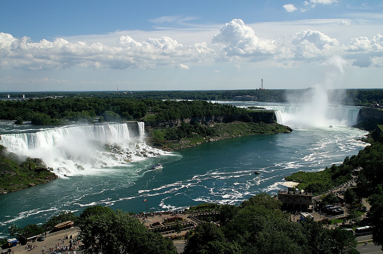
They were carved out by glaciers during the last ice age, which ended around 11,700 years ago. Lake Michigan is the only one entirely inside the United States. Water flows from Superior all the way down to Ontario and out through the St Lawrence River to the Atlantic, and on the way between Erie and Ontario it drops over Niagara Falls.
The Rockies and the Appalachians
North America has two great mountain chains, and they are very different ages.
The Rocky Mountains run about 4,800 kilometres from British Columbia down to New Mexico. They are geologically young — around 80 million years old — which is why they are jagged and steep. Denali in Alaska is the continent's highest peak at 6,190 metres.
The Appalachians in the east are much older, around 480 million years, and were once as tall as the Himalayas. Hundreds of millions of years of rain and ice have worn them down to rounded hills. Their rocks match up with mountains in Scotland and Morocco, because they were all one range before the Atlantic opened.
Tornado Alley
The United States gets more tornadoes than anywhere else on Earth — around 1,200 a year, roughly four times as many as the whole of Europe.
The reason is the shape of the continent. There are no east-west mountain ranges in the middle of North America, so cold dry air can sweep straight down from Canada and warm wet air can push straight up from the Gulf of Mexico. Where they collide, over the plains, the air starts to spin.
The area from Texas up through Oklahoma, Kansas and Nebraska is nicknamed Tornado Alley. A strong tornado can produce wind speeds above 480 kilometres an hour, faster than any other wind on Earth.
Make a Tornado in a Bottle
Fill a plastic bottle about two-thirds with water, add a drop of washing-up liquid and a pinch of glitter if you have some. Screw the lid on tightly.
Now hold it by the neck and swirl it in a fast circle for a few seconds, then stop and watch. A spinning funnel of water forms in the middle, exactly the shape of a tornado.
What you are seeing is called a vortex. The water spins around a low-pressure centre, and the glitter shows you the motion. Real tornadoes work the same way, with air instead of water, on a scale a hundred million times bigger.
The Grand Canyon
The Grand Canyon in Arizona is 446 kilometres long, up to 29 kilometres wide and about 1,800 metres deep. The Colorado River cut it, and it is still cutting.
The rocks at the bottom are around 1.8 billion years old — nearly half the age of the Earth. Walking down from the rim to the river takes you past layer after layer of rock, and each layer is a different chapter of the past.
The canyon itself is much younger than the rocks: the river has been carving it for somewhere between five and six million years. That sounds slow, but it means the river has removed enough rock to fill a stadium every year for millions of years.
Deserts, Swamps and Volcanoes
Death Valley in California is the hottest place ever measured on Earth. A temperature of 56.7 degrees Celsius was recorded there in July 1913, and readings above 54 still happen most summers. It is also the lowest point in North America at 86 metres below sea level.
The Everglades in Florida is a slow-moving river of grass, about 100 kilometres wide and only a few centimetres deep, and it is the only place on Earth where alligators and crocodiles live side by side.
Mexico and Central America sit on the Ring of Fire. Popocatépetl, an active volcano visible from Mexico City on a clear day, erupts regularly, and Central America has dozens more.
The Monarch Butterfly Journey
Every autumn, monarch butterflies fly from Canada and the northern United States to a small area of forest in central Mexico — a journey of up to 4,800 kilometres.
The extraordinary part is that no single butterfly makes the round trip. It takes three or four generations to get back north in spring, and the butterflies that fly south have never been there before. Nobody fully understands how they find the way.
They gather in such numbers on the oyamel fir trees that the branches bend under their weight. The overwintering sites are a protected biosphere reserve, and the population has fallen sharply in recent decades.
Where the Continent Ends
The border between North and South America is the Isthmus of Panama, a strip of land only about 50 kilometres wide at its narrowest. It appeared around three million years ago as volcanic islands joined up and sediment filled the gaps.
When it closed, it changed the world. It stopped water flowing between the Atlantic and the Pacific, which redirected ocean currents and strengthened the Gulf Stream — one reason Europe is as mild as it is. It also let animals walk between the two continents for the first time in millions of years, an event scientists call the Great American Biotic Interchange. Armadillos and porcupines went north; deer, bears and big cats went south.
The Panama Canal, opened in 1914, cut a shipping route back through it. Ships are raised 26 metres by locks, cross a lake in the middle, and are lowered again on the other side. Around 14,000 vessels pass through each year, and the journey saves them a 13,000-kilometre trip around the tip of South America.
The Caribbean
The Caribbean has thirteen independent countries and around twenty dependent territories spread across roughly 7,000 islands, islets and reefs. Only a few hundred are inhabited.
Most of the islands are the tops of underwater volcanoes or ancient coral platforms. The Lesser Antilles form a curved chain where one tectonic plate is sliding under another, which is why islands like Montserrat and Martinique have active volcanoes.
The region sits in the hurricane belt. Storms form off West Africa, cross the Atlantic gathering strength over warm water, and arrive between June and November. Warmer seas have made the strongest storms stronger, and small island nations are among the most exposed places on Earth to rising sea levels.
Ancient Civilisations
Long before Europeans arrived, North America had large cities and complex societies. The Maya built stone cities across southern Mexico, Guatemala and Belize, developed a writing system and a calendar of remarkable accuracy, and worked out the concept of zero independently.
The Aztecs built Tenochtitlan on an island in a lake, with causeways, floating gardens and a population that may have reached 200,000 — larger than any European city at the time. Mexico City is built on top of it.
Further north, Cahokia near modern St Louis had earthen mounds and perhaps 20,000 residents around 1100. The Ancestral Puebloans built cliff dwellings at Mesa Verde. The Inuit developed the technology to live in the high Arctic, where no one else could.
One Continent, Many Languages
English, Spanish and French are the main languages, and which one you hear depends on which colonial power arrived first. Spanish is spoken by more North Americans than English is, once Mexico and Central America are counted.
Canada is officially bilingual in English and French, and Quebec operates mainly in French. Greenland, the world's largest island and part of the Kingdom of Denmark, uses Greenlandic, an Inuit language.
Hundreds of Indigenous languages are still spoken, including Navajo, Cree, Cherokee, Nahuatl and dozens of Maya languages. Nahuatl gave English the words chocolate, tomato, avocado and coyote. To keep exploring, see the full list of countries in North America and find out about how volcanoes work.
