
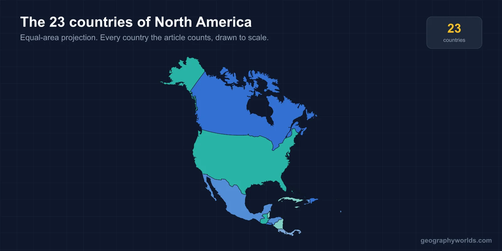
North America has 23 sovereign countries: three on the mainland, seven in Central America and thirteen in the Caribbean. It is the only continent whose count is built from three separate regional blocks, and the only one where the largest single landmass on it — Greenland — is not a country at all.
Three, Seven and Thirteen
The arithmetic is worth stating plainly, because most disagreements about North America's total come from including or dropping a whole block rather than arguing over individual states.
- The mainland three — Canada, the United States and Mexico.
- Central America's seven — Belize, Costa Rica, El Salvador, Guatemala, Honduras, Nicaragua and Panama. Covered in full in the seven countries of the isthmus.
- The Caribbean's thirteen — Antigua and Barbuda, the Bahamas, Barbados, Cuba, Dominica, the Dominican Republic, Grenada, Haiti, Jamaica, Saint Kitts and Nevis, Saint Lucia, Saint Vincent and the Grenadines, and Trinidad and Tobago, set out in the Caribbean count.
Three plus seven plus thirteen is 23. Sources that say three are describing the mainland only; sources that say ten have kept Central America and dropped the islands. Twenty-three is the figure once all sovereign states on the continental plate and its associated islands are counted, and all 23 are UN members — like Oceania and unlike Asia, Africa or Europe, North America has no disputed entries.
Where the Continent Stops in the South
The southern boundary is the Panama–Colombia border, and it is the least travelled land frontier in the Americas. The Darién Gap is about 100 km of roadless rainforest and swamp, and it is the only break in the Pan-American Highway, which otherwise runs some 30,000 km from Alaska to Tierra del Fuego. No road has ever been built through it, partly on cost, partly to stop foot-and-mouth disease spreading north, and partly because Panama and Colombia have both found reasons not to want one.
Some geologists place the divide differently, at the narrowest point of the isthmus in Panama or even at the Isthmus of Tehuantepec in southern Mexico, which would move Central America out of North America entirely. Latin America is a third scheme again, grouping Mexico and Central America with South America on language rather than geology. Twenty-three assumes the political border with Colombia, which is the most common convention and the one that keeps the count stable.
The Isthmus That Closed Three Million Years Ago
North and South America have not always been joined. The Isthmus of Panama closed roughly three million years ago, when volcanic activity and plate collision finally sealed the seaway between the two landmasses — one of the most consequential geological events of the last ten million years.
It triggered the Great American Biotic Interchange. Species that had evolved in isolation for tens of millions of years moved in both directions: armadillos, opossums and porcupines north, while cats, bears, deer, horses and camels went south. South America's native large mammals largely lost the exchange, and most of its endemic marsupial predators disappeared.
The closure also rerouted ocean currents, strengthening the Gulf Stream and, by many accounts, contributing to the onset of Northern Hemisphere glaciation. The continent that produced 23 countries is, geologically speaking, a recent assembly.
Greenland, Puerto Rico and the Places That Are Not Countries
Greenland is the largest island on earth at about 2.17 million km², sits firmly on the North American plate, and is not a country. It is an autonomous territory within the Kingdom of Denmark, with self-rule since 2009 covering almost everything except foreign policy and defence, and a population of around 56,000 — fewer people than a mid-sized town spread over an area larger than Mexico.
Puerto Rico is the other large omission: 3.2 million US citizens who elect their own governor, cannot vote for the president while resident, and send a non-voting delegate to Congress. Bermuda, the Cayman Islands, the Turks and Caicos, Aruba, Curaçao, Martinique, Guadeloupe, Saint Martin and the US Virgin Islands are all in the same category — populated, self-administered to varying degrees, and not sovereign.
Counted together, the territories hold roughly four million people. If Puerto Rico were independent it would be the fourth most populous country in the Caribbean. The line between the 23 and the rest is sovereignty, not size or significance.
The 8,891-Kilometre Border
The United States and Canada share the longest international border in the world at 8,891 km, including the 2,475 km between Alaska and the Yukon and British Columbia. Much of it follows the 49th parallel, a straight line agreed in the Anglo-American Convention of 1818 and extended to the Pacific by the Oregon Treaty of 1846.
Straight-line borders produce anomalies. The Northwest Angle in Minnesota is a piece of the United States reachable by land only through Canada, the result of a treaty drafted using a map that placed the source of the Mississippi in the wrong location. Point Roberts, Washington, is a peninsula cut off by the same parallel, where children cross an international border to attend secondary school.
The US–Mexico border is 3,145 km, and between them these two lines carry more trade than any other pair of land borders on the planet.
From 1776 to 1983
North America's independence sequence is the longest of any continent — more than two centuries from first to last.
The United States declared independence in 1776. Haiti followed in 1804, after the only slave revolt in history to produce a sovereign state. Mexico completed its war of independence in 1821, and the Federal Republic of Central America broke from it in 1823, fragmenting by 1841 into the five states that Costa Rica, El Salvador, Guatemala, Honduras and Nicaragua grew out of. The Dominican Republic separated from Haiti in 1844. Canada's confederation in 1867 began a gradual transfer that was not complete until the Statute of Westminster in 1931 and patriation of the constitution in 1982.
Then the Caribbean and Belize: Jamaica and Trinidad and Tobago in 1962, Barbados 1966, the Bahamas 1973, Grenada 1974, Dominica 1978, Saint Lucia and Saint Vincent 1979, Antigua and Barbuda 1981, Belize 1981, and Saint Kitts and Nevis on 19 September 1983 — the last country to become independent anywhere in the Americas. Nothing has been added in the forty years since.
Canada at 9.98 Million km², Saint Kitts at 261
Canada is the second-largest country in the world at about 9.98 million km², the United States third or fourth depending on how China's disputed territory is counted, at about 9.83 million, and Mexico is about 1.96 million. Those three hold roughly 99% of the land occupied by the 23 — everything else, twenty countries, fits into the remaining one per cent.
Saint Kitts and Nevis is 261 km², the smallest country in the Americas by area and population, with around 48,000 people. Canada is therefore about 38,000 times its size. The population range runs from the United States at roughly 335 million — where fifty states each hold more people than most Caribbean nations — down to Saint Kitts, a ratio of about 7,000 to one.
From Arctic Tundra to Tropical Reef
North America spans about 70 degrees of latitude, from Kaffeklubben Island off northern Greenland — the northernmost permanent land on earth — to the Panama–Colombia border at 7°N. No other continent except Asia covers so wide a climatic range, and the consequences show up in the country list.
The northern third is Arctic and subarctic: Canada's population of about 40 million lives overwhelmingly within 160 km of the US border, leaving one of the largest sparsely inhabited areas on the planet behind it. The middle is the continent's agricultural core, the Great Plains and the Mississippi basin, drained by a river system that reaches into 31 US states and two Canadian provinces.
The south is tropical, and it is also the most hazard-exposed part of the continent. The Caribbean and Central America sit in the Atlantic hurricane belt; the Pacific coast from Mexico to Panama sits on the Ring of Fire. Guatemala, El Salvador, Nicaragua and Costa Rica all have active volcanoes, and Mexico City is built on the drained bed of Lake Texcoco, which is why the 1985 and 2017 earthquakes were so destructive there. The three mainland giants have the space and the wealth to absorb these events; the twenty smaller countries mostly do not.
Three Economies Under One Agreement
The mainland three are bound by the United States–Mexico–Canada Agreement, which replaced NAFTA on 1 July 2020 after twenty-six years. Canada and Mexico are the United States' two largest trading partners, and the three together produce close to 30% of global GDP.
The continent is nonetheless three very different economies. The United States and Canada rank among the highest-income countries on earth; Haiti is the poorest country in the Western Hemisphere; Central America and the Caribbean depend heavily on remittances, which exceed 20% of GDP in several of them. Twenty-three countries, one trade bloc covering three of them, and a spread in living standards as wide as any continent's.
Learning 23 is easier than 49 or 54, and the blocks are what make it stick — three, then seven, then thirteen; if you want to check the middle block especially, the capital cities quiz covers every one of them.