
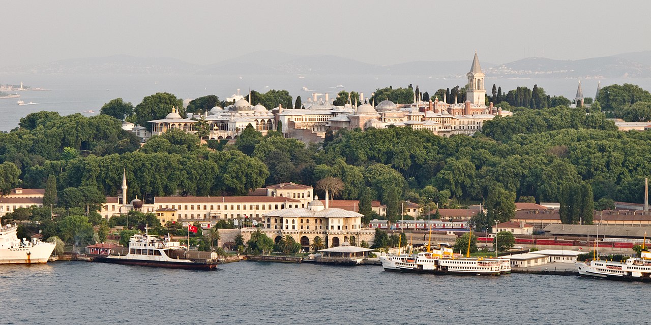
For over 600 years (1299-1922), the Ottoman Empire occupied one of the most geographically strategic positions in the world: the crossroads where Europe, Asia, and Africa meet. This position gave the Ottomans control over the land bridge between continents, the maritime chokepoints of the Bosporus and Dardanelles, and the overland trade routes connecting the Mediterranean, Persian Gulf, and Indian Ocean.
Introduction
The Ottoman Empire's longevity was fundamentally geographic. While other empires rose and fell around them, the Ottomans endured because they controlled territory that everyone needed to cross. Whether it was crusaders heading to the Holy Land, merchants trading between Europe and Asia, or pilgrims journeying to Mecca, they passed through Ottoman-controlled geography.

Geographic Context
- Position: Junction of Europe, Asia, Africa
- Key Straits: Bosporus, Dardanelles
- Major Seas: Mediterranean, Black, Red, Aegean, Caspian (influence)
- Crossroads Cities: Istanbul, Cairo, Damascus, Baghdad, Mecca
The Ottoman Empire's geography was defined by crossroads. Istanbul (Constantinople) sat on the Bosporus, the only connection between the Mediterranean and Black seas. Cairo controlled the isthmus between Africa and Asia. Damascus was the gateway between the Mediterranean and Mesopotamia. Baghdad linked Persia to the Arab world.
The empire's territory created a geographic bridge that every major trade route between Europe and Asia had to cross. Whether goods traveled overland via the Silk Road, by sea through the Red Sea and Persian Gulf, or along the Mediterranean coast, they passed through Ottoman-controlled territory, generating the toll revenue that funded the empire.
Key Events
- Constantinople Conquered: 1453 (became Istanbul)
- Egypt Conquered: 1517 (control of Red Sea trade)
- Siege of Vienna: 1529, 1683 (geographic limits of expansion)
- Suez Canal Opened: 1869 (geographic game-changer)
The conquest of Constantinople in 1453 gave the Ottomans control of the Bosporus strait, the most valuable geographic chokepoint in the eastern hemisphere. The conquest of Egypt in 1517 added control of the Red Sea, connecting Ottoman territory to the Indian Ocean spice trade and the holy cities of Mecca and Medina.
The failed sieges of Vienna (1529 and 1683) marked the geographic limits of Ottoman expansion in Europe. The Hungarian plains were suitable for Ottoman cavalry, but the mountainous terrain of the Alps and Carpathians beyond Vienna created a natural defensive barrier that Ottoman armies could not overcome.
Territorial Changes
- Peak Extent: ~5.2 million km² (17th century)
- Gradual Retreat: Lost territory in Europe, North Africa 18th-19th centuries
- Final Borders: Treaty of Sevres (1920), Lausanne (1923)
The Ottoman Empire's geographic retreat followed a predictable pattern: peripheral territories were lost first, while the core crossroads position was held longest. Greece gained independence in 1832, the Balkans were lost by 1913, Arab provinces were divided among European powers after World War I, but Turkey, occupying the geographic heart of the empire, survived.
The Treaty of Lausanne (1923), which established the Republic of Turkey, recognized that the geographic core of the Ottoman Empire, Anatolia and its European foothold including Istanbul, was defensible even when the periphery was not. Modern Turkey inherits the Ottoman crossroads position: controlling the Bosporus and Dardanelles straits remains a cornerstone of Turkish geopolitical influence.
Lasting Impact
- Turkish Straits: Still a major global chokepoint
- Middle East Borders: Many drawn from Ottoman provincial boundaries
- Religious Geography: Ottoman rule shaped the distribution of Islam in the Balkans
The Bosporus and Dardanelles remain among the world's most strategically important waterways. Roughly 3% of global oil trade and significant grain exports pass through the Turkish Straits. Turkey's control of these chokepoints gives it leverage in international affairs that directly echoes the Ottoman geographic position.
The Ottoman provincial system (vilayets and sanjaks) provided the template for many modern Middle Eastern borders. Iraq was assembled from three Ottoman vilayets: Mosul (Kurdish north), Baghdad (Sunni center), and Basra (Shia south). This geographic origin helps explain Iraq's persistent internal divisions.
Modern Relevance
- Turkey's NATO Role: Based on geographic crossroads position
- Refugee Corridor: Turkey as bridge between conflict zones and Europe
- Energy Transit: Oil and gas pipelines cross Turkish territory
Turkey's membership in NATO (since 1952) reflects the same geographic logic that made the Ottoman Empire powerful: controlling the crossroads between Europe and Asia, and between the Mediterranean and Black seas. Turkey's geographic position makes it an essential partner in any Western strategy for the Middle East and Central Asia.
Modern Turkey continues to leverage its crossroads geography. Oil and gas pipelines from Central Asia and the Caucasus cross Turkish territory to reach European markets. Turkey's position as a transit country for refugees from Syria, Iraq, and Afghanistan toward Europe demonstrates that the geographic crossroads function, moving people and goods between continents, is as relevant today as it was under the Ottomans.
Key Facts
- The Ottoman Empire controlled the Bosporus and Dardanelles for 470 years (1453-1923).
- Constantinople/Istanbul sits on the only waterway connecting the Mediterranean and Black seas.
- The empire occupied the junction of three continents for over 600 years.
- Modern Turkey still controls the Turkish Straits, through which 3% of global oil trade passes.
- Iraq's borders follow three Ottoman vilayets: Mosul, Baghdad, and Basra.
Fun Facts
- When Mehmed II conquered Constantinople in 1453, he transported warships overland on greased logs to bypass the defensive chain across the Golden Horn, one of the most dramatic geographic maneuvers in military history.
- The Ottoman coffeehouses of Istanbul were among the world's first public gathering places for news and discussion, functioning as geographic nodes of information exchange at the crossroads of three continents.
- The Ottomans maintained detailed geographic surveys (tahrir defterleri) of every village, field, and tax obligation in their empire, making them among the most geographically informed pre-modern states.
- The annual Hajj pilgrimage caravan from Damascus to Mecca, organized by the Ottomans, could number 60,000 people and stretched for kilometers across the desert, one of the largest regular geographic movements in the pre-modern world.
Final Thoughts
The Ottoman Empire's 600-year survival was a geographic achievement. By controlling the crossroads where three continents met, the straits connecting major seas, and the overland routes linking civilizations, the Ottomans made themselves geographically indispensable. Modern Turkey inherits this position, and the geographic logic that sustained the Ottoman Empire continues to shape Turkish and global geopolitics.
Test Your Knowledge!
Think you know your historical geography? Try our interactive geography quiz!
Play Country Quiz →