
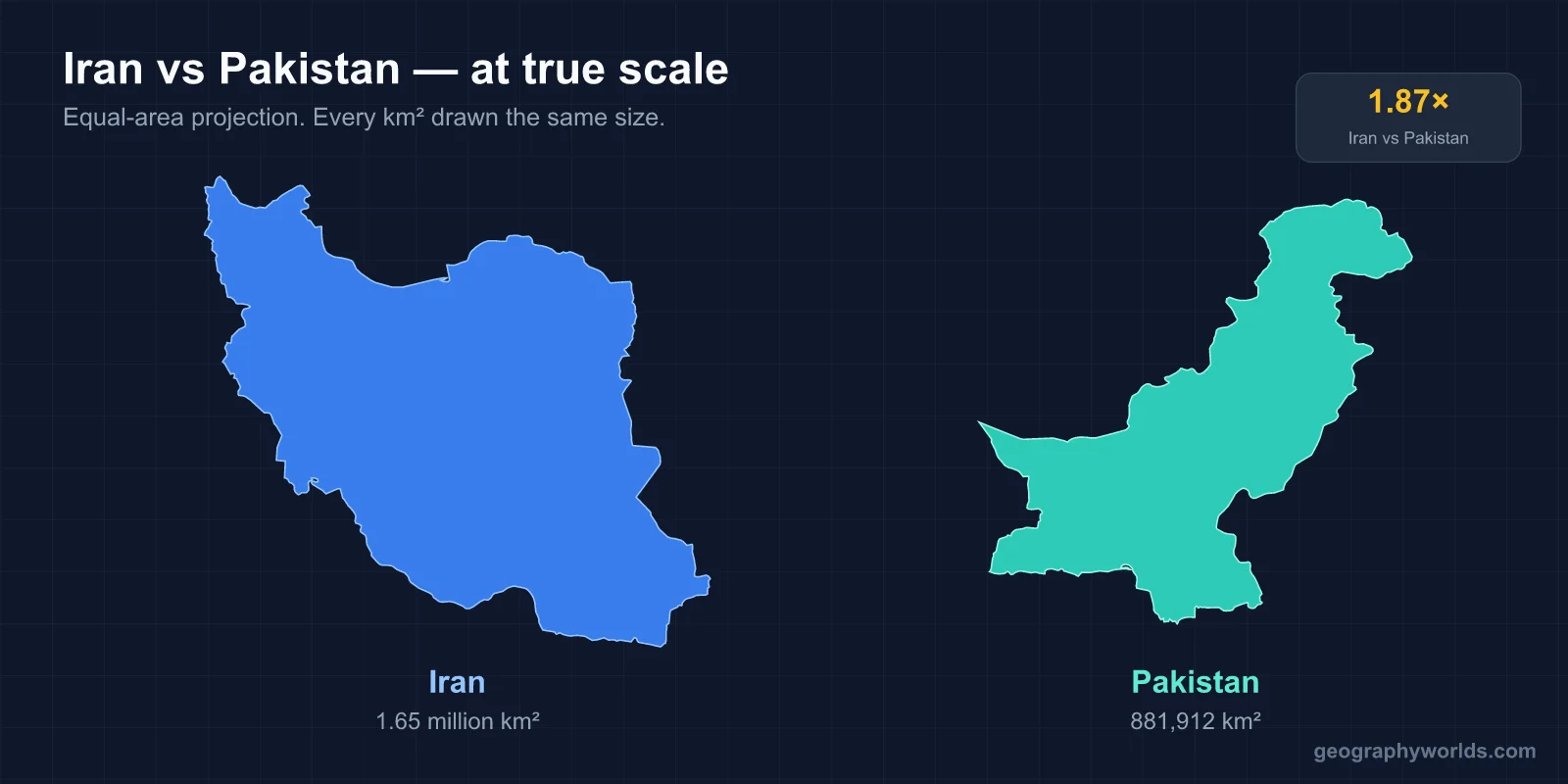
Pakistan and Iran are neighbouring Islamic republics of broadly similar area — Iran about 1.65 million km², Pakistan about 881,000 km² — but Pakistan has roughly two and a half times the population, at around 240 million against Iran's 90 million. They share a border of about 900 km, and the most consequential fact about that border is that it runs straight through the middle of the Baloch homeland.
The border that divides one people
The frontier was drawn by British officials in the 1870s — the Goldsmid Line — to separate British India's sphere from Persia's. Like many colonial boundaries it followed strategic convenience rather than settlement patterns, and it cut the Baloch lands in two.
The consequence persists. Balochistan is Pakistan's largest province by area and its least populous; Sistan and Baluchestan is among Iran's poorest provinces. Both sit at the far edge of their respective states, both are arid and sparsely populated, both have long-running insurgencies, and both governments accuse the other of harbouring militants who cross the line.
Neither government has an interest in the frontier being genuinely open, and neither has the capacity to close it. Iran fenced sections after cross-border attacks; Pakistan has fenced parts of its Afghan border for the same reason and made slower progress here. The practical arrangement is a line that exists on maps and is negotiated daily on the ground.
Smuggling — fuel above all, since subsidised Iranian petrol is worth several times more on the Pakistani side — is a major part of the border economy. Neither state fully polices the terrain, and Iran has built sections of wall and ditch along it.
A plateau against a river valley
Physically the two countries are organised on completely different principles.
Iran is a plateau country. Its interior sits mostly between 1,000 and 1,500 metres, ringed by mountains — the Zagros running north-west to south-east, the Alborz along the Caspian with Damavand at about 5,610 metres — and the middle of that ring holds two great salt deserts, the Dasht-e Kavir and the Dasht-e Lut. There is no major river system. Iran's historical answer to that was the qanat: gently sloping underground tunnels tapping mountain aquifers and carrying water tens of kilometres to settlements without evaporation loss.
Pakistan is a river country. The Indus and its tributaries drain the western Himalaya and Karakoram and run the length of the country to the Arabian Sea, and the population is concentrated along that corridor with an intensity that shows on any night-lights image. Punjab alone holds over half of Pakistan's people.
That difference shapes everything downstream. Iran's water constraint is aquifer depletion and disappearing lakes — Lake Urmia, once among the largest saltwater lakes in the world, has shrunk dramatically. Pakistan's is upstream control and glacial melt, mediated by the Indus Waters Treaty with India.
Where the mountains are highest
Pakistan has the more dramatic high ground by a wide margin. Five of the world's fourteen 8,000-metre peaks are on its territory, including K2 at 8,611 metres — the second-highest mountain on Earth — and Nanga Parbat, which anchors the western end of the Himalaya. The Karakoram holds some of the largest glaciers outside the polar regions.
Iran's mountains are lower but more pervasive: the Zagros runs for roughly 1,500 km and defines the country's western half, and it is the reason Iran's population clusters in a ring of basins and valleys rather than spreading evenly.
Both countries are seismically active for the same underlying reason — the Arabian plate driving into Eurasia — and both have suffered catastrophic earthquakes, Iran at Bam in 2003 and Pakistan in Kashmir in 2005.
Nuclear, and the asymmetry it created
Pakistan tested nuclear weapons in May 1998, days after India's tests, and is one of nine nuclear-armed states. Its arsenal is directed at India rather than Iran, and it operates outside the Non-Proliferation Treaty, having never signed it.
Iran signed the NPT and has consistently denied seeking weapons, while pursuing an enrichment programme that its neighbours and the IAEA have treated with sustained suspicion. The 2015 nuclear agreement traded restrictions for sanctions relief; the American withdrawal in 2018 unravelled it, and enrichment has since expanded well beyond the limits it set.
Both programmes also rest on the same geography of secrecy: remote, arid, sparsely populated interiors where large facilities can be built at distance from population and observation. Pakistan's Chagai test site sits in Balochistan; Iran's Fordow and Natanz sites are in the central plateau, one of them built into a mountain.
The asymmetry is notable: the country that built weapons quietly and outside the treaty faces comparatively little sanctions pressure, while the country inside the treaty has been under the heaviest sanctions regime applied to any large economy in decades. That is a fact about alliances rather than about physics — Pakistan's programme matured while it was a useful partner to the United States in Afghanistan.
Two very different population pyramids
The demographic contrast is the sharpest difference between them and the one with the longest consequences.
- Pakistan has a young, fast-growing population — a median age around 20, and one of the higher fertility rates in Asia. It is now the fifth most populous country in the world.
- Iran ran one of the most successful family-planning programmes ever recorded in the 1990s, cutting fertility from very high levels to below replacement within a generation. Its median age is now around 33 and rising, and the government has since reversed course and begun promoting births.
The result is that two neighbours of comparable size face opposite problems: Pakistan must create jobs and schooling for an enormous cohort of young people, while Iran is approaching the ageing profile of a middle-income European state under sanctions.
Oil, gas and what sanctions did
Iran holds some of the largest proven oil and natural gas reserves in the world — its share of the South Pars/North Dome gas field, split with Qatar, is enormous — and hydrocarbons dominate its export earnings.
Pakistan has no comparable endowment. Its economy rests on textiles, agriculture and remittances, and it has been a recurrent borrower from the IMF. Where Iran's central economic problem has been restricted access to markets and banking under sanctions, Pakistan's has been a persistent current-account deficit and energy shortfall.
Both have made large infrastructure bets on China. Pakistan's is the China–Pakistan Economic Corridor, running from Kashgar to the port of Gwadar — which sits on the Baloch coast about 100 km from the Iranian border, and is intended to give China an Arabian Sea outlet bypassing the Strait of Malacca.
Two ports, 170 km apart, backed by rivals
The clearest expression of the two countries' different alignments sits on the same stretch of coast. Gwadar, in Pakistani Balochistan, is being developed with Chinese finance as the maritime terminus of the China–Pakistan Economic Corridor. Chabahar, in Iranian Sistan and Baluchestan, is being developed with Indian investment as a route into Afghanistan and Central Asia that bypasses Pakistan entirely.
They are roughly 170 km apart. Two deep-water ports on the same arid coastline, serving two rival strategic projects, both intended to unlock trade routes into the same landlocked interior.
Neither has yet delivered on the promises made for it. Gwadar's throughput has stayed modest and local opposition over water, fishing rights and who benefits has been persistent; Chabahar has been constrained by sanctions deterring the investment and shipping it needs. But the pairing is a useful map of how the region's alignments actually run.
Persian and Urdu are not the same family
Iran's national language is Persian, an Indo-Iranian language written in a modified Arabic script, with substantial minorities speaking Azerbaijani, Kurdish, Arabic and Baloch.
Pakistan's national language is Urdu, which is mutually intelligible with Hindi in speech and written in a Perso-Arabic script — but it is the first language of a relatively small share of the population. Punjabi, Sindhi, Pashto and Baloch are all more widely spoken as mother tongues, and English retains official status and dominates higher administration.
Persian's influence on Urdu is heavy — much of its literary vocabulary is Persian-derived, a legacy of Persian being the court language of Mughal India. So the two countries' languages are related historically without being mutually intelligible.
Sunni and Shia, and what that changes
Iran is overwhelmingly Shia and has been the world's leading Shia power since the Safavids adopted the faith as state religion in the sixteenth century. Its 1979 revolution produced a system in which clerical authority sits above elected office.
Pakistan is majority Sunni with a substantial Shia minority — proportionally small but numerically among the largest Shia populations anywhere, given the size of the country. It was founded in 1947 explicitly as a homeland for the subcontinent's Muslims, which makes it one of the few states created on a religious rationale.
Relations between the two have consequently been cooperative and strained by turns: neighbours with a shared frontier problem, on opposite sides of the Sunni–Shia divide, with Pakistan maintaining close ties to Saudi Arabia. For the wider regional picture see our Iran and Pakistan country guides.
