

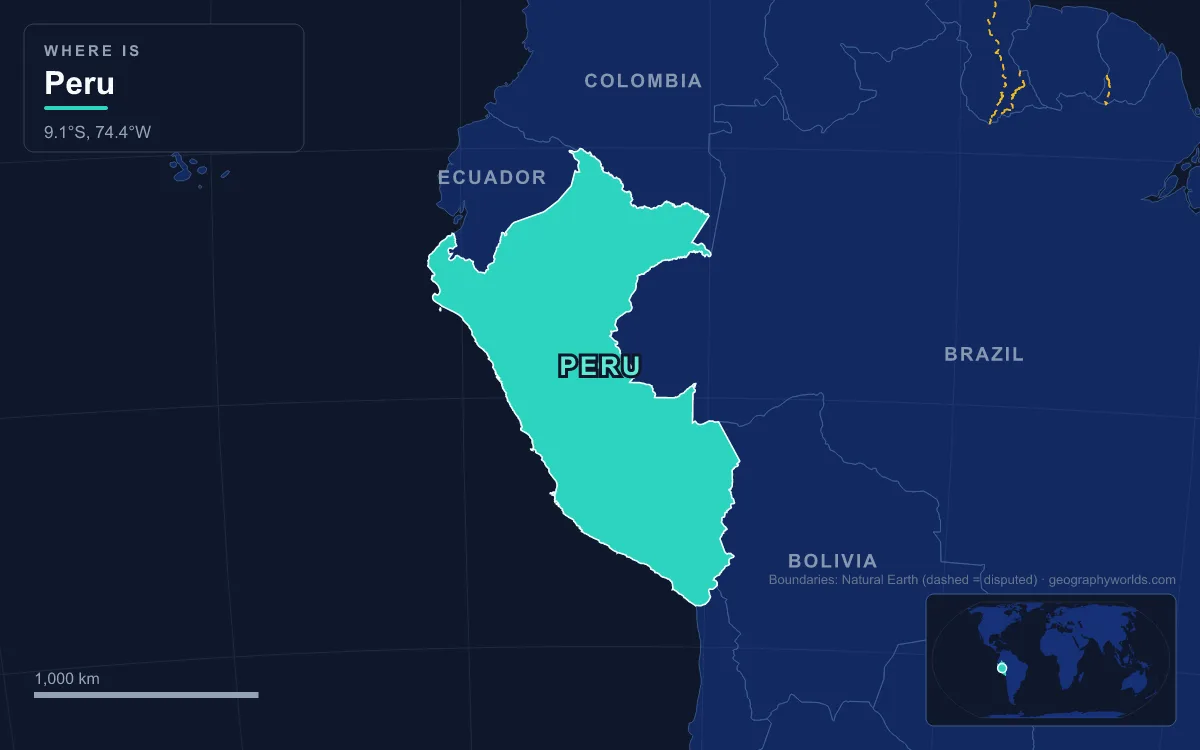
Peru lies on the central Pacific coast of South America, entirely south of the equator, and covers 1,285,216 km², making it the third-largest country on the continent. Its geography has three parts: a narrow coastal desert, the Andes, which run the length of the country and peak at Huascarán Sur, 6,768 m, the highest point in the tropics; and the Amazon lowlands, which make up roughly 60 percent of the territory. The main rivers are the Marañón and the Ucayali, which join near Nauta to form the Amazon, while dozens of short rivers cross the desert to the Pacific, and Lake Titicaca on the Bolivian border is the largest lake in South America. That layout decides where Peruvians live: about a third of a population of some 33.4 million (INEI projection, 2022) is packed into Lima, a desert city of around 10 million, while the rainforest that covers most of the map holds few people.
Lima and the River Oases of the Desert Coast
The coast, the zone geographers call the chala, runs from sea level to about 500 m and is mostly desert, with annual rainfall of about 5 mm near the Chilean border and up to about 200 mm in the north. It is crossed at intervals by rivers carrying snowmelt and highland rain down from the Andes, and every coastal city stands in one of those green valleys. Lima occupies three of them, the valleys of the Chillón, Rímac and Lurín. The 204 km Rímac, which rises in Huarochirí Province and reaches the sea at Callao, is the metropolis's main source of drinking water. Its name comes from the Quechua rimaq, "speaker", and the city's own name is traced to Limaq, the coastal Quechua form of the same word, once given to an oracle in the Rímac Valley.
With an estimated 10.09 million people in 2023, Lima is the second-most populous city in South America after São Paulo. Its growth has come largely from migration out of the highlands, and new districts called pueblos jóvenes have spread across the bare hills and sand around the old centre. Along the Pacific, districts such as Miraflores end in steep sea cliffs, with the Costa Verde road running along their foot.

Irrigation has always been the price of living here. On the north coast, 5 km west of Trujillo, the adobe ruins of Chan Chan cover about 20 km² at the mouth of the Moche Valley. From about 900 until the Inca conquest in 1470 it was the capital of the Chimor kingdom, and it was the largest pre-Columbian city in South America, fed by canals that led runoff from the Andes onto the desert. The modern equivalent runs past the same ruins: the Chavimochic project, begun in the 1960s and named for the Chao, Virú, Moche and Chicama valleys its main canal crosses, carries Andean water onto the desert of La Libertad. In the south, the Majes-Siguas scheme diverts the Colca River through a 101 km aqueduct to irrigate the Pampa de Majes near Arequipa, Peru's second city, with a projected 1.2 million people in 2025.
The Humboldt Current and the Anchoveta Fishery
The coast is dry partly because of the sea. The Humboldt Current, also called the Peru Current, carries cold water north along the shore, and near 5° south surface temperatures can be as low as 16 °C, remarkably cold for the tropics. The cold sea keeps the coast cool, the nearby Andes block rain clouds, and instead of rain the central and southern coast gets winter fog and a light drizzle called garúa. The same current drives upwelling that brings nutrients to the surface, and the system supplies roughly 18 to 20 percent of the world's marine fish catch.
The most important fish is the Peruvian anchoveta, which lives in huge schools within about 80 km of the shore and is ground into fishmeal. The catch peaked at 13.1 million tonnes in 1971, collapsed after overfishing and the El Niño of 1972, when warm water spread over the current and shut off the upwelling, and then recovered to 12.5 million tonnes by 1994. The strong El Niños of 1982–1983 and 1997–1998 cut the stock again, a reminder that Peru's largest fishery depends on the state of the current.
Farming by Altitude around Cusco and the Sacred Valley
Climbing east from the coast, the land changes with every few hundred metres. In 1941 the Peruvian geographer Javier Pulgar Vidal replaced the old coast-highland-jungle division with eight natural regions defined largely by elevation, and his scheme still shapes how Peruvians describe their land. The Quechua zone, between 2,300 and 3,500 m, is the heartland of highland settlement, with valleys suited to maize, wheat and squash. Above it, the suni grows quinoa, broad beans and olluco up to 4,100 m, and the puna, to 4,800 m, is grazing land for llamas and alpacas, with barley, potatoes and maca as the hardiest crops. Above that lies the janca, the zone of rock and glacier.
Cusco, at about 3,400 m, sits squarely in this vertical world. It was the capital of the Inca Empire, is today the largest city in the Peruvian Andes with 428,450 people in 2017, and was listed by UNESCO in 1983. The Incas farmed the steep slopes around it by building terraces, and at Moray, about 50 km northwest of the city at roughly 3,500 m, they shaped a set of circular terraced depressions, the largest about 30 m deep. Their form traps cold air, so the temperature between top and bottom can differ by as much as 15 °C. Their purpose is uncertain, but the range is widely thought to have let the Incas grow crops as if at several altitudes in one place. Downstream, the Urubamba River cuts a deep canyon past Machu Picchu, built around 1450 on a ridge at 2,430 m.

Cerro de Pasco and the Mining Towns of the High Andes
If the valleys fed Peru, the rocks of the Andes paid for it. Cerro de Pasco, founded as a mining settlement in 1578, became one of the world's richest silver districts after silver was found there in 1630, and in 1816 steam engines built by Richard Trevithick of Cornwall were installed to pump water from its flooded workings. At 4,330 m, with 58,899 people, it is among the highest cities in the world, linked to Lima, 300 km away, by road and by the Ferrocarril Central Andino. Mining remains central to the national economy: in 2019 Peru was the world's second-largest producer of copper and zinc, and in 2023 it ranked third for silver. The mines are also a source of environmental conflict, and mining waste is one of the main polluters of Peru's rivers and coastal waters.
Lake Titicaca and the Puno Altiplano
In the far south the Andes open into the Altiplano, a high, closed basin shared with Bolivia. At its northern end lies Lake Titicaca, whose surface stands at 3,812 m and which is often called the highest navigable lake in the world. It is the largest lake in South America by both area and volume. The western part lies in Peru's Puno Region, the eastern part in Bolivia's La Paz Department, and its only outlet, the Desaguadero River, removes just 10 percent of its water; the rest is lost to evaporation under strong sun and wind.
Puno, on the western shore, is Titicaca's main Peruvian port, in a region where potatoes, quinoa and herds of llamas and alpacas sustain rural life. Nearby, the Uru people live on floating islands built from layers of totora reed; counts range from about 60 to about 120 islands. The islands were originally defensive, since they could be moved if a threat arose.

Iquitos, the Ucayali and the Amazon Lowlands of Loreto
East of the Andes the land drops through the rupa rupa, forested foothills between 400 and 1,000 m cut by narrow river gorges called pongos, to the omagua, the low jungle plain below 400 m. This Amazon region covers roughly 700,000 km², giving Peru the fourth-largest area of tropical forest in the world after Brazil, the Democratic Republic of the Congo and Indonesia. Two great rivers drain it. The Marañón rises about 160 km northeast of Lima, runs northwest along the base of the Andes and breaks out onto the plain at the Pongo de Manseriche. The Ucayali, together with its headwaters the Apurímac, Ene and Tambo, runs 2,670 km from Nevado Mismi in Arequipa to meet the Marañón near Nauta, where the combined river takes the name Amazon.
Settlement here follows the rivers, because there are few roads. Iquitos, capital of the Loreto Region, with a metropolitan population of 471,993, is the largest city in the world that cannot be reached by road and is not on an island; people and goods arrive by river or air. It boomed during the rubber era of 1880 to 1914, when the Peruvian Amazon Company of Julio César Arana held indigenous workers in near slavery, and declined once rubber grown on Asian plantations undercut Amazonian prices. Later the region turned to timber and fish. Further south, gas from the Camisea fields, discovered by Shell in 1986 near the Urubamba River in the Cusco Region, is piped 540 km over the Andes to a terminal at Pisco on the coast, and a second line carries it on to Lima and Callao.
Tacna, the Rio Protocol and Borders Settled by War
Peru borders Ecuador, Colombia, Brazil, Bolivia and Chile, and its longest land border is with Brazil, running through the rainforest. The two borders that took longest to settle were in the desert and the northern Andes. After the War of the Pacific, the Treaty of Ancón of 1883 gave Tarapacá to Chile and left Tacna and Arica under Chilean administration pending a plebiscite that never took place. The Treaty of Lima, signed on 3 June 1929, split the territory: Tacna returned to Peru, Chile kept Arica and agreed to pay Peru up to US$6 million. In the north, the Rio Protocol, signed on 29 January 1942 after the Ecuadorian–Peruvian War of 1941–1942, drew a line through the Amazon and the eastern Andes. It left gaps in the demarcation, and fighting broke out again in 1981 and 1995 before the Itamaraty Peace Declaration opened the way to a final settlement.
Coast, mountains and forest still divide the country socially as well as physically, with capital and people concentrated on a desert fringe that depends on Andean water. Our guide to the Andes mountains follows the range beyond Peru, the geography of Lake Titicaca looks closely at the Altiplano lake, and the Chan Chan archaeological site shows how a desert city of the north coast once ran on river water.