

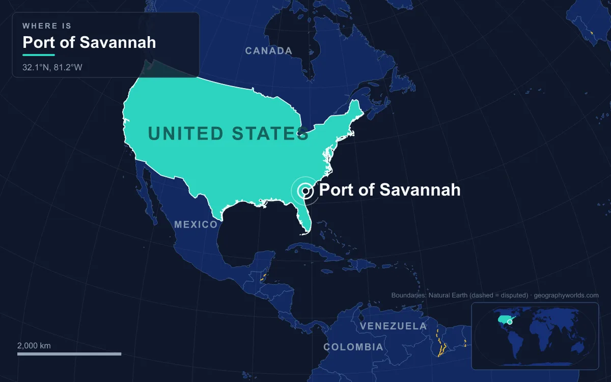
The Port of Savannah is a river port in Georgia, United States, whose terminals line both banks of the tidal Savannah River about 29 km (18 miles) upstream from the Atlantic Ocean. Run by the Georgia Ports Authority, which was set up in 1945, it handled about 5.5 million twenty-foot equivalent units (TEU) of containers in 2024, 35th in the world on Lloyd's List's One Hundred Container Ports ranking and one of the four busiest container ports in the United States. Its Garden City Terminal is the largest single-operator container terminal in North America. Savannah has been a seaport since James Oglethorpe landed on its bluff in 1733. What makes the place work is geography: a river deep enough to dredge, a bluff high enough to build on, flat coastal land for warehouses and a direct line inland to the fast-growing Southeast.
From Lake Hartwell to Tybee Roads: The Savannah River's Last 18 Miles
The Savannah River forms most of the border between Georgia and South Carolina. It begins at the meeting of the Tugaloo and Seneca rivers, a confluence now drowned under Lake Hartwell, and runs about 301 miles (484 km) from the edge of the Appalachians to the sea. Three Army Corps of Engineers dams, J. Strom Thurmond (1954), Hartwell (1962) and Richard B. Russell (1985), were built for hydroelectricity, flood control and navigation and hold back more than 120 miles (190 km) of reservoirs upstream.
At the city of Savannah the river is tidal. Below it the channel broadens into an estuary of marsh islands and back channels before reaching the Atlantic at Tybee Roads, beside Tybee Island, Georgia's easternmost point. Hutchinson Island, about 7 miles (11 km) long, lies in the river just north of downtown, where the Back River branches off to the north. The Intracoastal Waterway crosses the same stretch. This is the port's whole marine approach: a single dredged river channel running from Tybee Roads up to the berths.
Yamacraw Bluff, 1733: Oglethorpe's High Ground
The reason the city stands where it does is a bluff. On 12 February 1733 General James Oglethorpe and the settlers from the ship Anne landed at Yamacraw Bluff on the south bank, where they were met by Tomochichi, leader of the Yamacraw, and the traders John and Mary Musgrove. Savannah and the colony of Georgia were founded that day. The bluff gave the town higher ground on a coast that lies barely above sea level and is prone to flooding, while the river at its foot gave ships a sheltered berth about 18 miles (29 km) up from the open Atlantic.
The river also gave the colony its second city. Augusta, founded in 1736, grew where the Savannah crosses the Fall Line, the head of navigation for boats coming up from the coast, so the river tied the port to the Piedmont from the start. Savannah was the colonial capital and the first state capital of Georgia, and by the American Revolution it was the southernmost commercial port in the Thirteen Colonies. The border itself was fixed by the Treaty of Beaufort in 1787, which gave all islands in the river to Georgia, though in 1990 the US Supreme Court ruled that islands formed later on the South Carolina side belong to South Carolina.
A Shifting Channel: Steamboats, Blockade Runners and Fort Pulaski
The river bed is sandy, and that made it treacherous. Through the 19th century the channel shifted often, causing numerous steamboat accidents. The mouth of the river needed defending too. After the War of 1812 the federal government began Fort Pulaski on Cockspur Island, at the river's mouth, in 1829; a young Second Lieutenant Robert E. Lee worked on it, and it was finished in 1847 on wooden pilings driven up to 70 feet (21.3 m) into the mud.
During the Civil War, Savannah became one of the busiest harbours for blockade runners supplying the Confederacy, until Union rifled cannon on Tybee Island breached Fort Pulaski's brick walls in 1862 and closed the river mouth. In December 1864, at the end of William T. Sherman's March to the Sea, Confederate troops escaped across the river on a pontoon bridge over Hutchinson Island, and the city surrendered without being destroyed. Its historic district survives, and ships heading for the container terminals still pass directly in front of the old waterfront.

From 42 to 47 Feet: The Savannah Harbor Expansion Project
A river port lives or dies by the depth of its channel. For years the Savannah channel was maintained at 42 feet, which meant the neo-Panamax ships that began arriving through the enlarged Panama Canal had to call part-loaded. The Savannah Harbor Expansion Project, begun in 2015 at an estimated cost of about $973 million, three-quarters of it federal and the rest from Georgia, dredged the river to 47 feet. The deeper channel was expected to let loaded ships carry about 3,600 more containers through the harbour on every passage.
Even at 47 feet, Savannah is shallower than some East Coast rivals: the Port of Charleston, its main competitor to the northeast, has a 52-foot harbour channel, and New York–New Jersey 50. Deepening the river is also politically contested: disputes over dredging slowed plans for a new terminal further downstream for years, as described below.
Garden City Terminal: 1,345 Acres on the Georgia Bank
Upstream of downtown the river is flanked by flat, low land, and that space is what allowed the Georgia Ports Authority to build Garden City Terminal, a dedicated container terminal of 1,345 acres (about 5 km²) with 9,693 feet (2,955 m) of continuous berth, more than 1.1 million square feet of covered storage and 36 ship-to-shore cranes, 30 of them super post-Panamax. It is the largest container terminal in North America run by a single operator. The GPA's other Savannah facility, the 200.8-acre Ocean Terminal handles breakbulk cargo: forest products, steel, roll-on/roll-off vehicles and heavy-lift project cargo across 3,599 feet (1,099 m) of berth.

Growth followed the land. In the 1950s Savannah was the only US port to increase its trade while the national total fell 5%. Between 2000 and 2005 it was the fastest-growing seaport in the country, with container traffic compounding at 16.5% a year against a national average of 9.7%. It handled 2.3 million TEU in fiscal 2007, about 3 million by 2014 and a record 4.35 million in 2018.
Savannah's position on the Atlantic seaboard also made it reachable from Asia by two routes. In 2006 Maersk Line signed a twenty-year agreement making Savannah one of its main South Atlantic ports of call. In 2007 APL launched two all-water services to the port: the East Coast Savannah Express, which sailed from Ningbo through the Panama Canal and reached Savannah 22 days after leaving Hong Kong, and the Suez Express, which took 25 days from Singapore by way of Colombo and the Suez Canal.
The Talmadge Bridge Ceiling and a Terminal Downstream at Jasper
Depth is one ceiling; height is the other. Every ship bound for Garden City must pass under the Talmadge Memorial Bridge, which crosses the river between downtown and Hutchinson Island. The original 1953 cantilever bridge had become a hazard for large ships by the 1980s and was replaced in March 1991 by a four-lane cable-stayed span, but it still limits the port's air draught to 185 feet. In 2018 officials suggested it might one day have to be replaced for the port to serve the largest neo-Panamax ships.
A possible long-term answer lies downriver, below the bridge. The Jasper Ocean Terminal is a planned container port on the South Carolina bank, about 10 miles (16 km) below Savannah. Its plans call for 1,500 acres, ten berths, a 55-foot (17 m) channel able to take ships of up to 20,000 TEU and capacity for seven million TEU a year, at an estimated cost of $4.5 billion. The project began as a partnership between the Georgia and South Carolina ports authorities, but South Carolina handed its half-interest to Jasper County in 2021, and opening is now projected for 2035 to 2037.
Beyond the River: Inland Ports from Murray County to Cordele
The final piece of Savannah's site is what lies behind it: flat land and rail lines running deep into the Southeast. Large importers built their distribution centres beside the terminals. Target opened a two-million-square-foot import warehouse at the Savannah River International Trade Park, four miles from Garden City, in 2007; IKEA opened the first phase of a distribution centre there the same year, and Heineken USA followed in 2008.
The Georgia Ports Authority has pushed the port's reach further inland with rail-served terminals. The Appalachian Regional Port in Murray County, opened in August 2018, is linked to Savannah by a 388-mile CSX route and serves markets in Alabama and Tennessee. A 104-acre Northeast Georgia Inland Port, connected by Norfolk Southern, was planned to open in 2021, and a facility at Cordele is also rail-linked to the harbour. A 2017 University of Georgia study credited Georgia's ports with supporting 439,220 jobs, about 9% of all employment in the state.
The river that carries all of this is followed from its mountain headwaters in our guide to the Savannah River, and the coastal plain, barrier islands and marshes around the port are described in our look at the landforms of Georgia. For a harbour that solved the same problems of depth and bridge clearance on a much larger estuary, compare the Port of New York and New Jersey.