
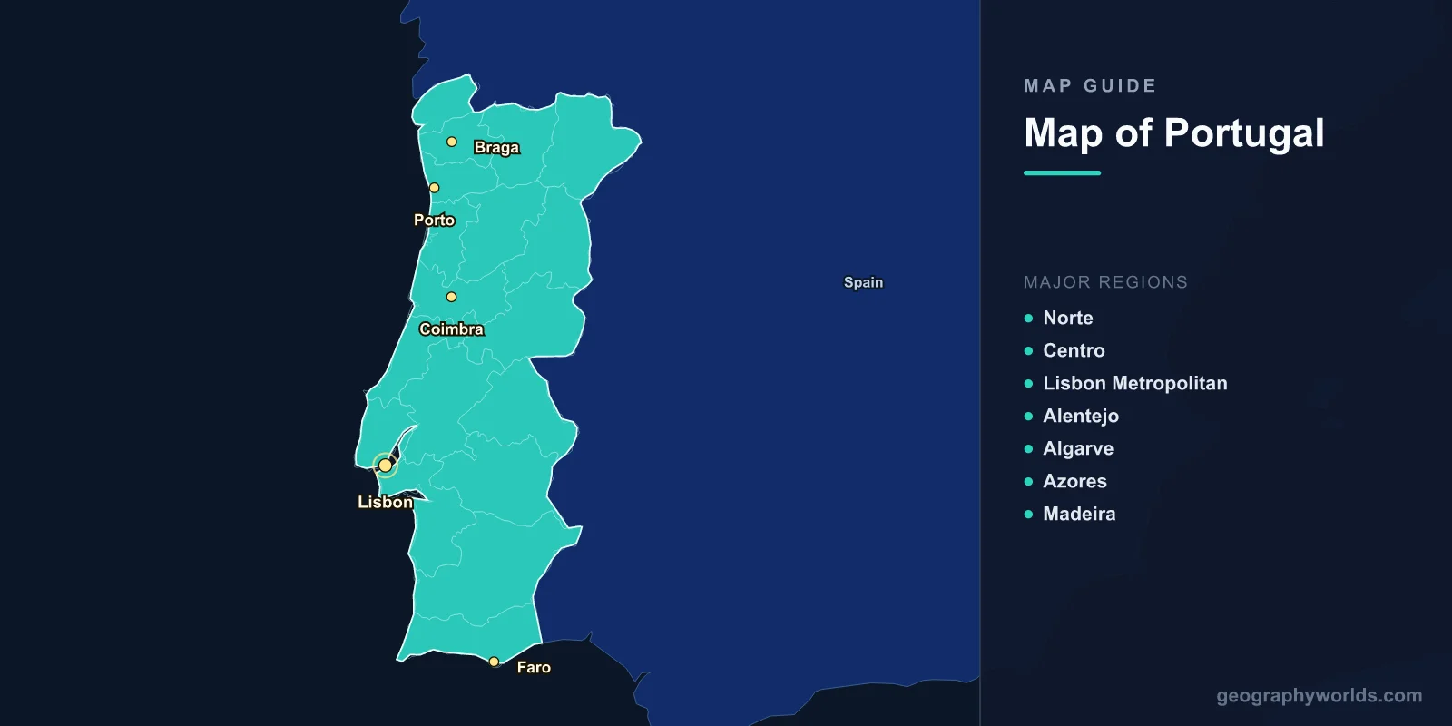
Portugal is located on the western coast of the Iberian Peninsula in southwestern Europe, covering 92,212 km2 (35,603 sq mi) with a population of approximately 10.3 million. The capital is Lisbon (38.7223°N, 9.1393°W). A map of Portugal shows a long, narrow mainland stretching 561 km north to south, plus the Atlantic archipelagos of the Azores and Madeira.
Introduction
Portugal is bordered by Spain to the north and east and the Atlantic Ocean to the west and south. Its 1,794 km of coastline features dramatic cliffs, sandy beaches, and river estuaries. The country’s geography transitions from the mountainous, green north to the flatter, drier Alentejo region and the tourism-heavy Algarve coast in the south.

Geographic Overview
- Area: 92,212 km2 (35,603 sq mi)
- Population: 10.3 million (2024)
- Capital: Lisbon
- Coordinates: 39.3999°N, 8.2245°W
- Highest Point: Mount Pico, 2,351 m (Azores)
- Coastline: 1,794 km (mainland)
Portugal’s mainland is divided by the Tagus River (Tejo) into a hillier, wetter northern half and a flatter, drier southern half. The Serra da Estrela in central Portugal reaches 1,993 m, the highest point on the mainland. The Azores, located 1,500 km west in the mid-Atlantic, consist of nine volcanic islands, while Madeira lies 1,000 km southwest of Lisbon.
Major Regions
- Norte: Northern region; Porto; mountainous terrain; Douro Valley wine country
- Centro: Central highlands; Serra da Estrela; university city of Coimbra
- Lisbon Metropolitan: Capital region; 2.9 million in greater area
- Alentejo: Largest region by area; rolling plains; cork oak forests
- Algarve: Southern coast; tourism hub; dramatic cliff formations
- Azores: Nine volcanic islands in the mid-Atlantic; 247,000 residents
- Madeira: Subtropical island; Funchal; 251,000 residents
Portugal’s mainland is divided into 18 districts for administrative purposes, though regional identities are strong. The Norte region produces most of the country’s wine and is culturally distinct from the south. The Alentejo, covering nearly a third of the mainland, is one of Europe’s least densely populated areas.
Major Cities
- Lisbon: Capital; 545,000 (city), 2.9 million (metro); mouth of the Tagus
- Porto: 240,000 (city), 1.7 million (metro); Douro River; second city
- Braga: 195,000; historic religious center; far north
- Coimbra: 143,000; oldest university in Portugal (founded 1290)
- Faro: 65,000; gateway to the Algarve
- Funchal: 105,000; capital of Madeira
Lisbon and Porto together account for over half of Portugal’s economic output. Lisbon’s natural harbor at the Tagus estuary made it one of Europe’s great maritime capitals during the Age of Discovery. Porto, at the mouth of the Douro, is famous for port wine production and its UNESCO-listed historic center.
Bodies of Water & Natural Features
- Tagus (Tejo): Longest river on the Iberian Peninsula; 1,007 km total; enters the sea at Lisbon
- Douro: 897 km total; forms part of the Spanish border; famous wine region
- Guadiana: 829 km; forms part of the southern border with Spain
- Serra da Estrela: Highest mainland range at 1,993 m; glacial valley; ski resort
- Ria Formosa: 60 km barrier island lagoon system; Algarve
Portugal’s rivers mostly originate in Spain and flow westward to the Atlantic. The Douro Valley is a UNESCO World Heritage Site, terraced for wine production over centuries. The Algarve’s coastline features sea caves, grottos, and dramatic sandstone cliffs, particularly at Ponta da Piedade near Lagos.
Neighboring Countries & Maritime Borders
- Spain: 1,214 km land border to the north and east
- Atlantic Ocean: Western and southern coasts
- Morocco: Across the Strait of Gibraltar (indirect maritime neighbor)
The Portuguese-Spanish border is one of the oldest in Europe, largely unchanged since the Treaty of Alcanices in 1297. Portugal’s Exclusive Economic Zone extends 1,727,408 km2 into the Atlantic, the third-largest in the EU, encompassing the Azores and Madeira. The country’s maritime heritage is central to its national identity.
Key Facts
- Portugal is the westernmost country in mainland Europe at Cape Roca (9.5°W).
- The Azores sit on the Mid-Atlantic Ridge where three tectonic plates meet.
- Portugal has 17 UNESCO World Heritage Sites.
- The Alentejo region produces over half the world’s cork.
- The Vasco da Gama Bridge in Lisbon is 12.3 km, the longest in the EU.
Fun Facts
- Portugal and England/UK have the world’s oldest active alliance, dating to the Treaty of Windsor (1386).
- The Azores’ Lake of Sete Cidades sits in a volcanic crater and appears half blue, half green.
- Portugal’s Berlengas archipelago has been a UNESCO Biosphere Reserve since 2011.
- Madeira’s Laurisilva forest is a surviving remnant of forests that covered southern Europe millions of years ago.
Final Thoughts
Portugal’s map reveals a compact but geographically diverse nation stretched along the Atlantic edge of Europe. From the granite mountains of the north to the limestone cliffs of the Algarve, and from the volcanic Azores to subtropical Madeira, Portugal packs remarkable geographic variety into its relatively small area.
Test Your Geography Knowledge!
Think you know your maps? Try our interactive geography games!
Play Geography Games →