
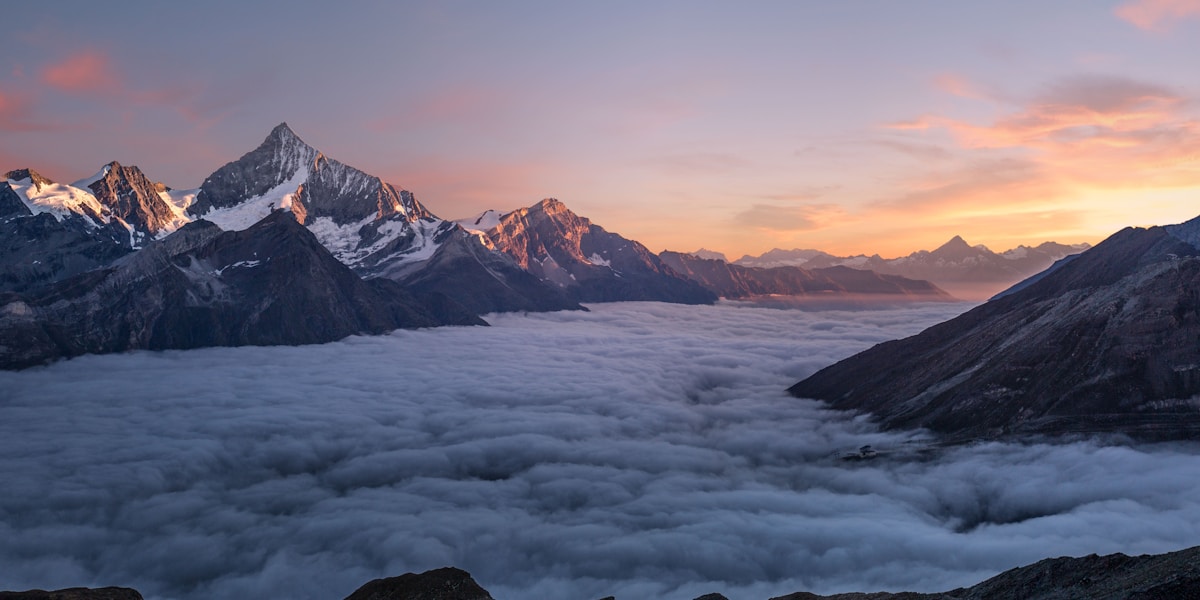
The Pyrenees are a mountain range forming a natural border between Spain and France, stretching approximately 430 km (270 miles) from the Atlantic Ocean to the Mediterranean Sea. The range contains Aneto (3,404 m / 11,168 ft) as its highest peak, shelters the tiny nation of Andorra, and has served as one of Europe's most significant natural boundaries for thousands of years.
Introduction
The Pyrenees are one of Europe's great mountain ranges, forming an almost unbroken wall between the Iberian Peninsula and the rest of continental Europe. Unlike the Alps, which have numerous wide passes and have been traversed by armies and traders since antiquity, the Pyrenees present a more formidable barrier — their passes are fewer, higher, and narrower, which has historically isolated the Iberian Peninsula and allowed distinct cultures to develop on either side. The range is home to the microstate of Andorra, nestled high in the eastern Pyrenees, and to the Basque people, whose language and culture predate all other known European civilizations. From the green, rain-soaked Atlantic foothills in the west to the dry, sun-baked Mediterranean slopes in the east, the Pyrenees pack remarkable geographic, ecological, and cultural diversity into a relatively compact range.

Geology and Formation
The Pyrenees formed during the Alpine orogeny, primarily between 100 and 50 million years ago, when the Iberian microplate collided with the Eurasian plate. This collision compressed, folded, and uplifted ancient sedimentary rocks, metamorphic basement rocks, and igneous intrusions into the mountain range we see today. The geological structure of the Pyrenees is an asymmetric fan shape — the northern (French) side tends to be steeper with shorter valleys, while the southern (Spanish) side has more gradual slopes and longer valleys.
The central Pyrenees contain the highest peaks and the most dramatic glacial landforms — deep U-shaped valleys, cirques, moraines, and glacial lakes (called ibones on the Spanish side and lacs on the French). During the last Ice Age, glaciers extended to low elevations, carving the dramatic landscapes visible today. However, modern Pyrenean glaciers are disappearing rapidly: the range had over 50 glaciers in the early 20th century, but only a handful remain, and scientists predict they will vanish entirely within the next few decades due to climate change.
Major Peaks and Geography
- Aneto (3,404 m): Highest peak in the Pyrenees, located in the Maladeta massif in Aragon, Spain
- Posets (3,375 m): Second highest, also in Aragon
- Monte Perdido (3,355 m): Part of the UNESCO-listed Ordesa and Monte Perdido National Park
- Vignemale (3,298 m): Highest peak on the French side of the border
- Pic du Midi d'Ossau (2,884 m): Iconic pyramid-shaped peak in the western Pyrenees
The Pyrenees are conventionally divided into three sections: the Atlantic (western) Pyrenees, characterized by green valleys, heavy rainfall, and Basque culture; the Central (High) Pyrenees, containing the highest peaks, deepest canyons, and most dramatic scenery; and the Mediterranean (eastern) Pyrenees, which are lower and drier, ending abruptly at the Mediterranean coast near the French-Spanish border.
Andorra: The Pyrenean Microstate
Andorra is a tiny principality (468 km squared, population ~80,000) nestled in the eastern Pyrenees between Spain and France. It has been an independent entity since 1278, governed by two co-princes: the President of France and the Bishop of Urgell in Spain — a unique arrangement that survives to this day. Andorra has no airport, no railway, and no military, but it does have duty-free shopping that attracts over 8 million visitors per year (roughly 100 times its population) and excellent ski resorts including Grandvalira, the largest in the Pyrenees.
The Camino de Santiago
Several routes of the Camino de Santiago (Way of Saint James) cross the Pyrenees, connecting France to Spain on the medieval pilgrimage route to Santiago de Compostela in Galicia. The most famous crossing is the Route Napoleon from Saint-Jean-Pied-de-Port on the French side to Roncesvalles in Spain — a demanding 25 km stage that climbs to 1,430 m with stunning views of the western Pyrenees. This crossing has been used by pilgrims for over 1,000 years and was also the route of Charlemagne's army in 778 CE, when the rearguard commanded by Roland was ambushed — an event immortalized in the medieval epic poem The Song of Roland.
The Camino attracts over 400,000 pilgrims annually, and the Pyrenean crossing is often cited as the most physically demanding and emotionally transformative stage of the entire journey.
Skiing and Outdoor Recreation
The Pyrenees offer excellent skiing on both the Spanish and French sides, generally at lower prices and with fewer crowds than the Alps. Major ski areas include Baqueira-Beret (Spain's most prestigious resort, popular with the Spanish royal family), Grandvalira in Andorra, Formigal in Aragon, and Cauterets and Saint-Lary on the French side. The range also offers superb summer hiking, with the GR 10 (French side) and GR 11 (Spanish side) long-distance trails traversing the entire range from Atlantic to Mediterranean. Mountain biking, canyoning, paragliding, and rock climbing are all popular activities.
Wildlife and Ecology
The Pyrenees harbor rich biodiversity, including several species found nowhere else. The Pyrenean chamois (isard) is the range's most iconic large mammal, while brown bears — reintroduced from Slovenia in the 1990s after the native population declined to fewer than 10 individuals — now number over 70 in the central Pyrenees. The bearded vulture (lammergeier), with its 2.8-meter wingspan, has been successfully reintroduced to the eastern Pyrenees. The Pyrenean desman, a bizarre semi-aquatic mole relative found only in Pyrenean and Iberian mountain streams, is one of Europe's rarest mammals.
Tragically, the Pyrenean ibex (bucardo) went extinct in 2000 when the last individual, a female named Celia, was killed by a falling tree. A cloning attempt in 2003 produced a live kid that survived only seven minutes, making the bucardo both the first species to be cloned and the first to go extinct twice.
Key Facts
- The Pyrenees stretch ~430 km (270 mi) from the Atlantic to the Mediterranean.
- Aneto at 3,404 m is the range's highest peak, located in Aragon, Spain.
- Andorra, nestled in the eastern Pyrenees, is one of the world's smallest countries.
- The range forms the natural border between Spain and France.
- Pyrenean glaciers are expected to disappear entirely within the next few decades.
Fun Facts
- The Pyrenean ibex is the only species to have gone extinct twice — once naturally in 2000 and once as a clone in 2003.
- Andorra receives over 8 million visitors per year for a population of just 80,000 — largely for duty-free shopping and skiing.
- The Song of Roland, one of the oldest works of French literature (circa 1100 CE), describes a Pyrenean battle.
- The Basque language (Euskara), spoken in the western Pyrenees, is not related to any other known language on Earth.
Final Thoughts
The Pyrenees may lack the towering altitude of the Alps or the Himalayas, but they more than compensate with their cultural richness, ecological diversity, and historical significance. From the ancient pilgrimage routes of the Camino de Santiago to the duty-free shops of Andorra, from the linguistic mystery of the Basque people to the tragic story of the last Pyrenean ibex, this mountain range offers a uniquely European blend of natural grandeur and human heritage that rewards every visitor.
Test Your Knowledge!
Think you know your geography? Try our interactive quizzes!
Play Geography Games →