

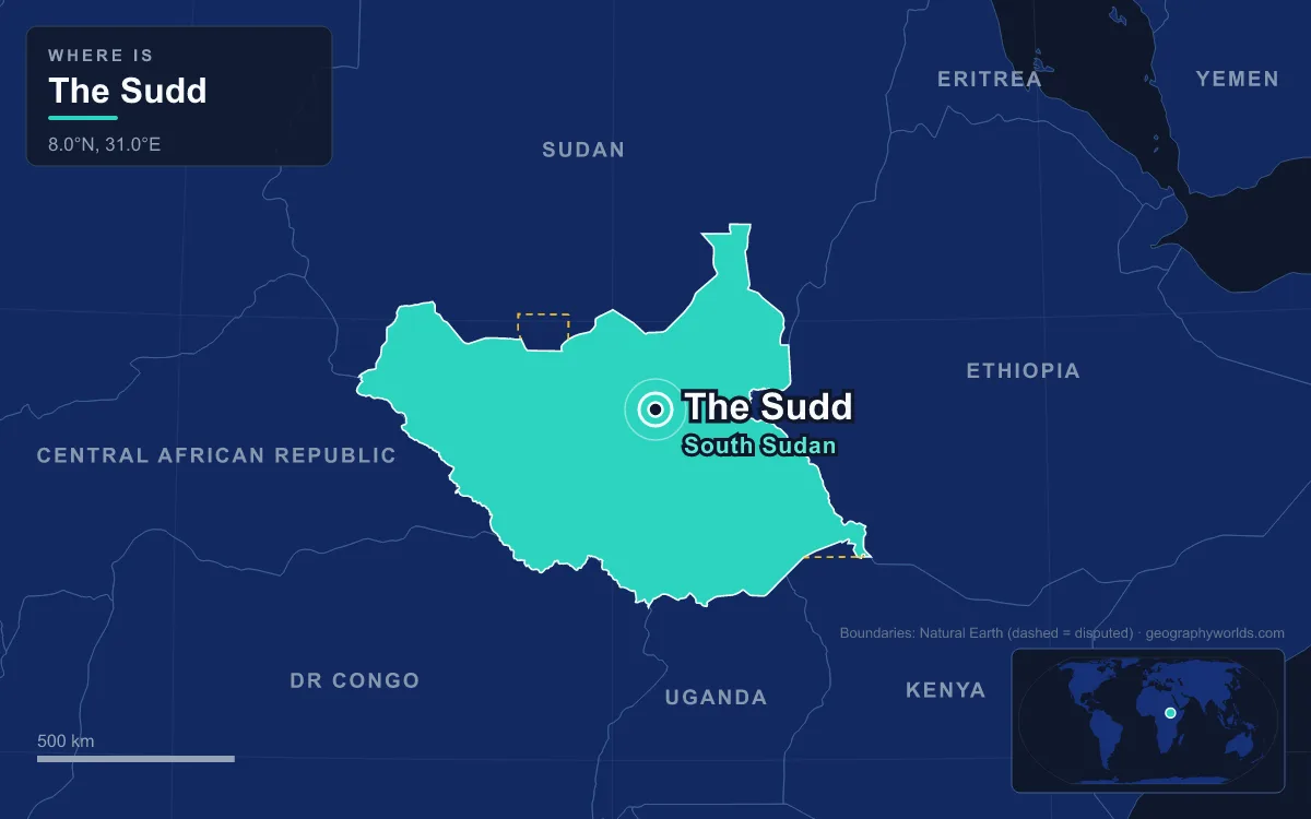
The Sudd is a vast freshwater swamp in South Sudan, formed where the White Nile, here called the Bahr al Jabal ("Mountain Nile"), spreads out across a flat clay plain. It stretches about 500 km from Mongalla in the south to near Malakal and the Sobat confluence in the north, and about 200 km from east to west, between latitudes 5.5° and 9.5° N. It averages more than 30,000 km², but in the wet season it can spread past 130,000 km², about 21% of the country. It is the largest freshwater wetland in the Nile Basin: a maze of papyrus and reed swamp, lagoons, meandering channels and seasonally flooded grassland. In 2006 an area of 57,000 km² was designated a Ramsar Wetland of International Importance. Its name comes from the Arabic sadd, "barrier". Understanding why the Nile stalls here means going back through hundreds of millions of years of geology, then the much more recent history of Lake Victoria, and finally the clay and plants of the swamp itself.
Cretaceous Rifts Under the Sudd: The Muglad and Melut Basins
The oldest part of the story is a set of faults. The Central African Shear Zone is a fault system running east-northeast from the Gulf of Guinea through Cameroon into Sudan, for about 4,000 km in total. It dates back at least 640 million years. When the supercontinent Gondwana broke apart in the Jurassic and Cretaceous, these old weaknesses moved again. The crust stretched and sank into long rift basins in Cameroon, the Central African Republic, Chad and Sudan, which then filled with sediment.
Two of the Sudanese rifts lie along the swamp's northern edge. The Muglad Basin, about 120,000 km² across southern Sudan and South Sudan, holds the Heglig and Unity oil fields. Chevron made the first finds there in the 1960s and 1970s near Bentiu, Malakal and Muglad. The Melut Basin lies east of the Nile in Upper Nile and Jonglei states and continues into Ethiopia as the Gambella Basin. Its largest field, Great Palogue, holds an estimated 900 million barrels. The Sudd lies in this same low region of old, sediment-filled rifts, on a plain so level that the ground in the swamp falls only about 1 m in every 13,000 m, so the river slows down and widens.
The Great Lakes Plateau Tilts North: 20 Million to 15,000 Years Ago
A low basin would only be a dry plain unless a large river flowed into it. For most of the Nile's history, no such river reached it. About 20 million years ago, the western side of the East African Rift began to rise and cut the Great Lakes region off from the Congo basin. Six million years ago the Nile in Egypt was a fairly short river, starting near the modern Wadi Howar. Lake Victoria did not exist, and the rivers of the Ugandan highlands did not flow north.
About 2.5 million years ago, the Rwenzori Mountains rose. A large ancient lake called Obweruka, where Lakes Albert and Edward are now, began to drain east instead of west, and Lake Victoria started to form. Its water still did not reach Sudan. Around 500,000 years ago Lake Victoria took roughly its modern shape. The Great Lakes plateau tilted north and began to drain, on and off, into what is now South Sudan, along rivers that roughly followed the modern White Nile. Ancient lakes formed in the area where the Sudd now lies.
The water supply was not reliable. Lake Victoria has dried out completely at least three times since it formed, probably during dry ice-age periods. The last time was about 17,300 years ago, and it refilled about 14,700 years ago when the African humid period began. By about 15,000 years ago the Great Lakes had their present shapes and flowed north all year round, and the modern course of the Nile was set. Some of the ancient lakes in South Sudan dried out at the same time. In geological terms, the Sudd as we know it is very young.
Black Cotton Clay and the Gradient From Juba to Bor
The landforms explain why the river stops behaving like a river here. North of Juba the Bahr al Jabal runs in a trough it has cut into the plain, and it winds from side to side between the trough's banks in one or more channels. Those banks get lower towards the north, and they disappear just north of Bor on the east bank and near Shambe on the west. Beyond that point nothing holds the river in. The floodplain slopes gently north, but the river runs north-northwest, at an angle to that slope. As a result the channels split, rejoin and multiply into a maze that shows up clearly on satellite images and elevation models.

The ground itself helps keep the water at the surface. The Sudd lies on heavy, nearly waterproof clay topped by about 500 mm of black-cotton vertisol. Wells show that sand appears only about 30 m down, so very little floodwater soaks into the ground. Instead, it spreads across the surface and evaporates. About half of the water entering the swamp is lost to evaporation and transpiration, and some estimates put it at 55%. Water levels rise and fall by up to 1.5 m with the floods. Local rainfall is only 55–65 cm a year, less than in neighbouring areas at the same latitude. So the Sudd is fed by the river, not by local rain.
Several rivers meet in this network. Just below Bor, the Bahr el Zeraf ("river of the giraffes") branches east from the Bahr al Jabal and runs about 280 km before rejoining it near New Fangak. From the west, the Bahr el Ghazal flows 716 km through the swamp to Lake No. Its basin is the largest of any part of the Nile, about 520,000 km², yet so much of its water is lost in the Sudd that it adds only about 2 m³/s on average. At Lake No the combined stream becomes the White Nile in the strict sense. At Malakal it is joined by the Sobat before heading north to Khartoum.
Floating Papyrus and the Lake Victoria Rise of 1961–1963
Once the water was spread across the plain, plants took over. The vegetation is arranged by depth and duration of flooding. From the open lakes and rivers outward, it runs through floating swamp, river-flooded grassland (called toic locally), rain-flooded grassland and, on the edges, wooded grassland. Phragmites reeds, Echinochloa pyramidalis and wild rice are rooted in the ground, so they grow only where floods are less than about 1.3 m deep. Papyrus, Vossia and Echinochloa stagnina have shallow or floating roots and grow in deeper, permanently wet water.
These floating plants are what made the swamp a barrier. When high water tears papyrus mats loose, they drift as islands up to 30 km long and can jam channels. This happened several times between 1879 and 1900, blocking the river to boats. The plant mix has also changed. Nile cabbage was once an important floating plant here, but it has largely been replaced by the invasive water hyacinth. Engineers have tried to push water through faster too. The Zeraf Cuts, dug in 1910 and 1913, send part of the Bahr al Jabal into the Zeraf, more than doubling its flow.
The swamp still responds closely to Lake Victoria, far upstream. Between 1961 and 1963 the lake rose and released more water. Flows at Mongalla roughly doubled, while flows at Malakal rose only by half. The extra water stayed in the Sudd. Its permanent swamp and seasonal floodplain together grew to 2.5 times their earlier size, with most of the growth in the permanent swamp. This showed, within a few years, the same process that made the Sudd in the first place: more water reaching a flat clay basin produces more swamp, not more downstream flow.
What the Swamp Built: A Barrier, a Refuge and the Jonglei Canal
The Sudd's first effect on history was to block travel. The ancient Egyptians failed to get through it. In AD 61 a party of Roman soldiers sent by Nero went up the White Nile and turned back at the Sudd, which marked the farthest Roman advance into equatorial Africa. Centuries later, explorers looking for the source of the Nile travelled overland from the coast to avoid it.
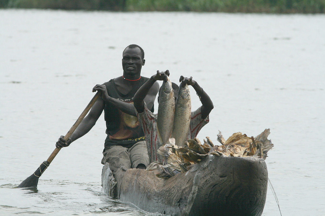
It also became a refuge for wildlife. More than 400 bird species have been recorded, and the Sudd holds a stronghold of the shoebill, numbering several thousand birds. About 70 fish species live here, including a few found nowhere else, such as Clarias engelseni. White-eared kob, tiang and Mongalla gazelle, about 1.2 million animals in all, take part in one of the largest mammal migrations on Earth. The endangered Nile lechwe grazes at the water's edge, and the sitatunga lives deep in the permanent swamp. Nuer and Dinka pastoralists graze their cattle on the seasonally flooded grasslands around the swamp, alongside rain-fed farming. Zeraf Island, Shambe and Mongalla are designated as game reserves.
Its evaporation has also attracted engineers. In the early 1900s Sir William Garstin, Egypt's Under-Secretary of State for Public Works, proposed a canal east of the swamp to carry the Bahr al Jabal past it. Egypt studied the scheme in 1946 and drew up plans between 1954 and 1959. Digging on the Jonglei Canal began in 1978, and by 1984, when the Sudan People's Liberation Army stopped the work, 240 km of the planned 360 km had been dug. The canal would have delivered 3.5–4.8 km³ of water a year downstream, but at the cost of the fisheries, grazing land and groundwater the Sudd supports. In 2008 Sudan and Egypt agreed to restart the project, but South Sudan became independent in 2011 and the canal remains unfinished. The swamp also affects the atmosphere: a 2019 study suggested that rising inflows into the Sudd may account for up to a third of a regional rise in atmospheric methane over the previous decade. The river that feeds it is followed from Lake Victoria to the Mediterranean in our Nile River guide. The country around it is covered in our South Sudan country guide, and Africa's other great inland wetland, also built where a river spreads across a flat basin, is described in our article on the Okavango Delta.