
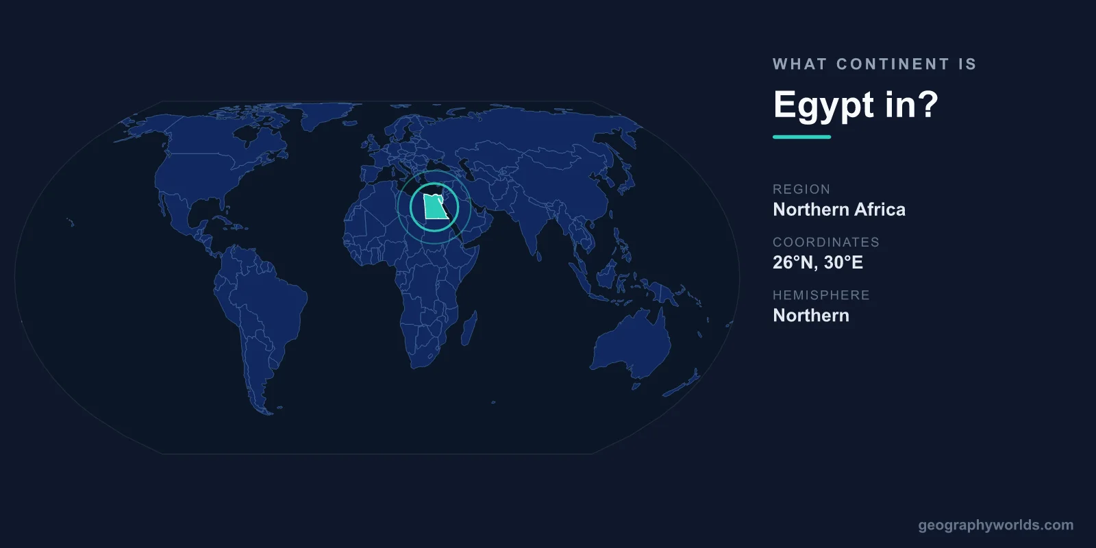
Egypt is in Africa: it occupies the north-east corner of the continent, and about 94% of its territory, including Cairo, Alexandria and the whole Nile Valley, lies on the African mainland. It is also a transcontinental country, because the Sinai Peninsula, about 6% of its area and home to roughly 600,000 people, lies east of the Suez Canal and is counted as part of Asia. By the usual convention the boundary between the two continents runs along the Isthmus of Suez, the route the canal follows. The main international groupings place Egypt with Africa: the United Nations statistical geoscheme puts it in Northern Africa, and it is a member of the African Union, as well as a founding member of the Arab League, which is headquartered in Cairo.
The Isthmus of Suez Convention: Where Africa Ends
Continents are partly a matter of agreement, and the line between Africa and Asia is drawn where the two landmasses are joined most narrowly. That is the Isthmus of Suez, a strip of flat, dry land about 125 km wide between the Mediterranean Sea and the Gulf of Suez, the north-western arm of the Red Sea. Since 1869 the isthmus has been cut by the Suez Canal, which was built between 1859 and 1869 and opened on 17 November 1869. It runs 193.3 km from Port Said on the Mediterranean to Port Tewfik at the city of Suez, with no locks, passing through Lake Timsah and the Great Bitter Lake on the way. Because the canal follows the isthmus, it serves as a handy visible marker of the continental boundary: the west bank is Africa, the east bank is Asia.
The convention was not always obvious. In Greco-Roman geography "Africa" meant ancient Libya, and its eastern edge was placed around Marmarica, at the Catabathmus Magnus escarpment west of the Nile; Egypt itself was often counted as part of Asia. Travel writers still kept the two apart in the early 19th century: William George Browne titled his 1806 book Travels in Africa, Egypt, and Syria. As the shape of the African landmass became clear, Egypt's place on it did too, and the Isthmus of Suez became the standard dividing line. It makes Sinai geographically Asian.
Geologists draw the line elsewhere. The African and Arabian plates meet further east, along the Gulf of Aqaba and the Dead Sea Transform, so the whole of Sinai, as well as Israel, the Palestinian territories, much of Lebanon and coastal Syria, sits on the African Plate. On that measure Egypt would be entirely African. The Suez convention is the one generally used on maps and in atlases, and it is the one this article follows. It also explains a curiosity of the African Union's map: apart from the island of Madagascar, Sinai is the only significant part of its members' territory that lies off the African mainland.

Sinai, Egypt's Asian 6%
The Sinai Peninsula is a triangle of desert and mountains between the Mediterranean in the north and the Red Sea in the south, bounded by the Gulf of Suez on the west and the Gulf of Aqaba on the east. Estimates of its size range from about 60,000 km² to 61,100 km², roughly 6% of Egypt and slightly smaller than Latvia. Its northern third is a flat, sandy coastal plain running from the canal to Gaza and Israel. The south rises into rugged mountains, a geological extension of the Red Sea Hills, among them Mount Catherine, at 2,642 m the highest point in Egypt, so the country's summit stands on the Asian side.
Sinai has been part of Egypt since the First Dynasty, around 3100 BC, and in ancient times it was valued for its turquoise mines. Its modern history has been more turbulent. Israel occupied the peninsula during the Suez Crisis of 1956 and again in the Six-Day War of 1967. Under the Egypt–Israel peace treaty of 1979, Israel withdrew in stages and handed back the last of it in 1982, apart from the small area of Taba, which was returned in 1989 after a ruling by an international arbitration commission. Today most of the peninsula is governed as two governorates, North Sinai with its capital at Arish and South Sinai with its capital at El Tor, while the Port Said, Ismailia and Suez governorates straddle the canal and include land on both continents.
Population tips the balance even further. North and South Sinai, which together cover around 60,000 km², had about 597,000 residents in January 2013, with Arish, at around 160,000 people, the largest city. Add the smaller strips of the Port Said, Ismailia and Suez governorates east of the canal, and still fewer than 2% of Egyptians live on the peninsula. That is why Egypt is usually called an African country outright rather than partly Asian. Turkey and Russia are different cases: each has large populations on both sides of a continental line.
Egypt's Extent: 1,420 km North to South, 1,275 km East to West
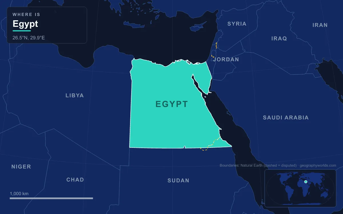
Egypt covers about 1,001,450 km², which makes it the 29th-largest country in the world. It lies mainly between latitudes 22° and 32° N and longitudes 25° and 35° E. The longest straight-line distance from north to south is 1,420 km, and from east to west 1,275 km. The southern border follows the 22nd parallel, and the western border, after an irregular stretch inland from the Gulf of Sallum, follows the 25th meridian south to the Sudanese tripoint, which gives the country its boxy shape on a map. More than 2,900 km of coast runs along the Mediterranean, the Gulf of Suez and the Gulf of Aqaba.
How close does Asia come to the capital? Calculated from the cities' coordinates (Wikipedia gives no figure), Cairo is about 117 km in a straight line from the canal at Ismailia and about 127 km from the city of Suez. The Nile Valley and Delta, where about 99% of Egyptians live on roughly 5.5% of the land, lie entirely in Africa, as do the Western Desert, which covers about two-thirds of the country, and the Eastern Desert between the Nile and the Red Sea. The whole layout is mapped in our Egypt geography map guide.
Neighbours on Two Continents: Libya, Sudan, Israel and Gaza
Egypt's land borders split along the same continental seam, and its two African neighbours have by far the longer ones. The border with Libya runs 1,115 km from the Gulf of Sallum on the Mediterranean south to Gabal El Uweinat, the mountain where Egypt, Libya and Sudan meet. The border with Sudan runs 1,276 km along the 22nd parallel from that tripoint to the Red Sea. Its eastern end is disputed: Egypt holds to the straight line agreed in 1899, which puts the Halaib Triangle, a 20,580 km² wedge of Red Sea shoreline, inside Egypt, while Sudan holds to an administrative line drawn by the British in 1902, which would place Halaib in Sudan. Sudan withdrew its forces in January 2000, and Egypt has administered Halaib since, while Sudan maintains its claim. The same discrepancy leaves Bir Tawil, a 2,060 km² tract of desert, claimed by neither country.
Across Sinai, Egypt's Asian neighbours are Israel and the Gaza Strip. The line between them dates from an Ottoman–British agreement of 1 October 1906 running from Rafah to Taba, and the 1979 peace treaty confirmed it as the international border with Israel. Israel built a 245 km barrier along it between 2010 and 2013, stretching from Eilat to the Gaza border. The border with the Gaza Strip is only about 12 km long, and the Rafah crossing is its only crossing point. Across the narrow Gulf of Aqaba, Egypt also faces Jordan and Saudi Arabia, both in Asia. Each frontier is described in more detail in the countries that border Egypt.
Northern Africa in the UN Geoscheme, the African Union and the Arab League
The United Nations Statistics Division, whose M49 geoscheme is a widely used standard for grouping countries, places Egypt in Northern Africa, alongside Algeria, Libya, Morocco, Sudan and Tunisia, as well as Western Sahara, a territory disputed between Morocco and the Sahrawi Arab Democratic Republic. The UN notes that its groupings are for statistical convenience and imply nothing political, but statistical tables built on M49 list Egypt under Africa.
Egypt's memberships point the same way, with one important addition. It was among the founding members of the Organisation of African Unity in Addis Ababa in May 1963, when President Gamal Abdel Nasser attended the founding summit, and Cairo hosted the organisation's next summit on 17–21 July 1964, after which Nasser chaired the OAU until October 1965. The OAU became the African Union in 2002, and President Abdel Fattah el-Sisi served as chairperson of the African Union from February 2019 to February 2020. Cairo is the largest urban agglomeration in the AU, although Lagos is its largest city proper.
At the same time Egypt is part of the Arab world. The Arab League was founded in Cairo on 22 March 1945 with seven members, Egypt among them, and has its headquarters there. Egypt was suspended in 1979 over its peace treaty with Israel, when the headquarters moved to Tunis, and readmitted in May 1989, after which the headquarters returned to Cairo in 1990. Through the League and its Arabic-speaking majority, Egypt is routinely grouped with the Middle East, a cultural and political region rather than a continent. None of that changes the geography: Egypt is an African country with a foothold in Asia, one of a small group of states described in our list of transcontinental countries.