
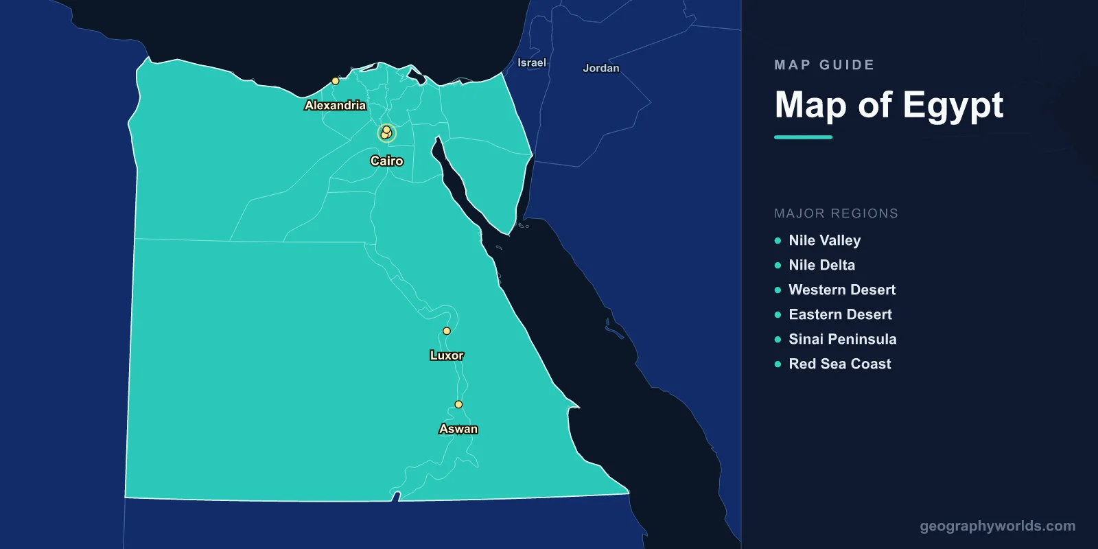
Egypt is located at the northeast corner of Africa, covering 1,001,450 km2 (386,662 sq mi) with a population of approximately 105 million. The capital is Cairo (30.0444°N, 31.2357°E). A map of Egypt shows 27 governorates, the Nile Valley and Delta, the Western and Eastern deserts, the Sinai Peninsula, and coastlines along the Mediterranean Sea and Red Sea. Over 95% of Egypt’s population lives within a few kilometers of the Nile.
Introduction
Egypt is bordered by Libya to the west, Sudan to the south, Israel and the Palestinian territories (Gaza Strip) to the northeast, and the Red Sea to the east. The Suez Canal, connecting the Mediterranean and Red seas, is one of the world’s most important waterways. Egypt’s geography is dominated by desert, with the Nile River providing a narrow ribbon of fertile land through an otherwise arid landscape.

Geographic Overview
- Area: 1,001,450 km2 (386,662 sq mi)
- Population: 105 million (2024)
- Capital: Cairo
- Coordinates: 26.8206°N, 30.8025°E
- Highest Point: Mount Catherine, 2,629 m (Sinai)
- Coastline: 2,450 km (Mediterranean and Red Sea)
Egypt is overwhelmingly desert—the Sahara covers the western two-thirds of the country (the Western Desert), while the Eastern Desert stretches between the Nile and the Red Sea mountains. The Nile Valley and Delta occupy only about 5.5% of Egypt’s land area but support over 95% of the population. The Sinai Peninsula, triangular in shape, bridges Africa and Asia.
Major Regions
- Nile Valley: Narrow fertile strip from Aswan to Cairo; Egypt’s agricultural heartland
- Nile Delta: 22,000 km2; fan-shaped; empties into the Mediterranean
- Western Desert: 681,000 km2; part of the Sahara; oases; Qattara Depression
- Eastern Desert: 223,000 km2; Red Sea Mountains; mineral-rich
- Sinai Peninsula: 60,000 km2; mountainous south; sandy north; between Asia and Africa
- Red Sea Coast: Resort and diving destination; coral reefs; desert shoreline
The Nile Delta is one of the world’s most densely populated deltas, supporting about 40 million people on 22,000 km2. The Western Desert contains five major oases (Siwa, Bahariya, Farafra, Dakhla, Kharga) that have sustained human habitation for millennia. The Qattara Depression in the Western Desert reaches 133 m below sea level, the lowest point in Africa.
Major Cities
- Cairo: 10.1 million (city), 21.3 million (metro); largest city in Africa and the Arab world
- Alexandria: 5.3 million; Mediterranean port; Egypt’s second city
- Giza: 4.0 million; Pyramids and Sphinx; part of Greater Cairo
- Shubra El-Kheima: 1.2 million; industrial suburb north of Cairo
- Luxor: 500,000; Upper Egypt; ancient Thebes; Valley of the Kings
- Aswan: 300,000; southernmost major city; Aswan High Dam
Greater Cairo, including Giza and satellite cities, forms a megacity of over 21 million people—the largest urban agglomeration in Africa and the Middle East. Alexandria, founded by Alexander the Great in 331 BC, remains Egypt’s primary Mediterranean port. Luxor and Aswan in Upper Egypt are centers of ancient Egyptian heritage, with temples and tombs spanning 3,000 years.
Bodies of Water & Natural Features
- Nile River: 6,650 km total; flows north through Egypt for 1,545 km; world’s longest (disputed)
- Suez Canal: 193.3 km; connects Mediterranean to Red Sea; opened 1869
- Lake Nasser: 5,250 km2; artificial lake behind Aswan High Dam
- Red Sea: Coral reefs; clear waters; up to 2,211 m deep
- Qattara Depression: Lowest point in Africa at -133 m; Western Desert
- White Desert: Chalk rock formations; Farafra Oasis region; surreal landscape
The Nile’s annual flood historically deposited fertile silt across the valley, sustaining Egyptian civilization for 5,000 years. The Aswan High Dam (completed 1970) ended the flood cycle and created Lake Nasser, one of the world’s largest artificial lakes. The Suez Canal eliminates the need for ships to navigate around Africa, shortening the Europe-Asia sea route by approximately 7,000 km.
Bordering Countries
- Libya: 1,115 km western border; Sahara Desert
- Sudan: 1,276 km southern border; Nile valley; longest border
- Israel: 266 km northeastern border; Sinai Peninsula
- Palestinian Territories (Gaza): 11 km border; Rafah crossing
- Red Sea maritime: Saudi Arabia across the Gulf of Aqaba and Red Sea
Egypt’s strategic location connecting Africa and Asia, and controlling the Suez Canal, gives it outsized geopolitical importance. The Sinai Peninsula is the only part of Egypt in Asia, separated from the African mainland by the Suez Canal. Egypt’s southern border with Sudan follows the 22nd parallel, with some disputed areas along the Nile.
Key Facts
- Over 95% of Egypt’s 105 million people live within a few kilometers of the Nile.
- The Suez Canal is 193.3 km long and handles roughly 12% of global trade.
- Egypt is 95% desert—the habitable area is only about 55,000 km2.
- Cairo is the largest city in Africa and the Arab world with 21.3 million in the metro area.
- The Nile flows 1,545 km through Egypt, entering the Mediterranean through its delta.
Fun Facts
- The Qattara Depression (-133 m) is the lowest natural point on the African continent.
- Egypt’s White Desert near Farafra features surreal chalk formations carved by wind erosion.
- The Siwa Oasis near the Libyan border was home to the Oracle of Amun, consulted by Alexander the Great.
- Lake Nasser stretches 500 km and extends into Sudan, where it is called Lake Nubia.
Final Thoughts
Egypt’s map reveals a country defined by the extraordinary contrast between the life-giving Nile and the surrounding desert. Understanding the Nile Valley, the Sinai Peninsula, the Suez Canal, and Egypt’s desert regions is essential to appreciating how geography has shaped one of the world’s oldest and most influential civilizations.
Test Your Geography Knowledge!
Think you know your maps? Try our interactive geography games!
Play Geography Games →