
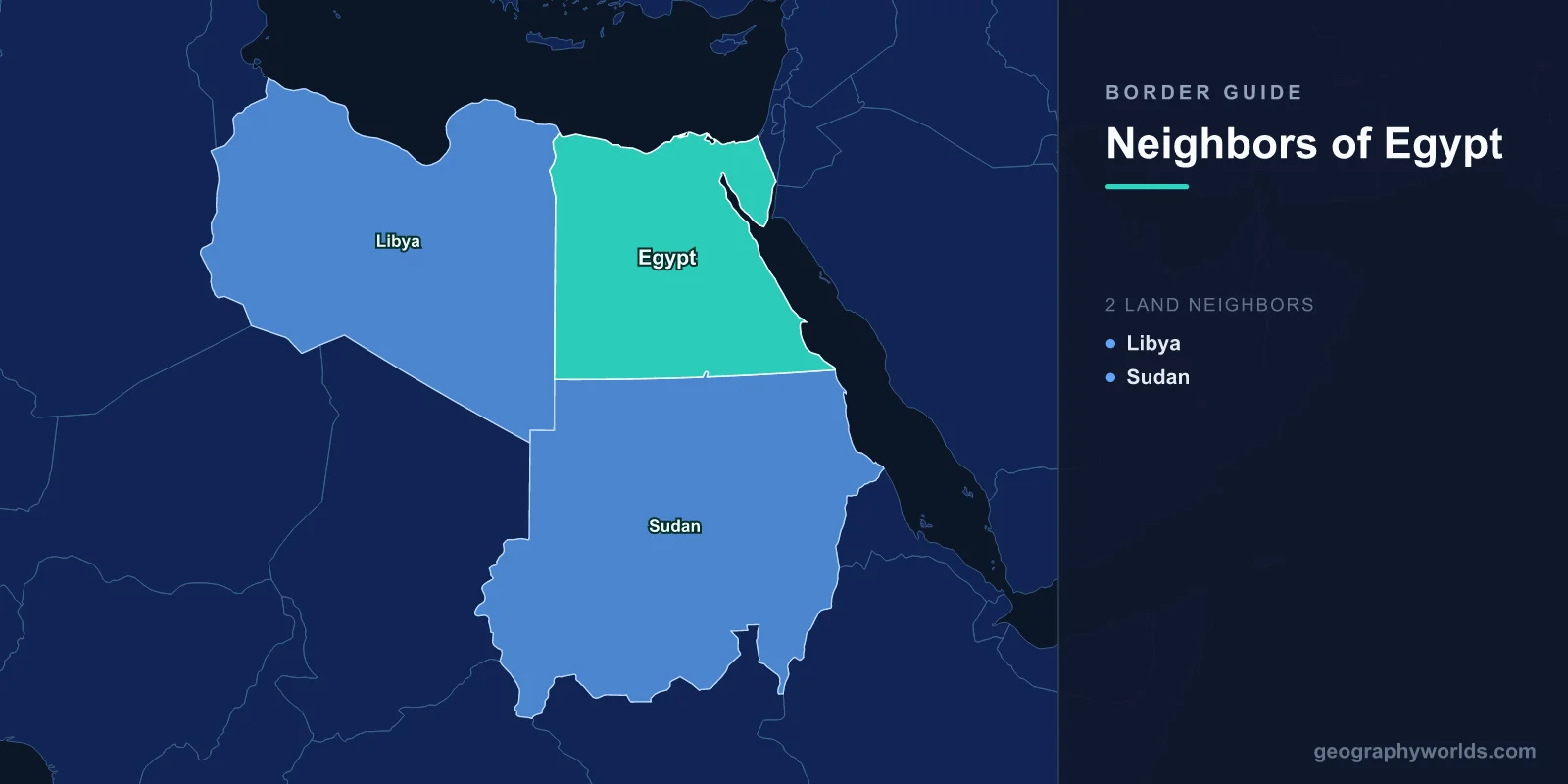
Egypt shares land borders with 3 countries: Libya (1,115 km), Sudan (1,276 km), and Israel (206 km), plus the Gaza Strip/Palestine (11 km), totaling approximately 2,608 km of land boundaries. Egypt is unique in spanning two continents, with the Sinai Peninsula in Asia and the rest of the country in Africa.
Introduction
Egypt's borders traverse some of the most inhospitable terrain on Earth — the Sahara Desert dominates the Libyan and Sudanese frontiers, while the Sinai Peninsula's rugged mountains and desert separate Egypt from Israel and Palestine. Despite having relatively few neighbors, Egypt's strategic position controlling the Suez Canal, the Nile River corridor, and the land bridge between Africa and Asia makes its borders among the most geopolitically significant in the world. Egypt has been a crossroads of civilizations for over 5,000 years.

Complete List of Countries Bordering Egypt
- Sudan: 1,276 km
- Libya: 1,115 km
- Israel: 206 km
- Palestine (Gaza Strip): 11 km
Egypt's land borders total approximately 2,608 km. The country also has extensive coastlines along the Mediterranean Sea (995 km) to the north and the Red Sea (1,941 km) to the east, with maritime neighbors including Saudi Arabia, Jordan, Greece, Turkey, and Cyprus. The Suez Canal connects these two seas, making Egypt a vital global shipping chokepoint.
Western Border: Libya
- Border length: 1,115 km — a straight line through the Sahara Desert
- Terrain: Almost entirely flat, featureless desert
- Key crossing: Salloum-Musaid crossing on the Mediterranean coast
The Egyptian-Libyan border stretches 1,115 km in an almost perfectly straight north-south line through the Sahara Desert. This border is one of the most desolate frontiers in the world — there are virtually no settlements, water sources, or landmarks along most of its length. The straight-line border was drawn by the Italian and British colonial administrations in the early 20th century with little regard for geographic features.
The sole significant border crossing is at Salloum (Egypt) and Musaid (Libya) on the Mediterranean coast. Since the Libyan Civil War beginning in 2011, Egypt has increased security along this frontier due to concerns about weapons and militant trafficking. The Siwa Oasis, one of Egypt's most remote settlements, lies near the Libyan border and was historically a stopping point on Saharan trade routes.
Southern Border: Sudan
- Border length: 1,276 km — Egypt's longest, through the Sahara and along the Nile
- Key issue: Hala'ib Triangle — a 20,580 km² disputed area administered by Egypt
- The Nile: The border region is dominated by Lake Nasser/Nubia, the world's second-largest artificial lake
Egypt's border with Sudan extends 1,276 km from the Libyan tripoint through the Sahara to the Red Sea coast. The border largely follows the 22nd parallel north, but two notable anomalies exist: the Hala'ib Triangle (administered by Egypt, claimed by Sudan) and Bir Tawil — famously one of the only pieces of land on Earth claimed by no country, as both Egypt and Sudan disclaim it in favor of their competing claims to the Hala'ib Triangle.
The Nile River, Egypt's lifeline, crosses this border, with Lake Nasser (called Lake Nubia on the Sudanese side) straddling the frontier. The construction of the Aswan High Dam in the 1960s created this massive reservoir and necessitated the relocation of the ancient Abu Simbel temples, which now sit near the border. Water politics between Egypt and Sudan (and upstream Ethiopia, with its Grand Renaissance Dam) remain among the most critical diplomatic issues in Northeast Africa.
Eastern Border: Israel and Palestine
- Israel border: 206 km — through the Sinai and Negev deserts
- Palestine (Gaza) border: 11 km — at the Rafah crossing
- Key feature: The Sinai Peninsula bridges Africa and Asia
Egypt's border with Israel runs 206 km through the desert terrain of the Sinai Peninsula and the Negev. This border was established by the Camp David Accords (1978) and the Egypt-Israel Peace Treaty (1979), following Israel's withdrawal from the Sinai, which it had occupied since the 1967 Six-Day War. The border includes the Taba crossing on the Gulf of Aqaba and several checkpoints along its length. The Sinai has experienced security challenges from militant groups, leading Egypt to maintain a significant military presence in the peninsula.
The Rafah crossing between Egypt and the Gaza Strip is just 11 km long but is one of the most politically sensitive borders in the world. It represents Gaza's only border crossing not controlled by Israel and has been subject to frequent closures. The border region has seen extensive tunnel construction and the building of buffer zones on the Egyptian side.
Historical Border Changes
Egypt's borders reflect the interplay of colonial map-drawing and modern conflicts. The Libyan border was established by agreements between British-controlled Egypt and Italian Libya in the early 1900s. The Sudanese border dates to the Anglo-Egyptian Condominium period (1899-1956). The most dramatic border changes involved the Sinai Peninsula: Israel captured the entire peninsula in 1967 and returned it in phases between 1979 and 1982 under the Camp David peace agreement. The Suez Canal, opened in 1869 and nationalized by Egypt in 1956, remains one of the world's most strategic waterways, with roughly 12% of global trade passing through it. Egypt's control of this canal — and its position bridging two continents — ensures its borders remain of global significance.
Key Facts
- Egypt borders 3 countries spanning Africa and Asia
- The Sudan border (1,276 km) is Egypt's longest
- Egypt controls the Suez Canal, through which 12% of global trade passes
- Bir Tawil on the Egypt-Sudan border is one of the only places on Earth claimed by no country
- The Sinai Peninsula was returned to Egypt by Israel under the 1979 Camp David Peace Treaty
Fun Facts
- Bir Tawil, between Egypt and Sudan, is one of the last unclaimed territories on Earth — both countries disclaim it because accepting it would mean giving up the larger Hala'ib Triangle.
- The Rafah crossing between Egypt and Gaza is just 11 km long but is among the most politically significant borders in the world.
- Lake Nasser on the Egypt-Sudan border is so large that when the Aswan High Dam was built, the ancient Abu Simbel temples had to be cut into blocks and moved to higher ground.
- The Suez Canal, at Egypt's eastern edge, is 193 km long and allows ships to avoid a 7,000 km detour around Africa.
Final Thoughts
Egypt's borders may be few, but their strategic significance is immense. Controlling the land bridge between Africa and Asia, the Suez Canal, and the upper Nile corridor, Egypt's frontiers have been contested by empires from the Romans to the British. Today, the peace with Israel, the water politics with Sudan and Ethiopia, and the security challenges in both the Sinai and the Libyan border remain central to the geopolitics of the Middle East and North Africa.
Test Your Knowledge!
Think you know your borders and boundaries? Try our interactive geography quiz!
Play Geography Games →