
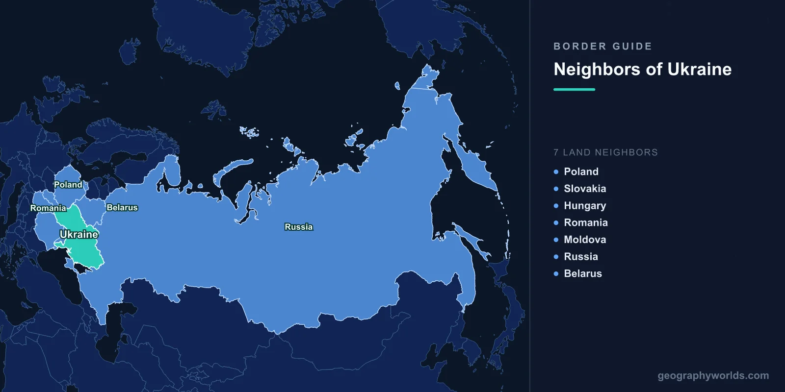
Ukraine borders seven countries: Poland, Slovakia, Hungary, Romania and Moldova to the west and south-west, Belarus to the north and Russia to the north-east and east. Its internationally recognised land borders total about 5,618 km. The longest is with Russia (1,944 km) and the shortest with Slovakia (97 km). Ukraine also has coastlines on the Black Sea and the Sea of Azov. Four of its neighbours, Poland, Slovakia, Hungary and Romania, are members of the European Union and NATO, so Ukraine's western border is the external frontier of both.
| Neighbour | Border length | Main crossing or feature |
|---|---|---|
| Russia | 1,944 km | Recognised line; front line since 2022 |
| Moldova | 1,202 km | Includes the Transnistria section |
| Belarus | 1,111 km | Pripyat marshes, Chernobyl zone |
| Romania | 601 km | Carpathians and Danube delta |
| Poland | 535 km | Medyka–Shehyni |
| Hungary | 128 km | Záhony–Chop |
| Slovakia | 97 km | Vyšné Nemecké–Uzhhorod |
Ukraine covers about 603,500 km², including Crimea, making it the largest country lying entirely within Europe. Before the full-scale war it had a population of about 41 million, and millions have since left or been displaced. That size, and its position between the European Union and Russia, explain why its borders have mattered so much in European history.
Poland: The Border Moved West
Ukraine's 535 km border with Poland runs south from the Bug River to the Carpathian foothills. It is a recent line. Before the Second World War, Lviv, then called Lwów, and much of what is now western Ukraine belonged to Poland. In 1945 the Allies moved Poland's eastern border west to roughly the Curzon Line proposed in 1919, and the region became part of Soviet Ukraine. Large populations were moved in both directions, and in 1947 the Polish government forcibly deported Ukrainians from its south-east in Operation Vistula. Relations later warmed, and in 2012 the two countries co-hosted the European football championship.
Since February 2022 this has been Ukraine's most important border. Millions of Ukrainians, mostly women and children, crossed into Poland in the first months of the full-scale Russian invasion, through crossings such as Medyka–Shehyni near the Polish town of Przemyśl, and much of the Western military aid sent to Ukraine has passed through Poland. The frontier from the other side is described in our guide to the countries that border Poland.
Slovakia and Hungary: The Transcarpathian Corner
Ukraine's two shortest borders both lie in Zakarpattia, the Transcarpathian region on the far side of the Carpathians. The city of Uzhhorod stands right on the border with Slovakia, 97 km long. Through this corner run major energy routes. The Druzhba oil pipeline to Slovakia and Hungary crosses here, and until the end of 2024 Russian gas flowed west through Ukraine to Slovakia. Ukraine declined to renew that transit contract, and the flows stopped on 1 January 2025.
The 128 km Hungarian border follows the plain of the Tisza River. At the Chop–Záhony crossing, the broad-gauge railways of the former Soviet Union meet Europe's standard gauge, so freight must be transferred or re-wheeled. Zakarpattia belonged to Hungary for most of its history and has a Hungarian minority of about 150,000 people, according to the last census, in 2001. The region passed to Czechoslovakia after the First World War, was reoccupied by Hungary in 1939 and joined Soviet Ukraine in 1945. Ukrainian laws on the language of education, passed from 2017, led to years of friction with the Hungarian government, which has also given Hungarian passports to many residents.
Romania: Mountains, Bukovina and the Danube Delta
The border with Romania, about 601 km, comes in two parts. In the west it crosses the Carpathians. Ukraine's highest peak, Hoverla, at 2,061 m, stands a short distance from it, and the historic region of Bukovina is divided between the two countries, with Chernivtsi on the Ukrainian side. The Carpathians themselves are described in our guide to the Carpathian Mountains.
In the south-east the border reaches the Danube delta, where the river's northern Chilia branch forms the boundary before reaching the Black Sea. The two countries argued for years over a Ukrainian shipping canal through the delta, and over Snake Island, a small island off the delta. In 2009 the International Court of Justice drew their sea boundary, giving Romania most of the disputed seabed. Snake Island became famous again in February 2022, when its small Ukrainian garrison defied a Russian warship. Since 2022 the Ukrainian Danube ports of Izmail and Reni have become crucial routes for grain exports, shipping through Romanian waters to avoid the blockaded Black Sea ports.
Moldova and Transnistria
Ukraine's second-longest border, about 1,202 km, surrounds Moldova on three sides. More than a third of it, the eastern section along the Dniester, borders Transnistria, a strip of land that broke away from Moldova in 1990–92 and is controlled by a Russian-backed government that no UN member recognises. The territory is explained in our guide to what Transnistria is. Since 2022, Ukraine has kept this section tightly controlled.
The southern end of the border has an odd feature. Near the village of Palanca, a short stretch of the main highway from Odesa to the Danube ports passes through Moldovan territory. Nearby, at Giurgiulești, Moldova has less than a kilometre of Danube shoreline, which lets it operate its only port. Border treaties in the early 2000s set out rights for each country's traffic across the other's territory.
Belarus: Marshes and the Chernobyl Zone
The 1,111 km border with Belarus crosses the Polesia, or Pripyat, marshes, one of the largest wetlands in Europe. It also runs through the zone around the Chernobyl nuclear power plant. The exclusion zone on the Ukrainian side and the Polesie State Radioecological Reserve on the Belarusian side together form a large, almost uninhabited area, where wildlife has returned since the 1986 disaster. The Pripyat River flows south out of Belarus through the zone and into the Kyiv Reservoir on the Dnieper. In February 2022 Russian forces crossed from Belarus through this zone in their attempt to reach Kyiv, about 90 km south of the border. Since their withdrawal that spring, Ukraine has fortified and mined much of the northern frontier.
Russia: The Recognised Line and the Front
The border with Russia, 1,944 km, runs from the Belarusian tripoint east and south past Kharkiv, Ukraine's second city, only about 30 to 40 km from the border, to the Sea of Azov. Since Russia annexed Crimea in 2014 and claimed four more Ukrainian regions in 2022, the internationally recognised line and the line of actual control have diverged. Most of the world still recognises the border as it was in 1991. The Kerch Strait, between Crimea and Russia's Taman peninsula, is crossed by a road and rail bridge Russia opened in 2018 and 2019. How this frontier fits into Russia's wider ring of neighbours is covered in our guide to the countries that border Russia.
The Sea Frontier
Ukraine's coastline on the Black Sea and the Sea of Azov is about 2,800 km long, and it has been as contested as its land borders. The Sea of Azov, shallow and almost enclosed, was declared the shared internal waters of Ukraine and Russia in a 2003 treaty, reached through the narrow Kerch Strait. In November 2018 Russian forces fired on and seized three Ukrainian naval vessels trying to pass through the strait, and since 2022 Russia has controlled the whole Azov coast. On the Black Sea, the port of Odesa, Ukraine's largest, was blockaded after the invasion. In July 2022 a deal brokered by Turkey and the United Nations, the Black Sea Grain Initiative, let ships carry Ukrainian grain from Odesa's ports. When Russia withdrew from it a year later, Ukraine opened its own shipping corridor along the coasts of Romania and Bulgaria, NATO members whose waters Russian forces avoided.
Rivers That Cross the Borders
Ukraine's great rivers mostly rise or run near its frontiers. The Dnieper, about 2,200 km long, rises in Russia's Valdai Hills, flows through Belarus and then south through Kyiv to the Black Sea, dividing Ukraine into a left and right bank. In June 2023 the Kakhovka dam on its lower course was destroyed, draining its huge reservoir and flooding towns downstream. The Dniester rises in the Ukrainian Carpathians, flows along and through Moldova, and returns to Ukraine before reaching the sea near Odesa. The Western Bug forms part of the borders with Poland and Belarus, and the Tisza part of those with Hungary and Romania.
Borders That Moved in the Twentieth Century
Almost every part of Ukraine's present frontier was drawn or redrawn between 1918 and 1954. Galicia and Volhynia came from Poland in 1939–45, northern Bukovina and southern Bessarabia from Romania in 1940, and Transcarpathia from Czechoslovakia in 1945. Crimea was transferred from the Russian to the Ukrainian Soviet republic in 1954. When the Soviet Union dissolved in 1991, those internal lines became international borders, and in the 1994 Budapest Memorandum Russia, the United States and the United Kingdom committed to respect Ukraine's borders in return for its giving up the nuclear weapons it had inherited.