
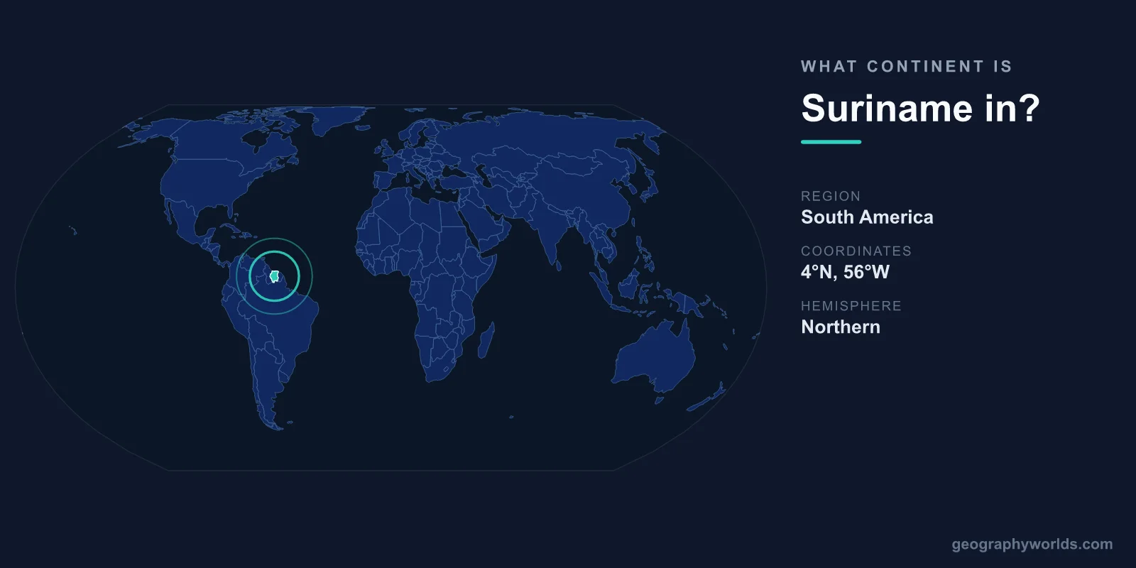
Suriname is located in South America, on the continent's northeastern Atlantic coast. It is the smallest sovereign country on the continent by land area and sits between Guyana to the west and French Guiana to the east, with Brazil bordering it to the south. Despite being firmly part of South America in geographic and political terms, Suriname is also widely associated with the Caribbean because of its cultural ties and its membership in regional Caribbean institutions.
Where Exactly Is Suriname on the Continent?
Suriname occupies the northern shoulder of South America, a region sometimes called the Guianas, which it shares with neighbouring Guyana and French Guiana. The country faces the Atlantic Ocean to the north, and its narrow coastal plain is where almost all of its people live. The capital, Paramaribo, sits near the mouth of the Suriname River, just a short distance inland from the coast.
Covering roughly 163,820 square kilometres, Suriname is comparable in size to the North African nation of Tunisia, or to the U.S. state of Georgia. That makes it the smallest country in South America by area, yet it still dwarfs many Caribbean island nations. Its position just a few degrees north of the equator gives it a hot, humid tropical climate year-round.
Is Suriname in South America or the Caribbean?
The short answer is both, depending on how you measure it. Geographically and according to the United Nations classification, Suriname is unambiguously a South American country. There is no body of water separating it from the rest of the continent; it is part of the same landmass that stretches south through Brazil to Argentina.
Culturally and politically, however, Suriname leans toward the Caribbean. It is a full member of the Caribbean Community (CARICOM) and the Caribbean Single Market and Economy, alongside its neighbour Guyana. This dual identity is one of the things that makes Suriname unusual. You will often see it grouped with Caribbean nations in sporting events, regional summits, and tourism marketing, even though a globe clearly places it on the South American mainland.
Suriname's Borders and Neighbours
Suriname shares land borders with three territories, all of them in South America:
- Guyana lies to the west, separated in part by the Corantijn River.
- French Guiana, an overseas department of France, lies to the east across the Maroni River.
- Brazil forms the long southern frontier through dense, largely uninhabited rainforest.
To the north, the Atlantic Ocean defines the coastline. Because French Guiana is French territory, Suriname is one of the few countries in the Americas that borders the European Union by land. Suriname also stands out as the only sovereign nation in the Western Hemisphere where Dutch is the official language, a legacy of its time as a Dutch colony before independence in 1975.
A Land Defined by Rainforest
One of the most striking features of Suriname's geography is its forest cover. Roughly 93 percent of the country is blanketed in tropical rainforest, making it one of the most heavily forested nations on Earth. The vast interior is sparsely populated, crossed by rivers rather than roads, and home to Indigenous and Maroon communities living in remote settlements.
The Central Suriname Nature Reserve, a UNESCO World Heritage Site, protects about 1.6 million hectares of pristine forest and showcases the country's extraordinary biodiversity. The highest point, Juliana Top, rises to around 1,230 metres in the interior highlands. Because so much of the population is concentrated along the coast, Suriname has one of the lowest population densities in the world, at roughly four people per square kilometre.
People and Culture in a South American Setting
Suriname's location on the South American mainland is matched by one of the most diverse populations on the continent. Centuries of colonial labour migration brought people from India and the Indonesian island of Java, who joined African-descended Creole and Maroon communities and the original Indigenous inhabitants. The result is a remarkable mix of Hindustani, Javanese, Creole, Maroon, Chinese, and Indigenous peoples living side by side.
Paramaribo reflects this blend, with mosques, Hindu temples, synagogues, and Dutch colonial churches sharing the same streets. The historic inner city of Paramaribo is itself a UNESCO World Heritage Site, prized for its wooden colonial architecture. To explore Suriname's geography, history, and travel highlights in more depth, see our suriname country guide.
Frequently Asked Questions
What continent is Suriname in?
Suriname is in South America. It sits on the continent's northeastern coast, bordered by Guyana, French Guiana, Brazil, and the Atlantic Ocean.
Is Suriname a Caribbean country?
Geographically Suriname is South American, but it is a member of CARICOM and shares strong cultural and historical ties with the Caribbean, so it is often counted among Caribbean nations.
What is the capital of Suriname?
The capital is Paramaribo, located near the mouth of the Suriname River close to the Atlantic coast. Its historic centre is a UNESCO World Heritage Site.
Why do people in Suriname speak Dutch?
Suriname was a Dutch colony until it gained independence in 1975. It remains the only sovereign nation in the Americas where Dutch is the official language.