
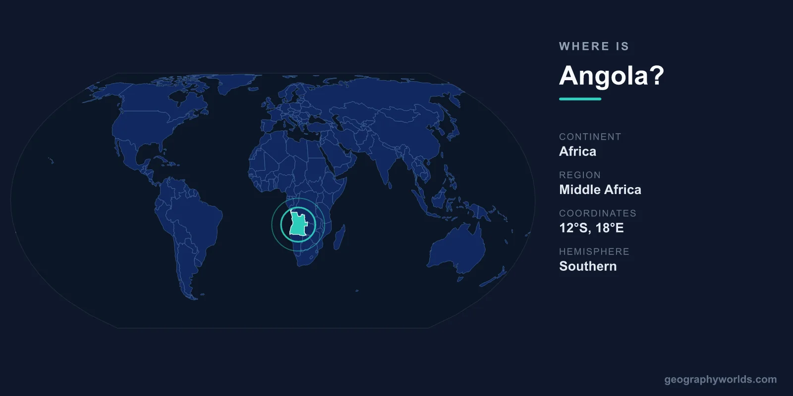
Angola lies on the Atlantic coast of southern Africa, occupying the western edge of the continent between roughly 4°S and 18°S latitude. It is bordered by the Atlantic Ocean to the west and by the Democratic Republic of the Congo, the Republic of the Congo, Zambia, and Namibia on land. Its capital, Luanda, sits on the northern coast, and the country spreads across 1,246,700 square kilometres, making it one of the largest nations in Africa.
Where Angola Sits on the Map
Angola is firmly in the Southern Hemisphere and the Eastern Hemisphere, placing it in the region geographers call Southern Africa, though it borders the Central African nations of the Congo Basin to the north. If you trace Africa's western coastline downward from the Gulf of Guinea, Angola is the broad stretch of land that faces the South Atlantic before the coast curves toward Namibia and South Africa.
The country has a long Atlantic shoreline running for well over 1,600 kilometres. This coastal position has shaped Angola's history, trade, and identity, from early Portuguese maritime contact in the 15th century to its modern role as a major oil exporter shipping crude from offshore fields. The capital, Luanda, founded in 1576, is among the oldest European-established cities in sub-Saharan Africa and remains the political, economic, and cultural heart of the nation.
Angola's Neighbours and Borders
Angola shares land borders with four countries, and its position links the Atlantic coast to the African interior:
- Democratic Republic of the Congo (DRC) – the longest border, lying to the north and northeast.
- Republic of the Congo – touches the small Angolan exclave of Cabinda in the far north.
- Zambia – to the east, across the high inland plateau.
- Namibia – to the south, separated in part by the Cunene River.
A distinctive feature of Angola's geography is Cabinda, a province physically separated from the rest of the country by a narrow strip of DRC territory along the Congo River. Despite its small size, Cabinda is hugely important to Angola because of its rich offshore oil reserves.
Landscape and Geographic Features
Angola is a country of dramatic contrasts. A relatively narrow coastal lowland gives way quickly to an interior highland plateau that covers most of the territory, with elevations frequently above 1,000 metres. The country's highest point, Mount Moco, rises to roughly 2,620 metres in the central highlands.
One of the most spectacular natural sites is the Tundavala Gap near the city of Lubango, where the plateau drops away in a sheer escarpment of more than 1,000 metres, offering vast panoramic views. Rivers are another defining element: the Cunene and the Cubango (Okavango) flow southward, while northern rivers feed into the Congo system. The arid Namib Desert reaches into Angola's far southwest, contrasting sharply with the lush, tropical north.
Climate and Environment
Because Angola stretches across many degrees of latitude and a wide range of altitudes, it contains several climate zones. The north and the interior plateau experience a tropical climate with a distinct rainy season, generally from October to April, and a cooler dry season. The southern coast, cooled by the cold Benguela ocean current, is markedly drier and more desert-like.
This environmental variety supports diverse ecosystems, from coastal mangroves and dry savanna to highland grasslands and tropical forest in the north. Such diversity gives Angola significant agricultural potential and considerable biodiversity, including national parks that are gradually recovering wildlife populations after decades of civil conflict.
People, Language, and Identity
Angola is home to roughly 34 million people, the majority of whom live in the western half of the country, especially around Luanda. Portuguese is the official language, a legacy of centuries of Portuguese colonial rule that ended with independence in 1975, and Angola is one of the largest Portuguese-speaking nations in the world. Widely spoken Bantu languages include Umbundu, Kimbundu, and Kikongo.
Christianity is the dominant religion, woven through festivals, music, and daily life. Angola is a presidential republic, and its currency is the Angolan kwanza (AOA). For a fuller picture of its history, economy, and travel highlights, see our angola country guide.
Frequently Asked Questions
What continent is Angola on?
Angola is located on the continent of Africa, in the Southern Africa region along the Atlantic Ocean. It lies in both the Southern and Eastern Hemispheres.
What is the capital of Angola?
The capital is Luanda, a coastal city on the northern Atlantic seaboard. It is the country's largest city and serves as its political and economic centre.
Which countries border Angola?
Angola borders four countries: the Democratic Republic of the Congo and the Republic of the Congo to the north, Zambia to the east, and Namibia to the south. The Atlantic Ocean forms its entire western edge.
How big is Angola?
Angola covers about 1,246,700 square kilometres, making it roughly twice the size of France and one of the seven largest countries in Africa by area.
