
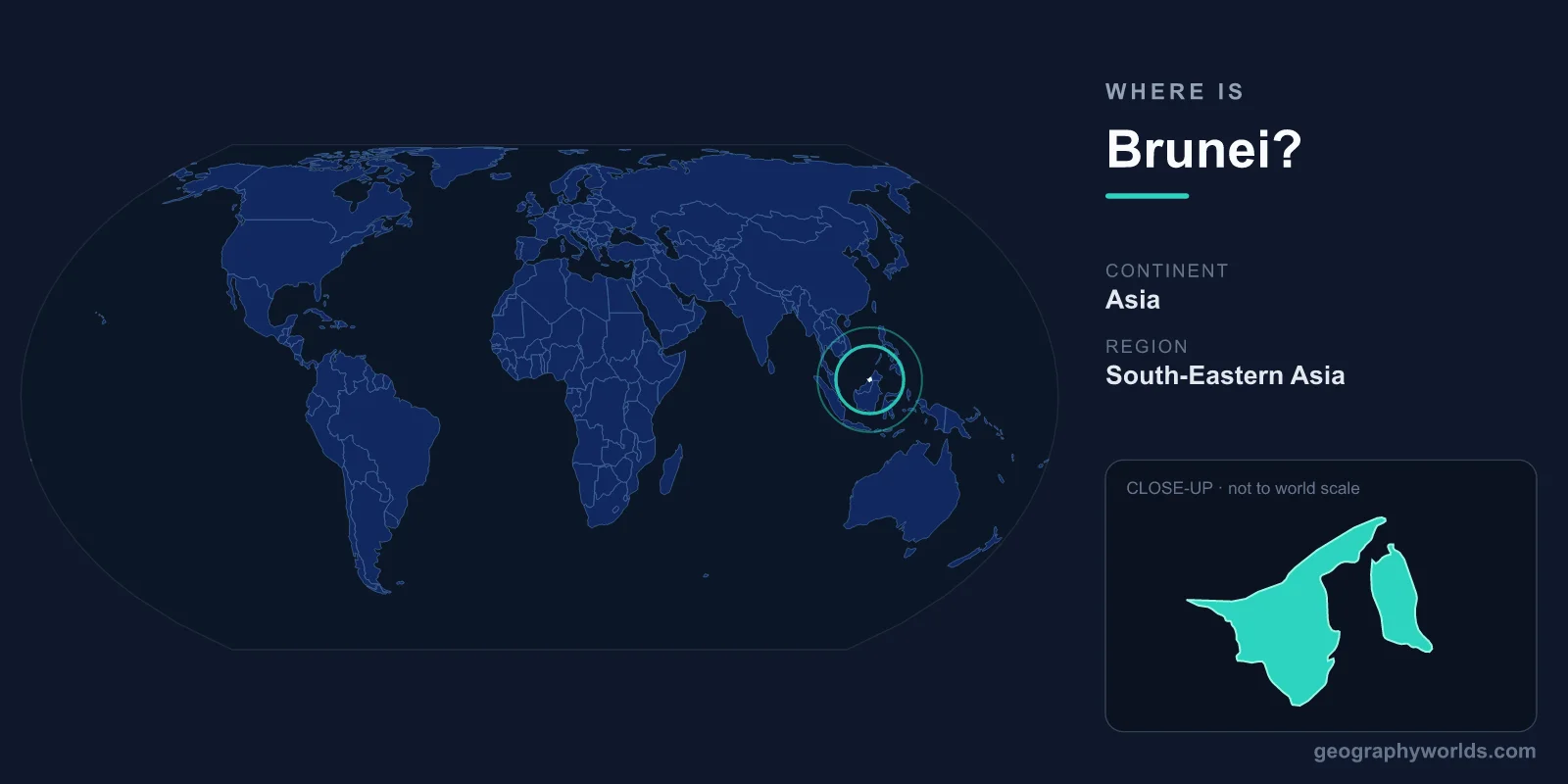
Brunei sits on the northern coast of Borneo, facing the South China Sea and entirely surrounded by the Malaysian state of Sarawak — which even splits the country into two separate parts. This tiny, oil-rich sultanate of just 5,765 km² is one of the smallest and wealthiest nations in Asia.
Location
Brunei (officially Brunei Darussalam, meaning "Abode of Peace") is located on the northern coast of the island of Borneo in Southeast Asia. It faces the South China Sea to the north and is entirely surrounded on its land borders by the Malaysian state of Sarawak. The country sits at approximately 4°N latitude, 114°E longitude.
Brunei covers just 5,765 km², making it one of the smallest countries in Asia — slightly smaller than Delaware. Remarkably, the country is split into two separate parts by the Limbang District of Sarawak, which juts northward to the coast and divides Brunei into a larger western portion (containing the capital Bandar Seri Begawan and the oil-rich Belait district) and a smaller, mostly uninhabited eastern portion (Temburong district).
Region & Neighbors
Brunei shares its only land border with Malaysia (Sarawak state), with a total border length of 266 km. The Limbang corridor of Sarawak physically separates Brunei's two parts, and until recently, travel between them required passing through Malaysian territory. A 30 km bridge (the Temburong Bridge, opened in 2020) now connects the two halves directly across Brunei Bay.
Across the South China Sea to the north and northwest, Brunei faces Vietnam (~1,200 km), the Philippines (Palawan island, ~600 km), and the disputed Spratly Islands. The rest of Borneo is shared by Malaysia (Sabah and Sarawak) and Indonesia (Kalimantan). Brunei was once a powerful maritime sultanate that controlled much of Borneo and parts of the Philippines, but its territory shrank dramatically during the colonial era.
Key Geographic Facts
Brunei's geography is characterized by a flat to gently undulating coastal plain in the west, rising to hills and mountains in the east. The country's highest point is Bukit Pagon at 1,850 meters in the rugged Temburong district near the Sarawak border.
Approximately 70% of Brunei is covered by tropical rainforest — one of the highest proportions in the world and among the best-preserved primary forests in Southeast Asia. The Ulu Temburong National Park, accessible by longboat through pristine jungle, protects 550 km² of virgin rainforest and is considered one of Borneo's most important conservation areas.
The western part of Brunei, where most people live, sits atop significant oil and natural gas reserves that have made the sultanate one of the wealthiest nations per capita in the world. The Seria oil field, discovered in 1929, was the first major petroleum discovery in Borneo. Offshore fields in the South China Sea now produce most of Brunei's hydrocarbons.
Brunei Bay, a large sheltered bay on the country's eastern coast, contains the Kampong Ayer — a water village of 30,000+ residents living in stilt houses connected by wooden walkways, often called the "Venice of the East." It is one of the largest water settlements in the world and has existed for over 1,300 years.
Travel & Access
Brunei International Airport (BWN) in Bandar Seri Begawan is the sole commercial airport, served by Royal Brunei Airlines and several regional carriers. Direct flights connect to Singapore (2 hours), Kuala Lumpur (2.5 hours), Hong Kong, Dubai, Melbourne, and London. There are no direct flights from North America.
Overland entry from Malaysia's Sarawak state is possible via several border crossings, with bus services from Miri (Sarawak) to Bandar Seri Begawan taking about 2-3 hours. Ferry services from Labuan (a Malaysian federal territory off Sabah) also connect to Brunei. The Temburong Bridge, a 30 km sea-crossing bridge opened in 2020, is Southeast Asia's longest oversea bridge and allows direct travel between Brunei's two halves without entering Malaysia.
Key Facts
- Location: Northern coast of Borneo, Southeast Asia, facing the South China Sea.
- Area: 5,765 km² (one of the smallest countries in Asia).
- Capital: Bandar Seri Begawan.
- Coordinates: Approximately 4°N, 114°E.
- Borders: Entirely surrounded by Malaysia (Sarawak) on land; South China Sea to the north.
- Highest point: Bukit Pagon, 1,850 m.
- Split into two non-contiguous parts by Malaysia's Limbang corridor.
- Tropical rainforest covers approximately 70% of the country.
Fun Facts
- Brunei is split into two separate parts by Malaysian territory — the only way to drive between them without leaving Brunei is the 30 km Temburong Bridge, opened in 2020.
- Kampong Ayer, Brunei's water village of 30,000+ people living in stilt houses, has been inhabited for over 1,300 years.
- Brunei's sultan lives in the Istana Nurul Iman palace, the world's largest residential palace with 1,788 rooms — larger than Buckingham Palace and the Palace of Versailles.
- Despite its tiny size, Brunei once controlled most of Borneo and parts of the Philippines — the name "Borneo" may even derive from "Brunei."
- Brunei has no income tax, and citizens receive free education, free healthcare, and subsidized housing and fuel, funded by oil and gas wealth.
Test Your Knowledge!
Think you know your world geography? Try our interactive quiz!
Play Country Quiz →