
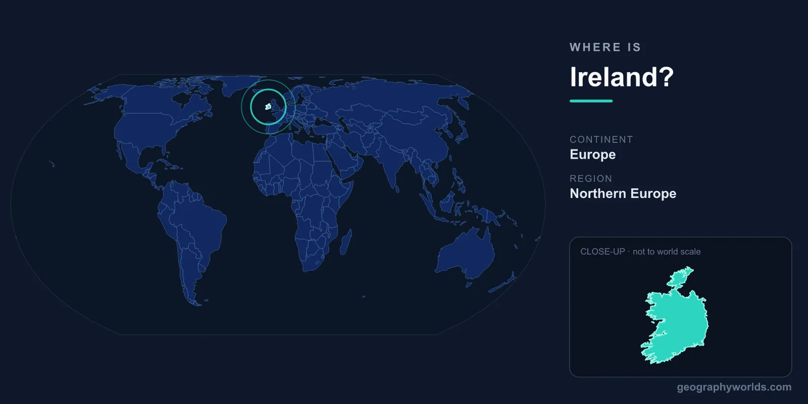
Ireland is located in north-western Europe, occupying most of the island of Ireland in the North Atlantic Ocean, just west of Great Britain across the Irish Sea. The Republic of Ireland covers an area of roughly 70,273 km², with Dublin as its capital, and sits firmly within both the Northern and Western Hemispheres of the world.
Where Exactly Is Ireland on the Map?
Ireland lies between approximately 51.5° and 55.5° North latitude and 5.5° to 10.5° West longitude, placing it among the westernmost countries in Europe. The island rests on the European continental shelf, separated from the larger island of Great Britain by the Irish Sea to the east and the narrow North Channel to the north-east. To the south, west, and north, Ireland faces the open expanse of the North Atlantic Ocean, with nothing but water between its rugged western coast and North America.
Despite its northerly position, Ireland enjoys a surprisingly mild, temperate maritime climate thanks to the warming influence of the Gulf Stream. This is why the country is famously green year-round, earning it the nickname the "Emerald Isle." Ireland is a cool, wet, oceanic land of rolling pastures, bogs, and dramatic coastlines, not a tropical destination.
The Island of Ireland and Its One Land Border
The island of Ireland is politically divided into two parts. The Republic of Ireland, an independent sovereign state, governs about five-sixths of the island. The remaining north-eastern corner is Northern Ireland, which is part of the United Kingdom. This makes the United Kingdom the Republic of Ireland's only land neighbour, with the border running roughly 499 km across the island.
This boundary is unusual in modern Europe because, since the Good Friday Agreement of 1998, it has been largely invisible on the ground, with no border posts or checkpoints. Apart from this single frontier, Ireland is surrounded entirely by water, making it one of the few European nations with just one land border. To learn more about the country, see our ireland country guide.
How Big Is Ireland and Where Does It Sit Regionally?
At about 70,273 km², the Republic of Ireland is a relatively small country. It is comparable in size to nations such as Latvia, Lithuania, or Sri Lanka, and a little smaller than the U.S. state of South Carolina. The entire island of Ireland, including Northern Ireland, measures roughly 84,421 km².
Geographically, Ireland belongs to the region often called Northern or North-Western Europe, and it is one of the British Isles, a group that also includes Great Britain. Ireland is also part of the European Union, of which it has been a member since 1973. After the United Kingdom left the EU, Ireland became the only English-speaking member state to share a land border with a non-EU territory.
Landscape and Coastal Geography
Ireland's terrain is often likened to a shallow saucer: a central lowland of plains, lakes, and peat bogs ringed by coastal mountains and hills. The highest peak is Carrauntoohil, in the MacGillycuddy's Reeks of County Kerry, rising to about 1,038 metres. The River Shannon, at around 360 km, is the longest river in both Ireland and the British Isles.
The Atlantic coastline is deeply indented and home to some of Europe's most striking natural landmarks. The Cliffs of Moher in County Clare plunge more than 200 metres into the ocean, while the west coast forms part of the Wild Atlantic Way, one of the world's longest defined coastal driving routes at roughly 2,500 km. Numerous islands, including the Aran Islands and Achill Island, dot the seas around the mainland.
People, Capital, and How Ireland Is Governed
Around 5 million people live in the Republic of Ireland, with roughly a third of them in the Greater Dublin Area. Dublin, situated on the east coast at the mouth of the River Liffey, is the political, economic, and cultural heart of the nation. The country has two official languages, Irish (Gaeilge) and English, though English is the language used in everyday life by most of the population.
Ireland is a parliamentary republic, with a President as head of state and a Taoiseach (prime minister) as head of government. The currency is the euro (EUR), adopted in 2002. Christianity, historically Roman Catholic, has deeply shaped the country's culture and traditions, although Irish society has become increasingly secular and diverse in recent decades.
Frequently Asked Questions
Is Ireland part of the United Kingdom?
No. The Republic of Ireland is a fully independent country. Only Northern Ireland, in the north-east of the island, is part of the United Kingdom. The Republic gained independence from Britain in 1922.
What ocean surrounds Ireland?
Ireland is surrounded by the North Atlantic Ocean on its west, south, and north sides. To the east, the Irish Sea separates it from Great Britain, and the North Channel divides the two islands in the north-east.
What continent is Ireland in?
Ireland is in Europe, specifically in north-western Europe. It is one of the British Isles and has been a member of the European Union since 1973.
How far is Ireland from Great Britain?
At its narrowest point, the North Channel between Ireland and Scotland is only about 20 km wide. The Irish Sea crossing to Wales or England is wider, but the two islands remain close neighbours connected by frequent ferries and flights.