
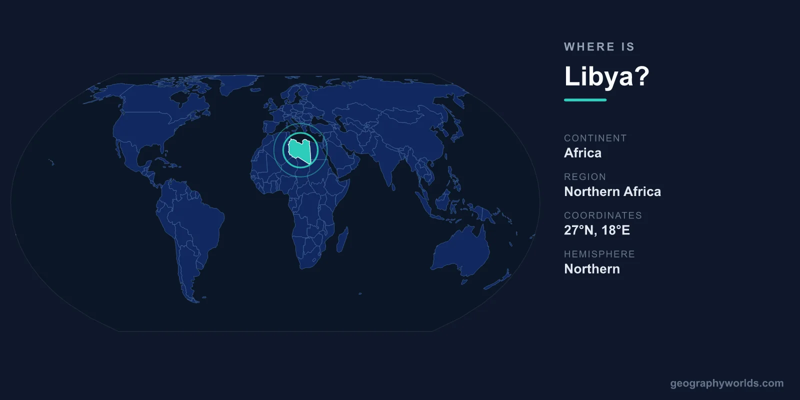
Libya is located in North Africa, fronting the central Mediterranean Sea, with its territory stretching south deep into the Sahara Desert; its capital is Tripoli and it covers roughly 1,759,540 km². Sitting in both the Northern and Eastern Hemispheres, Libya occupies a strategic position between the Maghreb to the west and Egypt and the Nile Valley to the east, making it a long-standing crossroads between Africa, the Mediterranean world, and the trade routes of the Sahara.
Where Libya Sits on the Map
Libya lies along the southern shore of the Mediterranean, with a coastline running for well over 1,700 kilometres. Most of the country sits between roughly 19°N and 33°N latitude and 9°E and 25°E longitude. To picture it, find the large bay known as the Gulf of Sidra (Gulf of Sirte), which takes a deep bite out of Libya's northern coast and effectively divides the country's two historic halves: Tripolitania in the northwest and Cyrenaica in the northeast.
This Mediterranean frontage places Libya directly across the sea from Italy, Greece, and Malta. The short maritime distance to southern Europe has shaped Libya's history for millennia, from Phoenician and Greek colonists to Roman provinces, and it remains central to the country's modern trade and migration routes today.
Countries That Border Libya
Libya shares land borders with six countries, a large number that reflects its sprawling size. Three neighbours lie across the Sahara to the south, while the others sit to the east and west:
- Tunisia and Algeria to the west, in the Maghreb region.
- Niger and Chad to the southwest and south, deep in the desert interior.
- Sudan to the southeast.
- Egypt to the east, along the route toward the Nile.
Many of these boundaries run as straight lines through near-empty desert, a legacy of colonial-era agreements rather than natural features like rivers or mountains. Because so much of the borderland is uninhabited Sahara, the most heavily used crossings cluster near the Mediterranean coast, especially the routes linking Libya to Tunisia and Egypt.
The Land: Desert, Coast, and Oases
More than 90% of Libya is desert or semi-desert, making it one of the most arid countries on Earth. The Sahara dominates the interior, including vast seas of sand dunes and stony plains. Yet the landscape is not uniform. The Jabal Nafusa highlands rise behind the western coast, while the green hills of the Jebel Akhdar ("Green Mountain") near Benghazi receive enough rainfall to support farming and forest.
Scattered oases such as Ghadames and the lakes of the Ubari Sand Sea punctuate the desert, historically serving as vital waypoints for caravans. The narrow coastal strip is where life concentrates: the overwhelming majority of Libya's roughly 7 million people live within a short distance of the Mediterranean, where the climate is milder and water more available.
Why Libya's Location Has Always Mattered
Libya's position at the meeting point of the Mediterranean and the Sahara has made it a bridge between continents for thousands of years. The ancient Greeks settled Cyrenaica in the east, while the Romans built spectacular cities along the coast. The ruins of Leptis Magna, east of Tripoli, remain among the best-preserved Roman sites anywhere and are a UNESCO World Heritage location.
In the modern era, geography turned Libya into an energy power. Large oil and natural gas reserves discovered beneath the desert in the late 1950s transformed the economy, and the country's short shipping distance to Europe gives those exports added value. Politically, Libya operates under a provisional governing arrangement following years of instability, and Arabic is the official language while Sunni Islam is the dominant faith. The national currency is the Libyan Dinar (LYD). For a fuller picture of its history, culture, and travel context, see our libya country guide.
Frequently Asked Questions
What continent is Libya on?
Libya is on the continent of Africa, specifically in the North Africa region known as the Maghreb's eastern edge. It borders the Mediterranean Sea to the north and the Sahara Desert across most of its interior.
What is the capital of Libya?
The capital of Libya is Tripoli, located on the northwestern coast along the Mediterranean. It is the country's largest city and its main political, commercial, and cultural centre. Benghazi, in the east, is the second-largest city.
Is Libya a large country?
Yes. At about 1,759,540 km², Libya is the fourth-largest country in Africa and one of the largest in the world by area, bigger than all of Western Europe combined. Despite this size, its population is relatively small because most of the land is uninhabitable desert.
What sea borders Libya?
The Mediterranean Sea borders Libya along its entire northern coast. The Gulf of Sidra forms a large bay in the centre of that coastline, separating the historic regions of Tripolitania and Cyrenaica.
