
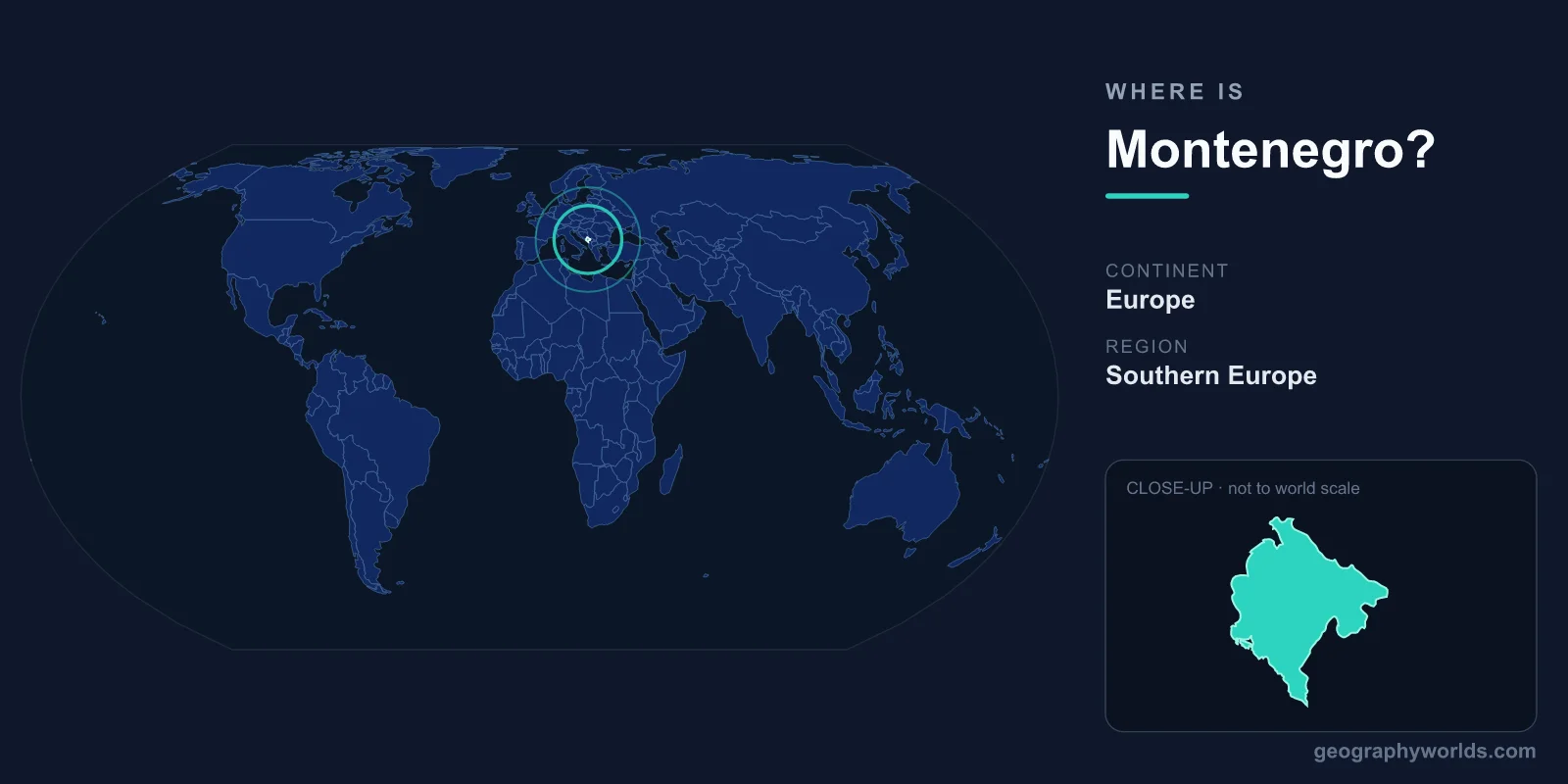
Montenegro sits in southeastern Europe on the Adriatic Sea coast of the western Balkans. With 293 km of stunning coastline including the fjord-like Bay of Kotor, this small nation of 13,812 km² packs dramatic geography into a compact space — its very name means "Black Mountain."
Location
Montenegro is located in southeastern Europe, on the western side of the Balkan Peninsula. It faces the Adriatic Sea to the southwest, with a coastline stretching 293 km from the Croatian border in the northwest to Albania in the southeast. The country covers 13,812 km², roughly the size of Connecticut, making it one of Europe's smaller nations.
The capital and largest city is Podgorica (population ~190,000), located inland in the Zeta River plain. The historic former royal capital, Cetinje, sits in a mountain valley and serves as the "Old Royal Capital." Montenegro declared independence from the State Union of Serbia and Montenegro in 2006, making it one of Europe's newest sovereign states.
Region & Neighbors
Montenegro shares borders with five countries in a remarkably compact footprint:
- Croatia — 14 km border to the northwest (one of Europe's shortest international borders).
- Bosnia and Herzegovina — 242 km border to the north and northwest.
- Serbia — 157 km border to the northeast.
- Kosovo — 76 km border to the east.
- Albania — 186 km border to the southeast, including shared Lake Skadar.
Despite its small size, Montenegro's position at the intersection of Central European, Mediterranean, and Balkan cultural zones gives it a remarkably diverse heritage. The Adriatic coast has Venetian influences, the interior shows Ottoman and Serbian traditions, and the northern mountains have their own distinct highland culture.
Key Geographic Facts
Montenegro's name, derived from Venetian Italian, means "Black Mountain" — a reference to the dark, densely forested Mount Lovćen that looms above the coast. The country's geography is dominated by rugged mountains and deep gorges, with over 60% of the terrain above 1,000 meters.
The Bay of Kotor (Boka Kotorska) is Montenegro's most famous geographic feature — a winding, fjord-like inlet that penetrates 28 km into the mountains, often described as the southernmost fjord-like bay in Europe. (Technically it's a submerged river canyon, not a true fjord carved by glaciers, but the visual resemblance is striking.) The medieval town of Kotor at the bay's inner end is a UNESCO World Heritage Site.
The Tara River Canyon in northern Montenegro is the deepest canyon in Europe (1,300 m) and second-deepest in the world after the Grand Canyon. The Tara River is known as the "Tear of Europe" for its crystal-clear turquoise water. Lake Skadar, shared with Albania, is the largest lake in the Balkans (370-530 km² depending on season) and one of Europe's most important bird habitats.
Montenegro's highest peak is Bobotov Kuk at 2,522 m in the Durmitor massif, which is both a national park and a UNESCO World Heritage Site.
Travel & Access
Montenegro has two international airports: Podgorica Airport (TGD) and Tivat Airport (TIV) on the coast near the Bay of Kotor. Tivat is the more convenient gateway for coastal tourism. Both receive flights from major European cities. The country is also easily accessible overland from Croatia (Dubrovnik is just 2 hours from the Bay of Kotor), Serbia, Bosnia, and Albania.
The Adriatic Highway runs along the entire coast, and the country's small size means you can drive from the coast to the northern mountains in about 3-4 hours. A scenic railway connects the coast (Bar) to Podgorica and continues to Belgrade, Serbia, crossing dramatic mountain terrain including the Mala Rijeka Viaduct, one of the highest railway bridges in Europe.
Key Facts
- Location: Southeastern Europe, western Balkans, Adriatic coast.
- Area: 13,812 km² (roughly the size of Connecticut).
- Capital: Podgorica.
- Coastline: 293 km along the Adriatic Sea.
- Borders: Croatia (14 km), Bosnia & Herzegovina (242 km), Serbia (157 km), Kosovo (76 km), Albania (186 km).
- Highest point: Bobotov Kuk, 2,522 m.
- Name means "Black Mountain" in Venetian Italian.
- Independent since 2006 (from State Union of Serbia and Montenegro).
Fun Facts
- The Bay of Kotor is often called Europe's southernmost fjord, though it's technically a submerged river canyon, not glacier-carved.
- The Tara River Canyon is 1,300 meters deep — the deepest canyon in Europe and second only to the Grand Canyon worldwide.
- Montenegro has the shortest international border in Europe with Croatia, at just 14 km.
- The country's 14 km border with Croatia is so short that it takes only minutes to cross from one country to the other.
- Lake Skadar hosts the largest pelican colony in Europe, with Dalmatian pelicans nesting in its reed beds.
Test Your Knowledge!
Think you know your world geography? Try our interactive quiz!
Play Country Quiz →