

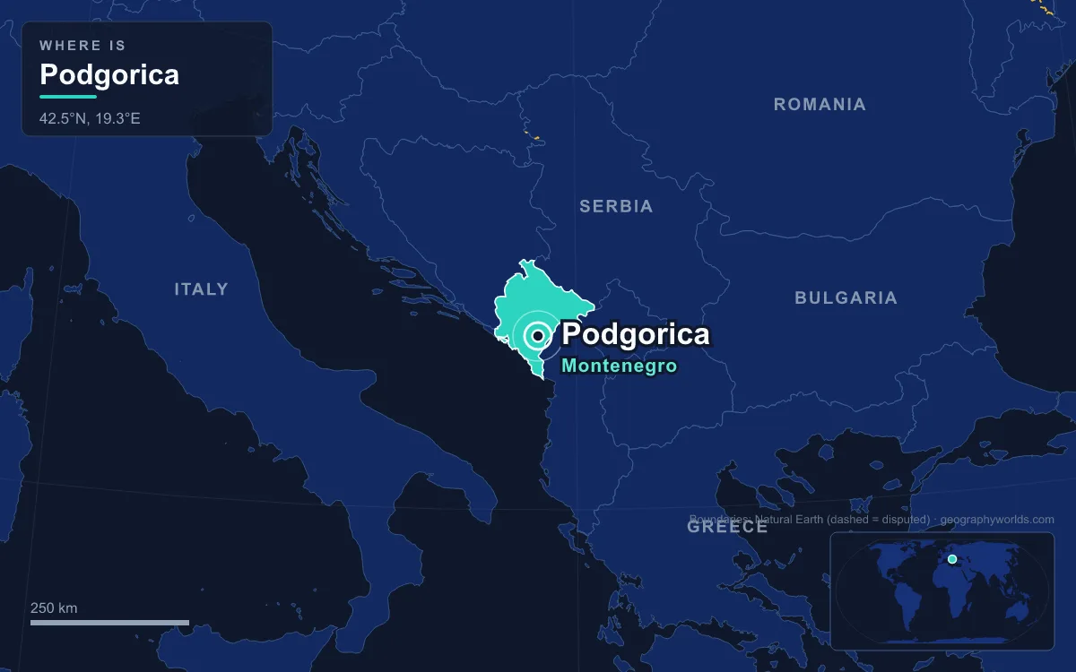
Podgorica is the capital and largest city of Montenegro. It sits on a flat plain in the centre of the country, where the Ribnica stream meets the Morača river, about 15 kilometres north of Lake Skadar and some 35 kilometres inland from the Adriatic. The 2023 census counted 179,505 people in the city, close to a third of Montenegro's 623,633 residents. The name means "under the hill", after Gorica, the cypress-covered hill of 130 metres that rises over the centre. For most of its history Podgorica was a garrison and market town rather than a seat of government: Cetinje, up in the mountains, was the royal capital. The city was rebuilt after heavy bombing in the Second World War, renamed Titograd from 1946 to 1992, and has been the capital of an independent state only since 2006. Six places in and around the city, taken in rough historical order, show how that happened.
Doclea, the Roman Town Three Kilometres North of Podgorica
Before there was a Podgorica there was Doclea. The ruins lie about 3 kilometres north of the modern centre. The Docleatae, an Illyrian people, gave the place its name, and under Emperor Claudius (who ruled from 41 to 54 AD) Doclea became a Roman municipium. At its height it held between 8,000 and 10,000 people, a large town for the Balkan interior. Pliny the Elder mentioned the cheese of Doclea as a well-known Illyrian product, and tradition says that the mother of Emperor Diocletian came from here.
When Diocletian reorganised the empire's provinces, Doclea became the capital of the new province of Praevalitana. That gives the Podgorica area its oldest claim to being a capital, well over a thousand years before the modern city took the role. The town declined in the 4th and 5th centuries, was attacked by the Visigoths, and was wrecked by an earthquake in 518. Slavs later rebuilt a settlement here, and the Slavic form of the name, Duklja, became the name of a medieval state that roughly covered today's south-eastern Montenegro, from the Bay of Kotor to the Bojana river. What remains today is a field of foundations, column drums and the outlines of a forum and basilicas, set in dry grassland with the hills of the Zeta valley behind.
The Clock Tower and Stara Varoš, Relics of Ottoman Podgorica
The name Podgorica first appears in 1326, in a court document kept in the archives of Kotor. The town was then a stop on the trade road between the Republic of Ragusa (Dubrovnik) and inland Serbia, which ran through Trebinje and Nikšić. The Ottomans took it in 1474 and built a large fortress within a few years. For four centuries Podgorica was an Ottoman frontier town facing the free Montenegrin highlands, first as part of the Sanjak of Scutari and later of the Scutari Vilayet.
The old Ottoman town grew up on the left bank of the Ribnica, in the district now called Stara Varoš. Most of it was lost to the bombing of the Second World War and to post-war rebuilding, but a knot of narrow lanes survives along with two mosques, the Osmanagića and Starodoganjska, and the old bridge over the Ribnica. The best-known survivor is the Sahat Kula, a free-standing stone clock tower 19 metres tall, built in 1667 by Hadži-paša Osmanagić, a prominent local citizen. It stands on Bećir Beg Osmanagić square.

The tower also marks the change of rulers. After the Montenegrin–Ottoman War, the Congress of Berlin in 1878 gave Podgorica to the Principality of Montenegro. The town then had about 1,500 houses and more than 8,000 people of Orthodox, Catholic and Muslim faith. In 1890 the tower received a new clock mechanism from the Colbachini foundry in Bassano del Grappa, Italy, and around the same time a metal cross was fixed to its top to mark the town's passage from Ottoman to Christian Montenegrin rule. The old mechanism was kept for its historic value when an electric one was installed in January 2012.
Ribnica Fortress Above the Morača Confluence
A short walk from the clock tower, the ruins of the Ribnica fortress sit on the rocks where the Ribnica flows into the Morača. The Ottomans built it around 1477, and it was one of two fortresses that guarded Stara Varoš. Its Turkish name, Depedöğen, is still used locally as Depedogen. For a long time it served as an ammunition store, which proved to be its undoing: in 1878 lightning set off an explosion that destroyed much of the interior and exterior.
The site has a second identity. Many believe that a much older fortress stood here in the 12th century and that Stefan Nemanja, founder of the Nemanjić dynasty of medieval Serbia, was born on this spot. For that reason Serbs in Montenegro call it Nemanjin Grad, "Nemanja's Town". The name is thought to have been popularised by King Nikola of Montenegro after he took Podgorica from the Ottomans in 1878. Orthodox ceremonies are still held among the walls. Standing on the ruin you can see the other feature that defines the city centre: the Morača, some 70 metres wide near downtown, has cut a canyon about 20 metres deep straight through the town, so that the river runs well below street level.
The Petrović Palace Gallery and the Rise of Titograd
Under Montenegrin rule Podgorica grew into the largest town in the small kingdom. Roads were built to all neighbouring towns by 1902, tobacco became its first significant commercial product, and a savings bank opened in 1904. King Nikola's family built a residence here, the Dvorac Petrovića, now set in the city's largest public park. After 1918 the Podgorica Assembly, still a disputed event in Montenegrin politics, voted to merge Montenegro with Serbia inside the new Kingdom of Serbs, Croats and Slovenes. Between the wars the town had about 14,000 people.
The Second World War nearly erased it. Podgorica was bombed more than 80 times; a single raid on 5 May 1944 killed about 400 civilians. The city was liberated on 19 December 1944. In July 1946 Josip Broz Tito visited and promised federal money to rebuild it, and the city became the capital of the Socialist Republic of Montenegro. A 1948 law renamed it after him, backdated to July 1946. The spelling in the law was Titovgrad, but the federal gazette printed Titograd, and that was the form that stuck.
Titograd grew fast around new industry. The Radoje Dakić heavy machinery plant opened in 1946, and in the late 1960s the city won a politically charged contest with Zadar and Mostar to host Yugoslavia's expanding aluminium industry; the aluminium plant was built in 1969. A university, named after Veljko Vlahović, was founded in 1974. On 15 April 1979 an earthquake of magnitude 6.9 damaged the city. By 1981 the city's GDP per head had reached 87% of the Yugoslav average. In 1984 the palace buildings were converted into a gallery for art from the Non-Aligned Movement countries, and since 1995 they have belonged to the city's Modern Arts Centre (Centar savremenih umjetnosti), which holds about 1,500 works. A referendum on 2 April 1992 brought back the name Podgorica.
The Millennium Bridge, Opened on Montenegro's National Day in 2005
The 1990s passed Podgorica by in one sense, since the Yugoslav wars were not fought in its streets, but sanctions and hyperinflation stalled the economy, and NATO aircraft struck targets around the city in 1999. The skyline you see today mostly dates from the years around independence. Its symbol is the Millennium Bridge, a cable-stayed crossing of the Morača designed by Marjan Pipenbaher of the Slovenian firm Ponting with Mladen Ulićević of the Faculty of Civil Engineering in Podgorica. It opened on 13 July 2005, Montenegro's National Day.
The bridge is 173 metres long, and its single pylon rises 57 metres above the road deck. Twelve cables hold up the roadway and another 24 run to counterweights. It cost about 7 million euros and links the Boulevard of Ivan Crnojević in the old centre to the newer districts across the river, easing pressure on the older bridges. Beside it, the pedestrian Moscow Bridge opened on 19 December 2008.

In May 2006 Montenegrins voted for independence, and Podgorica became the capital of a sovereign state. The former Ivan Milutinović Square was rebuilt and renamed Independence Square. The city has since been reorganised: Tuzi became a separate municipality in 2018 and Zeta followed in 2022, which is why older figures for "Podgorica Municipality" run higher than today's city numbers. Cetinje keeps the title of old royal capital and the president's official residence.
The Cathedral of Christ's Resurrection Below Gorica Hill
The newest of the city's major landmarks took twenty years to build. Work on the Cathedral of the Resurrection of Christ, the seat of the Serbian Orthodox Metropolitanate of Montenegro and the Littoral, began in 1993 to a design by Predrag Ristić. It was consecrated in 2013, timed to the 1,700th anniversary of the Edict of Milan, with the heads of several Orthodox churches present, among them the Ecumenical Patriarch Bartholomew and the Serbian Patriarch Irinej. Its twin towers and large arch borrow from the medieval Cathedral of St Tryphon in Kotor, and the interior is covered in icon murals on gold backgrounds. Metropolitan Amfilohije Radović, who led the metropolitanate from 1990 to 2020, is buried in its crypt.

The cathedral also reflects who lives here now. In the 2023 census 54.7% of the city's people identified as Montenegrins and 30.3% as Serbs, with Bosniaks at 2.7%. Most residents are Orthodox, but Muslims and Catholics are sizeable minorities; the main Catholic church, the Church of the Holy Heart of Jesus in the Konik district, is a brutalist building of 1966. About 6.5% of residents are foreign nationals, a share that has grown as expatriates move to the city.
From the cathedral steps the reasons for the city's position are plain. Podgorica stands at 40 metres above sea level at the northern end of the Zeta plain, flat ground in a mostly mountainous country, with roads and the Belgrade–Bar railway converging on it. Mount Rumija shuts off the sea breeze, so summers are hot: the record is 44.8 °C, set on 24 August 2007. It is also, with a mean of 1,659 mm of rain a year, the wettest capital in Europe, well ahead of Ljubljana's 1,362 mm. For the wider picture of the country around it, see where Montenegro is on the map, how it fits into the geography of the Balkan Peninsula, and our full Montenegro country guide.
Quick Facts About Podgorica
- Country: Montenegro
- Continent: Europe (Southern Europe)
- Country population: approximately 626 thousand
- Capital city status: Podgorica is the capital of Montenegro, the seat of national government, and the location of foreign embassies, parliament, and the head of state's official residence.
Frequently Asked Questions
What is the capital of Montenegro?
The capital of Montenegro is Podgorica. Podgorica is the seat of national government, hosts most foreign embassies and consulates, and is typically where the head of state and parliament are located.
What continent is Podgorica in?
Podgorica, the capital of Montenegro, is located in Europe, in the Southern Europe region. As Montenegro's capital, Podgorica serves as the country's primary connection to the broader Europen political, economic, and cultural sphere.
Why is Podgorica the capital of Montenegro?
Podgorica was chosen as the capital of Montenegro for reasons that typically combine geography, history, and politics. Capital city selections often reflect a desire for centrality (being accessible from across the country), historical importance (being a longstanding seat of government or culture), or neutrality (being acceptable to multiple regions or ethnic groups within the country). The specific reasons for Podgorica's designation are detailed in the city's history above.
What is Podgorica known for?
As the capital of Montenegro, Podgorica is best known for housing the country's central government institutions — parliament, presidential or royal residences, supreme court, and key ministries. It is also typically a major cultural and economic center within Montenegro, hosting national museums, embassies, and signature monuments. The introduction and history sections above provide detailed coverage of the city's specific notable institutions and landmarks.
Related Pages
- Montenegro Country Guide — full geography, climate, economy, and culture overview
- Flag of Montenegro — meaning, history, and design of Montenegro's national flag