
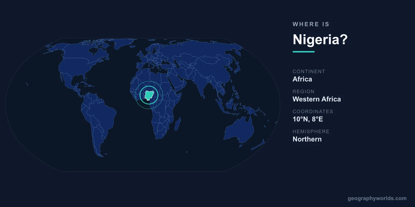
Nigeria is located in West Africa along the Gulf of Guinea, bordered by Benin to the west, Niger to the north, Chad to the northeast, and Cameroon to the east. Sitting on the African continent in the Northern and Eastern Hemispheres, it covers 923,768 km² and is governed from its purpose-built capital, Abuja. With roughly 220 million people, Nigeria is the most populous country in Africa and one of the most influential nations on the continent.
Where Nigeria Sits on the Map
Nigeria lies entirely north of the Equator, stretching from about 4°N near the coast to roughly 14°N at its desert-fringe northern edge, and from around 3°E to 15°E in longitude. This places it firmly in the tropics, in the part of West Africa where the continent's bulge curves down toward the Gulf of Guinea, an arm of the Atlantic Ocean. Its southern shoreline runs for about 850 kilometres along that gulf, giving Nigeria its only natural maritime boundary.
To picture its scale, Nigeria is close in size to France or to roughly twice the area of California. It ranks among the 30 to 35 largest countries in the world by land area, yet it carries far more demographic weight than its size alone would suggest, since it is home to roughly one in every six Africans. The entire country falls within a single time zone, West Africa Time (UTC+1), and observes no daylight-saving changes, so its clocks stay one hour ahead of GMT all year round.
Key Facts
- Continent: Africa (West Africa, Gulf of Guinea)
- Capital: Abuja (seat of government since 1991)
- Largest city: Lagos
- Area: 923,768 km² — roughly the size of France
- Population: About 220 million — the most populous country in Africa
- Bordering countries: Benin, Niger, Chad, Cameroon
- Currency & language: Nigerian naira (NGN); English (official)
The Countries That Border Nigeria
Nigeria shares land borders with four neighbouring countries, each shaping its trade, security, and cultural exchange:
- Benin — to the west, a busy commercial frontier linking Nigeria to the wider coast of West Africa and a major route for cross-border trade.
- Niger — along the long northern boundary, marking the transition toward the Sahel and the Sahara, with deep historical and ethnic ties across the line.
- Chad — to the northeast, where the two countries meet near Lake Chad in the far corner of the map.
- Cameroon — to the east and southeast, sharing Nigeria's longest land border across rugged highland terrain.
To the south, instead of a land border, Nigeria meets the Atlantic Ocean. The convergence of Nigeria, Niger, Chad, and Cameroon around Lake Chad makes that region a meeting point of four nations, an area of both shared culture and recurring regional concern. Nigeria's central location within West Africa, combined with its size and population, has long made it the natural anchor of regional politics and commerce.
The Land and Its Geography
Nigeria's terrain changes dramatically as you travel from south to north. The coastal belt is dominated by the vast Niger Delta, where the River Niger and the River Benue empty into the Gulf of Guinea through a maze of creeks, mangrove swamps, and wetlands — one of the largest delta systems on Earth and the heart of Nigeria's oil industry.
Moving inland, dense tropical rainforest gives way to rolling savanna and the broad central plateau. The Jos Plateau rises in the middle of the country, while the highest point, Chappal Waddi near the Cameroon border, reaches about 2,419 metres. In the far north, the land flattens and dries into Sahel scrub approaching the Sahara, where the seasonal Harmattan wind carries dust across the country between November and March. The Niger and Benue rivers meet in a great "Y" near the centre of the country, draining much of its interior. Among Nigeria's best-known landmarks is Zuma Rock, a massive monolith rising beside the highway just outside Abuja.
Climate and Seasons
Because Nigeria spans roughly ten degrees of latitude, its climate is best understood as a gradient running south to north. The coast and delta have a humid, equatorial climate with heavy rainfall and two wet peaks, supporting rainforest and year-round greenery. The central belt experiences a tropical savanna climate with a clear wet season from about April to October and a dry season for the rest of the year. In the far north, the climate becomes semi-arid, with short, intense rains and a long, hot dry season dominated by the dusty Harmattan. Rather than spring, summer, autumn, and winter, Nigerians generally speak of just two seasons — the rainy season and the dry season — whose timing varies by region.
People, Capital, and Cities
Nigeria's capital is Abuja, a planned city in the country's centre that replaced Lagos as the seat of government in 1991. Lagos, on the southwestern coast, remains the largest city and economic powerhouse, ranking among the most populous and fastest-growing urban areas in the world. Other major centres include Kano in the north, Ibadan in the southwest, and Port Harcourt near the oil-rich delta. Nigeria operates as a federal presidential republic divided into 36 states plus the Federal Capital Territory, and its central position makes Abuja the headquarters of the Economic Community of West African States (ECOWAS).
English is the official language, a legacy of British colonial rule, but it sits atop an extraordinary landscape of more than 500 languages, with Hausa, Yoruba, and Igbo spoken by the largest groups. Religion is split roughly evenly between Islam, dominant in the north, and Christianity, prevalent in the south. The everyday currency is the Nigerian naira (NGN). To explore the country's regions, economy, and travel highlights in more depth, see our nigeria country guide.
Why Nigeria's Location Matters
Nigeria's position on the Gulf of Guinea has shaped its history and economy for centuries. The coastline gave early access to maritime trade routes that connected the interior to the wider Atlantic world, and today the same waters host the ports and offshore oil fields that power one of Africa's largest economies. As West Africa's demographic and economic giant, sitting at a crossroads between the Sahel to the north and the coast to the south, Nigeria functions as a regional hub for trade, finance, culture, and music — its film and entertainment industries reach audiences across the continent and beyond. Understanding where Nigeria sits helps explain why it carries such outsized influence in African and global affairs.
Frequently Asked Questions
What continent is Nigeria in?
Nigeria is in Africa, specifically in the West Africa region along the Gulf of Guinea. It lies in both the Northern and Eastern Hemispheres, entirely north of the Equator.
What is the capital of Nigeria?
The capital is Abuja, a purpose-built city in the centre of the country that became the seat of government in 1991. Lagos was the former capital and remains the largest and most economically important city.
How many countries border Nigeria?
Nigeria borders four countries: Benin to the west, Niger to the north, Chad to the northeast, and Cameroon to the east. Its southern edge meets the Atlantic Ocean at the Gulf of Guinea.
Is Nigeria a large country?
Yes. At 923,768 km² it is one of the larger countries in Africa, roughly the size of France, and with about 220 million people it is the most populous nation on the continent.
