
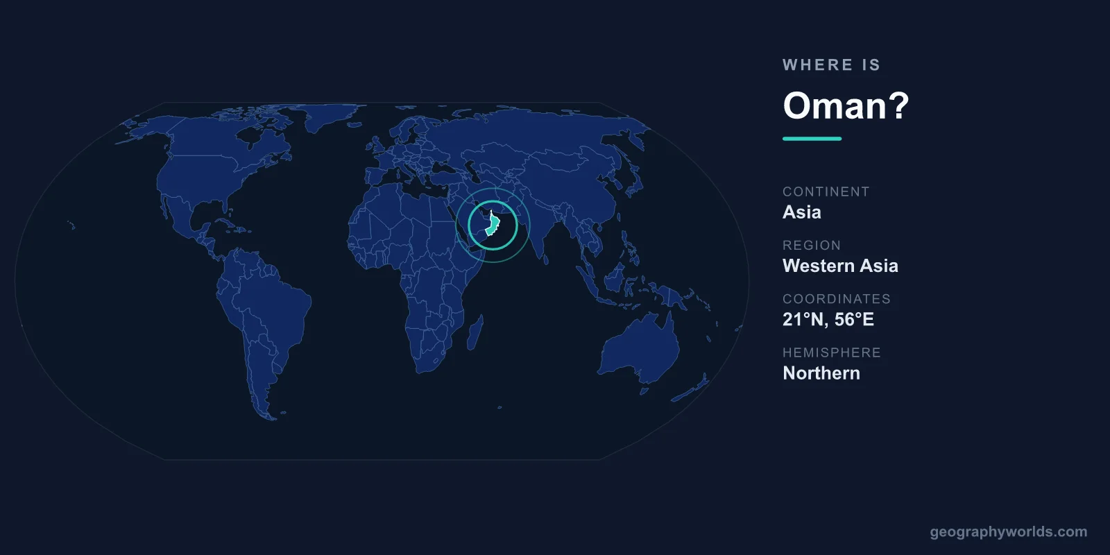
Oman lies on the southeastern corner of the Arabian Peninsula in Western Asia, fronting the Arabian Sea and the Gulf of Oman, and sharing land borders with the United Arab Emirates, Saudi Arabia, and Yemen. Its capital, Muscat, sits on the northern coast, and the country covers roughly 309,500 square kilometres, making it comparable in size to Italy or the U.S. state of New Mexico.
Where Exactly Is Oman on the Map?
Oman occupies the far southeastern edge of the Arabian Peninsula, placing it firmly in the Northern and Eastern Hemispheres. Most of the country lies between roughly 16 and 26 degrees north latitude and 52 to 60 degrees east longitude. This position gives Oman a long, strategic coastline that stretches for more than 2,000 kilometres along the Arabian Sea, the Gulf of Oman, and the entrance to the Persian Gulf.
One of the most important geographic facts about Oman is its control of the southern shore of the Strait of Hormuz, the narrow waterway through which a large share of the world's seaborne oil passes. The country's Musandam Peninsula, separated from the rest of Oman by UAE territory, juts into this strait, giving Oman an outsized role in global maritime trade. You can learn more in our oman country guide.
Which Countries Border Oman?
Oman shares land borders with three nations, all on the Arabian Peninsula:
- United Arab Emirates – to the northwest, including the section that surrounds the Musandam exclave.
- Saudi Arabia – to the west, across the vast sands of the Rub' al Khali (the Empty Quarter), one of the largest continuous deserts on Earth.
- Yemen – to the southwest, along the rugged terrain leading toward the Dhofar region.
To the north and east, Oman has no land neighbours at all. Instead it faces open water: the Gulf of Oman in the northeast and the Arabian Sea, part of the wider Indian Ocean, along its long southern and eastern flank. This maritime frontier has shaped Oman into a seafaring nation for thousands of years, with historic trade links reaching as far as East Africa, India, and China.
The Landscape: Deserts, Mountains, and Coast
Despite its position on the edge of the Arabian Desert, Oman is far from a flat expanse of sand. The country contains striking variety. The Al Hajar Mountains arc across the north, rising to Jebel Shams, the highest peak at around 3,000 metres, whose deep canyon is sometimes called the "Grand Canyon of Arabia." Inland lies a share of the Rub' al Khali, while the coast alternates between rocky cliffs, fishing villages, and sweeping beaches.
The southern Dhofar region is geographically unique. Each summer the khareef, a monsoon influenced by the Indian Ocean, brings mist and rain that turn the hills around Salalah a lush green, an unexpected sight in Arabia. This climatic quirk, tied directly to Oman's location at the edge of the monsoon belt, makes Dhofar one of the most distinctive landscapes in the Middle East.
Muscat and Oman's Other Towns
Muscat, the capital, hugs the northern coast where the Al Hajar Mountains meet the Gulf of Oman, an old port city framed by dramatic dark rock. It is home to the celebrated Sultan Qaboos Grand Mosque, one of Oman's best-known landmarks. Other major centres include Salalah in the far south, Sohar and Sur along the coast, and Nizwa, a historic inland town once the country's capital.
Oman's population is roughly 5 million people. Arabic is the official language, and Islam is the state religion, with the distinctive Ibadi school predominating. Governed as an absolute monarchy under a sultan, Oman uses the Omani rial (OMR) as its currency. Its blend of desert, mountain, and ocean geography has long made it a crossroads between Arabia, Africa, and Asia.
How to Place It Without a Map
Oman occupies the south-eastern corner of the Arabian Peninsula, facing the Arabian Sea and the Gulf of Oman rather than the Persian Gulf proper. Muscat sits at roughly 23 degrees north, about the same latitude as Havana, Karachi and the southern tip of Taiwan.
It is the third-largest country on the peninsula after Saudi Arabia and Yemen, at around 310,000 square kilometres, which makes it slightly larger than Poland.
An Empire That Reached East Africa
Oman is unusual among Arabian states in having been a naval power with overseas possessions. In the eighteenth and nineteenth centuries it controlled Zanzibar, stretches of the Swahili coast and ports in what is now Pakistan and Iran.
Sultan Said bin Sultan moved his capital to Zanzibar in 1840, governing from the African side of the empire rather than from Muscat, and the sultanate split in two after his death in 1856. Gwadar, on the Balochistan coast, remained Omani until it was sold to Pakistan in 1958.
The legacy is linguistic and culinary. Swahili is widely spoken among Omanis whose families returned after the 1964 Zanzibar revolution, and the trade in cloves, dates and dhow-building runs through both coasts.
The Mountains and the Monsoon
The Hajar range runs parallel to the northern coast, rising to about 3,000 metres at Jebel Shams, and it separates the coastal plain from the interior desert. The terraced villages on Jebel Akhdar grow pomegranates, roses and apricots at altitudes where frost is possible.
The far south is different again. Dhofar, around Salalah, catches the tail of the Indian Ocean monsoon each summer, and for roughly three months the hills turn green under persistent drizzle and fog while the rest of Arabia bakes.
That microclimate supported the frankincense trade, which made the region wealthy in antiquity. The Land of Frankincense sites, including the ruins at Sumhuram and the groves of Wadi Dawkah, are a UNESCO World Heritage Site.
Oman Has Territory Inside Another Country
The Musandam Peninsula, which commands the southern side of the Strait of Hormuz, is Omani but separated from the rest of the country by the United Arab Emirates. Reaching it overland requires crossing UAE territory twice.
There is a second, smaller exclave at Madha, entirely surrounded by the UAE, and inside Madha sits Nahwa, a village belonging to the UAE and surrounded in turn by Omani land. It is one of the very few second-order enclaves anywhere in the world.
The arrangement is a survival of tribal allegiances rather than any drawn frontier: the boundaries follow which sheikh a village pledged to in the twentieth century, and they were only formally agreed in 2008.
The Strait of Hormuz Sits on Its Doorstep
Musandam's position matters far beyond Oman. The Strait of Hormuz is about 33 kilometres wide at its narrowest and carries a very large share of the world's seaborne oil, with the shipping lanes running through Omani territorial waters.
That gives a country of around five million people a standing role in global energy security, and it is part of why Oman has maintained working relations with Iran, the Gulf states and the West simultaneously rather than aligning with any bloc.
Inbound and outbound tankers use separate lanes about 3 kilometres wide, with a buffer zone of the same width between them, a traffic scheme explained in our Strait of Hormuz guide. The same neutrality made Muscat the venue for the secret talks between the United States and Iran in 2013 that led to the nuclear agreement.
The Water System Is Two Thousand Years Old
Oman receives very little rain, and its agriculture has depended for millennia on the aflaj, gravity-fed channels carrying water from mountain aquifers to the settlements and date gardens below.
Five of them are a UNESCO World Heritage Site, and some are estimated to date from around 500 AD, with the system possibly older still. Water is allocated by time share rather than volume, measured historically by the movement of the stars, and administered by a village official whose role is inherited.
Thousands of aflaj are still in use. They are the reason towns such as Nizwa and Bahla exist where they do, on the inland side of the Hajar mountains rather than on the coast.
Common Questions About Oman's Location
What continent is Oman in?
Oman is in Asia, specifically in the Middle East region on the Arabian Peninsula. It sits within Western Asia, sharing the peninsula with Saudi Arabia, Yemen, the UAE, and other Gulf states.
Is Oman a country in the Middle East?
Yes. Oman is an independent country in the Middle East, located on the southeastern Arabian Peninsula. It is one of the six member states of the Gulf Cooperation Council (GCC), alongside Saudi Arabia, the UAE, Kuwait, Qatar, and Bahrain.
What ocean and seas border Oman?
Oman's eastern and southern coasts face the Arabian Sea, part of the Indian Ocean. Its northern coast borders the Gulf of Oman, and the Musandam Peninsula reaches into the Strait of Hormuz near the Persian Gulf.
How far is Oman from Dubai?
Muscat, Oman's capital, lies roughly 350 to 400 kilometres by road from Dubai in the UAE, a drive of around four to five hours. The two countries share a direct land border, making overland travel between them common.