
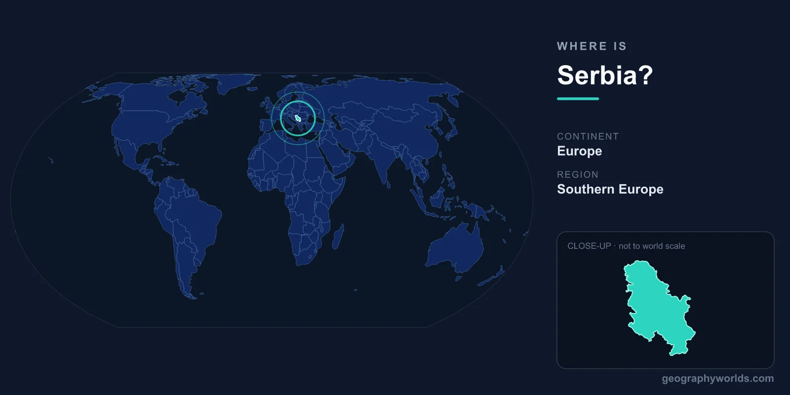
Serbia is a landlocked country in the central Balkans of southeastern Europe, sitting at the crossroads where central Europe meets the Mediterranean and Near Eastern worlds. Its capital, Belgrade, stands at roughly 44.8° N and 20.5° E, near the heart of the Balkan Peninsula, and the country covers about 88,361 square kilometers without touching any sea.
Where Exactly Is Serbia on the Map?
Serbia lies in the Northern and Eastern Hemispheres, occupying the interior of the Balkan Peninsula in southeastern Europe. It is firmly landlocked, with no coastline of its own, yet it is far from isolated: the country sits along historic routes linking western and central Europe to Greece, Turkey, and the Middle East. For centuries these corridors have made Serbia a natural meeting point for armies, traders, and travelers.
The two great rivers that define Serbian geography are the Danube and the Sava, which meet at Belgrade. The Danube enters from the northwest and flows toward Romania, while the Sava arrives from Croatia and Bosnia. These waterways connect the otherwise sea-locked nation to the Black Sea and, via canals, to the North Sea, giving Serbia an important inland-shipping outlet despite its lack of an ocean coast.
Which Countries Border Serbia?
Serbia shares land borders with eight neighbors, one of the highest counts in the region and a clear sign of its central position in the Balkans:
- Hungary to the north
- Romania to the northeast
- Bulgaria to the east
- North Macedonia to the south
- Kosovo to the south (its status is disputed; Serbia considers it part of its territory)
- Montenegro to the southwest
- Bosnia and Herzegovina to the west
- Croatia to the northwest
This ring of neighbors means Serbia touches nearly every part of the Balkans at once. It is the only country in the peninsula that borders both EU members such as Hungary, Romania, Bulgaria, and Croatia, and the non-EU states of the western Balkans. That position has shaped Serbia's role as a transit hub, with major highways and rail lines from Budapest to Athens passing directly through the country.
Serbia's Landscape: From Northern Plains to Southern Mountains
Serbia's terrain divides neatly along a north–south line. The northern province of Vojvodina is part of the broad, flat Pannonian Plain, a fertile lowland of wheat, corn, and sunflower fields drained by the Danube, Sava, and Tisa rivers. It is one of the most productive agricultural regions in southeastern Europe.
South of the rivers, the land rises into rolling hills and then into genuine mountains. The Dinaric Alps reach in from the west, while the Carpathian and Balkan ranges shape the east. Serbia's highest peak lies in the far southwest near the Kosovo and Albania borders, climbing above 2,600 meters. Between these uplands run river valleys, gorges, and basins — most famously the dramatic Đerdap (Iron Gates) Gorge, where the Danube carves through the mountains along the Romanian frontier.
How Big Is Serbia and Who Lives There?
At roughly 88,361 km², Serbia is comparable in size to Austria, Portugal, or the U.S. state of Maine — a mid-sized European country rather than a tiny one. Its population is around 7 million people, concentrated heavily in Belgrade, which is home to well over a million residents and ranks among the larger cities of southeastern Europe.
Most people speak Serbian, a South Slavic language written in both the Cyrillic and Latin alphabets. The dominant faith is Serbian Orthodox Christianity, and the country uses the Serbian dinar (RSD) rather than the euro. Serbia is a parliamentary republic and an official candidate for membership in the European Union. To explore more on the nation's people, history, and travel highlights, see our serbia country guide.
A Crossroads Through History
Serbia's location has made it a perennial frontier. It sat on the boundary between the Roman and Byzantine worlds, later marked the edge between the Ottoman and Habsburg empires, and in the 20th century lay at the center of Yugoslavia. Belgrade itself has been fought over and rebuilt dozens of times precisely because whoever controlled the Danube–Sava confluence controlled a gateway between Europe and the East. That long history of being "in the middle" is the single best way to understand where Serbia sits, both on the map and in the story of Europe.
Frequently Asked Questions
Is Serbia in Eastern or Central Europe?
Serbia is usually classified as part of southeastern Europe, in the Balkan region. Because it sits at a crossroads, it is sometimes grouped with central Europe (especially the northern Vojvodina region) and sometimes with the broader east, but geographers most commonly place it in the southeastern Balkans.
Does Serbia have a coastline?
No. Serbia is landlocked and has no sea access. Until Montenegro became independent in 2006, the union of Serbia and Montenegro shared an Adriatic coast, but modern Serbia relies on its rivers — chiefly the Danube — for waterborne trade.
What is the capital of Serbia and where is it?
The capital is Belgrade, located in the north-central part of the country where the Sava River joins the Danube. Its strategic riverside position has made it one of the oldest continuously inhabited cities in Europe.
How many countries border Serbia?
Serbia borders eight countries: Hungary, Romania, Bulgaria, North Macedonia, Kosovo, Montenegro, Bosnia and Herzegovina, and Croatia — making it one of the most connected nations in the Balkans.