
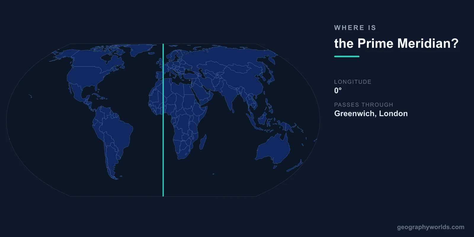
The Prime Meridian is the imaginary line at 0° longitude that runs from the North Pole to the South Pole, passing through the Royal Observatory in Greenwich, London, United Kingdom. It divides the Earth into the Eastern Hemisphere (0° to 180°E) and the Western Hemisphere (0° to 180°W). All longitude on Earth is measured as degrees east or west of this line.
Introduction
The Prime Meridian also serves as the basis for Greenwich Mean Time (GMT), the reference time against which all time zones are calculated. The Greenwich meridian was established as the international standard at the International Meridian Conference in Washington, D.C., in 1884, when delegates from 25 nations voted to adopt it.

Exact Location & Coordinates
- Longitude: 0° (by definition)
- Key Location: Royal Observatory, Greenwich, London (51.477°N, 0°)
- Countries Crossed: UK, France, Spain, Algeria, Mali, Burkina Faso, Togo, Ghana
- Total Length: Pole to pole (~20,004 km)
The Prime Meridian passes through eight countries: the United Kingdom, France, Spain, Algeria, Mali, Burkina Faso, Togo, and Ghana. In the UK, a brass strip and later a laser line at the Royal Observatory in Greenwich mark the meridian's position. Visitors can literally stand with one foot in the Eastern Hemisphere and one in the Western.
Interestingly, modern GPS measurements place the true 0° longitude line (the IERS Reference Meridian used by GPS) approximately 102 meters east of the historic Greenwich observatory line. This discrepancy exists because the original measurement used local gravitational vertical, while GPS uses a mathematical model of the Earth. Both are "correct" for their respective purposes.
Surrounding Countries & Borders
- United Kingdom: Passes through Greenwich, London
- France: Crosses from the English Channel through western France
- Spain: Passes through eastern Spain
- Africa: Crosses Algeria, Mali, Burkina Faso, Togo, Ghana
The Prime Meridian crosses the English Channel from the UK to France, passing through the city of Le Havre. It continues south through western France, crosses the Pyrenees into eastern Spain, and traverses the Mediterranean before crossing Algeria, Mali, Burkina Faso, Togo, and reaching the Gulf of Guinea at Ghana's coast.
In Africa, the meridian passes through the Sahara Desert in Algeria and Mali before crossing the Sahel and reaching the tropical coast. Ghana was the first sub-Saharan African country to gain independence (1957), and the Prime Meridian's passage through its territory connects it symbolically to the global coordinate system.
Geographic Context
- GMT/UTC: Greenwich Mean Time is the basis for Coordinated Universal Time
- Time Zones: All 24 time zones are measured as offsets from GMT/UTC
- International Date Line: At 180° longitude — the Prime Meridian's antipodal line
- Historic Rivals: Paris, Washington, Cadiz, and others once competed for 0° longitude
Before 1884, there was no single agreed Prime Meridian. Different countries used their own capital cities as the reference point for longitude. France used the Paris Observatory, Spain used Cadiz, and the United States used Washington, D.C. This created enormous confusion for international shipping and communication.
The 1884 International Meridian Conference in Washington selected Greenwich largely because Britain was the world's dominant naval and commercial power, and most of the world's shipping charts already used the Greenwich meridian. France abstained from the vote and did not adopt the Greenwich meridian officially until 1911.
Physical Characteristics
- Length: ~20,004 km (pole to pole)
- Mostly Over Water: Like all meridians, it crosses more ocean than land
- Marker at Greenwich: A laser line shines north from the Royal Observatory at night
- GPS Offset: Modern GPS 0° is ~102 m east of the historic Greenwich line
The Prime Meridian, like all lines of longitude, runs from pole to pole and is approximately 20,004 kilometers long. Unlike the equator, which follows Earth's widest circumference, meridians are all the same length (they converge at the poles). All meridians cross the equator at right angles.
At the Royal Observatory in Greenwich, the meridian is marked by a strip on the ground and by a green laser projected northward at night that can be seen across London. The observatory, designed by Sir Christopher Wren and built in 1675, originally existed to improve navigation at sea by accurately charting the stars.
Why It Matters
- Navigation: All longitude coordinates reference the Prime Meridian
- Timekeeping: GMT/UTC is the global time standard, referenced from Greenwich
- Mapping: Foundation of the geographic coordinate system used worldwide
- History: Resolution of the "longitude problem" was one of the great scientific challenges
The Prime Meridian's establishment was the resolution of the "longitude problem" — one of the greatest scientific and practical challenges of the Age of Exploration. Determining longitude at sea required knowing the exact time at a reference point (like Greenwich) while measuring local time from the Sun. John Harrison's marine chronometers, developed in the 18th century, finally solved this problem.
Today, the Prime Meridian underpins the entire system of global positioning and timekeeping. Every GPS coordinate includes longitude measured from the Prime Meridian. Every time zone is defined as an offset from UTC (essentially GMT). The decision made in 1884 by 25 nations continues to structure how 8 billion people navigate, communicate, and coordinate across the globe.
Key Facts
- The Prime Meridian is at 0° longitude, passing through Greenwich, London.
- It was adopted as the international standard at the 1884 International Meridian Conference.
- The meridian crosses 8 countries from the UK through West Africa.
- Modern GPS places true 0° about 102 meters east of the historic Greenwich line.
- All time zones are measured as offsets from Greenwich Mean Time (GMT/UTC).
Fun Facts
- France abstained from the 1884 vote and did not officially adopt the Greenwich meridian until 1911.
- A green laser line marks the Prime Meridian at Greenwich and can be seen across London at night.
- Before 1884, different countries used different prime meridians, creating navigational chaos.
- The GPS 0° meridian runs through a park in Greenwich, 102 m east of the famous brass line at the observatory.
Final Thoughts
The Prime Meridian passes through Greenwich, London at 0° longitude, dividing the Earth into Eastern and Western Hemispheres and serving as the reference for all global positioning and timekeeping. Established by international agreement in 1884, this invisible line structures how billions of people navigate, coordinate, and measure time. The choice of Greenwich was historical and political, but its practical impact is universal.
Test Your Knowledge!
Think you know where things are on the map? Test your skills!
Play Geography Games →