
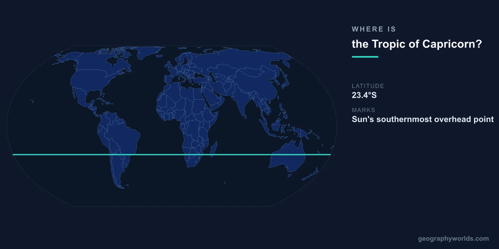
The Tropic of Capricorn is located at approximately 23.436°S latitude (roughly 23°26'S), circling the Earth through South America, southern Africa, Australia, and the southern Pacific and Atlantic Oceans. It marks the most southerly latitude at which the Sun can appear directly overhead, which occurs on the December solstice (approximately December 21-22).
Introduction
Together with the Tropic of Cancer at 23.436°N, the Tropic of Capricorn defines the southern boundary of the tropical zone. Because the Southern Hemisphere has far more ocean than the Northern Hemisphere at this latitude, the Tropic of Capricorn crosses less land and fewer countries than its northern counterpart.

Exact Location & Coordinates
- Latitude: 23.436°S (23°26'S)
- Circumference: ~36,788 km at this latitude
- Countries Crossed: 10 countries
- Movement: Shifts ~0.47 arcseconds per year (currently moving north)
The Tropic of Capricorn crosses 10 countries: Chile, Argentina, Paraguay, Brazil, Namibia, Botswana, South Africa, Mozambique, Madagascar, and Australia. It also crosses the Atlantic and Indian Oceans. The majority of its circumference is over water, particularly the vast southern Pacific.
Like the Tropic of Cancer, the Tropic of Capricorn's position slowly shifts due to changes in Earth's axial tilt. Currently moving northward at roughly 14.4 meters per year, the tropic will reach its minimum extent (22.1°S) in roughly 10,000 years before expanding again.
Surrounding Countries & Borders
- South America: Chile, Argentina, Paraguay, Brazil
- Africa: Namibia, Botswana, South Africa, Mozambique, Madagascar
- Oceania: Australia (Queensland, Northern Territory, Western Australia)
In Brazil, the Tropic of Capricorn passes near the city of Sao Paulo (the largest city in the Southern Hemisphere with roughly 22 million in its metropolitan area). The line crosses through the states of Mato Grosso do Sul, Parana, and Sao Paulo, marking the approximate southern limit of Brazil's tropical climate zone.
In Australia, the Tropic of Capricorn crosses the continent from Exmouth in Western Australia through Alice Springs in the Northern Territory to Rockhampton in Queensland. The line roughly marks the boundary between Australia's tropical north and its arid/subtropical center and south.
Geographic Context
- December Solstice: Sun directly overhead at Capricorn on ~December 21-22
- Southern Tropics: Area between equator and Capricorn is the southern tropical zone
- Desert Belts: Kalahari, Atacama, and Australian deserts lie near this latitude
- Hadley Cell: Descending dry air at ~23.5°S creates desert conditions (same mechanism as Cancer)
The same atmospheric mechanism that creates deserts near the Tropic of Cancer operates in the Southern Hemisphere. The descending limb of the southern Hadley cell creates high-pressure zones near 23.5°S, producing arid conditions. The Kalahari Desert of southern Africa, the Atacama Desert of Chile, and the vast arid interior of Australia all lie near the Tropic of Capricorn.
However, the Southern Hemisphere has significantly less land at this latitude than the Northern Hemisphere. The Tropic of Capricorn passes through far more ocean, which moderates the desert effect. The Southern Hemisphere's deserts are generally smaller and less extreme than their northern counterparts (except for the Atacama, which is the driest non-polar desert on Earth).
Physical Characteristics
- Solar Angle: Sun at 90° on December solstice; ~43° on June solstice
- Day Length: ~13.5 hours on December solstice; ~10.5 hours on June solstice
- Seasons: December solstice is midsummer in the Southern Hemisphere
- Counterpart: Tropic of Cancer at 23.436°N is the northern equivalent
On the December solstice, an observer at the Tropic of Capricorn experiences the longest day of the year in the Southern Hemisphere (~13.5 hours) and sees the Sun directly overhead at solar noon. This is the Southern Hemisphere's midsummer, while the Northern Hemisphere experiences its shortest day.
The seasons are reversed between the tropics of Cancer and Capricorn. When the Sun is at its highest over the Tropic of Cancer (June solstice, Northern Hemisphere summer), the Tropic of Capricorn experiences its shortest day (Southern Hemisphere winter). This semi-annual oscillation of the Sun between the two tropics drives Earth's seasonal patterns.
Why It Matters
- Climate Boundary: Marks the southern edge of the tropical zone
- Agriculture: Defines the southern limit of year-round tropical crop production
- Wine Regions: Some of the world's finest wine regions lie just south of the tropic
- Tourism: Marks the line between tropical beach destinations and temperate regions
The Tropic of Capricorn has practical significance for agriculture. Within the tropics (between Cancer and Capricorn), crops like sugarcane, tropical fruits, and rice can generally be grown year-round. South of Capricorn, agriculture shifts to temperate crops, and frosts become possible. Major agricultural regions near the tropic include Brazil's sugarcane belt and Australia's tropical fruit industry.
The wine regions of Argentina (Mendoza), Chile, South Africa (Western Cape), and Australia (Barossa Valley) all lie south of the Tropic of Capricorn, in the temperate zone that provides the temperature variations needed for quality wine grape production. The contrast between tropical agriculture north of the line and wine country south of it illustrates the tropic's practical significance.
Key Facts
- The Tropic of Capricorn is at ~23.436°S latitude, marking the Sun's southernmost overhead position.
- It crosses 10 countries across South America, southern Africa, and Australia.
- The Sun is directly overhead at the Tropic of Capricorn on the December solstice (~December 21-22).
- Desert belts (Kalahari, Atacama, Australian interior) coincide with this latitude.
- The tropic moves northward at ~14.4 meters per year due to changes in Earth's axial tilt.
Fun Facts
- The Tropic of Capricorn is named after the constellation Capricornus, though precession means the Sun is now in Sagittarius during the December solstice.
- Sao Paulo, the largest Southern Hemisphere city (~22 million metro), sits near the Tropic of Capricorn.
- Alice Springs in Australia's Red Centre sits almost exactly on the Tropic of Capricorn.
- If you stand on the Tropic of Capricorn on the December solstice, a vertical stick will cast no shadow at solar noon.
Final Thoughts
The Tropic of Capricorn at approximately 23.436°S marks the southern boundary of the tropical zone, mirroring the Tropic of Cancer in the north. Though it crosses less land than its northern counterpart, its influence on climate, agriculture, and desert formation is equally significant. From the Atacama Desert to the Australian outback to the sugarcane fields of Brazil, the Tropic of Capricorn shapes the geography, ecology, and human activity of the Southern Hemisphere.
Test Your Knowledge!
Think you know where things are on the map? Test your skills!
Play Geography Games →