
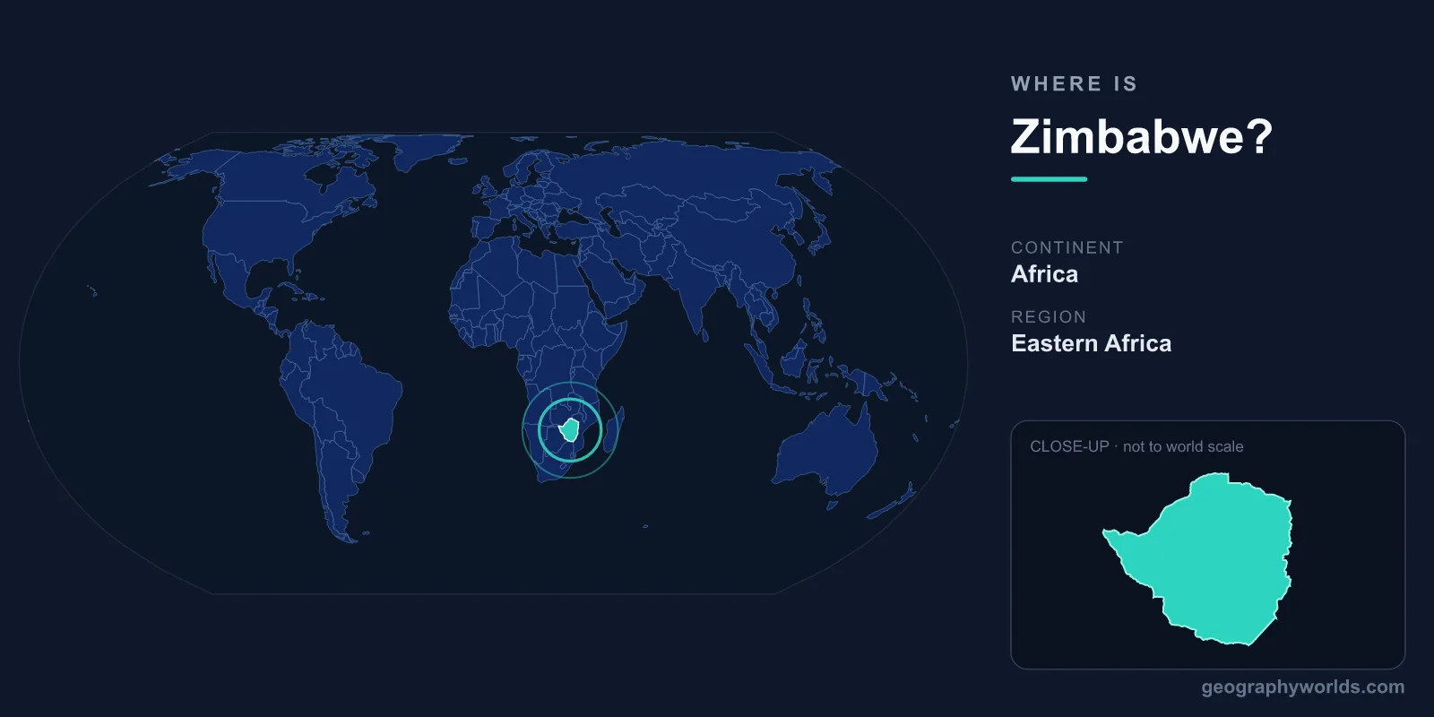
Zimbabwe is a landlocked country in southern Africa, lying just south of the Zambezi River and north of the Limpopo, between roughly 15°S and 22°S latitude and 25°E and 33°E longitude. It sits entirely within the Southern and Eastern Hemispheres, covering 390,757 km² of high plateau and river valley. Its capital, Harare, lies in the country's northeast, and Zimbabwe borders four nations — South Africa, Botswana, Zambia and Mozambique — without touching any ocean.
Where Exactly Is Zimbabwe on the Map?
To find Zimbabwe, look at the southern third of the African continent. It occupies a roughly diamond-shaped block of land between the two great rivers that give it its natural frame: the Zambezi to the north and northwest, and the Limpopo to the south. The country has no coastline, so its position is best understood through its neighbors and rivers rather than any seacoast. On a globe, Zimbabwe sits well below the equator but still inside the tropics, with the Tropic of Capricorn passing just south of its border near the Limpopo.
At 390,757 km², Zimbabwe is comparable in size to Germany or Japan, and slightly larger than the U.S. state of Montana. Most of the country sits on the Highveld, a broad central spine of high ground running northeast to southwest at elevations of 1,200 to 1,600 metres above sea level. This elevated plateau gives Zimbabwe a temperate, pleasant climate despite lying well within the tropics — one reason early settlers and farmers concentrated along this central ridge. To the north, the land falls away toward the Zambezi valley; to the south and southeast, it descends into the hotter, drier Lowveld.
Which Countries Border Zimbabwe?
Zimbabwe shares land borders with four countries, and its landlocked position means trade and travel depend heavily on these neighbors and the transport corridors that cross them to the sea.
- South Africa – to the south, across the Limpopo River, reached via the busy Beitbridge border post, one of the busiest land crossings in Africa.
- Botswana – to the southwest, sharing a long border near the Kalahari fringe and the Plumtree crossing.
- Zambia – to the northwest and north, across the Zambezi River, with the two nations meeting dramatically at Victoria Falls and at Lake Kariba.
- Mozambique – to the east and northeast, providing Zimbabwe's shortest routes to Indian Ocean ports such as Beira.
This four-country frontier places Zimbabwe at a crossroads of southern African trade. Goods moving inland from the ports of Mozambique and South Africa pass through Zimbabwe, and the country is a member of both the Southern African Development Community (SADC) and the African Union. Because it has no port of its own, Zimbabwe relies on the Beira Corridor to the east and rail and road links south to South African ports such as Durban for the bulk of its imports and exports.
Rivers, Highlands and Natural Landmarks
Zimbabwe's most famous geographic feature is Victoria Falls, where the Zambezi River plunges over a basalt cliff more than 100 metres high and over a kilometre wide. Known locally as Mosi-oa-Tunya, "the smoke that thunders," it forms part of the border with Zambia and is one of the Seven Natural Wonders of the World, as well as a UNESCO World Heritage Site.
Downstream, the Zambezi has been dammed to create Lake Kariba, one of the largest artificial lakes on Earth by volume, which supplies hydroelectric power to both Zimbabwe and Zambia. In the east, the Eastern Highlands rise toward Mozambique, peaking at Mount Nyangani (2,592 metres), Zimbabwe's highest point, with cool, misty forests very different from the savanna elsewhere. The terrain elsewhere ranges from the broad Highveld grasslands to the lower, hotter Lowveld of the south, home to wildlife reserves such as Gonarezhou National Park. In the northwest, Hwange National Park — the country's largest — shelters one of Africa's biggest elephant populations.
Climate and the Three Veld Regions
Geographers usually divide Zimbabwe into three altitude zones, each with its own climate and land use:
- Highveld: the central plateau above 1,200 metres, with the mildest temperatures, the best farmland, and most of the major cities, including Harare and Bulawayo.
- Middleveld: the transitional belt between roughly 600 and 1,200 metres, used for mixed farming and grazing.
- Lowveld: the low-lying river basins of the south and southeast below 600 metres, hot and prone to drought, where sugar estates and big-game reserves dominate.
Zimbabwe has a single rainy season, generally from November to March, followed by a long, dry winter. Most rain falls as afternoon thunderstorms, and the country is periodically affected by drought, which has a heavy impact on both farming and hydroelectric output from Lake Kariba.
People, Capital and Time Zone
Harare, the capital and largest city, sits on the northern Highveld and serves as Zimbabwe's political, economic and cultural hub. Bulawayo, in the southwest, is the second-largest city and the gateway to the historic Matabeleland region. The country is home to roughly 16 million people, who speak English, Shona and Ndebele among 16 officially recognized languages. Christianity is the dominant religion, often blended with traditional beliefs.
Zimbabwe runs on Central Africa Time (CAT, UTC+2) year-round, with no daylight saving changes. It is a presidential republic, and after years of monetary turbulence the country has used a mix of currencies; today it relies on the Zimbabwe Gold (ZiG) alongside foreign currencies such as the US dollar in everyday transactions. Just south of Masvingo lie the Great Zimbabwe ruins, the stone city that gave the modern nation its name and stands as one of Africa's most important archaeological sites. If you want to learn more, see our full Zimbabwe country guide.
Key Facts
- Continent: Africa (Southern Africa region)
- Capital: Harare
- Area: 390,757 km² (similar to Germany or Japan)
- Bordering countries: South Africa, Botswana, Zambia, Mozambique
- Coastline: None – Zimbabwe is landlocked
- Highest point: Mount Nyangani, 2,592 m
- Time zone: Central Africa Time (UTC+2), no daylight saving
Frequently Asked Questions
Is Zimbabwe in South Africa or a separate country?
Zimbabwe is its own independent country. It lies in the region called southern Africa and borders the nation of South Africa to its south, but the two are entirely separate states. Zimbabwe gained independence in 1980.
Does Zimbabwe have a coastline?
No. Zimbabwe is landlocked, with no access to the sea. Its nearest ocean ports are in Mozambique, especially Beira, and in South Africa, which it reaches by road and rail corridors across its borders.
What continent is Zimbabwe on?
Zimbabwe is in Africa, specifically in the Southern Africa region, sitting in both the Southern and Eastern Hemispheres between the Zambezi and Limpopo rivers.
What is the capital of Zimbabwe?
The capital is Harare, located on the northern Highveld plateau in the northeast of the country. It is Zimbabwe's largest city and main commercial center.