

Border towns and twin cities are among the most fascinating places in political geography — urban areas that straddle international boundaries, creating communities where residents cross between countries as casually as crossing a street. These towns develop unique hybrid cultures, blended economies, and practical solutions to the challenges of living on the line.
Introduction
From the massive El Paso-Ciudad Juarez metroplex on the US-Mexico border to the quiet cooperation of Scandinavian twin towns, border communities demonstrate that international boundaries are not just lines of separation but also zones of connection where different nations meet, mix, and create something distinctively their own.
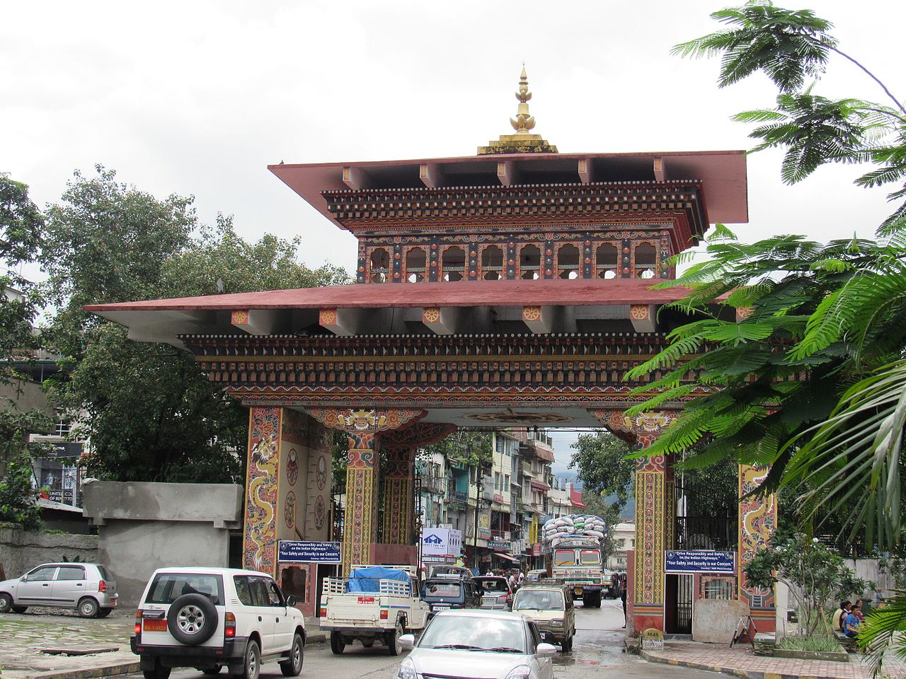
El Paso-Ciudad Juarez: The Largest Border Metroplex
- Combined Population: ~2.7 million people
- Countries: United States and Mexico
- Daily Crossings: ~80,000 people
- Economic Output: ~$100 billion combined GDP
El Paso, Texas, and Ciudad Juarez, Chihuahua, form the largest binational metropolitan area on any international border, with a combined population of approximately 2.7 million people. The two cities share a desert valley along the Rio Grande and function as a single economic unit despite the heavily fortified border that separates them. Approximately 80,000 people cross between the cities daily for work, school, shopping, and family visits.
The relationship between the two cities is deeply asymmetric. El Paso has a median household income roughly four times higher than Ciudad Juarez, driving massive cross-border commerce. Maquiladoras — export-oriented factories — employ over 300,000 workers in Juarez, many producing goods for American companies. Meanwhile, Mexican shoppers cross north to buy American consumer goods, generating billions in retail sales for El Paso businesses.
Haparanda-Tornio: Scandinavian Cooperation
- Combined Population: ~30,000
- Countries: Sweden and Finland
- Language: Swedish, Finnish, and Meankieli spoken
- Unique Feature: Shared IKEA store straddles the border
Haparanda, Sweden, and Tornio, Finland, represent perhaps the most seamlessly integrated twin city in the world. Located at the mouth of the Torne River on the Gulf of Bothnia, these two towns have developed a level of cooperation that makes the international border nearly invisible. They share a bus system, a tourist information center, and even a golf course where you tee off in Finland and putt in Sweden.
The towns cooperate through a joint municipal council called Provincia Bothniensis and have created a shared commercial district called Rajalla — "On the Border" — that includes an IKEA store built deliberately on the boundary line. Residents commonly live in one country and work in the other. The border is complicated by the fact that Finland and Sweden are in different time zones, meaning Tornio is one hour ahead of Haparanda despite being a few hundred meters away.
Gorizia-Nova Gorica: From Division to Unity
- Combined Population: ~70,000
- Countries: Italy and Slovenia
- Divided: 1947 (Treaty of Paris)
- European Capital of Culture: Joint award, 2025
Gorizia in Italy and Nova Gorica in Slovenia were once a single city before the 1947 Treaty of Paris divided them as punishment for Italy's alliance with Nazi Germany. Yugoslavia received the eastern suburbs and rail station, creating a new planned city called Nova Gorica. For decades, a wall and fence separated the two halves, splitting families and neighborhoods.
When Slovenia joined the European Union in 2004 and the Schengen Area in 2007, the barriers came down and the twin city began to reintegrate. In 2025, Gorizia and Nova Gorica were jointly named European Capital of Culture — the first time a cross-border city received the honor. Piazza della Transalpina, once divided by a wall, is now an open square where children from both countries play freely across what was once an Iron Curtain frontier.
Nicosia: The Last Divided Capital
- Population: ~340,000 (both sides combined)
- Countries: Republic of Cyprus and Turkish-controlled Northern Cyprus
- Divided Since: 1974 (Turkish invasion)
- Buffer Zone: UN-patrolled Green Line runs through city center
Nicosia is the world's last divided capital city, split between the Republic of Cyprus in the south and the self-declared Turkish Republic of Northern Cyprus in the north. The division dates to 1974, when Turkey invaded the island following a Greek-backed coup. A UN-patrolled buffer zone called the Green Line runs through the historic city center, cutting through neighborhoods, markets, and even individual buildings.
The Ledra Street crossing, opened in 2008, allows pedestrians to walk between the two sides for the first time since 1974. The contrast is stark: the south is a prosperous EU member state with modern infrastructure, while the north remains internationally unrecognized and economically isolated. Despite decades of negotiation, reunification talks have repeatedly failed, and the border remains a daily reality for Nicosia's 340,000 residents.
Other Remarkable Border Towns
- Baarle-Hertog/Nassau: Belgian-Dutch border runs through houses
- Cieszyn-Cesky Tesin: Poland-Czech Republic, divided in 1920
- Lloydminster: Straddles Alberta-Saskatchewan border in Canada
Baarle-Hertog and Baarle-Nassau, on the Belgian-Dutch border, form what may be the most confusingly divided municipality in the world. Due to medieval land grants, 22 Belgian exclaves are scattered within Dutch territory, and 7 Dutch counter-exclaves sit within those Belgian parcels. The border runs through houses, shops, and restaurants. Residents determine their nationality by their front door's location — leading some to move their front door to the preferred country.
Cieszyn (Poland) and Cesky Tesin (Czech Republic) were divided in 1920 when the newly independent nations of Poland and Czechoslovakia disputed the coal-rich Teschen Silesia region. The Olza River became the border, splitting a community that had existed as a single town for centuries. Since both countries joined the Schengen Area, residents cross freely between the two halves, and joint cultural festivals celebrate the shared heritage that the border could not erase.
Key Facts
- El Paso-Ciudad Juarez is the world's largest border metroplex with ~2.7 million people and 80,000 daily crossings
- Haparanda-Tornio share a bus system, tourist office, and an IKEA deliberately built on the Sweden-Finland border
- Gorizia and Nova Gorica were jointly named European Capital of Culture 2025 — the first cross-border city to receive the honor
- Nicosia remains the world's last divided capital, split by a UN buffer zone since 1974
- Baarle-Hertog/Nassau has 22 Belgian exclaves within Dutch territory, with borders running through individual buildings
Fun Facts
- In Baarle, your nationality can depend on which side of a building your front door faces — some people have moved their doors
- Haparanda and Tornio are in different time zones despite being walking distance apart
- El Paso is consistently rated one of America's safest cities despite being adjacent to one of Mexico's most violent
- The Ledra Street crossing in Nicosia required 34 years of negotiation before pedestrians could cross a 100-meter stretch
Final Thoughts
Border towns and twin cities are laboratories of international cooperation, demonstrating what happens when daily life demands pragmatic solutions to political division. Whether through shared bus systems, joint cultural celebrations, or simply the daily reality of crossing for work and groceries, these communities prove that borders are as much about connection as separation.
Test Your Knowledge!
Think you know the world's borders? Try our interactive geography quiz!
Play Neighbor Quiz →