
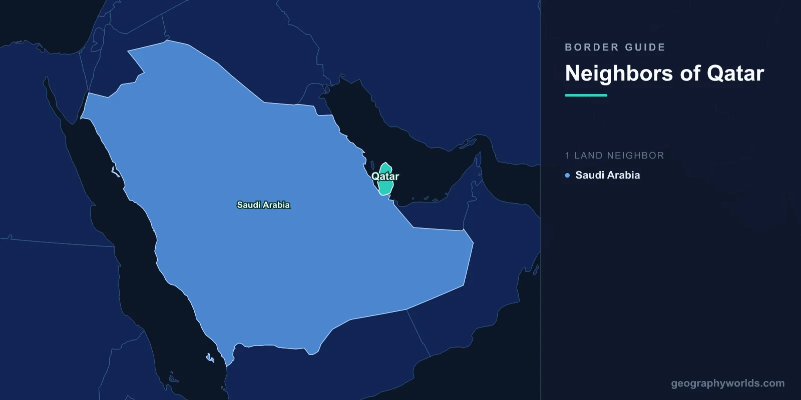
Qatar shares a land border with exactly one country: Saudi Arabia. The frontier runs about 87 kilometres across the base of the Qatari peninsula, from the Gulf of Bahrain in the west to the Khor al-Udaid inlet in the east, and it has a single crossing point at Abu Samra. Everything else is water — roughly 560 kilometres of coastline on the Persian Gulf — and Qatar's maritime neighbours are Bahrain, the United Arab Emirates and, across the median line, Iran.
Eighty-Seven Kilometres of Desert
The land boundary was fixed by agreement between Qatar and Saudi Arabia in 1965 and revised in 2001 after a period of disagreement, including an incident at the Khafus border post in 1992 in which two people were killed.
It crosses flat, gravelly desert with no settlements along it and very little to distinguish one side from the other. At its eastern end it meets Khor al-Udaid, the inland sea where dunes run straight into a shallow tidal lagoon — a landscape distinctive enough to be on Qatar's UNESCO tentative list, and one that nearly separates the southern tip of the peninsula from the mainland.
The eastern terminus also settled an old question about whether Qatar and the United Arab Emirates share a land boundary. They do not: the 1965 and 2001 arrangements gave Saudi Arabia a corridor to the coast at Khor al-Udaid, which means Qatar's only land neighbour is Saudi Arabia and the UAE is separated from it by a strip of Saudi territory.
The Blockade
On 5 June 2017, Saudi Arabia, the United Arab Emirates, Bahrain and Egypt severed relations with Qatar, closed their airspace to Qatari aircraft and shut the land border at Abu Samra. They issued thirteen demands including the closure of Al Jazeera, the downgrading of relations with Iran and the removal of the Turkish military presence.
The effect was immediate and severe because Qatar's supply chain ran through that one crossing. An estimated 40 per cent of the country's food arrived by truck from Saudi Arabia, and construction materials for the 2022 World Cup programme came the same way.
Within days supermarket shelves in Doha emptied and were refilled by airlifts from Turkey and Iran. Qatar rerouted shipping through Omani ports at Sohar and Salalah, opened new air corridors over Iranian airspace, and accelerated the completion of Hamad Port.
Four Thousand Cows
The most-repeated detail of the blockade is also the most illustrative. Qatar had relied on Saudi dairy imports, so a Qatari businessman arranged to fly in Holstein dairy cattle — several thousand of them, in batches, on Qatar Airways freighters from Europe and the United States.
The animals were installed in air-conditioned barns in the desert north of Doha, and within a couple of years the operation was supplying the domestic market and exporting. Qatari food self-sufficiency in dairy and poultry rose sharply over the blockade period.
It became the emblem of the whole episode: a country with 87 kilometres of land border and enormous gas revenues deciding that the answer to being cut off was to buy its way around the problem.
The Canal That Was Not Dug
In 2018, Saudi media reported plans for the Salwa Canal — a waterway roughly 60 kilometres long and 200 metres wide to be cut along the border, turning Qatar into an island. Proposals circulating at the time included a nuclear waste facility and a military base on the Saudi side of the cut.
Bids were reportedly sought and the project was discussed publicly by Saudi commentators. Nothing was built. Whether it was ever a serious engineering proposition or an instrument of pressure, it remains the only case in modern times of a state publicly contemplating the physical severing of a neighbour from a continent.
Al-Ula, and the Reopening
The blockade ended at the Gulf Cooperation Council summit at Al-Ula in January 2021, with a declaration restoring relations and reopening borders and airspace. None of the thirteen demands had been met.
The consensus assessment is that the blockade failed on its own terms and accelerated exactly what it was meant to prevent: closer Qatari relations with Iran and Turkey, greater self-sufficiency, and a diversified logistics network that no longer depends on a single land crossing.
Abu Samra reopened and traffic resumed, but the strategic lesson in Doha was permanent. Qatar has continued to invest in port capacity and domestic food production on the assumption that the land border is a convenience rather than a necessity.
Hawar, and a Dispute Settled at The Hague
Qatar's most consequential territorial dispute was not with Saudi Arabia but with Bahrain, over the Hawar Islands close to the Qatari coast, the shoals at Fasht ad Dibal and Qit'at Jaradah, and the ruined town of Zubarah on the Qatari mainland.
The disagreement was more than a century old, produced a naval standoff in 1986 when Bahrain built a coastguard station on a shoal, and was referred to the International Court of Justice. The judgment in March 2001 awarded the Hawar Islands to Bahrain and Zubarah to Qatar, and divided the remaining features.
Both states accepted the ruling promptly. Relations improved sufficiently that the two discussed a causeway between them, and Zubarah was inscribed as a UNESCO World Heritage site in 2013. It is one of the cleanest examples anywhere of a long-running Gulf dispute settled by a court and implemented without complaint.
The Gas Field Under the Median Line
Qatar's most valuable asset sits across a maritime boundary. The North Field, off the north-east coast, is the largest single non-associated natural gas field in the world, and it continues across the median line with Iran, where it is called South Pars.
The two countries have never agreed a unitisation arrangement of the kind normally used for straddling reservoirs, and have simply produced from their own sides. That geological fact is the underlying reason Qatar has maintained working relations with Iran throughout every regional crisis, including at the height of the blockade, when Iranian airspace and Iranian food imports kept the country supplied.
It also explains Qatar's outsized diplomatic role. A state of under three million people with the third-largest gas reserves on earth, sharing its principal field with Iran and hosting the largest American airbase in the region at Al Udeid, has both the means and the motive to talk to everyone.
Borders Drawn by Oil Concessions
Much of the Gulf's political map was drawn by geologists rather than diplomats. Before oil, the relationship between a ruler and the tribes of the interior was one of allegiance rather than territory, and asking where a boundary lay would have been close to meaningless in the desert behind the coastal towns.
Oil concessions required definite areas, because a company needed to know whose signature bound which ground. British officials in the 1930s therefore set about converting webs of allegiance into lines, interviewing rulers about which tribes paid them zakat and where those tribes watered their camels, and drawing boundaries accordingly.
Qatar's frontier with Saudi Arabia is a product of that process, as are most of the peninsula's other land borders, which is why so many of them remained unsettled into the 1960s and beyond and why several were only demarcated in the 1990s and 2000s. It also explains why disputes in this region so often centre on sparsely inhabited ground: the land was not worth defining until something valuable was found beneath it.
The Border at the Airport
For most people entering Qatar, the operative frontier is Hamad International rather than Abu Samra. The country's population is overwhelmingly foreign — construction, services and domestic work are performed almost entirely by migrants from South Asia, the Philippines and Africa — and entry, residence and departure have been governed by the sponsorship system known as kafala.
Under kafala an employer controlled a worker's visa, and historically their ability to change jobs or leave the country. Scrutiny during the preparation for the 2022 World Cup produced substantial reforms: exit permits were largely abolished, a minimum wage introduced, and job changes permitted without employer consent, with the International Labour Organization opening an office in Doha.
Implementation has been uneven and enforcement is the recurring criticism. But it demonstrates where the real border control lies in a Gulf state: not at the desert crossing, which handles trucks, but in the legal status attached to the nine in ten residents who arrived by air.
A Peninsula, Not an Island
Qatar's geography is often described as though it were an island, and functionally it sometimes behaves like one. But it is a peninsula roughly 160 kilometres long, joined to the Arabian mainland along that 87-kilometre line, and the connection matters.
Before gas, the peninsula was among the poorest places in the Gulf, its economy built on pearling until the Japanese cultured pearl destroyed that trade in the 1930s. Population was tiny and concentrated on the coast, and the interior was crossed by Bedouin whose movements paid no attention to any boundary.
Today roughly nine in ten residents are foreign nationals, and the population has multiplied many times over within living memory. A country whose citizens are a small minority of its own population has an unusual relationship with the idea of a border: the frontier that matters most is the one at the airport. Qatar in wider terms is our Qatar country guide, and our Middle East countries guide sets it beside its Gulf neighbours.
