
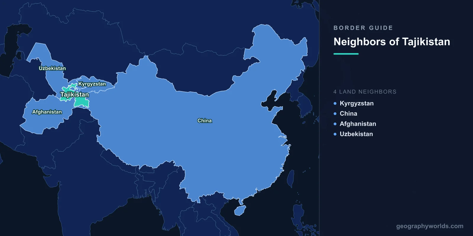
Tajikistan shares land borders with four countries: Kyrgyzstan to the north, China to the east, Afghanistan to the south, and Uzbekistan to the west and north-west. It is landlocked, it is the most mountainous state in the former Soviet Union with over nine-tenths of its territory in highlands, and until very recently roughly half of one of those four borders had never been agreed.
Borders Drawn Inside a Union That No Longer Exists
Central Asia's frontiers were created in the 1920s and 1930s by Soviet national delimitation, which carved the region into republics on the basis of nationality as understood by Soviet ethnographers and, frequently, by the requirements of irrigation and cotton administration.
These were internal administrative lines within a single state, and they were adjusted repeatedly — land was transferred between republics by decree, sometimes leased rather than ceded, and the paperwork was inconsistent. When the Soviet Union dissolved in 1991, those lines became international boundaries overnight.
Nowhere is the result messier than the Fergana valley, the fertile, densely populated basin divided between Uzbekistan, Kyrgyzstan and Tajikistan. Roads cross and recross frontiers, irrigation canals begin in one country and serve another, and several pieces of territory sit entirely inside a neighbour.
Vorukh
Vorukh is a Tajik enclave of roughly 130 square kilometres and some 30,000 people, entirely surrounded by Kyrgyz territory in the Batken region. It is Tajikistan's largest exclave, and reaching it from Tajikistan proper means crossing Kyrgyz land.
The disputes around it concern water and roads rather than nationalism. The Isfara river irrigates farmland on both sides, and a head works structure controlling its distribution has been the flashpoint for repeated violence. So has road access: Kyrgyzstan building a bypass road around Vorukh, or Tajikistan building one to it, has each been read by the other side as an attempt to change facts on the ground.
Clashes involving villagers throwing stones escalated over the years into exchanges of gunfire, and then into something considerably worse.
Two Wars in Two Years
In April 2021, a dispute over the installation of surveillance cameras at a water intake near Vorukh escalated within hours into fighting involving mortars and armoured vehicles between the two countries' border forces. Around 55 people were killed, most of them Kyrgyz, and tens of thousands were evacuated.
In September 2022 it happened again, on a larger scale. Fighting spread along a wide section of the frontier, involving artillery, rockets and drones, and struck the town of Batken itself. Something close to a hundred people were killed on each side and well over a hundred thousand were displaced.
These were not skirmishes between irregulars. They were engagements between the armed forces of two states, both members of Russian-led security structures, fought over an undelimited border.
The Line Gets Drawn
After the 2022 war the two governments negotiated seriously. Of roughly 970 kilometres of shared frontier, several hundred kilometres had remained undescribed since 1991, and working groups went section by section through Soviet-era maps from different decades that did not agree with each other.
Agreement on the full length was reached and signed in 2025, accompanied by land swaps, arrangements for shared water infrastructure and provisions on road access to the enclaves. Crossings that had been shut for years reopened.
It is a genuinely significant outcome: one of the most dangerous undelimited borders in Asia was settled by negotiation rather than by either side prevailing. Implementation — moving households, exchanging plots, rebuilding damaged villages — is the part still to be done.
Afghanistan, and 1,300 Kilometres of River
The southern border with Afghanistan is the longest of the four, running roughly 1,350 kilometres along the Panj river and then the upper Amu Darya. It was fixed by Anglo-Russian agreement in the 1890s as the limit between the Russian and British spheres — the same settlement that created Afghanistan's Wakhan Corridor, a finger of Afghan territory deliberately inserted to keep the two empires from touching.
Tajiks are Afghanistan's second-largest ethnic group, and the population on both banks of the Panj is largely the same, speaking closely related varieties of Persian. In many places the river is narrow enough to shout across.
The border is the principal northern route for Afghan opiates moving toward Russia and Europe, and interdiction along it has been a focus of international assistance for two decades with limited measurable effect. Russia maintains its largest foreign military base at Dushanbe and has historically helped guard this frontier.
After Kabul Fell
When the Taliban took Kabul in August 2021, Tajikistan adopted the most hostile posture of any neighbouring state. It refused to recognise the new government, called for Tajik representation in it, granted asylum to figures from the previous administration, and awarded a state honour to the leader of the National Resistance Front.
The border was reinforced, and the alignment has held since, making Dushanbe the outlier among Afghanistan's neighbours, most of which have reached some working accommodation. The practical effects have included restricted trade and periodic closures on a frontier that matters considerably to communities on both sides.
Uzbekistan: From Minefields to Reopening
Relations with Uzbekistan were frozen for two decades. After incursions by the Islamic Movement of Uzbekistan in 1999 and 2000, Uzbekistan mined sections of the border, killing and maiming substantial numbers of civilians over subsequent years, and imposed visa requirements on a population with dense cross-border family ties.
The deeper dispute was water. Tajikistan's Rogun dam on the Vakhsh, intended to be among the tallest in the world and to resolve the country's chronic winter electricity shortages, was seen by Uzbekistan as a threat to the irrigation water its cotton economy depends on downstream. Islam Karimov warned publicly that water disputes could lead to war.
The position changed after Karimov's death in 2016. Shavkat Mirziyoyev normalised relations quickly: flights resumed, visas were eased, crossings reopened, demining began, and Uzbekistan dropped its objection to Rogun, which is under construction.
The Pamirs, and a Piece of Land Given to China
The eastern border with China runs through the Pamirs at altitudes above 4,000 metres, some of the least accessible terrain on earth. China had long claimed a much larger area — around 28,000 square kilometres — on the basis of Qing-era boundaries.
In 2011 the Tajik parliament ratified an agreement ceding roughly 1,000 square kilometres, about 3.5 per cent of the claimed area, in exchange for China relinquishing the rest. The government presented it as a diplomatic victory; opposition figures called it a capitulation.
The only crossing, the Kulma Pass, links the Pamir Highway to the Karakoram Highway and is open seasonally. Chinese investment has since become central to the Tajik economy, and Chinese security personnel have reportedly operated near the Afghan frontier in the Pamirs.
Gorno-Badakhshan, an Internal Frontier
The Pamir region, Gorno-Badakhshan, covers nearly half of Tajikistan's territory with a small fraction of its population. Its people are largely Ismaili Muslims speaking Pamiri languages distinct from Tajik, and the region has an autonomous status that has been progressively hollowed out.
It was a stronghold of the opposition during the Tajik civil war of 1992 to 1997, and relations with Dushanbe have remained tense, with security operations in 2012, 2018 and a substantial crackdown in 2022 following protests. The Aga Khan's development network has been a major provider of services there, including the road and bridge links across the Panj to Afghanistan.
Labour That Leaves and Money That Returns
The border that matters most to Tajik households is not one of the four on the map but the route to Russia. Something approaching a million Tajik citizens work there in a typical year, in construction, transport and services, and remittances have at times exceeded a third of national income — among the highest ratios anywhere in the world.
That dependence makes Tajikistan acutely exposed to conditions it cannot influence: Russian economic downturns, rouble depreciation, and periodic tightening of migration rules have each transmitted directly into Tajik villages. Restrictions and hostility toward Central Asian migrants intensified sharply after the attack on a Moscow concert hall in March 2024 that Russian authorities attributed to Tajik nationals.
It also shapes the country's foreign policy. A state whose principal export is labour to one country, whose principal investor is another, and whose southern border faces a third that it refuses to recognise has narrow room for manoeuvre, and Dushanbe's careful balancing between Moscow and Beijing reflects that.
Four Borders, All of Them Mountains
Tajikistan's position is defined by altitude. Almost every route in or out crosses a high pass, the country is cut in two by ranges that close in winter, and the tunnels and roads linking Dushanbe to the north and east have been built largely with Chinese and Iranian money.
That is why the borders matter so much: a landlocked, mountainous country whose internal connections are worse than its external ones depends on its neighbours not merely for trade but for the ability to move between its own regions. There is more in our Tajikistan country guide; our guide to the Central Asian states sets it beside its neighbours, and the geography of the Silk Road covers the routes its passes once carried.
