

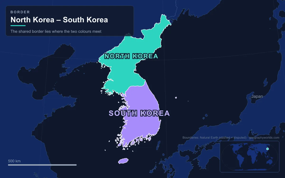
In the Joint Security Area at Panmunjom, a low concrete strip about 20 cm wide separates two countries that have never signed a peace treaty. That strip is part of the Military Demarcation Line, the centre of the Korean Demilitarized Zone (DMZ): a buffer 250 km (160 miles) long and about 4 km wide that crosses the Korean Peninsula from the Han River estuary on the Yellow Sea to the coast near Goseong on the Sea of Japan (East Sea). It was created by the Korean Armistice Agreement of 27 July 1953, when each army pulled back 2,000 m from the front line, and it has been the de facto border between North and South Korea ever since. The DMZ crosses the 38th parallel at an angle, so its western end lies south of the parallel and its eastern end north of it. Despite its name, the land on either side is among the most heavily militarised on earth. Almost nobody crosses it, which is why the few places where people once did, or still try to, tell its story best.
The Han River Estuary, a Crossing That Never Opened
At its western end the DMZ becomes water. The whole estuary of the Han River, where it meets the Imjin and flows into the Yellow Sea, is a "Neutral Zone" closed to civilian vessels. The 1953 armistice actually provided for civil shipping here, which would have given Seoul a direct route to the sea, but the two Koreas and the United Nations Command never made it work. For decades Seoul was effectively cut off from the ocean, until South Korea opened the Ara Canal in 2012, too narrow for anything larger than tourist and leisure boats. On 30 January 2019 military officers from both sides signed an agreement to open the estuary to civilian boats for the first time. It was due to start that April, but after the failed Hanoi summit between Donald Trump and Kim Jong Un in February 2019 it was postponed indefinitely.
Imjingak and the Freedom Bridge
The nearest most visitors get to the border without a military escort is Imjingak, a park on the Imjin River outside Paju. It was built in 1972 to console people on both sides who cannot return to their hometowns and gets roughly 1.2 million visitors a year. Its centrepiece is the Freedom Bridge, a former railway bridge over which repatriated prisoners of war returned south after the armistice. Until 1998 it was, apart from the army-controlled Liberty Bridge, the only way from South Korea onto the DMZ and the only direct link to Panmunjom.
North of Imjingak begins the Civilian Control Zone, a band 5 to 20 km deep in front of the DMZ's southern edge, created on the orders of the US Eighth Army in February 1954. Civilians enter it only with permission, and armed soldiers usually ride on tour buses. Most photographs of the "DMZ fence" are really of this outer Civilian Control Line fence; the fence on the DMZ's own southern boundary is off limits to everyone except soldiers, and photographing it is illegal.

Dorasan Station on the Gyeongui Line
The railway that crosses the Imjin continues to Dorasan, a station just 650 m from the DMZ's southern boundary. It lies on the old Gyeongui Line, which ran from Seoul to Pyongyang and on to Sinuiju before the division; the North calls its half the P'yŏngbu Line. Presidents Kim Dae-jung and George W. Bush opened the station on 11 April 2002. The first passenger test train ran from Dorasan to Kaesong on 17 May 2007, and from 11 December 2007 a freight train made a 16 km run across the border every weekday, carrying materials to the Kaesong Industrial Region and bringing finished goods back.
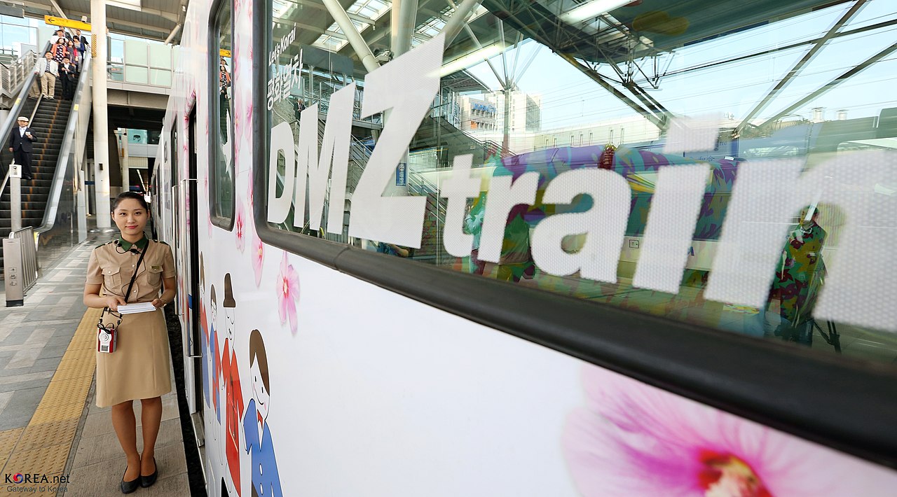
North Korea closed the crossing on 1 December 2008. It reopened and shut repeatedly after that, and in 2024 North Korea blew up the tracks just north of the demarcation line. Dorasan is now a terminus facing a dead end, and even Korail's tourist trains stopped calling in 2019 for lack of passengers. On 24 April 2026 Korail restored service with the "DMZ Peace Link", a tour train that runs from Seoul Station to Dorasan every other Friday.
The Third Tunnel South of Panmunjom
Not every crossing was meant to be seen. Since 15 November 1974, South Korea has found four tunnels dug under the DMZ from the North. The first, spotted when a patrol saw steam rising from the ground, reached more than 1 km past the demarcation line; days later a North Korean explosive device inside it killed a US Navy commander and a South Korean Marine major. The second was found on 19 March 1975, and the fourth on 3 March 1990 near Haean in the old Punchbowl battlefield, 145 m below ground.
The third, found in October 1978 after a tip from a defector, is the one visitors see. It runs south from near Panmunjom, is 1,635 m long, about 2 m high and wide, and lies about 73 m deep, cut through granite. Tunnellers had advanced 435 m under the southern half of the DMZ, and South Korea says it could have moved 30,000 soldiers an hour towards Seoul, only 44 km away. North Korea first denied building it, then called it a coal mine and painted some walls black, but no coal has been found in the granite. Visitors reach it down a sloping access shaft.
Panmunjom and the Joint Security Area
Panmunjom was a hamlet of fewer than ten huts on the Kaesong–Seoul road, 53 km north-northwest of Seoul and 10 km east of Kaesong, where the armistice was signed. The Joint Security Area nearby is the one place where the two sides stand face to face. The blue conference huts straddle the demarcation line, which runs down the middle of the tables inside, between South Korea's Freedom House and North Korea's Panmungak. Military talks between North Korea and the United Nations Command were held here until March 1991, and the two Koreas still use it for diplomatic meetings.
The JSA has seen most of the border's crossings, both official and desperate. On 23 November 1984 Vasily Matuzok, a Soviet citizen on an official tour from the northern side, ran across the line to defect; in the firefight that followed, one South Korean and three North Korean soldiers were killed. In November 2017 a North Korean soldier, Oh Chong-song, drove to the line, ran across, and was shot several times by his own side; he survived. On 27 April 2018 Kim Jong Un stepped south here to meet President Moon Jae-in and sign the Panmunjom Declaration, and on 30 June 2019 Donald Trump became the first sitting US president to set foot in North Korea. On 18 July 2023 a US Army private, Travis King, left a tour group and ran north; he was handed back on 27 September 2023. The peninsula's split, and why this spot became its hinge, is covered in our guide to the historical geography of Korea's division.
The Bridge of No Return
Inside the JSA, a small bridge over a stream carries the demarcation line across its middle. After the armistice, prisoners of war brought here were told they could stay in the country that held them or cross, and that once across they could never come back, which gave it the name the Bridge of No Return. Its most famous later crossing came on 23 December 1968, when Commander Lloyd Bucher and 81 crewmen of the USS Pueblo, captured by North Korea on 23 January that year, were released and walked south across it.
The bridge's use ended with the axe murder incident of August 1976, when North Korean soldiers killed two US officers, Captain Arthur Bonifas and First Lieutenant Mark Barrett, during an argument over trimming a tree. The United Nations Command then insisted the line inside the JSA be marked and enforced. Within 72 hours North Korea built a new crossing on its own side, still called the "72-Hour Bridge", and the old bridge fell out of use.
Kaesong and the Road North
Beyond Panmunjom the road and railway run 10 km to Kaesong, where for twelve years the border was crossed every working day. The Kaesong Industrial Region opened in 2004 as a joint project: South Korean firms employed North Korean workers, and by April 2013 there were 123 companies with about 53,000 North Korean staff. North Korea withdrew its workers during a crisis in April 2013; the two sides agreed in August 2013 to reopen the park, and the South finally closed it on 10 February 2016. A joint liaison office opened in a Kaesong building after the 2018 summit, as a de facto embassy. North Korea demolished it on 16 June 2020. On 15 October 2024 it also blew up the inter-Korean road, which South Korea had helped build with about $125 million.
Goseong and the Road to Mount Kumgang
The last crossing is at the eastern end, near the coast in Goseong County. The armistice line reversed the old division here: Goseong lies north of the 38th parallel and was part of North Korea before 1953, while Kaesong, south of the parallel, went the other way. From 1998 South Koreans could visit Mount Kumgang (Diamond Mountain) in the North, at first by cruise ship and later by bus on a road built through the DMZ. On 17 May 2007 the first train crossed on the new Donghae Bukbu Line beside that road. More than a million South Koreans made the trip before July 2008, when a 53-year-old tourist, Park Wang-ja, was shot dead after entering what North Korea said was a military area. The South suspended the tours, and in January 2024 North Korea said it would close the resort's administration altogether.
Between Goseong and the Han estuary, the land nobody crosses has become a refuge. More than 6,000 species of plants and animals live in the zone, including over 100 of the 267 endangered animal species found in Korea, among them the red-crowned crane, the white-naped crane, the critically endangered Korean fox and the Asiatic black bear. For how the zone fits into the mountains and rivers of the northern half of the peninsula, read our guide to North Korea's geography.