

From Lough Foyle in the north-west to Carlingford Lough in the east, the 499-kilometre Irish border separates Northern Ireland, part of the United Kingdom, from the Republic of Ireland. Somewhere between 270 and 300 roads cross it, some of them more than once. Since Brexit it has also been a frontier between the European Union and a non-member state, yet you can drive across it without stopping: people have moved freely since 1923 and goods since 1993, and the Brexit withdrawal agreement commits all sides to keeping it open. It matters because it is the line where partition, the Troubles and Brexit all met, and on the ground it is almost invisible.
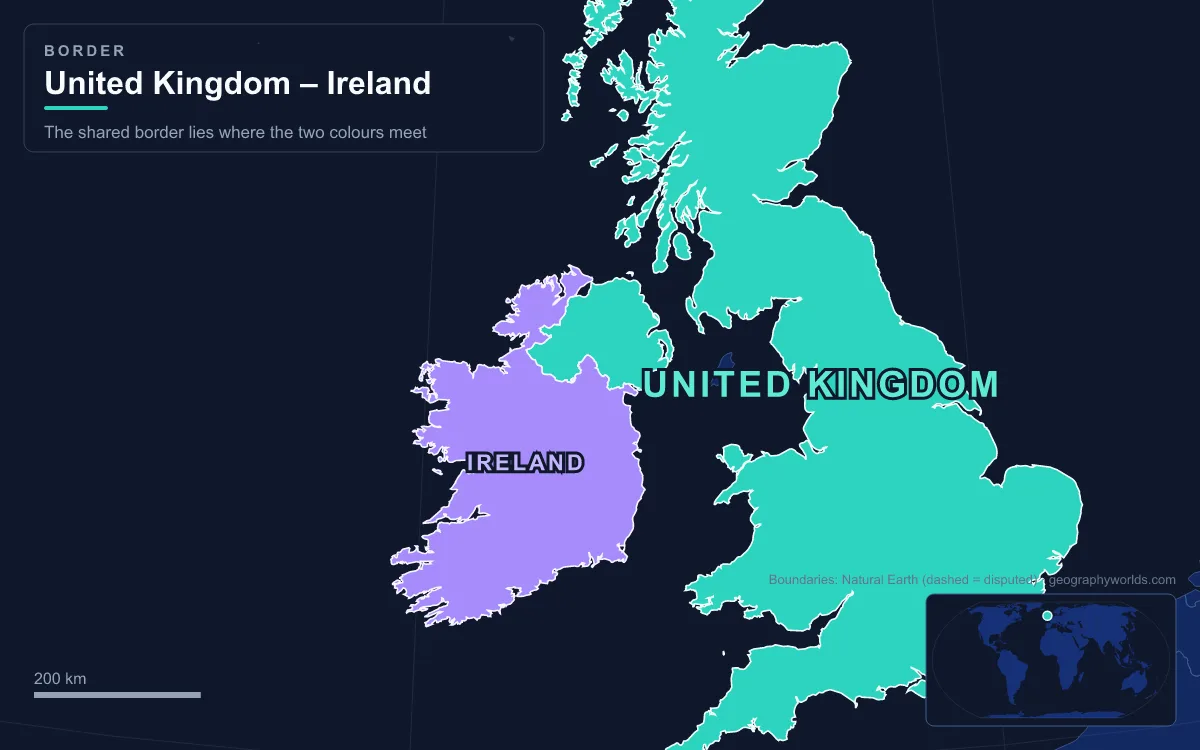
Nobody sat down to design the line. The Government of Ireland Act 1920 defined Northern Ireland as the parliamentary counties of Antrim, Armagh, Down, Fermanagh, Londonderry and Tyrone, so the border simply follows the old county boundaries, most of them set in the 17th century. When the Irish Free State was established on 6 December 1922, Northern Ireland opted out the following day, and the county line became an international frontier. A Boundary Commission sat in 1924–25 to adjust it to “the wishes of the inhabitants”. When its proposals leaked, the three governments shelved them and in December 1925 confirmed the 1920 line unchanged. Because it is inherited rather than surveyed, the border is about four times as long as the straight-line distance between its two sea loughs. Following it from end to end means following those county edges.
Lough Foyle, Muff and the Edge of Derry
The border starts in the water. Lough Foyle divides County Donegal from County Londonderry, and even that division is contested. In 1923 a Free State court held that the Free State’s waters ran right up to the Londonderry shore, and Northern Ireland’s government disagreed. The argument over fishing rights was eventually managed in 1952 by a Foyle Fisheries Commission run jointly from Dublin and Belfast. It shared out the fish without settling who owned the water.
On land, the first place on the line is Muff, a Donegal village near where the River Foyle enters the lough, with the Northern Irish village of Culmore just to its south. Derry is only a few kilometres away. With 85,279 people at the 2021 census it is Northern Ireland’s second-largest city, and it sits so close to the frontier that its natural hinterland is Donegal. During the Troubles that closeness meant a heavy security presence and slow traffic on every road between the city and the county. The N13/A2 between Letterkenny and Derry was listed in 2007 as one of the three busiest crossings on the border.
Lifford Bridge, Where the Finn and Mourne Become the Foyle
South of Derry the border follows the River Foyle upstream to the point where it is formed. At Strabane the River Mourne meets the Finn, and the Foyle begins. Strabane, a County Tyrone town of 13,507 people in 2021, stands on the east bank. Across Lifford Bridge is Lifford, the county town of Donegal, where the county council sits, although many people assume Letterkenny is the county town. The N15/A38 crossing here was the third road on that 2007 list of the busiest border crossings.

Pettigo and Belleek on the Termon and the Erne
From Strabane the line turns south-west through the Tyrone and Donegal hills towards Lough Erne. At Pettigo the Termon River runs straight through the village and forms the border. Most of the village, including Main Street and the Diamond at its centre, is in Donegal. The small part on the Fermanagh side is officially called Tullyhommon but known locally as “High Street” because it looks down on the rest of the village from the hillside.
A little further west is Belleek, where the River Erne leaves Fermanagh for the Atlantic. Most of the village is in County Fermanagh, but part of it lies across the Erne in Donegal. With 904 residents in 2011, it is the most westerly settlement in Northern Ireland, which makes it the most westerly in the United Kingdom. The pottery that made its name has produced its thin Parian ware here since 1863, and the present company began trading as the Belleek Pottery Works Company in 1884. West of Belleek, Donegal hangs on to the rest of the Republic by a strip of land only about 9 kilometres wide. That is why some journeys from Donegal to other parts of the Republic are easier through Northern Ireland.
Belcoo, Blacklion and Cuilcagh Mountain
The border now swings south, and for the first time it follows real high ground. Only in the highlands between Cavan and Fermanagh can the border be said to follow anything that actually gets in the way of travel. The villages of Belcoo, in Fermanagh, and Blacklion, in Cavan, face each other across the line beside Lough MacNean, with Blacklion on the N16 road to Sligo. Belcoo and neighbouring Holywell had 439 people in 2021. Since 2003 the Lough MacNean Tourism Initiative has promoted the area around the lough and cross-border links between the two villages.

To the south-east rises Cuilcagh, a 666-metre ridge of sandstone and bog. It is the highest point in both Fermanagh and Cavan, and the only county top in Ireland shared across the border. Its two slopes drain in opposite directions. On the northern, Fermanagh side, streams sink into limestone and join underground to form the Marble Arch Caves. On the southern side, water runs underground until it rises at the Shannon Pot in Cavan, the traditional source of Ireland’s longest river.
Around Fermanagh to Clones and the N54
East of Cuilcagh the border becomes a maze. It wraps around County Fermanagh on three sides, and its only two short stretches along the historic Ulster provincial boundary are Fermanagh–Leitrim here and Armagh–Louth far to the east. Around Upper Lough Erne and into Monaghan, roads cross the line again and again. The N54/A3 crosses it four times within 10 kilometres. Before the railway closed in 1957, the line between Clones and Cavan crossed the border six times in 13 kilometres, and in the early years trains faced a customs check at each crossing.
Clones shows what partition did to a border market town. Partition cut it off from much of its hinterland in Fermanagh, and the damage lasted for decades: it had 1,885 residents at the 2022 census and is still part of a region the Irish government has marked out for development because of its below-average economy. From here the line heads north-east along the Tyrone–Monaghan boundary, then turns south into Armagh.
South Armagh, Newry and the N1 at Dundalk
This is the stretch most closely associated with the Troubles. From the early 1970s to the late 1990s the British Army tried to seal the border, cratering or blocking many small roads and blowing up bridges on what were officially called “unapproved roads”. South Armagh in particular was dominated by Army surveillance posts. The effort never worked, because there were simply too many lanes. Margaret Thatcher admitted there was “no way we can patrol the 500 miles”. The last military controls were removed by about 2005, in step with the 1998 Good Friday Agreement.
Today the main road through here is the N1/A1, the Dublin–Belfast route, the first of the three busiest crossings named in 2007. Newry, a city of 27,913 people on the Clanrye River, lies about 55 kilometres from Belfast and 108 from Dublin. Dundalk, the county town of Louth, with 43,112 people in 2022, is 7 kilometres south of the line. Traffic figures show how ordinary crossing has become. Each month about 177,000 lorries, 208,000 vans and 1.85 million cars cross the border, and around 30,000 people commute across it every day.
That traffic is why Brexit caused so much trouble here. After the 23 June 2016 referendum, all sides said they wanted no hard border. The Northern Ireland Protocol agreed in October 2019 kept Northern Ireland aligned with the EU single market for goods, which moved most checks to the ports. The Windsor Framework later adjusted how that works without changing the principle. As a result, the trade frontier in practice runs down the Irish Sea, which unionists describe as an “Irish Sea border”, while the land line stays open.
Carlingford Lough and the Unsettled Water Line
The border ends as it began, in a sea lough whose ownership has never been formally settled. Carlingford Lough is a glacial fjord with County Down and the Mourne Mountains on its northern shore and County Louth and the Cooley Mountains on its southern shore. The Newry River enters it just past Narrow Water Castle, a 16th-century tower house near Warrenpoint. As recently as 2005 a British minister listed both Carlingford Lough and Lough Foyle as areas where the boundary with Ireland is politically disputed, while describing the dispute as “quiescent”. Since the Good Friday Agreement, both loughs have been managed by a joint cross-border body, the Foyle, Carlingford and Irish Lights Commission.
The Troubles left other divisions too, and some of them are more solid than anything on this frontier. The walls inside Belfast and Derry are covered in our guide to peace lines and separation walls. The counties the border cuts through are mapped in Northern Ireland’s geography, and the one land neighbour this border gives the Republic is covered in our look at the countries that border Ireland.