
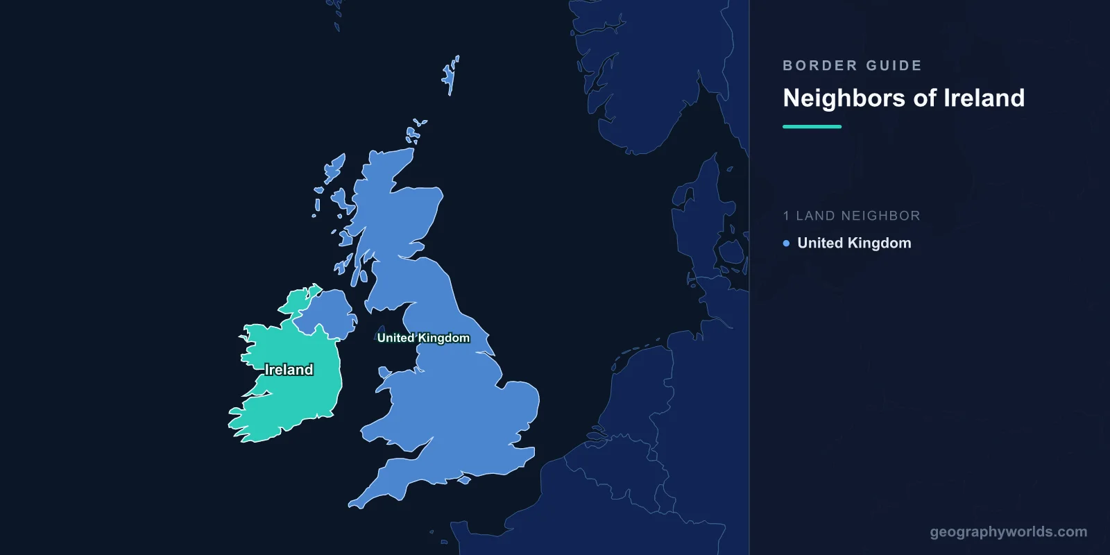
Ireland has one land neighbour: the United Kingdom, by way of Northern Ireland. The two states meet along 499 kilometres of hedgerow, river and hill road, from the shore of Lough Foyle in County Donegal to Carlingford Lough in County Louth. There is no third option and no disputed second frontier — everything else around the Republic is Atlantic, Celtic Sea or Irish Sea. Within the European Union, that puts Ireland in a very small club of members with a single land border, and an even smaller one whose only neighbour sits outside the bloc. Poland, at the EU's eastern edge, manages seven neighbours; Ireland manages one, and has spent a hundred years arguing about it.
A Line Drawn by Act of Parliament, Not by Survey
The boundary did not emerge from a war, a river or a mountain range. It came from the Government of Ireland Act 1920, a Westminster statute that created two devolved parliaments on the island and defined Northern Ireland as six named counties: Antrim, Armagh, Down, Fermanagh, Londonderry and Tyrone. Partition took legal effect on 3 May 1921.
Six counties, not the nine of historic Ulster. Donegal, Cavan and Monaghan were left out for a reason that had nothing to do with geography and everything to do with electoral arithmetic — a nine-county unit would have produced a unionist majority somewhere near 56 per cent, which unionist leaders considered too narrow to defend over time. Six counties gave them roughly two-thirds.
Because those county boundaries already existed, nobody surveyed the new frontier. It simply adopted lines fixed during the Plantation of Ulster in the early 1600s, which had themselves followed parishes, townlands, streams and drainage ditches. That is why the border behaves so strangely on the ground: it dog-legs around individual fields, cuts through farmyards, crosses the same stream repeatedly, and in a handful of cases passes through buildings. It was never engineered to be an international boundary and it shows.
The Commission That Was Supposed to Redraw It
Almost nobody expected the 1920 line to be permanent. Article 12 of the Anglo-Irish Treaty, signed on 6 December 1921, provided for a Boundary Commission to fix the frontier "in accordance with the wishes of the inhabitants, so far as may be compatible with economic and geographic conditions". Michael Collins argued in the Dáil that nationalist-majority areas — south Armagh, south Down, Fermanagh, Tyrone, the city of Derry — would inevitably transfer south, leaving a rump Northern Ireland too small to survive. That expectation carried the Treaty through a bitterly divided parliament.
The Commission finally convened in 1924 under Richard Feetham, a South African judge, with Eoin MacNeill representing the Free State and J. R. Fisher appointed for Northern Ireland after the Belfast government refused to nominate anyone. Feetham read "economic and geographic conditions" narrowly and concluded that the Commission could adjust the line, not relocate it.
On 7 November 1925 the Morning Post in London published a leak of the draft findings. They proposed only marginal changes — and, humiliatingly for Dublin, included a transfer of part of east Donegal into Northern Ireland. MacNeill resigned on 20 November. On 3 December 1925 the three governments signed an agreement shelving the report entirely and confirming the existing boundary, in exchange for the Free State being released from a share of the imperial debt. The report itself stayed unpublished until 1969. The border that was designed as a provisional administrative line has now outlasted almost every European frontier drawn in the same decade.
Roads That Cross the Frontier Four Times in Ten Minutes
Five counties of the Republic touch the border, and the way they interlock with the north produces some of Europe's least rational cartography.
| Republic county | Faces | Border quirk worth knowing |
|---|---|---|
| Donegal | Londonderry, Tyrone, Fermanagh | Connected to the rest of the Republic by a narrow neck through Leitrim; Lough Foyle's jurisdiction is still unsettled |
| Leitrim | Fermanagh | Shortest border stretch of the five counties, barely a few kilometres |
| Cavan | Fermanagh | Blacklion faces Belcoo across a bridge — two villages, one street, two states |
| Monaghan | Fermanagh, Tyrone, Armagh | The Drummully salient hangs into Fermanagh, attached to Monaghan by a thread of land |
| Louth | Armagh, Down | Carlingford Lough divides Omeath from Warrenpoint; the maritime boundary has never been agreed |
The Drummully salient — locally the "Drummully polyp" — is the most quoted case. The direct road between Clones in Monaghan and Cavan town crosses the border repeatedly in a short run, because the frontier follows old townland lines rather than the roadway. Along the Fermanagh–Cavan stretch, drivers switch jurisdiction more often than they change gear.
Pettigo is stranger still. The village sits on the Termon river with its main street in County Donegal and its northern edge, Tullyhommon, in County Fermanagh. Two states, one settlement, one bridge. For an island that is smaller than many people assume, the border manages an extraordinary amount of complication in a very short distance.
The Common Travel Area Predates the European Union by Half a Century
One reason none of this stopped ordinary life is an arrangement older than the EU, older than the European Coal and Steel Community, and older than the Republic itself. The Common Travel Area emerged informally in 1923, when British and Irish authorities agreed to operate a joint approach to immigration control rather than police the new frontier. Irish citizens in the UK and British citizens in Ireland retained rights to live, work, vote in most elections and access healthcare and social welfare on the same terms as nationals — reciprocal rights that survived Irish neutrality in the Second World War, the declaration of the Republic in 1949, and both states joining the European Communities together in 1973.
It is also why Ireland is not in Schengen. Joining would mean placing controls on movement to and from Britain, and successive Irish governments judged that too high a price. Dublin and London reaffirmed the arrangement in a memorandum of understanding signed on 8 May 2019, deliberately in advance of Brexit, to make clear that whatever happened to trade, people would keep moving.
Customs Huts, Then Nothing, Then a Question Again
Goods have had a harder time of it than people. A customs frontier went up on 1 April 1923, with a small number of "approved roads" carrying legitimate traffic and everything else technically off limits. It sustained a decades-long smuggling economy: cattle and butter running one way, sugar and later fuel and cigarettes running the other, all dictated by whichever side's prices and subsidies were out of step that season.
Those posts closed on 1 January 1993, when the European single market removed customs formalities between member states. The security infrastructure of the Troubles came down more slowly, with British Army watchtowers in south Armagh surviving until the end of Operation Banner on 31 July 2007. By then the border had become genuinely invisible — the only cue for a driver being road signs switching between kilometres and miles.
Brexit reopened the question in 2021, since the frontier became the edge of the EU single market. Rather than build anything on 499 kilometres of country road, the Northern Ireland Protocol and its 2023 successor, the Windsor Framework, kept Northern Ireland aligned with EU goods rules and moved checks to the Irish Sea ports — a solution that irritates unionism precisely because it protects the land border. From Dublin's perspective the outcome was the one thing that mattered: nothing was built on the line itself.
What Actually Runs Across the Line
Plenty of the island operates as one unit regardless of which state you are standing in. Electricity is the clearest case: since 2007 the whole island has traded power through a Single Electricity Market, with generators north and south bidding into the same pool and interconnectors carrying current across the frontier in both directions. Water services, rail, and the all-island animal health regime work along similar lines — cattle movements have long been tracked island-wide because disease does not stop at a townland ditch.
Dairy is the case economists reach for. A large share of the milk produced on Northern Irish farms is tankered south for processing, and a good deal of it returns north as cheese or powder, meaning a single litre may cross the border two or three times before it reaches a shop. It is precisely this pattern that made a hard land frontier unworkable in practice rather than merely unpopular: you cannot inspect a supply chain that crosses jurisdictions several times a week on back roads with no infrastructure at all.
One Neighbour, Two Interpretations
The unusual thing about Ireland's border is not its length or its shape but the fact that it exists at all inside a single island, drawn by statute, tested by a commission that lost its nerve, and preserved by an agreement designed to make it matter as little as possible in daily life. Ask people in Clones or Strabane where the border is and they will point at a bridge, a bend, a farm gate.
If you want to see how much odder Ireland's outline becomes once you separate the six counties from the twenty-six, try picking the shapes out cold in the Country Shapes game — the island is one silhouette almost everyone recognises, and one border almost nobody can draw from memory.