

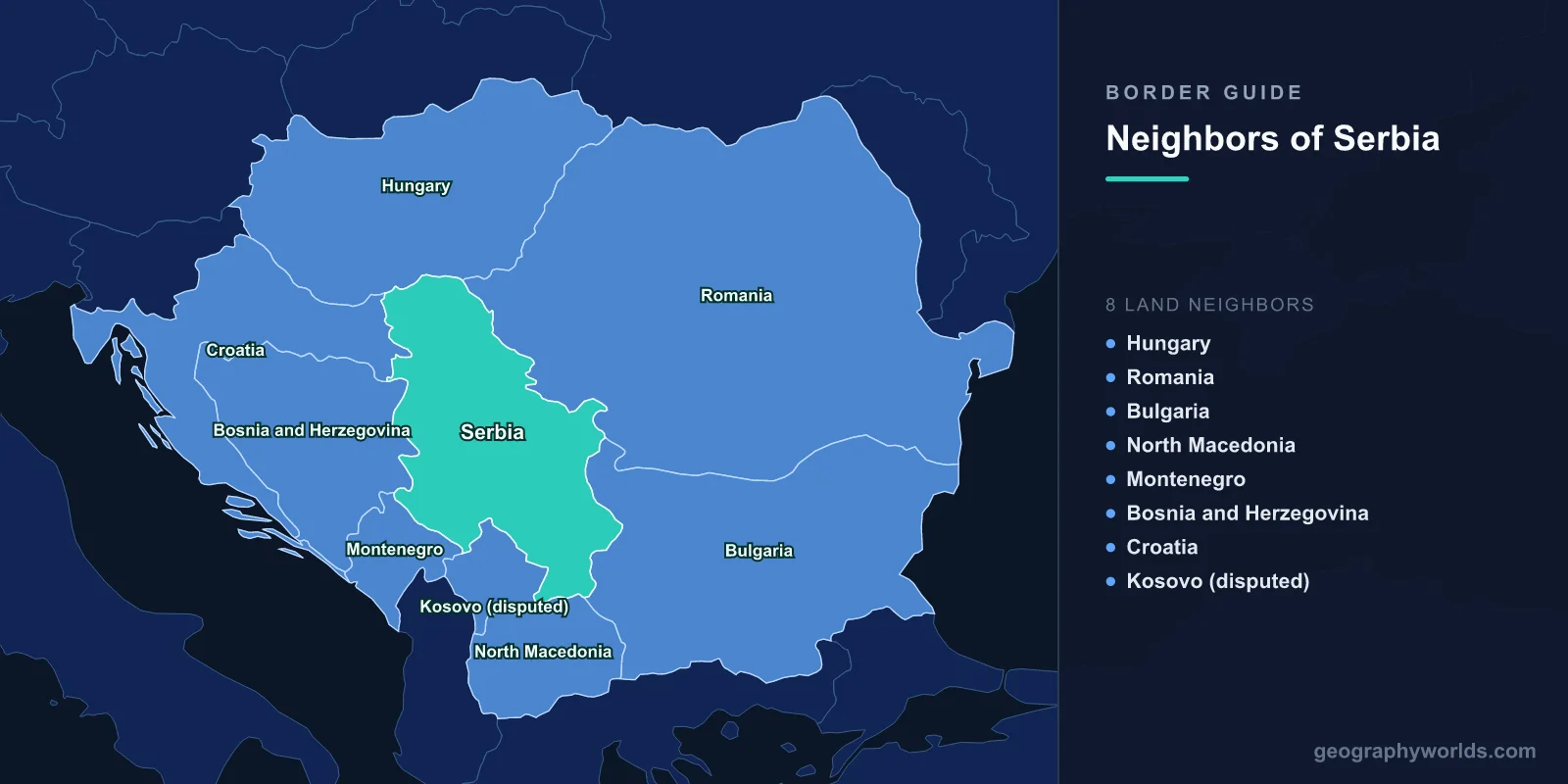
Landlocked Serbia shares land borders with seven internationally undisputed neighbours: Hungary to the north, Romania and Bulgaria to the east, North Macedonia to the south, and Montenegro, Bosnia and Herzegovina and Croatia to the west. It also meets Kosovo, which declared independence in 2008. Serbia does not recognise that independence and calls the line an administrative boundary. Serbia's own figures treat Kosovo as Serbian, so they add a 113.5 km border with Albania and lengthen the lines with Montenegro and North Macedonia. The longest single border is with Romania, about 546 km, much of it along the Danube; the shortest undisputed one is with North Macedonia, 102 km. These lines matter because Serbia sits on the main land route between Central Europe and Greece and Turkey, and because three of them (Croatia, Kosovo and the Albanian claim) are still contested.
Hungary: 175 km Across the Vojvodina Plain
Serbia's northern border runs about 175 km east from the Danube near the Croatian tripoint to the Romanian tripoint near Kübekháza. It is a flat line across the Pannonian Plain, separating Serbia's autonomous province of Vojvodina from southern Hungary. The Treaty of Trianon drew it after the First World War. Hungary moved it during the Second World War, but the changes were reversed after 1945. Even its western end is uncertain, because the exact tripoint depends on the unresolved Croatia–Serbia dispute over the Danube.
Ten land crossings, one of them by rail, cross the line, and some are open only to Serbian, Swiss and EEA nationals. Since Hungary is in the EU and the Schengen Area and Serbia is not, this is an external frontier of both. In June 2015, during the European migrant crisis, Hungary's cabinet approved a 4-metre fence with razor wire along the whole border, and the border was sealed on 14 September, with a budget of about 30 billion forints that also covered two camps for asylum applicants. Two days later, migrants stopped near Horgoš and Röszke tore away a section of the new fence, and Hungarian police answered with tear gas and water cannon.

Romania: 546 km Through the Banat and the Iron Gates
The Romanian border is Serbia's longest: 546.4 km, of which 256.8 km cross the Banat plain on land and 289.6 km follow the Danube. The land section dates from 1919–1920, when the historical Banat was divided between Romania, which took two thirds, and the Kingdom of Serbs, Croats and Slovenes, which took one third. Where it begins, near Rabe in Serbia, Beba Veche in Romania and Kübekháza in Hungary, the three villages mark the "Triplex Confinium" with an annual cultural event.
From Baziaș the Danube takes over and runs through the Iron Gates (Đerdap), a gorge between the Carpathians and the Balkan Mountains. Romania and Yugoslavia built the Iron Gate I dam there from 1964 and finished it in 1972. It is the largest dam on the Danube, and its twelve turbines were divided equally, 1,026 MW to each country. Serbia's Đerdap National Park covers 640 km² of the Serbian bank. Ten crossings, two of them railway lines, link the countries, and the border ends at the mouth of the Timok. Our post on Romania's neighbouring countries tells the same line's story from the Romanian side.
Bulgaria: 341 km From the Timok to Midžor
The Bulgarian border runs about 341 km south from the Danube–Timok confluence, 315 km of it on land, first along the Timok and then over the Balkan Mountains (Stara Planina) to the tripoint with North Macedonia near Žeravino. On the ridge it crosses Midžor (Midzhur in Bulgarian), which at 2,169 m is the highest peak of the Western Balkan Mountains and the highest point in Serbia, not counting Kosovo. Because the summit lay in the border zone, visitors were kept off it until the early 1990s.

The southern stretch moved after the First World War. Under the Treaty of Neuilly, Bulgaria ceded several districts to the Kingdom of Serbs, Croats and Slovenes in 1920, including the towns now called Dimitrovgrad and Bosilegrad. In the 2022 Serbian census, ethnic Bulgarians were still the majority in both municipalities. Bulgarian writers call these areas the "Western Outlands", a term Serbia objects to as hinting at a territorial claim, and Belgrade has not used it in talks with Sofia since 1948. Five crossings are open along this border.
North Macedonia: 102 km at the Head of the Vardar Corridor
The shortest undisputed border runs about 102 km from the Kosovo tripoint near Preševo east to the Bulgarian tripoint at Žeravino. If the section between Kosovo and North Macedonia is counted as Serbian, as Serbia does, the figure becomes 283 km. Short as it is, the line sits on Serbia's main north–south axis: the motorway and railway from Belgrade through Niš follow the Great and South Morava valleys to Preševo and on to Skopje and the Vardar valley.
Three crossings are open on the undisputed section, two of them for motor vehicles. The four crossings between North Macedonia and Kosovo, including Blace/Elez Han, are run by Kosovo. A Serb minority lives just across the line: North Macedonia's 2021 census counted 23,847 ethnic Serbs, concentrated along the northern border in Staro Nagoričane and Kumanovo municipalities.
Kosovo: The Line Serbia Calls Administrative
Kosovo declared independence from Serbia on 17 February 2008 and has since been recognised by at least 110 UN member states. Serbia does not recognise it and still claims it as the Autonomous Province of Kosovo and Metohija, so Belgrade treats the line of roughly 350 to 380 km (sources differ) that runs along Kosovo's northern and eastern edge as an internal administrative boundary. Kosovo treats it as an international border. On Serbia's maps, Kosovo's outer frontiers, including 113.5 km with Albania, count as Serbia's own.
The European Union has mediated practical arrangements without either side changing its legal position. Implementation of an EU-brokered agreement on managing the crossing points was set to begin on 10 December 2012, and the Brussels Agreement of 19 April 2013 committed both governments not to block each other's EU path. In August 2013, they agreed to establish permanent crossing points through 2014. The line has still seen standoffs, including tensions in 2017 when both sides mobilised forces after a train painted with "Kosovo is Serbia" was stopped before it could cross.
Montenegro: 170 km Since the 2006 Referendum
Serbia and Montenegro were one state until 2006. On 21 May that year, 55.5 percent of Montenegrin voters chose independence, just above the 55 percent threshold, and the internal republic boundary became an international border. It runs about 170 km from the Bosnian tripoint east through mountain country to the Kosovo tripoint. On Serbia's definition it continues south along Kosovo's edge for a total of 249 km.
Four crossings are open between Serbia and Montenegro. Landlocked Serbia's access to the Adriatic Sea runs through Montenegro, so these crossings carry its traffic to the coast. Two further crossings, Kula on the road from Rožaje to Peć and Kućište between Plav and Peć, lie on the disputed section and are not controlled by Serbia.
Bosnia and Herzegovina: 302 km Down the Drina
The western border runs about 302 km from the Croatian tripoint near Jamena south to the Montenegrin tripoint near Kukurovići, and for most of that distance it follows the Drina. The river is 346 km long, the longest tributary of the Sava, and known for its fast, cold, green water. Its name comes from the Roman Drinus, itself from an Illyrian original. Hydroelectric dams at Zvornik and Perućac have turned stretches of the border river into reservoirs. Near the southern end the line has two oddities: a Serbian pene-enclave near Strmac joined to the rest of Serbia by a strip 30 metres wide, and the Bosnian enclave of Međurečje, entirely surrounded by Serbia.
It has more crossings than any other Serbian border: 19 are open, including two ferries and four railway crossings. Many link twin settlements across the river, such as Zvornik on the Bosnian bank and Mali Zvornik, a municipality of 11,219 people in 2022, on the Serbian one. Downstream from Mali Zvornik the Drina flows between Majevica, on the Bosnian side, and Gučevo, on the Serbian side, and enters the Lower Podrinje region.
Croatia: 262 km Along a Disputed Danube
The Croatian border, about 262 km, runs mostly along the Danube in the northwest and then overland through Syrmia to the Bosnian tripoint. It is the subject of an unresolved dispute dating from 1947. Serbia holds that the border follows the thalweg, the middle of the river's main channel. Croatia holds that it follows the boundaries of the riverside cadastral municipalities, which trace the Danube's 19th-century course before engineering works straightened it. Along a section of about 140 km the two claims diverge, over an area reported at up to 140 km². The line of control mostly corresponds to Serbia's claim. The stakes are the river itself: the Danube runs 588 km through Serbia or along its borders, and the disputed section includes river islands and riverside land on both banks.
The dispute goes back to a federal commission led by Milovan Đilas in 1945, which assigned Vukovar to Croatia and Šid to Vojvodina; Ilok went to Croatia after a local referendum. Nine crossings, one of them by rail, are open today. For how the two countries compare beyond this river, read our Croatia vs Serbia comparison, and for Serbia's position in the Balkans as a whole, see where Serbia is.