
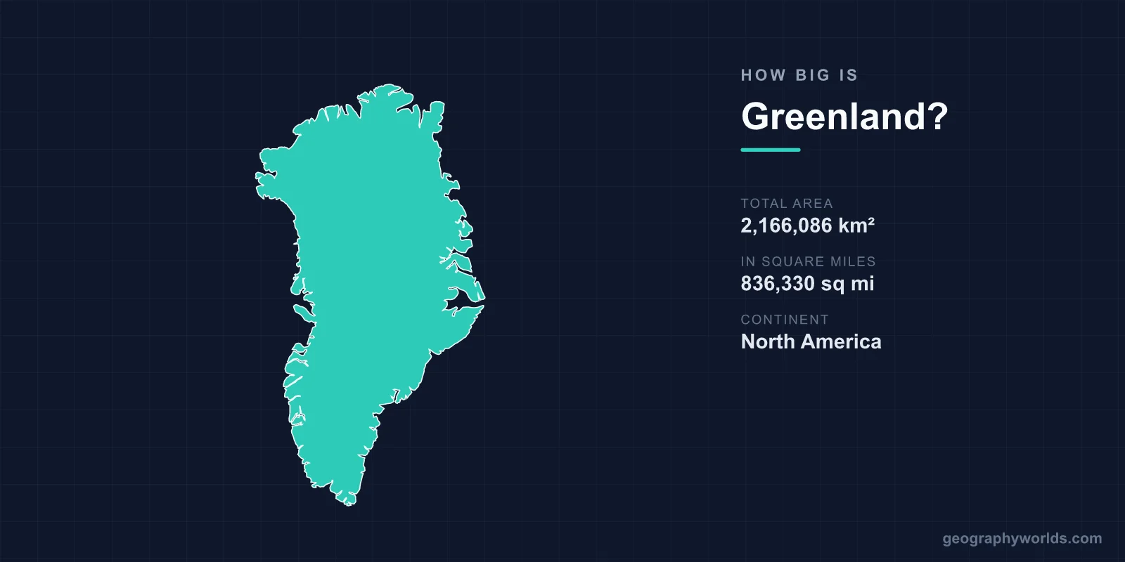
Greenland covers 2,166,086 km² (836,330 sq mi), which makes it the largest island in the world and, if it were an independent country, about the 12th-largest on Earth, just ahead of Saudi Arabia (2,149,690 km²) and behind the Democratic Republic of the Congo. It is roughly three times the size of Texas, about a quarter bigger than Alaska and nearly nine times the size of the United Kingdom. Around 81% of that area, some 1,755,637 km², lies under ice, leaving 410,449 km² of ice-free land, and the whole territory had only 56,542 people in 2025. The best way to grasp the size is to travel it: some 2,700 km from its southern cape to its northern shore, up to about 1,100 km across the ice, and across three time zones.
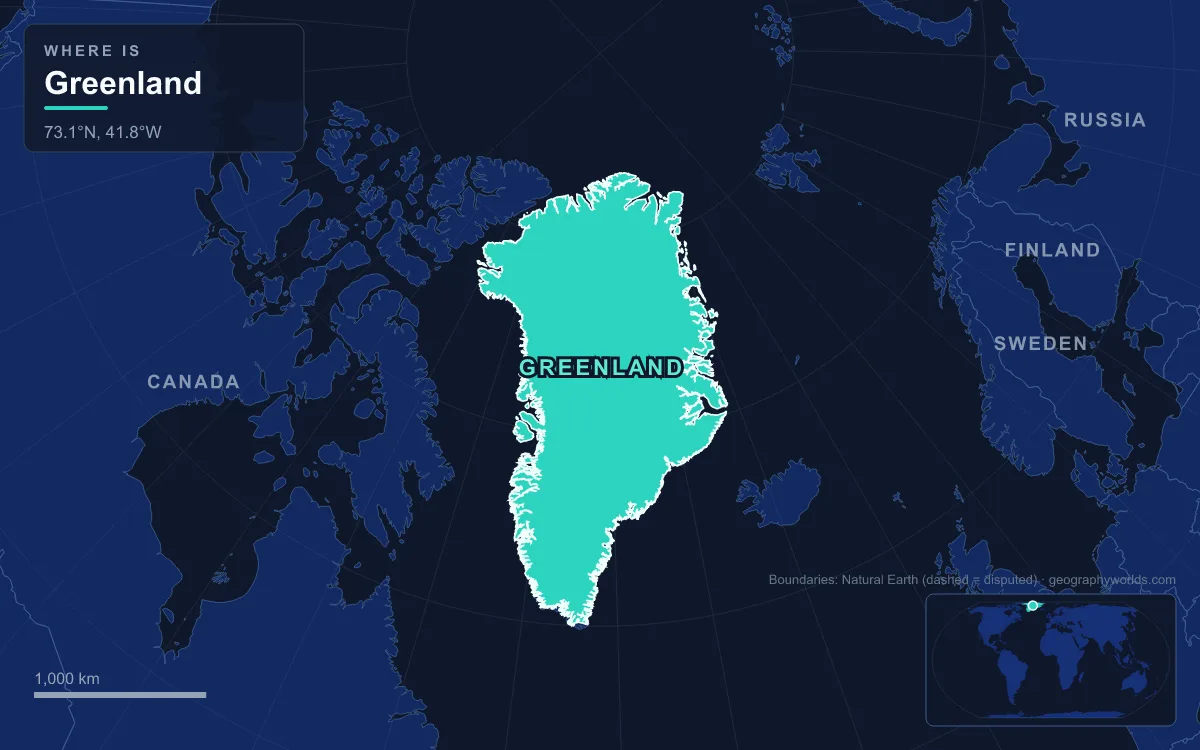
Cape Farewell to Kaffeklubben: 2,700 km North to South
Greenland's southern tip is Cape Farewell (Nunap Isua) on Egger Island, at 59°46′ north, on the same latitude as St Petersburg, Oslo and the Shetland Islands. An unnamed islet 2.3 km further south marks the territory's absolute southern extreme at 59°44′. The northern extreme is Kaffeklubben Island, at 83°40′ north, the northernmost undisputed point of land on Earth. Just south of it lies Cape Morris Jesup, the tip of the Greenland mainland in Peary Land; the American explorer Robert Peary, who first sighted Kaffeklubben in 1900, believed the cape itself was the world's northernmost land, until a Canadian survey in 1969 found the island's tip 750 m further north.
Those two ends are almost 24 degrees of latitude apart, and because Kaffeklubben also lies some 13 degrees of longitude further east, the straight-line distance between them works out to roughly 2,700 km. That span covers more than a quarter of the distance from the equator to the North Pole, and the difference in conditions along the way is just as wide. Near Cape Farewell, the sheltered Qinngua Valley holds Greenland's only natural forest, a valley about 15 km long where mountains up to 1,500 m block the cold winds off the ice and over 300 plant species grow. Peary Land in the far north, by contrast, is a peninsula reaching into the Arctic Ocean that holds the northernmost archaeological ruins on Earth, found in 2023.
Kujalleq and Nuuk: The Inhabited South-West
Travelling north from Cape Farewell up the west coast, the first region is Kujalleq, the southernmost of Greenland's five municipalities. Its main town, Qaqortoq, had 3,069 people in 2025 and is the fourth-largest town in Greenland. Kujalleq includes the Qinngua Valley and Cape Farewell itself, but even here farmland is scarce: arable land amounts to only about 0.1% of Greenland's area.
Further up the coast is Nuuk, the capital, founded in 1728 when the Danish-Norwegian missionary Hans Egede's earlier Hope Colony was moved to the mainland site. With 20,113 residents in January 2025, it holds more than a third of the territory's people and is one of the smallest capitals in the world. Nuuk sits in Sermersooq ("Much Ice"), a municipality that also takes in every community on the far side of the ice sheet, so a single local authority stretches clean across Greenland from coast to coast.

What makes these distances hard is that almost none of them can be driven. There are virtually no roads between towns in Greenland, no railways and no inland waterways; in 2017 the country had just 383 km of local roads, all within or around settlements, and all three of its traffic lights are in Nuuk. Moving between towns means a plane, a helicopter or a boat. Until the rebuilt Nuuk Airport opened in 2024, the main international hub was Kangerlussuaq, a former US base at the head of a long fjord north of the capital.
Disko Bay to Qaanaaq: Up the West Coast
Sisimiut, the second-largest town, lies about 320 km north of Nuuk on the Davis Strait, in Qeqqata municipality. North of Sisimiut the coast reaches Disko Bay, divided between Qeqertalik and Avannaata municipalities, which were created when the old Qaasuitsup municipality was split in 2018. Ilulissat, about 350 km north of the Arctic Circle, had 5,149 people in 2025 and is the third-largest town.
Next to Ilulissat is the Ilulissat Icefjord, a UNESCO World Heritage Site since 2004. It runs 40 km west from the ice sheet to Disko Bay and is fed by Sermeq Kujalleq (Jakobshavn Isbræ), the most productive glacier in the Northern Hemisphere, which moves 20 to 35 m a day and calves around 20 billion tonnes of icebergs a year.
The settled west coast fades out in the far north-west. Qaanaaq, with 591 residents in 2025, is one of the northernmost towns in the world; its people were forcibly relocated there in 1953 when their old home was taken for the US base then called Thule Air Base. That base, now Pituffik Space Base and run by the US Space Force under the 1951 defence agreement, sits on the same coast. Beyond it the Nares Strait separates Greenland from Canada's Ellesmere Island, and in its middle lies Hans Island, split between Canada and Denmark in June 2022, which gave Greenland a 1,280 m land border with Canada.
Across the Ice Sheet: Up to 1,100 km Wide
Turn east from the coast and almost everything is ice. The Greenland ice sheet covers about 1.71 million km², roughly 80% of the island, and is the second-largest body of ice on Earth after Antarctica's. It is on average 1,673 m thick and more than 3,488 m at its deepest, and its surface rises to about 3,200 m in the east-central interior. At latitude 77° north, near its northern edge, it reaches its maximum width of about 1,100 km, which is the widest stretch of Greenland that a traveller would cross entirely on ice.
The weight of the ice is so great that it presses the interior bedrock below sea level; if the ice melted, the middle of Greenland would be covered by water. Temperatures on top rarely rise above freezing: the record high at Summit Camp, a year-round research station on the ice sheet established in 1989, is just 2.2 °C, and the lowest temperature ever recorded in the Northern Hemisphere was measured near the summit of the ice sheet on 22 December 1991. Greenland's towns all sit on the ice-free margins, so a crossing of the ice sheet passes research stations at most.
Tasiilaq, Ittoqqortoormiit and the Empty East
The east coast, facing Iceland across the Denmark Strait (290 km wide at its narrowest), is far emptier than the west. Its largest town, Tasiilaq on Ammassalik Island, had 1,985 people in 2020. Much further north lies Ittoqqortoormiit, with 329 residents in 2026, often described as one of the most remote settlements on Earth.

The town stands at the entrance to Scoresby Sound, one of the largest fjord systems in the world. Mapped in 1822 by the English whaler William Scoresby, it branches over about 38,000 km², and its longest arm reaches 340 to 350 km inland. Between Tasiilaq and Ittoqqortoormiit, in the Watkins Range, rises Gunnbjørn Fjeld, a nunatak of about 3,694 m that is the highest point in Greenland and in the Arctic.
Beyond Fleming Fjord, a short way north of Scoresby Sound, the east coast belongs to no municipality at all. It lies inside the Northeast Greenland National Park, created in 1974 and expanded to its present size in 1988. At 972,000 km² it is the world's largest national park, bigger than 166 of the world's 195 countries and alone larger than Tanzania. It has no towns, only a handful of stations such as the Danmarkshavn weather station in Dove Bay.
Three Time Zones From Pituffik to Danmarkshavn
Greenland's width shows up on the clock. Since 29 October 2023, most of the island, the whole west coast plus Tasiilaq and Ittoqqortoormiit on the east, has used West Greenland Time, UTC−2, with summer time following European Union dates. Before that change the east-coast towns kept their own East Greenland Time. The Danmarkshavn area on the north-east coast keeps UTC+0 all year, the same as Iceland, because it is supplied from there. Pituffik Space Base in the north-west runs on Atlantic Time, UTC−4, and switches to summer time on United States dates.
So a weather observer at Danmarkshavn is four hours ahead of a colleague at Pituffik in winter and three hours ahead in summer, though both stand on the same island at roughly 76° to 77° north. Mainland Denmark, which keeps control of Greenland's foreign affairs, security policy and monetary policy, is on UTC+1, another hour further on.
Why Mercator Makes Greenland Look the Size of Africa
Many people picture Greenland as even bigger than it is, because the Mercator projection used on classroom wall maps and early web maps stretches land near the poles. At Greenland's latitudes the distortion is severe: on Mercator, Greenland appears about the same size as Africa, when Africa is in fact about 14 times larger. Greenland's true area is comparable to that of the Democratic Republic of the Congo alone.
Even at its true size, Greenland is the third-largest area in North America after Canada and the United States, and the least densely populated territory in the world: in 2025 there was roughly one person for every 38 km² of the island, or for every 7 km² of its ice-free land. For the ice that makes up most of that area, see our Greenland ice sheet guide; for the map distortion, read how the Mercator projection works; and to set Greenland directly against America's biggest state, try is Greenland bigger than Alaska?