
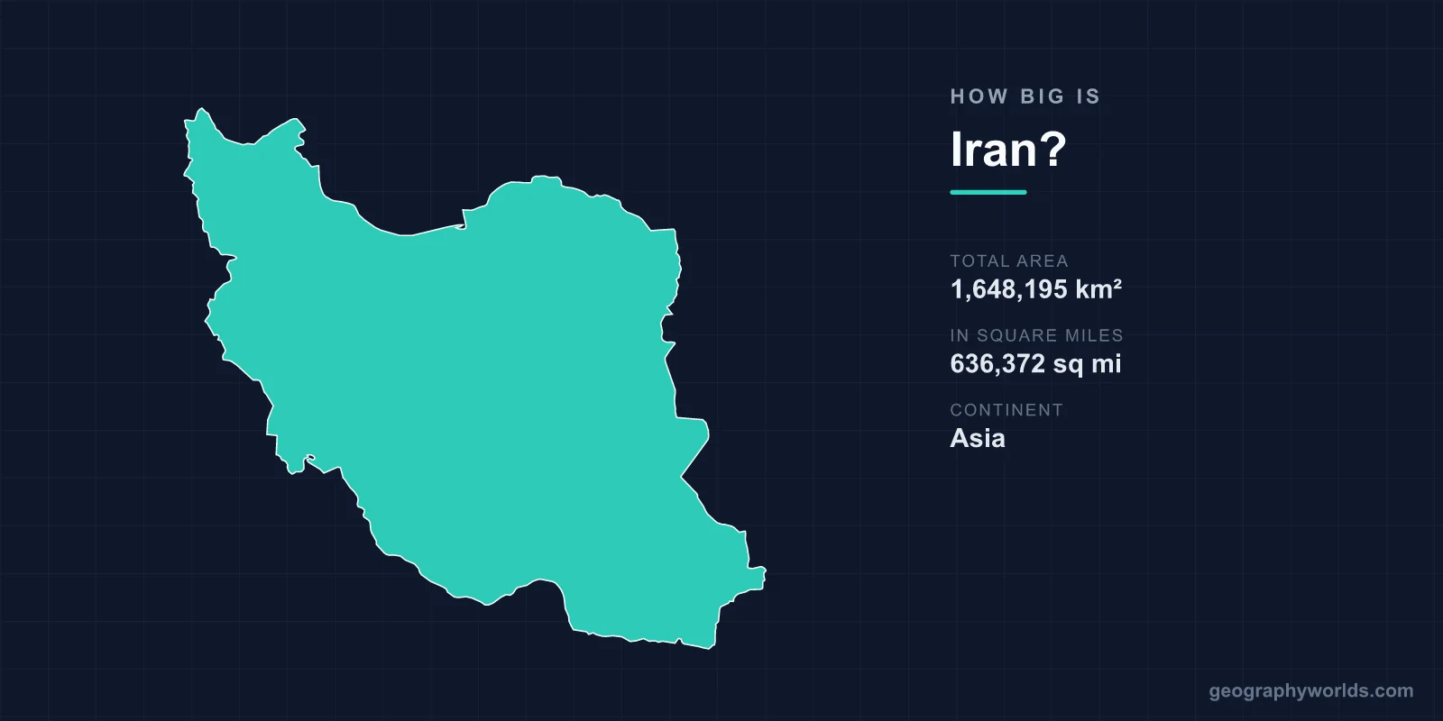
Iran is a big country by any measure: it covers 1,648,195 km² (636,372 sq mi), which ranks it 17th in the world, just behind Libya and just ahead of Mongolia, and second in West Asia after Saudi Arabia. Its land area is slightly larger than Alaska’s and slightly more than three times that of metropolitan France. Measured diagonally, from West Azerbaijan province in the north-west to Sistan and Baluchestan in the south-east, Iran runs about 2,333 km, and its land borders with seven countries add up to nearly 5,900 km. The best way to feel that size is to cross it.
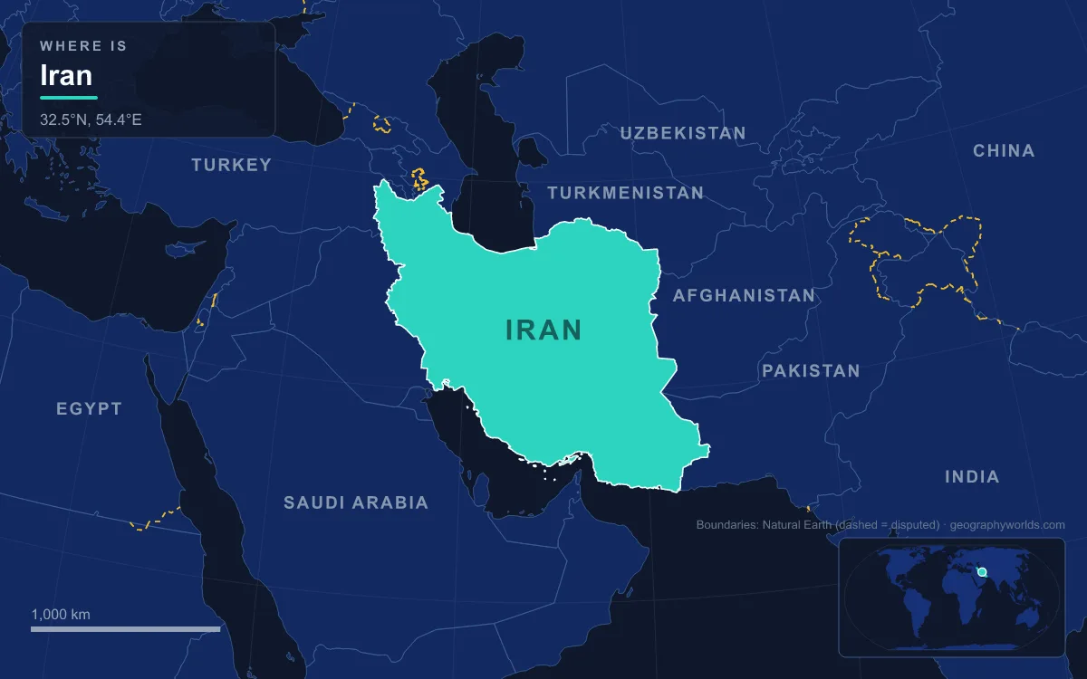
From Qush in West Azerbaijan to Pasabandar on the Gulf of Oman
Start at the top. Iran’s northernmost settlement is Qush in West Azerbaijan province, at 39°44′N, in the corner of the country that faces Turkey and the Nakhchivan exclave of Azerbaijan. The southernmost town is Pasabandar in Sistan and Baluchestan, at 25°04′N on the Gulf of Oman, close to the Pakistani border. Between them lie almost 15 degrees of latitude, a spread that takes the climate from snowbound mountain winters in the north-west to a south where average July highs pass 38 °C.
A traveller heading south from the north-west passes first through Tabriz, the capital of East Azerbaijan, which sits in the Quru River valley about 130 km from the borders with Armenia and Azerbaijan. The country here belongs to the Armenian highlands, with cold winters and heavy snow. To the west lies Lake Urmia, a salt lake that at its greatest extent covered about 6,000 km² and was the largest lake in West Asia; by late 2017 it had shrunk to 10% of that size after drought, dams on its feeder rivers and heavy groundwater pumping, before partly refilling from 2019.
East of Tabriz the Alborz mountains wall off the Caspian Sea. Iran’s Caspian shoreline is about 740 km long, and the coastal plain beneath the Alborz stretches some 640 km while being less than 50 km wide at its widest; in places under 2 km separate the beach from the foothills. The Caspian shore is also Iran’s lowest ground, at 28 m below sea level. Barely 66 km north-east of Tehran stands Mount Damavand, a dormant volcano of 5,610 m (18,406 ft) that is the highest peak in Iran and in Western Asia. Damavand has a special place in Persian mythology and folklore, and it is also the highest volcano in Asia, so within a short drive of the capital the land climbs from below sea level on the Caspian to more than 5.6 km above it.
South of Tehran the road drops onto the Central Plateau, a set of closed basins averaging about 900 m above sea level. Iran’s geographical centre is placed at the Markar Clock Tower in Yazd, deep in this dry interior. Continue south and the land climbs again into the Zagros, a series of parallel ridges that bisect the country from north-west to south-east; many peaks pass 3,000 m and at least five in the south-central Zagros pass 4,000 m. Only beyond them, on the Persian Gulf and the Gulf of Oman, does the land fall back to the sea, and along much of the Persian Gulf and Gulf of Oman shore the Zagros reach right down to the water, leaving no real coastal plains.

The far south-east ends at Chabahar, a free-trade-zone port in Sistan and Baluchestan and the southernmost city in Iran after nearby Konarak. Pakistan’s port of Gwadar lies about 170 km further east along the same coast. Offshore, the islands of the Persian Gulf push Iran’s reach further still; Abu Musa, administered by Iran, is also claimed by the United Arab Emirates, as are the Greater and Lesser Tunbs.
From Soleyman Aghol near Turkey to Kuhak on the Pakistan Border
Turn the map sideways. Iran’s westernmost point is Soleyman Aghol in West Azerbaijan, at 44°03′E, close to the Turkish frontier. Its easternmost is Kuhak in Sistan and Baluchestan, at 63°15′E, on the border with Pakistan. That is just over 19 degrees of longitude, and it has a measurable effect on the day. Solar noon arrives roughly 77 minutes earlier in Kuhak than in Soleyman Aghol, yet the whole country keeps a single clock. Iran Standard Time is UTC+3:30, defined by the meridian at 52.5°E that also anchors the Iranian calendar, and since 21 September 2022 Iran has observed it all year round, having abolished daylight saving time for the second time. Our guide to Iran’s half-hour time zone explains why the offset is not a whole hour.
The west–east crossing runs through the emptiest part of the country. From the Zagros foothills and the lowland of Khuzestan, the triangular extension of the Mesopotamian plain that averages about 160 km wide and is crossed by the Karun, Iran’s only navigable river, the land rises onto the plateau. East of Tehran and Isfahan it reaches the Dasht-e Kavir, the Great Salt Desert, about 800 km long by 320 km wide with an area of around 77,600 km², spread across the provinces of Semnan, Tehran, Isfahan, Yazd and Khorasan.
Further south-east lies the Dasht-e Lut, in Kerman and Sistan and Baluchestan provinces. It covers about 51,800 km², is one of the largest of Iran’s drainage basins at 480 km long and 320 km wide, and has dunes in its south-east that reach 300 m. Satellites have measured its sand surface at 70.7 °C, the highest land surface temperature known on Earth. UNESCO added the Lut to the World Heritage List on 17 July 2016. Except for scattered oases, both deserts are uninhabited, which is one reason Iran’s towns string out around the rim of the plateau rather than across it.

East of the Lut the route reaches the Sistan basin, where a chain of connected salt lakes straddles the border with Afghanistan, fed by the Helmand River, which rises in Afghanistan. Iran has protested Afghanistan’s damming of Helmand tributaries, which limits the flow reaching Sistan in drought years. Beyond Sistan, Kuhak and the Pakistani frontier mark the end of the crossing.
Seven Neighbours Along Nearly 5,900 Kilometres of Land Border
A country this wide touches a lot of others. Iran has land borders with seven states, and the lengths show how the map is shaped. Iraq takes the longest stretch, 1,599 km down the Zagros to the Arvand Rud, known in Arabic as the Shatt al-Arab, the river formed by the Tigris and Euphrates whose lower course marks the border down to the Persian Gulf. Turkmenistan follows with 1,148 km across the north-east, then Afghanistan and Pakistan in the east. Azerbaijan meets Iran on two separate fronts, 689 km in all, split between the Nakhchivan exclave in the west and the main part of the country in the east. Armenia has only 44 km, the short section that separates those two Azerbaijani stretches. The CIA total for all seven borders is 5,894 km; the separate border figures below add up to 5,844 km, because sources measure some of the lines differently.
Add the water frontiers and the perimeter grows further: the 740 km Caspian shore in the north, which Iran shares with Russia, Azerbaijan, Kazakhstan and Turkmenistan as littoral states, and a combined coastline of about 2,815 km on the Persian Gulf and the Gulf of Oman. Iran’s exclusive economic zone in those southern waters covers about 168,718 km², a modest figure for such a long coast because it is set by bilateral agreements or median lines across the narrow Persian Gulf. Each of the seven land neighbours is covered in our article on the countries that border Iran.
Kerman, Sistan and Baluchestan and Iran Beside Saudi Arabia, Libya and Alaska
Inside its borders, Iran is divided into 31 provinces, and they vary in size as much as the landscapes do. Kerman, the ancient satrapy of Carmania, is the largest at 183,285 km², nearly 11% of the country. Sistan and Baluchestan is second at 180,726 km². Tehran province, which holds the capital and its huge suburbs, covers only 18,814 km², about a tenth of Kerman. The large eastern provinces are also among the least populated, because they take in the Lut, the Kavir margins and the dry Sistan basin. Our breakdown of Iran’s 31 provinces lists every one with its capital.
Against other countries, Iran sits in a cluster of similar giants. Libya, ranked 16th at 1,759,540 km², is about 7% larger; Mongolia, 18th at 1,564,116 km², is about 5% smaller. Saudi Arabia, with about 2,149,690 km², is the only country in West Asia bigger than Iran, roughly 30% larger. Among Iran’s neighbours, Turkey covers 783,562 km², so Iran is a little more than twice its size, and Iraq, at 438,317 km², would fit inside Iran almost four times. The CIA World Factbook offers comparisons for other readers: slightly larger than Alaska, slightly smaller than the Australian state of Queensland, and slightly larger than the Canadian province of Quebec.
Of the 1,648,195 km² total, about 1,531,595 km² is land and about 116,600 km² is water. Iran’s 2016 census counted 79.9 million people, a fourfold increase on 1956, and later estimates put the population above 85 million. Even so, the average density at the 2016 census was under 50 people per km², because the Lut and the Kavir are empty and most Iranians live on the mountain rims and in the basins around cities such as Tehran, home to around 9 million people in the city and 16.8 million in the metropolitan area, and Mashhad, about 740 km east of the capital, with some 3.4 million at the 2016 census. That pattern, a ring of settled highlands around a dry and almost empty centre, is the clearest mark of Iran’s size: a country so wide that its interior is a desert crossing in its own right.