
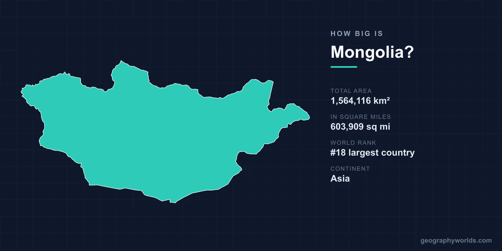
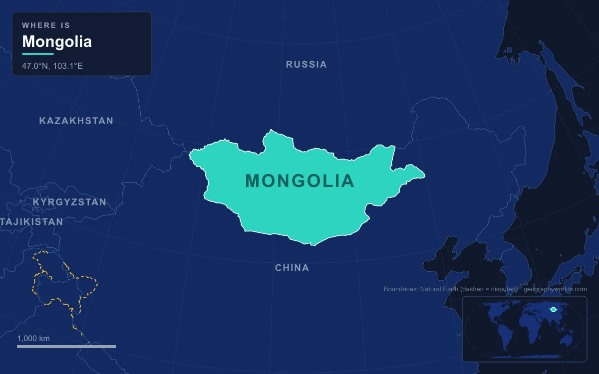
At 1,564,116 km² (603,909 sq mi), Mongolia is the 18th-largest country in the world. It is the second-largest landlocked country after Kazakhstan, and about 2.25 times the size of Texas. Measured between its extreme points, it stretches about 2,400 km from the Altai Mountains in the west to the grasslands of Dornod in the east, and about 1,260 km from the Darkhad Valley near Siberia to the Gobi on the Chinese border. It has only two neighbours: Russia along a 3,485 km border to the north and China along a 4,630 km border to the south. Its far west keeps a different time from the rest of the country, and the land falls from 4,374 m in the Altai to 560 m in the east. With 3,544,835 people in 2024, about 2.3 per km², Mongolia is the most sparsely populated sovereign state in the world, if Western Sahara is excluded.
Mongolia’s 1,564,116 km² against Alaska, Iran and Kazakhstan
Mongolia’s total area is 1,557,507 km² of land and 6,609 km² of water, according to the UN figures used in Wikipedia’s country list. It sits in the ranking just below Iran (1,648,195 km², 17th) and above Peru (1,285,216 km², 19th). It is often compared with Alaska, but Alaska is bigger at 1,723,337 km², about 159,000 km² more than Mongolia. Kazakhstan, the only larger landlocked country, is about 1.7 times Mongolia’s size. Mongolia is still the largest landlocked country that does not border an inland sea, since Kazakhstan touches the Caspian. The two countries never meet. Mongolia’s western tripoint with Russia and China, on the summit of Tavan Bogd Uul, lies only about 40 km east of the point where China, Kazakhstan and Russia meet, linked by a short stretch of Russia–China border high in the Altai.
Mongolia is also high. Its average elevation is 1,580 m, and in general the land slopes down from the Altai in the west and the mountains of the north to plains and basins in the east and south. It lies mostly between latitudes 41° and 52° north, roughly the same as the band from Rome to London, and between longitudes 87° and 120° east. The country is divided into 21 provinces, called aimags, and 330 districts, called sums. The capital, Ulaanbaatar, is run separately with the status of a province. The trip below follows the map from the westernmost point to the easternmost.
Starting in the west: Bayan-Ölgii and the Altai at 87°44′E
Mongolia’s westernmost point is in Altai Tavan Bogd National Park, in Tsengel sum of Bayan-Ölgii Province, on the border with China’s Xinjiang. The park covers 6,362 km² below the Tavan Bogd massif, where the borders of Mongolia, Russia and China meet. Its lakes, Khoton, Khurgan and Dayan, lie among mountains that are home to argali sheep, ibex and snow leopards. The country’s highest point, Khüiten Peak, rises here on the China border. Its height is usually given as 4,374 m (14,350 ft), although some sources give 4,356 m. Its name means “cold peak”, and it is covered in snow all year.

Bayan-Ölgii is Mongolia’s highest aimag and its westernmost. It is also the only one with a Kazakh and Muslim majority. It was created in August 1940, with its capital at Ölgii. Only about 10% of the province is forested, mostly with Siberian larch. Here Russia and China share a border of only about 40 km before Kazakhstan begins. Further south and east, the Altai range runs northwest to southeast along the Chinese border and contains Mongolia’s highest mountains.
Two clocks: the UTC+7 line through Khovd and Uvs
Mongolia covers about 33 degrees of longitude, so it uses two time zones. Mongolian Standard Time is UTC+8, the same as Beijing. The three far-western aimags, Bayan-Ölgii, Khovd and Uvs, use UTC+7. The line between the two zones runs very close to longitude 97.5° east. By the sun, that is where UTC+6 and UTC+7 should meet, so Mongolia keeps clocks about an hour ahead of solar time all year, in effect permanent summer time. The country has tried daylight saving several times, in 1983–1998, 2001–2006 and 2015–2016, but does not use it now.
The UTC+7 zone covers the Great Lakes Depression, a dry basin with no outlet to the sea, where western rivers end in lakes instead. The largest is Uvs Lake, Mongolia’s biggest lake by area at 3,350 km². It is a shallow, very salty lake at 759 m, and its northeastern tip reaches into Russia’s Tuva Republic. The nearest large town is Ulaangom. Its name comes from subsen, a Turkic and Mongolian word for the bitter dregs left over from making airag, fermented mare’s milk, a reference to the lake’s undrinkable water. Lakes and rivers cover 10,560 km² of Mongolia in total, only 0.67% of the country.
North to the Darkhad Valley and Lake Khövsgöl at 52°N
The northernmost point, at about 52.15° north, is in Tsagaannuur sum of Khövsgöl Province. It lies northwest of the Darkhad Valley and faces Russia’s Tuva Republic. The Darkhad Valley itself is about 160 km long and 40 km wide, covers 4,270 km² and lies at about 1,600 m. It was transferred from the People’s Republic of Tannu Tuva to Mongolia in 1925. East of it lies Lake Khövsgöl, at 1,645 m. The lake is 136 km long and 262 m deep and holds almost 70% of Mongolia’s fresh water, about 0.4% of all the fresh water in the world. Mongolians call it the “Mother Sea”.

Khövsgöl drains south through the Egiin Gol into the Selenge, Mongolia’s main river system, which flows north into Lake Baikal and then to the Arctic Ocean. The water travels more than 1,000 km between the two lakes and drops 1,169 m, although they are only about 200 km apart in a straight line. This is the southern edge of the Siberian taiga. The north is the wettest part of Mongolia, with 200 to 350 mm of rain and snow a year on average, and the far north of Bulgan Province gets about 600 mm. Official figures class only 8 to 10% of the country as forest and less than 1% as arable land.
Through the Khangai and Khentii to Ulaanbaatar and the railway south
The Khangai Mountains fill much of central and north-central Mongolia. They are older, lower and more worn down than the Altai, and covered with forests and high pastures. To the northeast, the Khentii Mountains run about 400 km from northeast to southwest. They separate rivers that flow to the Arctic through Lake Baikal from rivers that flow to the Pacific. The Onon, Kherlen and Tuul all rise there. Ulaanbaatar sits at 1,351 m in the valley of the Tuul. With just over 1.6 million people in December 2022, it holds almost half of Mongolia’s population. It gets about 310 mm of rain and snow a year, almost all in July and August, and its average annual temperature is below freezing.
The main north–south route crosses the country here. The Trans-Mongolian Railway, opened on 1 January 1956, runs from Sükhbaatar on the Russian border through Darkhan, Ulaanbaatar, Choir and Sainshand to Zamyn-Üüd on the Chinese border. At the Chinese border, trains change from the 1,520 mm Russian gauge to the 1,435 mm standard gauge.
South across the Gobi to Ömnögovi at 41°N
The southern third of the journey is the Gobi. The name comes from the Mongolian word for “dryland”, which Mongolians use for arid rangeland with enough plants for camels. The whole Gobi, shared with northern China, is about 1,600 km long and 800 km wide and covers roughly 1,295,000 km². Southern Mongolia gets only 100 to 200 mm of rain and snow a year, and some parts get none in most years. Summer temperatures in the southern Gobi can reach 38 °C, yet across most of the country average temperatures are below freezing from November to March. Mongolia’s southernmost point, at about 41.58° north, is in the Gobi Small A protected area in Nomgon sum of Ömnögovi Province, facing China’s Inner Mongolia. Further west in the same province, the Khongoryn Els dunes, known as the “Singing Sands”, cover more than 965 km² of Gobi Gurvansaikhan National Park, about 180 km from Dalanzadgad.
East to Dornod, Khalkhgol and Hoh Nuur at 560 m
East of Ulaanbaatar, the mountains give way to the plains of the eastern steppe. Dornod, whose name means “east”, is the easternmost aimag, and its capital is Choibalsan. Buryats made up 22.8% of its population at the 2000 census. Mongolia’s easternmost point, at about 119.98° east, is in Numrug National Park in Khalkhgol sum, on the border with China’s Inner Mongolia. In 1939 the Khalkhin Gol river nearby gave its name to the battles in which Soviet and Mongolian forces defeated Japan and Manchukuo. The lowest point in the country is also in the east: Hoh Nuur, a lake in Choibalsan sum at about 560 m. Northeastern rivers flow to the Pacific, as the Onon joins the Shilka and then the Amur. Even so, Mongolia’s easternmost tip is still about 645 km from the nearest sea, the Bohai Sea at Jinzhou in China.
That is the size of Mongolia: about 2,400 km and two time zones from end to end, with mountains, lakes, taiga, desert and steppe in between, and about 2.3 people for every square kilometre. To see whether the US state most often compared with it really is smaller, read is Mongolia bigger than Alaska? For the desert that fills the south, see our Gobi Desert geography guide, and for the only bigger landlocked country, compare Mongolia and Kazakhstan.